Plan a Trip


Panch Pokhari Pilgrimage Trek Transport And Trail Guide
 Panch Pokhari Trek Transport Guide: The Complete Transport and Trail Guide
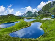
In a country already dense with sacred lakes, ancient temples, and pilgrimage trails, Panch Pokhari stands apart. Five crystalline glacial lakes, each named for and dedicated to Lord Shiva, are clustered on a high ridge at 4,100 meters in the remote Sindhupalchok district, northeast of Kathmandu, with the Jugal Himal, Langtang, Rolwaling, and Ganesh Himal ranges visible on the horizon in every direction. The name means simply Five Lakes in Nepali, but that plainness undersells the reality: each lake catches the sky differently, the surrounding alpine meadow fills with wildflowers in spring, and on the full moon of Janai Purnima in August, the hillsides and the lake shore come alive with thousands of pilgrims who have climbed here on foot specifically to bathe in these waters and change their sacred Janai thread in the presence of Shiva.
This guide is written specifically for travellers planning to visit Panch Pokhari, whether as pilgrims, trekkers, or both. It covers everything: the legend and religious significance of the five lakes, every road access option from Kathmandu, precise driving times and road conditions along the Araniko Highway and Sindhupalchok district roads, the two main trekking routes to the lakes and their day-by-day stages, permits and what checkpoints to expect, seasonal timing and how the Janai Purnima festival changes the logistics, wildlife and biodiversity within Langtang National Park, accommodation realities, packing requirements for this high-altitude but rarely commercialized trail, and how to combine the Panch Pokhari trek with a wider Kathmandu Valley itinerary using Nepal Vehicle Hiring Pvt Ltd for every transport leg.
Unlike the famous trekking circuits of Annapurna, Everest, and Langtang, Panch Pokhari is still largely outside the international trekking mainstream. The Trekking Agencies’ Association of Nepal formally explored and opened this route only in 2012, and even today, the trail infrastructure remains basic, the teahouse network thin, and the signage incomplete compared to Nepal’s more commercialised trekking corridors. That is, emphatically, a feature rather than a drawback for the right traveller, and this guide is built to give you everything you need to arrive at those five sacred lakes fully prepared and properly transported, without any avoidable logistical surprises that catch under-prepared visitors on this route. The Panch Pokhari trail rewards preparation more than almost any other trek in the Kathmandu region precisely because so little of what you need can be sourced along the way; everything from your sleeping bag to your cash to your permits must be sorted before you leave Kathmandu, and a well-planned vehicle transfer to the correct trailhead is the first and most foundational step in making that preparation work.
The Legend and Sacred Significance of the Five Lakes
Panch Pokhari’s religious importance is inseparable from one of Hindu mythology’s most significant stories. During the Samudra Manthan, the churning of the cosmic ocean described in the Bhagavata Purana and the Mahabharata, a poison called Halahala emerged from the depths and threatened to destroy all creation. Lord Shiva, the destroyer and protector, swallowed the poison to save the universe. The venom burned his throat with intense heat and thirst, and where his trident struck the Earth in relief, five springs of pure, cool water burst from the ground. These five sources are said to be the origin of the five lakes of Panch Pokhari.
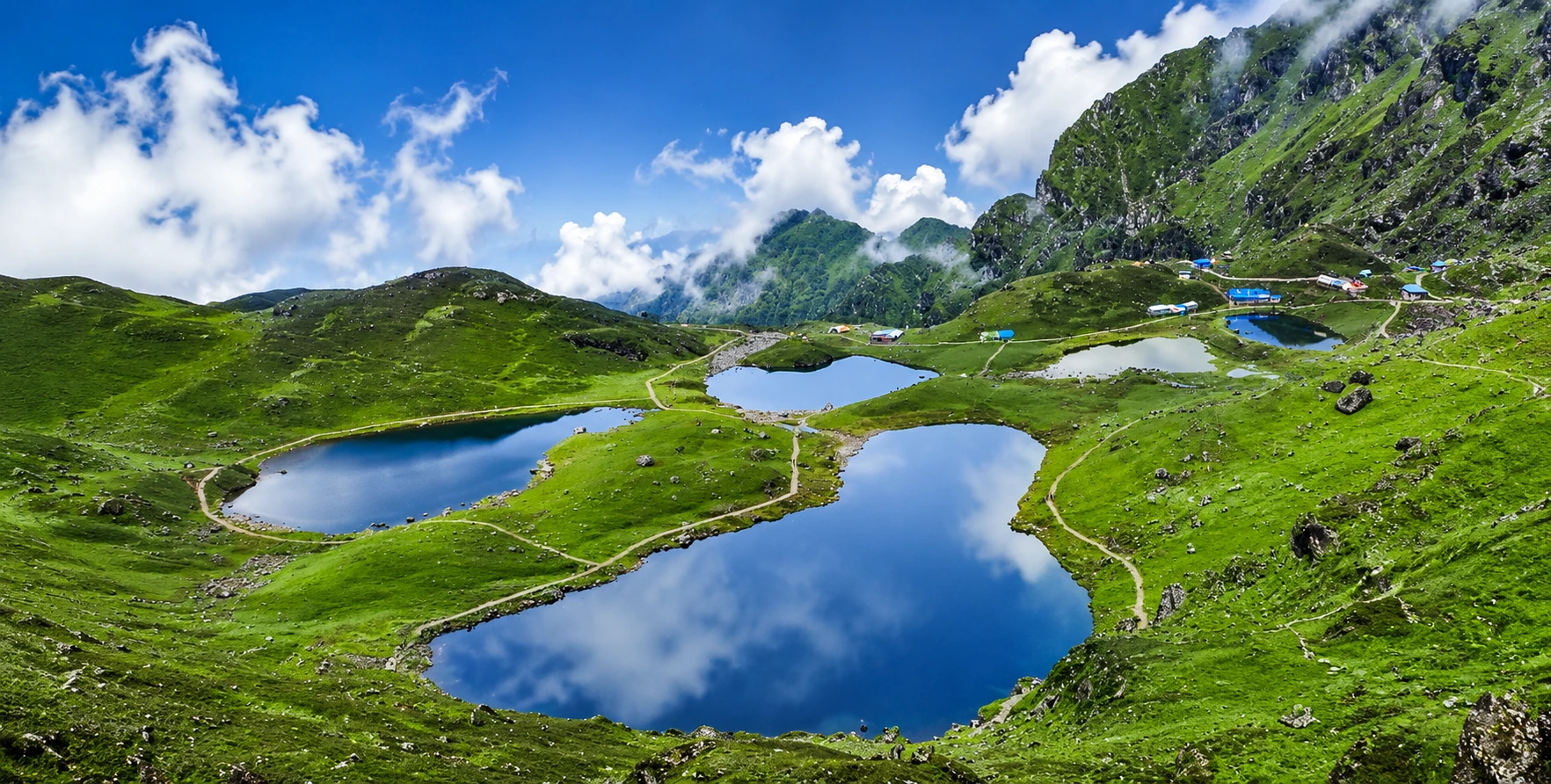
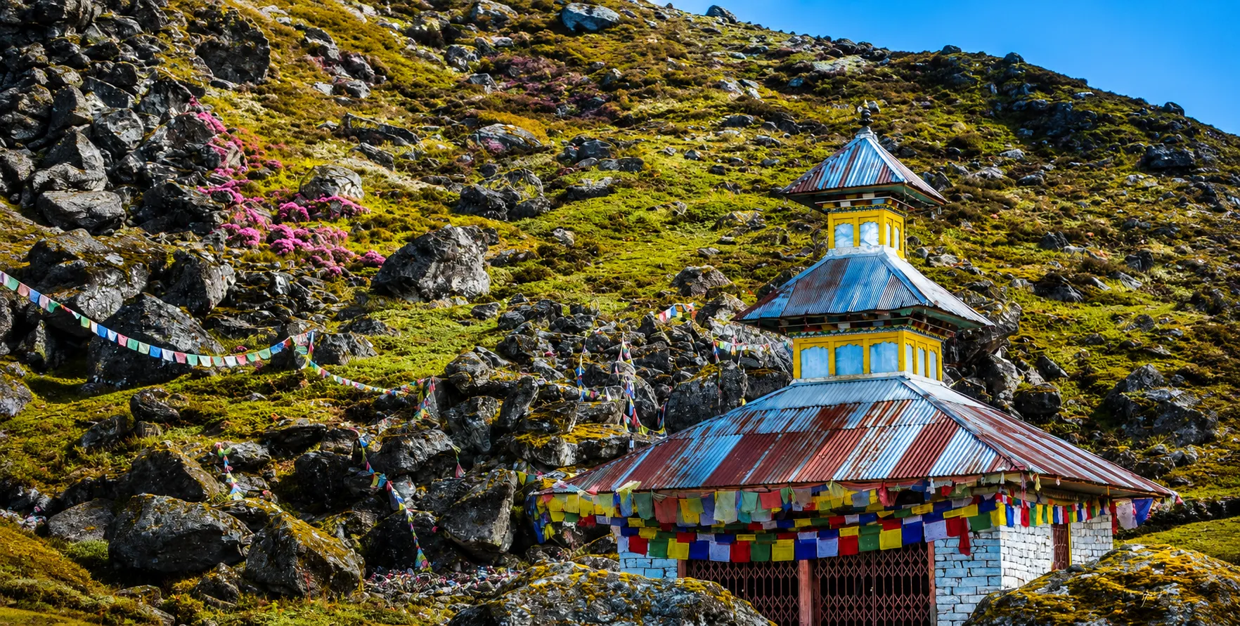
Each of the five lakes has a distinct name connected to Shiva’s divine nature and the Shaivite spiritual tradition, and devotees who bathe in them during auspicious periods are believed to be purified of sins accumulated across multiple lifetimes. The lakeshore templelake-shore temple, dedicated to Lord Shiva, serves as the ritual centre during Janai Purnima, when priests and local shamans lead ceremonies that draw participants from across Nepal and across the border in India.
The Buddhist dimension of Panch Pokhari’s significance is also genuine and should not be treated as incidental. The lakes are considered the residence of Jambhu Lama, a local protective deity in the Tibetan Buddhist tradition, and the communities along the trekking trail, including the Tamang and Yalmu people of Sindhupalchok, are predominantly Buddhist and have maintained shrines, mani walls, and small monasteries along the route for generations. In this sense, the Panch Pokhari pilgrimage trail reflects the characteristic blending of Hindu and Buddhist sacred traditions that defines religious life across much of Nepal’s hill region, where the same landscape holds meaning for both traditions simultaneously and the same traveller, whether Hindu pilgrim or Buddhist meditator, is walking a trail that has been spiritually charged for centuries.
For trekkers without a specific religious motivation, this layered sacred character adds a dimension of cultural depth that purely scenic treks lack. Arriving at Panch Pokhari during a non-festival period, a trekker will still find two pilgrim houses near the shore, the Lord Shiva temple, ritual offerings left by recent visitors, and the quieter, more personal form of devotion that characterises the non-festival season, when individual pilgrims and small family groups make their own private pilgrimages to the lakes outside the peak August festival crowd.
Where Panch Pokhari Is and Why It Is Harder to Reach Than It Looks
Panch Pokhari sits in the northeastern corner of Sindhupalchok district, one of Nepal’s 77 districts, in the Bagmati Province. Administratively, it falls within the boundaries of Langtang National Park, which also encompasses parts of Rasuwa and Nuwakot districts, and is classified as a protected area under Nepal’s national conservation framework. The straight-line distance from Kathmandu to Panch Pokhari is not large. Still, the mountainous terrain between them makes road access circuitous, and the final trekking approach is steep enough that the total journey time is considerably longer than the map distance implies.
Sindhupalchok District connects to Kathmandu via the Araniko Highway. The same corridor runs northeast from Kathmandu toward the Tibet border at Rasuwagadhi (now the primary Nepal-Tibet crossing, following the closure of the older Kodari crossing after the 2015 earthquake). The Araniko Highway is a paved, reasonably maintained road to Bahrabise and beyond toward the border, and this corridor is the primary vehicle access route for the Panch Pokhari trek. From various points along or just off the Araniko Highway, district roads branch toward the two main trekking trailheads: Chautara and Chimchi.
The 2015 Gorkha earthquake heavily affected Sindhupalchok district, as it lies close to the earthquake’s epicentre and suffered significant landslide damage and infrastructure losses. Since then, road reconstruction and trail rebuilding have continued. Conditions have improved substantially, but travellers should understand that the Sindhupalchok road network remains more prone to landslides during and after monsoon season than most other districts in the Kathmandu region, and that road conditions can vary significantly depending on whether post-monsoon repairs have been completed before a visit.

Kathmandu to Panch Pokhari: All Vehicle Access Options
Route One: Kathmandu to Chautara, the Southern Trailhead
The most common starting point for the Panch Pokhari trek is Chautara, the administrative headquarters of Sindhupalchok district, reached via the Araniko Highway northeast of Kathmandu. The driving distance from Kathmandu to Chautara is about 77 kilometres by road, and the journey typically takes five to seven hours in a private jeep, reflecting the winding, hilly final stretch from the Araniko Highway to Chautara town. A public bus runs on this route but takes much longer, requires a transfer, and is not a reliable option for trekkers carrying significant gear. For a private jeep transfer, our Kathmandu-to-Sindhupalchok Jeep service covers this corridor and can drop trekkers directly at the trailhead rather than at the town centre.
From Chautara, the trekking trail toward Panch Pokhari begins by climbing north through Sano Okhreni and a series of terraced villages, then ascends through dense rhododendron and oak forests as it gains altitude. This southern approach is the longer of the two main routes to the lakes and typically takes five to six days of walking to reach Panch Pokhari from Chautara, passing through communities of Tamang, Sherpa, Brahmin, and Chhetri households across the Sindhupalchok hill belt before breaking through the tree line into alpine meadow terrain in the final two days of approach.
Route Two: Kathmandu to Chimchi (Chhimti), the Shorter Northern Approach
A shorter alternative begins from Chimchi village, also spelt Chhimti, reached via a branch road off the Araniko Highway at Melamchi. The Melamchi junction is well known as the site of the Melamchi Water Supply Project, a major infrastructure project connecting the Melamchi River in Sindhupalchok to the Kathmandu Valley’s water supply system. From the Melamchi junction, a district road climbs northeast toward Chimchi, which sits at roughly 1,350 meters and serves as the starting point for a faster, more direct approach to Panch Pokhari that can reach the lakes in as few as four to five days of trekking compared to the six days typically required from Chautara. Our Kathmandu Jeep service can drop trekkers at the Chimchi trailhead on request, and the Melamchi corridor is a regular route for our drivers.
From Chimchi, the trail climbs through Tuppi Danda and Nashympati before making the final approach to the lakes. This shorter itinerary suits trekkers on a tighter schedule or those focused on the pilgrimage destination rather than a long, gradual approach through multiple communities. The trade-off is that the ascent from Chimchi to Panch Pokhari is steeper and more compressed, which trekkers should factor into planning, especially if they may not be fully acclimatised before starting the trek.
Alternative Starting Points Along the Araniko Highway Corridor
Some longer itineraries, particularly those designed by trekking agencies that want more village cultural exposure, begin in Simpal, a small roadside settlement on the Araniko Highway, or in Bahrabise, farther northeast, adding trekking days in exchange for a more gradual, village-rich approach from a lower altitude. For trekkers arriving from Kathmandu, these longer approaches are less commonly booked by independent travellers but suit organised group trips that want a more immersive, multi-community experience before reaching the high-altitude lakes. Our Kathmandu to Langtang region jeep network already operates this general Araniko Highway corridor for Langtang and Kerung border transfers, making the Sindhupalchok approach road a natural extension of routes our drivers already run regularly.
Road Conditions and What to Expect on the Drive
The Araniko Highway out of Kathmandu is paved and well maintained for most of its length through Sindhupalchok district. However, it climbs steadily through the Bhote Koshi gorge. It passes several sections that have historically been vulnerable to landslides during the monsoon and to flash flooding on the lower riverside stretches. After the 2015 earthquake, several sections of the Araniko Highway required significant repair and reconstruction. While the main highway is now generally motorable year-round, the district branch roads that peel off toward Chautara, Chimchi, and the lesser-used trailhead villages remain more variable in quality, with unpaved sections, seasonal washouts, and narrow single-lane stretches that require careful driving.
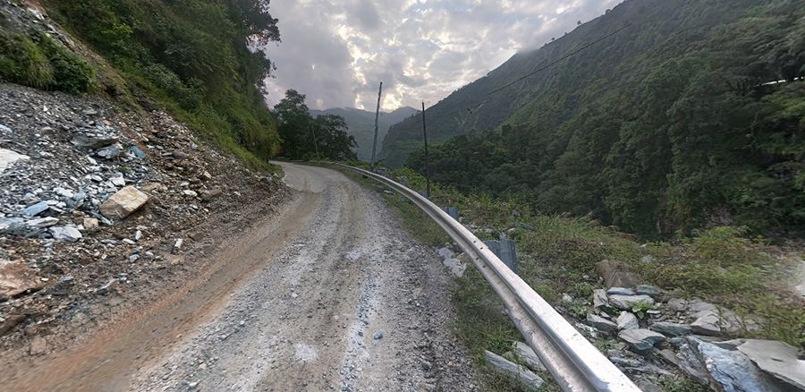
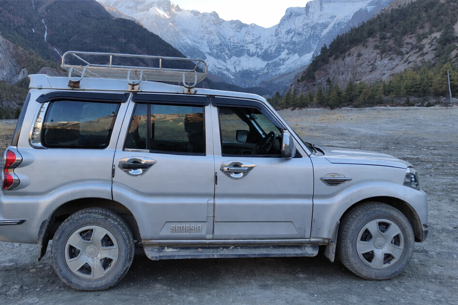
A 4WD jeep is the correct vehicle for any transfer beyond the main Araniko Highway onto the district roads serving the Panch Pokhari trailheads. Sedans and standard cars lack the ground clearance and drivetrain confidence for the steeper, rougher sections of the Chautara approach road and the Chimchi branch road, particularly during or after rain. We explain this reasoning in more detail in our dedicated piece on why a 4WD jeep is the right choice for Nepal’s mountain roads, and the Sindhupalchok district road network is a textbook example of the conditions it applies to.
Travellers planning their Panch Pokhari trip during or immediately after the monsoon season (June through September) should plan for possible road closures due to landslides on the final stretch toward Chautara and on the Chimchi access road. Our drivers monitor these conditions as part of standard pre-trip planning. For any Sindhupalchok trip booked through Nepal Vehicle Hiring, we will flag any known road disruptions before departure and advise on the best available trailhead access point given current conditions. During peak pilgrimage season around Janai Purnima in August, road traffic on the Araniko Highway and the Chautara approach increases dramatically, and an early-morning departure from Kathmandu is strongly advisable to clear the valley and the lower highway before traffic builds.
The Trail: Stage-by-Stage from Trailhead to Sacred Lakes
Chautara to Tuppi Danda
The opening stage from Chautara climbs immediately into the Sindhupalchok hill terrain through a landscape of terraced farms, small Tamang villages, and gradually thickening forest as the trail gains elevation. This lower section of the trail is the most populated, with households from the Brahmin, Chhetri, and Tamang communities along the trail, where basic food and water are available. Trail conditions here are typical of Nepal’s middle-hill terrain: a mix of stone stairways, earthen paths, and occasional dirt tracks between the villages.
Tuppi Danda to Nashympati and Pauwa Bas
As the trail climbs beyond the lower settlement zone, it enters denser rhododendron and oak forest, with views of the Jugal Himal appearing on the northern horizon when the canopy opens at ridge crossings. This section passes through Nashympati, a small forest-edge settlement used as an overnight stop, and the trail feels more remote, with fewer households and longer gaps between water sources. Pauwa Bas roughly marks the transition from mid-hill to high-altitude terrain, and nights here can be noticeably colder than in the lower trailhead villages.
Pauwa Bas to Hile Bhanjyang
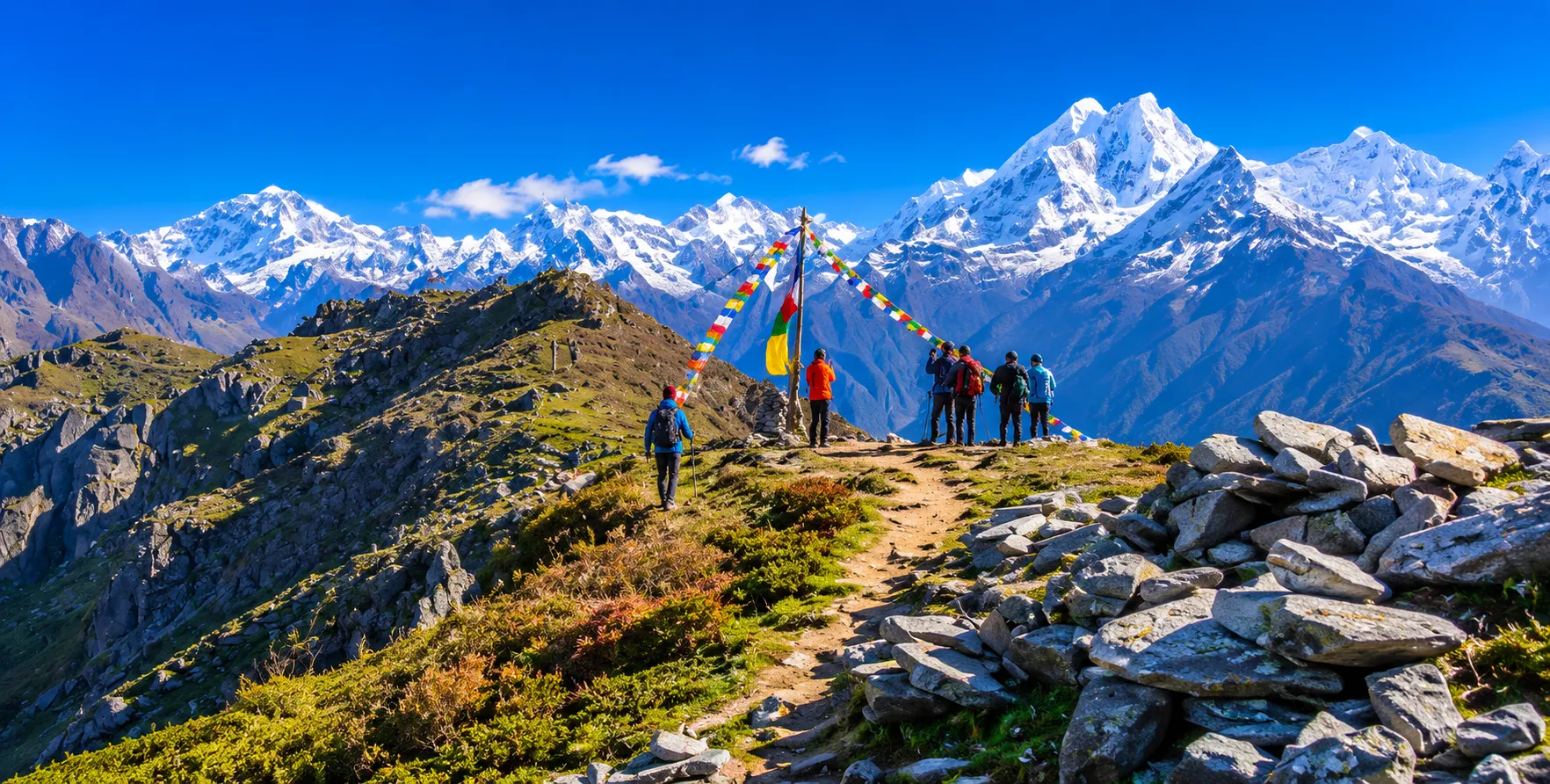
The stage to Hile Bhanjyang involves a significant climb followed by a steep descent, passing through largely uninhabited forest, with the trail narrowing and receiving far less maintenance than the lower sections. Mountain views from the ridgeline crossings on this stage extend to the Langtang, Jugal, Rolwaling, and Ganesh Himal ranges, and on clear days the summits of Dorje Lakpa (6,966 m), Madiya (6,257 m), Phurbi Chhyachu (6,637 m), and Gaurishankar (7,134 m) are visible. This stretch makes the remoteness of the Panch Pokhari trail most tangible for trekkers accustomed to the well-supplied, well-trafficked trails of the Annapurna or Everest regions.
Hile Bhanjyang to Panch Pokhari (4,100 m)
The final approach to the lakes climbs through increasingly rocky, open terrain above the tree line, crossing alpine meadows and boulder fields before the five lakes come into view. The approach follows a steady ascent through Nashympati to the lake basin, and trekkers consistently describe the first sight of the five glacial lakes against the backdrop of the Jugal Himal as the most striking visual moment of the entire route. The Lord Shiva temple and two pilgrim houses sit on the lakeshore, where trekkers and pilgrims alike camp or stay in basic overnight accommodations.
The Viewpoint Above the Lakes
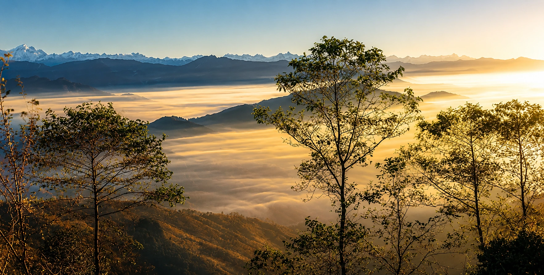
From the lake basin, a short one-hour hike to the viewpoint ridge above Panch Pokhari opens a full-circle panorama that encompasses the Dorje Lakpa massif, Gaurishankar, the full Jugal Himal chain, the distant Rolwaling range, the Ganesh Himal group to the west, and the Langtang range to the northwest. Several itineraries build in an extra day at the lakes specifically to make this sunrise viewpoint hike in stable early-morning light, when visibility is typically alearest,and the 8,000-meter peaks on the horizon catch the dawn before the valleys below to.
Janai Purnima: The Festival That Transforms the Trail
The single event that most dramatically changes the character of a Panch Pokhari trip is Janai Purnima, the full-moon festival of Shrawan, which falls in late July or August, depending on the lunar calendar. During this festival, the normally quiet trail to Panch Pokhari becomes a genuine mass pilgrimage, with thousands of Hindu devotees climbing from surrounding villages and towns to the lakes specifically to perform the ritual bathing and the renewal of the Janai, the sacred thread worn by twice-born Hindu men, in the presence of the five sacred waters.
Shamans, known as dhami-jhankri in Nepali, are particularly numerous at Panch Pokhari during Janai Purnima, arriving with their ritual drums, chanting, and trance-state ceremonies that represent a much older layer of spiritual practice than either mainstream Hinduism or Tibetan Buddhism, and which draw significant attention from travellers with an interest in indigenous religious traditions. The sight of hundreds of shamans drumming and dancing simultaneously at a high-altitude sacred lake while thousands of pilgrims bathe and pray is not something easily replicated anywhere else in Nepal, and travellers specifically interested in this experience should plan their trip to coincide with the Janai Purnima window rather than treating it as a complication to be avoided.
That said, the festival period does create significant practical complications for vehicle transport and accommodation. The Chautara approach road becomes extremely busy with pilgrim traffic in the days before and after the festival, and both trailheads see far more simultaneous footfall than at any other time of year. Accommodation at the lake shore fills up quickly; camping may be necessary even for trekkers who expected teahouse accommodation, and book the jeep transfer from Kathmandu well in advance rather than arranging it at short notice. Returning to Kathmandu immediately after the festival also requires careful planning, since the return traffic surge on the Araniko Highway and the district roads can produce significant delays.
For travellers not specifically motivated by the Janai Purnima pilgrimage, the spring window of March to May and the autumn window of September to November offer the clearest mountain views, the most stable road and trail conditions, and a significantly quieter experience at the lakes themselves. These are the same seasons that serve the broader Langtang and Annapurna trekking regions covered in our unlimited tour and trek vehicle hire guide, and the same seasonal logic applies here.
Permits Required for the Panch Pokhari Trek
Because Panch Pokhari lies within Langtang National Park, trekkers need a Langtang National Park Entry Permit, which differs from the ACAP permit required for the Annapurna region. You can obtain this permit at Nepal Tourism Board offices in Kathmandu or at park checkpoints along the approach trail, and the fee structure follows the standard national park entry framework: higher for non-SAARC foreign nationals, lower for SAARC nationals, and a specific rate for Nepali citizens.
In addition to the national park permit, the Panch Pokhari trail currently requires a TIMS card (Trekkers’ Information Management System). Unlike the Everest region, where a local municipality fee has effectively replaced the TIMS, and unlike the Annapurna region, where enforcement has become inconsistent, the TIMS card remains a standard requirement for the routes in Sindhupalchok and Langtang National Park. Arrange it before departure in Kathmandu. You can typically get both the park permit and the TIMS card on the same day at the Nepal Tourism Board’s Pradarshani Marg office in Kathmandu.
Panch Pokhari does not fall under Nepal’s restricted area regulations, which means it requires no special restricted area permit, no minimum group size, and no compulsory government-licensed guide for the trek itself, though carrying a local guide is strongly advisable given the trail’s remoteness, limited signage, and basic infrastructure compared to Nepal’s more developed trekking corridors. A guide familiar with the Sindhupalchok hill trails makes a meaningful difference in navigation and in understanding the cultural and religious sites along the way.
Wildlife, Flora, and the Ecological Significance of the Lakes
Panch Pokhari holds a unique designation in wetland ecology: it is classified as the ninth-highest-altitude wetland, reflecting both the extreme elevation of the five lakes and the ecological rarity of functioning glacial lake ecosystems at this altitude. The lake basin and surrounding alpine meadow support a range of high-altitude flora that changes visibly with the season, from wildflower-carpeted meadows in spring and early summer to frost-rimmed grass and bare rock in winter.
The forested slopes of the approach trail, from roughly 1,500 to 3,500 meters, pass through the transition zones between subtropical broadleaf forest at the lower elevations, mixed temperate forest including rhododendron, oak, and alder, and subalpine rhododendron and juniper scrub that characterises the forest immediately below the tree line. This transition is one of the most varied altitudinal vegetation gradients on any single trekking route in Nepal’s Bagmati Province, and spring trekkers in particular encounter the rhododendron bloom, which transforms large sections of the trail into shades of crimson, pink, and white in March and April.
Wildlife along the trail includes species typical of Langtang National Park’s protected forest: the endangered red panda has been recorded in the park’s forest zones, including the Sindhupalchok sections, alongside Himalayan tahr, musk deer, leopard, Himalayan black bear, and a wide range of high-altitude bird species, including the Himalayan monal pheasant, Nepal’s national bird, which frequents alpine meadow edges at elevations approaching and exceeding the lake basin itself. The lakes serve as a watershed for the Indravati River system, contributing to regional water supply and giving the ecological protection of the lake basin significance beyond the immediate trekking and pilgrimage context. The ninth-highest altitude wetland designation, which the Panch Pokhari lake system carries, also reflects a broader reality: high-altitude wetlands are among the most ecologically fragile and least understood ecosystems on Earth, and the relative remoteness of Panch Pokhari compared to more heavily visited sacred lake sites has so far helped preserve the ecological integrity of the lake basin in a way that more popular destinations have sometimes struggled to maintain as visitor numbers have grown. This ecological value is an argument, alongside the cultural and religious ones, for thoughtful, well-prepared trekking rather than poorly organised mass access.
Accommodation and Food Along the Panch Pokhari Trail
The Panch Pokhari trail is honest about its infrastructure limitations, and trekkers expecting the well-supplied teahouse network of the Everest Base Camp or Annapurna Base Camp routes will find the reality here considerably more basic. The lower sections of the trail, through the Sindhupalchok hill villages between the trailhead and roughly 2,500 meters, have small local tea shops and very basic guesthouses or homestays that provide simple meals and a bed in a private household rather than a purpose-built trekking lodge. Dal bhat, eggs, potatoes, and seasonal vegetables are the standard menu throughout; speciality trekking dishes common on the more commercial routes are largely unavailable.
Above roughly 2,500 meters, accommodation becomes even more limited, with some stages of the trail requiring either a tented camp or a stay in a basic pilgrim shelter rather than any form of commercial teahouse. The two pilgrim houses at the lake shore itself are available for overnight stays during and around the Janai Purnima festival period. Still, they may not be reliably staffed outside festival season, which is a key reason organised group trekking on the Panch Pokhari trail typically involves carrying camping equipment by porters rather than relying on finding open teahouse accommodation at every stage.
This accommodation reality is not a criticism of the trail; it reflects how new and non-commercial the Panch Pokhari route remains compared to Nepal’s established trekking circuits. This means trekkers planning an independent trip without an organised agency need to be genuinely self-sufficient from the upper trail stages onward, carrying a good sleeping bag, some emergency rations, and water purification capability, and ideally coordinating with a local guide who knows which community homestays are currently operating at each stage.
A Complete Sample Itinerary: Kathmandu to Panch Pokhari and Back
The following itinerary uses the Chimchi approach for efficiency. It is structured around a private jeep transfer from Kathmandu for the road legs, with porter and guide support for the trekking sections. You can book all vehicle transfers through our Plan a Trip page.
- Day 1 — Arrive in Kathmandu. Collect the Langtang National Park permit and TIMS card from the Nepal Tourism Board. Check gear and obtain any remaining cash; ATMs are unavailable on the trail.
- Day 2 — Early morning private jeep transfer from Kathmandu along the Araniko Highway to the Chimchi/Chhimti trailhead, approximately five to six hours. Overnight at a basic teahouse or homestay in Chimchi.
- Day 3 — Trek from Chimchi to Tuppi Danda (2,320 m), roughly seven hours through terraced farmland and lower forest. Overnight in a basic teahouse.
- Day 4 — Trek from Tuppi Danda to Nashympati or Hile Bhanjyang (3,400 m), around five to six hours through dense rhododendron forest. Mountain views begin opening at ridgeline crossings. Overnight in a tent camp or basic shelter.
- Day 5 — Trek from Hile Bhanjyang to Panch Pokhari (4,100 m), around four to six hours. Ascend through rocky alpine terrain to the five sacred lakes. Visit the Lord Shiva temple and the lake shore. Overnight in the pilgrim house or tent at the lake.
- Day 6 — Optional early sunrise hike to the viewpoint above the lakes for panoramic views of Dorje Lakpa, Gaurishankar, the Jugal Himal, Rolwaling, and Langtang ranges. Return to the lakes for rest. Overnight at Panch Pokhari for a second night, or begin descent.
- Day 7 — Descend via Nashympati and Tuppi Danda back toward the Chimchi trailhead. The descent is faster but still a full day of walking on steep, uneven terrain.
- Day 8 — Complete descent to Chimchi. Private jeep pickup and return transfer to Kathmandu along the Araniko Highway. Overnight in Kathmandu.
This eight-day round trip can be extended by taking the Chautara southern approach for a richer village experience, or shortened by one day if trekkers opt not to spend two nights at the lakes. On return to Kathmandu, the same vehicle and driver can continue with any subsequent legs of a wider Nepal itinerary — valley sightseeing via our Kathmandu Sightseeing Tour or an onward transfer to Pokhara via the Kathmandu to Pokhara Bus for trekkers extending their Nepal trip into the Annapurna region.
Combining Panch Pokhari With a Wider Nepal Itinerary
Because Panch Pokhari is located northeast of Kathmandu rather than north or west, it fits naturally at the beginning or end of a broader Nepal itinerary rather than as a mid-trip leg. Travellers arriving in Kathmandu and wanting to begin with a spiritually significant, off-the-beaten-path experience before the better-known circuits often start with Panch Pokhari, then return to Kathmandu before continuing to Pokhara for the Annapurna region or flying to Lukla for the Everest trek. Our Kathmandu to Syabrubesi Jeep Transfer and Kathmandu to Dhunche Jeep serve a similar northeast Kathmandu corridor and can be combined with a Panch Pokhari trip for travellers who want to explore more of the Sindhupalchok and Rasuwa districts in a single extended Kathmandu-based trip.
For travellers interested in the Helambu trekking area, which lies in the same general northeast quadrant of Kathmandu as Panch Pokhari, the two destinations can be combined into a longer loop itinerary that returns to Kathmandu via a different route from the one used on the approach, providing more variety within a single continuous trip. For visitors interested in rafting on the Bhote Koshi River, one of Nepal’s most renowned whitewater stretches, the Araniko Highway corridor that serves as the jeep access route for Panch Pokhari also passes directly alongside this famous rafting destination, making a Bhote Koshi rafting day a natural add-on to the vehicle hire for any Panch Pokhari transfer.
What to Pack and How to Prepare for Panch Pokhari
Panch Pokhari requires more careful packing than many of Nepal’s more commercial trekking routes, because the limited infrastructure along the trail means you cannot count on resupplying food or equipment beyond the lower trailhead villages, and because the 4,100-meter altitude of the destination makes cold-weather preparation non-negotiable even in the nominally milder spring and autumn seasons.
- Sleeping bag rated to -15°C or lower — nights at the lake basin can be genuinely cold at any time of year, and the pilgrim house accommodation does not provide bedding.
- Full waterproof layering system — base layer, fleece or down mid-layer, and windproof and waterproof outer shell. Afternoon weather at altitude can change rapidly.
- Sturdy, broken-in trekking boots — the trail includes rocky, steep sections that are hard on ankle stability and harder still on new footwear.
- Water purification — UV purifier or iodine tablets, as stream water along the upper trail should not be drunk untreated and bottled water is unavailable beyond the lower villages.
- Emergency food supplies — energy bars, nuts, or other calorie-dense portable food for the upper trail stages where teahouse menu options are severely limited.
- Headlamp and spare batteries — essential for sunrise viewpoint hikes, early morning departures, and basic teahouse or tent camp evening use.
- Trekking poles — the steep descents from Hile Bhanjyang and from the lakes themselves are considerably easier on the knees with pole support.
- Cash in sufficient quantity — no ATMs exist beyond the Araniko Highway and Chautara town; carry enough for the entire trekking portion of the trip.
- Travel insurance confirming helicopter evacuation coverage — the Panch Pokhari trail is remote enough that an injury or severe altitude-related illness requiring evacuation would involve a helicopter, which standard travel insurance does not cover.
The Communities Along the Trail: Tamang, Sherpa, and the Sindhupalchok Hill People
One of the most distinctive and underappreciated aspects of the Panch Pokhari trail is the cultural and ethnic diversity of the communities it passes through. Sindhupalchok district is one of Nepal’s most ethnically heterogeneous districts. The northern hill section of the trekking trail, between the lower trailhead villages and the high-altitude lake basin, passes through settlements where Tamang, Sherpa, Yalmu, Brahmin, and Chhetri households often sit within a few minutes’ walk of one another, each maintaining distinct but overlapping cultural and religious traditions.
The Tamang people, the most numerous community along most of the trail’s mid-altitude section, are one of Nepal’s largest ethnic groups and are predominantly Buddhist, with a culture deeply influenced by Tibetan traditions, including their language, which belongs to the Tibeto-Burman family and is closely related to Tibetan, their monastic architecture, and their festival calendar. Tamang villages along the Panch Pokhari trail often feature mani walls, carved stone tablets bearing the Om Mani Padme Hum mantra, small gompa shrines, and prayer flag lines strung between houses and ridge crossings, all of which add a tangible visual and spiritual texture to the walking day that is absent from the purely teahouse-focused trekking infrastructure of more commercial routes.
The Yalmu people, a smaller community also present in this part of Sindhupalchok, maintain a particularly close traditional relationship with the Panch Pokhari lake site itself, and have historically played a custodial role in the lake’s religious observances alongside the Brahmin priests who lead the formal Hindu rituals during Janai Purnima. Encountering this layered community relationship, where a Buddhist Tamang village, a Hindu Brahmin priesthood, and a Yalmu custodial tradition all converge around the same set of five sacred lakes, is one of the most intellectually interesting aspects of the Panch Pokhari experience for travellers interested in Nepal’s complex religious and ethnic landscape.
Interactions with households along the lower trail offer a level of genuine, unscripted cultural contact that is harder to achieve on Nepal’s more commercially developed trekking corridors, where the teahouse economy has, over decades, created a mediated, hospitality-business relationship between trekker and host rather than a genuine household encounter. On the Panch Pokhari trail, where the homestay and small community tea shop model still dominates over the purpose-built trekking lodge, the hospitality tends to be more direct, more personal, and more reflective of daily life in Sindhupalchok’s hills than a visitor would encounter in a Namche Bazaar or Ghorepani teahouse.
Panch Pokhari Versus Gosaikunda: Choosing Between Nepal’s Two Great Sacred Lake Treks. Travellers researching sacred lake pilgrimage destinations in Nepal will quickly encounter Gosaikunda and Panch Pokhari, and the two sites invite a direct comparison worth addressing clearly. Gosaikunda, at 4,380 meters in the Rasuwa district north of Kathmandu, is the older and more internationally famous of the two sacred lake destinations, with a well-developed trail network connecting it to both the Langtang Valley and the Helambu circuit. Our Kathmandu to Dhunche Jeep and Kathmandu to Syabrubesi Jeep Transfer services both approach from the Rasuwa side and cover the general Gosaikunda access corridor.
The key differences between the two destinations are trail development, crowd levels, cultural context, and approach flexibility. Gosaikunda is served by a well-marked, teahouse-equipped trail from Dhunche or Syabrubesi that international trekkers have used for decades, meaning reliable accommodation at most stages and trail infrastructure that makes independent trekking straightforward. Panch Pokhari, by contrast, has only been formally opened as a trekking destination since 2012, has a much thinner teahouse network, requires more self-sufficiency on the upper trail, and is consequently quieter, less tramped, and more genuinely off the beaten path.
Gosaikunda is also associated with Janai Purnima, drawing its own large pilgrimage during the same August festival window, so both sites see their peak pilgrimage crowds simultaneously. Travellers specifically seeking to avoid festival-period crowds at a sacred lake destination will find neither site entirely quiet during Janai Purnima. Still, Panch Pokhari remains meaningfully less crowded than Gosaikunda in absolute numbers even during the peak pilgrimage period. Outside the festival season, Panch Pokhari offers greater solitude throughout.
In summary: trekkers and pilgrims wanting a well-established, teahouse-supported trail with flexible length options and the option to combine with the Langtang Valley circuit should choose Gosaikunda. Those specifically seeking a more remote, community-based, and less commercially developed sacred lake experience with fewer other trekkers on the trail should choose Panch Pokhari. Both are exceptional destinations for their respective purposes, and travelers with enough time in Nepal can realistically fit both into a longer itinerary centered on the northeast Kathmandu district cluster, using the same general jeep corridor out of Kathmandu for both legs and only diverging at the specific junction toward Rasuwa for Gosaikunda or Sindhupalchok for Panch Pokhari. Because the two destinations share a broadly similar vehicle access corridor, a single vehicle hire booking can cover the combined itinerary rather than two separate arrangements, keeping logistics simple and costs proportionally lower than booking each leg independently.
Frequently Asked Questions About the Panch Pokhari Trek
Is the Panch Pokhari trek suitable for beginners?
It is classified as moderate to challenging rather than beginner-friendly. Thedestination’s altitude of 4,100 meters, combined with the steep approach, basic accommodation, and remoteness of the upper trail, makes it more demanding than Nepal’s most accessible short treks, such as Poon Hill. Trekkers with reasonable fitness, prior hiking experience, and careful preparation can complete it successfully. Still, first-time high-altitude trekkers without prior experience above 3,000 meters should consider acclimatising in Kathmandu for at least one to two days before beginning and taking the slower Chautara approach rather than the shorter but steeper Chimchi route.
Do I need a guide for this trek?
While Panch Pokhari does not legally require a government-licensed guide under Nepal’s current trekking regulations for this specific route, the trail’s limited signage, basic infrastructure, and genuine remoteness make a local guide strongly advisable in practice. Navigation errors on the upper trail could lead to a significant safety situation, given the distances between settlements and the lack of mobile signal on most of the upper route.
When is the absolute best time to visit Panch Pokhari?
For mountain views and trail conditions, October and November are generally considered the best months, offering post-monsoon clarity and stable weather. For the Janai Purnima pilgrimage experience, go in August, accepting the trade-off of busier trails, more variable weather, and the possibility of monsoon-related road disruption on the approach. Spring from March to May is the best time for rhododendron blooms and a strong second choice for mountain views.
Can I drive all the way to Panch Pokhari, or is trekking mandatory?
No road reaches Panch Pokhari itself. The vehicle access ends at the trailheads of Chautara or Chimchi, and the approach from either point requires several days of foot travel. No shortcut, cable car, or partial road access exists beyond these trailheads.
Why Choose Nepal Vehicle Hiring for Your Panch Pokhari Transport
The Araniko Highway corridor northeast of Kathmandu is a route our driver regularly runs for Langtang National Park transfers, Kerung border crossings, and access to the broader Sindhupalchok district, meaning we bring genuine route familiarity rather than a generic hill-road experience to the Panch Pokhari transfer. We know the road conditions on the branch road to Chautara, the Melamchi junction turn for the Chimchi approach, and the seasonal landslide-risk sections that require either an early-morning start or a contingency trailhead plan during monsoon season. We also understand the specific logistical demands of the Janai Purnima pilgrimage window, including the dramatically increased road traffic on the approach corridor during that period and the importance of an early-morning departure from Kathmandu to clear the valley before the pilgrim convoys build up on the highway. Our full Jeep fleet covers every 4WD route in this corridor, and our Plan a Trip service can coordinate the Panch Pokhari jeep transfer with any wider Nepal itinerary that comes before or after.
For trekkers combining Panch Pokhari with a Langtang Valley trip, our Kathmandu to Syabrubesi Jeep Transfer and Kathmandu to Dhunche Jeep share the same general northeast approach via the Kathmandu highway and can be booked consecutively with a single operator. For a broader picture of how our vehicle network covers every trekking region in Nepal, our complete guide to unlimited tour and trek vehicle hire and our Complete Nepal Tourism Guide provide the full context.
Book Your Kathmandu to Panch Pokhari Jeep Transfer Today
Whether you are arriving as a Hindu pilgrim for Janai Purnima, as a trekker seeking solitude and genuine high-altitude wilderness, or as a cultural traveller drawn to the Tamang and Sherpa village trail and the extraordinary convergence of Hindu and Buddhist sacred traditions at the five glacial lakes of Sindhupalchok, Nepal Vehicle Hiring Pvt Ltd can arrange a comfortable, well-maintained 4WD jeep with an experienced driver who knows the Araniko Highway corridor and the Sindhupalchok district roads that lead to the Panch Pokhari trailheads. From your first morning departure from Kathmandu, through the winding hill-road climb to Chautara or the Melamchi junction turn toward Chimchi, and back to Kathmandu at the end of the trek, every vehicle leg of your Panch Pokhari journey is in capable,d well-prepared hands. Call or WhatsApp us at ++9779814227196 or visit vehiclehiringnepal.com to plan your pilgrimage.
- The Legend and Sacred Significance of the Five Lakes
- Where Panch Pokhari Is and Why It Is Harder to Reach Than It Looks
- Kathmandu to Panch Pokhari: All Vehicle Access Options
- Road Conditions and What to Expect on the Drive
- The Trail: Stage-by-Stage from Trailhead to Sacred Lakes
- Janai Purnima: The Festival That Transforms the Trail
- Permits Required for the Panch Pokhari Trek
- Wildlife, Flora, and the Ecological Significance of the Lakes
- Accommodation and Food Along the Panch Pokhari Trail
- A Complete Sample Itinerary: Kathmandu to Panch Pokhari and Back
- Combining Panch Pokhari With a Wider Nepal Itinerary
- What to Pack and How to Prepare for Panch Pokhari
- The Communities Along the Trail: Tamang, Sherpa, and the Sindhupalchok Hill People
- Frequently Asked Questions About the Panch Pokhari Trek
- Why Choose Nepal Vehicle Hiring for Your Panch Pokhari Transport

Related Blog & Articles
Kathmandu to Panch Pokhari Trek Vehicle: The Sacred Five Lakes Within Reach of the Capital
Kathmandu to Jiri Road Trip Guide

Kathmandu to Dolakha Vehicle Rental – Car, Jeep, Van, Hiace & Bus Hire
Kathmandu to Salleri Jeep Guide
Kathmandu to Dhulikhel Car Hire – Private Car Rental for a Perfect Day Trip