Plan a Trip


Dolpo Region Vehicle Hire Nepal
 Dolpo Region Vehicle Hire Nepal
There is a moment, usually somewhere on the long drive west from Surkhet along the Karnali Highway, when Nepal stops looking like the Nepal most travelers know. The terraced farmland and roadside tea shops thin out. The valley narrows. The road turns to gravel, then to compacted dirt, then to something that requires the full attention of an experienced driver and the full capability of a high-clearance 4WD vehicle.
The mountains ahead take on the stark, ochre-gray palette of the trans-Himalayan plateau rather than the green-forested profile of the mid-hills. And somewhere in that transition, it becomes clear why Dolpo is called Nepal’s last frontier: not as a marketing phrase, but as a plain geographic fact.
Dolpo, officially Dolpa District, is Nepal’s largest district by area, covering 7,889 square kilometers in the country’s far northwest. Most of it lies within Shey Phoksundo National Park, Nepal’s largest national park. It borders Tibet to the north, is hemmed in by the Dhaulagiri massif to the east, and is separated from the rest of the country’s road network by the Karnali river system and the high passes of the Himalayan rain shadow belt.
The entire district has a population of roughly 36,700 people, most of them Dolpo-pa, a community of Tibetan-influenced semi-nomads who follow a blend of Bon and Tibetan Buddhist traditions that has remained essentially unchanged for centuries. Until 1989, the entire region was closed to foreign trekkers entirely. Only the southern fringe of Lower Dolpo was opened that year, and Upper Dolpo remained off-limits until 1992.
This guide is written specifically for travelers planning a Dolpo expedition in 2026, with a focus on vehicle hire and transport logistics that can make or break the trip. Dolpo is not a place where improvising ground transport works; every leg of the journey, from Kathmandu to Nepalgunj, from Nepalgunj onward by air or road, from the Juphal airstrip or Dunai road-end to the trek start, and all the way back, requires planning and the right vehicle on the right road.
At Nepal Vehicle Hiring Pvt Ltd, we operate the overland jeep route from Kathmandu to Dunai via the Karnali Highway, maintain detailed knowledge of both air and road access options to this remote region, and have covered the Shey Phoksundo Lake Jeep Tour on our Shey Phoksundo Lake Jeep Tour page. This guide pulls together everything a traveler needs to understand before making transport decisions for what is, by any measure, Nepal’s most logistically demanding trekking destination.
Understanding Dolpo’s Geography: Why Getting There Is Half the Expedition
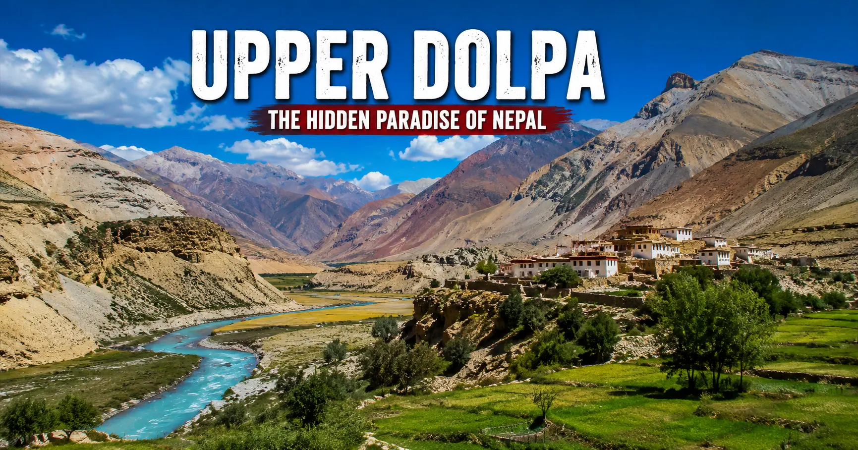
Dolpo’s geography explains its isolation more clearly than any historical account. The district sits north of the main Himalayan watershed in the trans-Himalayan rain shadow, the same high-altitude desert belt that also shelters Upper Mustang, Ladakh, and parts of western Tibet. This position means that while the monsoon drenches most of Nepal from June through September, Dolpo remains comparatively dry, receiving only a fraction of the rainfall that falls on the mountains to its south. This is ecologically significant, producing a landscape of semi-arid highlands, sparse juniper scrub, and high alpine pasture that feels fundamentally different from the rhododendron forests and terraced hillsides of Nepal’s middle hills.
The district divides naturally into two zones whose distinction matters enormously for transport and permit planning. Lower Dolpo encompasses the southern portion of the district, including Dunai (the district headquarters), the Bheri and Suli Gad river valleys, and most critically, Shey Phoksundo Lake, Nepal’s deepest lake at approximately 145 meters and one of the most visually arresting places in the entire Himalayan region. Upper Dolpo, also called Inner Dolpo, lies north of Phoksundo Lake and encompasses the high-altitude valleys of Tarap, Panzang, Nangkhong, and Tsharka, along with Shey Gompa, the Crystal Mountain pilgrimage circuit, and the villages of Saldang, Dho Tarap, and Tinje, communities that sit among the highest permanently inhabited settlements on Earth.
The four main valleys of Dolpo — Tsharka, Tarap, Panzang, and Nangkhong — each support small communities of Dolpo-pa people who move between lower valley winter settlements and high summer pastures with their yaks, goats, and sheep in a seasonal transhumance pattern that has defined life here for generations. The high passes connecting these valleys and to the outside world, including Kang La (5,350 m), Jeng La (5,110 m), Numa La (5,190 m), Baga La (5,070 m), and Shey La (5,000 m), are the physical barriers that keep Dolpo as remote and self-contained as it is, and that make every crossing in an Upper Dolpo itinerary a genuine high-altitude undertaking rather than a scenic stroll.
Dolpo’s geography also explains why it remained closed to foreign trekkers until 1989, later than almost any other district in Nepal. The combination of its position on the Tibetan border, the political sensitivity of trans-Himalayan communities with cross-border cultural and trade ties to Tibet, and the sheer difficulty of administering or monitoring access to a region this remote all contributed to a closure policy that remained in place for decades after the rest of Nepal opened to trekking tourism in the 1960s and 1970s. Even after the 1989 partial opening, Upper Dolpo remained closed until 1992, and the restricted area permit system that still governs access today is a direct continuation of that policy of managed, monitored entry rather than open access.
The Bon Religion and the Cultural Character of Dolpo
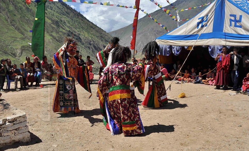
Dolpo is the heartland of the Bon religion in Nepal, and understanding what this means is essential for understanding why the region draws the particular travelers it does. Bon is the pre-Buddhist indigenous spiritual tradition of Tibet, predating the introduction of Buddhism to the Tibetan plateau by centuries. While Tibetan Buddhism largely displaced it across most of Tibet after the eighth century, isolated communities in western Nepal, particularly in Dolpo, maintained Bon practice in relatively pure form because the region’s extreme remoteness protected it from the forces of religious standardization that swept the rest of the plateau.
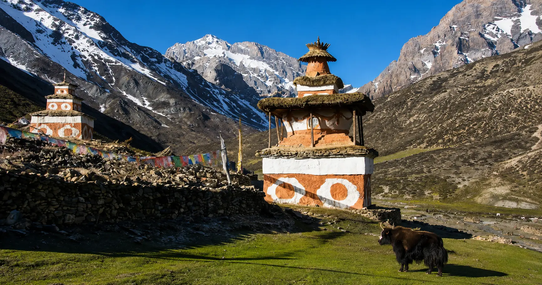
The sacred geography of Dolpo is organized around Bon cosmological principles rather than Buddhist ones, most visibly in the Crystal Mountain, a natural rock formation near Shey Gompa that serves as the center of a kora, or ritual circumambulation circuit, walked by Bon pilgrims in a counterclockwise direction, opposite to the clockwise direction used by Buddhist pilgrims. Shey Gompa, sometimes called the Crystal Monastery, is a 900-year-old monastery that serves as a spiritual convergence point: its architecture and many of its practices reflect the Bon tradition.
At the same time, it also functions within the broader landscape of Tibetan Buddhism, which now exerts influence across the region. The Shey Festival, held annually in August at the time of the full moon, draws pilgrims from across Dolpo and from Tibet for a multiday celebration of ritual dance, prayer, and community gathering.
The villages of Dolpo, particularly in Upper Dolpo, are physically unlike any other settlements in Nepal. Their stone houses, flat roofs, and compact, fortress-like layout reflect an architectural tradition adapted to the extreme cold, high wind, and sparse timber of the trans-Himalayan environment, with each village containing its own small gompa or prayer space and often several mani walls covered in carved mantras and prayer stones. The anthropologist and writer David Snellgrove documented Dolpo extensively in the 195.
The region later became internationally famous through Peter Matthiessen’s book The Snow Leopard, published in 1978 and widely considered one of the finest pieces of nature and spiritual writing in the English language, which followed a journey through Dolpo with the biologist George Schaller in search of the Himalayan blue sheep and the elusive snow leopard.
Shey Phoksundo Lake: The Defining Visual Experience of the Region
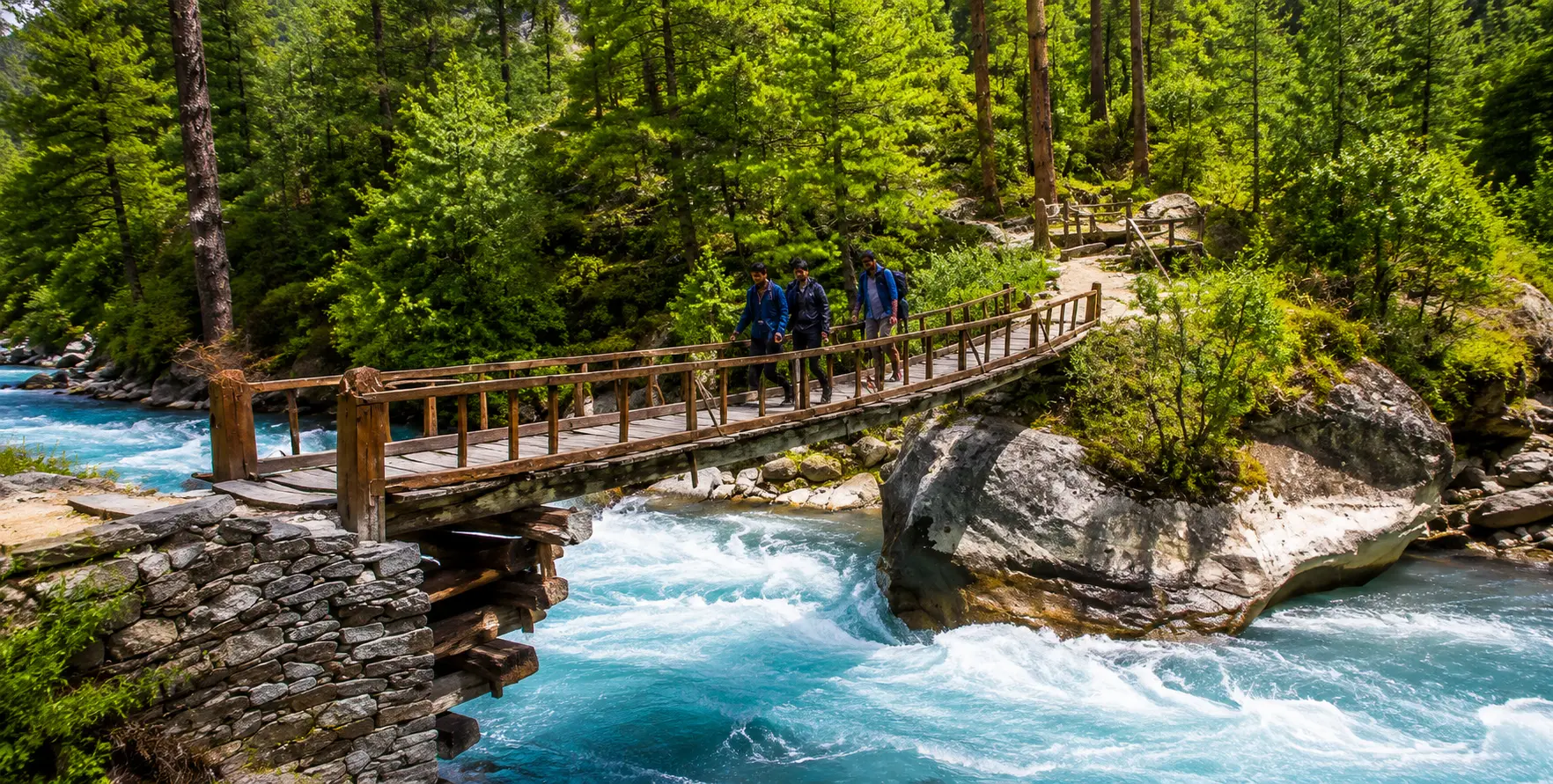
No single feature of Dolpo is as immediately and viscerally arresting as Shey Phoksundo Lake, and that is saying something, given the landscape’s overall visual intensity. Sitting at 3,611 meters above sea level in a deep rock basin carved by glacial action, Phoksundo is Nepal’s deepest lake at approximately 145 meters.
It is internationally known for the extraordinary color of its water: a shade of cobalt and turquoise so vivid that photographs of it are frequently mistaken for digital enhancement by viewers unfamiliar with the lake, when in fact the color is entirely natural, produced by the specific mineral content and clarity of the glacial water combined with the high-altitude sunlight above it.
The lake sits below the village of Ringmo, one of the most scenic inhabited locations in Nepal, with its stone houses, prayer flags, and terraced barley and buckwheat fields arranged above the lakeshore in a composition that has served as the backdrop for numerous documentary films and photography expeditions. Nepal’s highest waterfall, Phoksundo Falls, tumbles into the lake from the western side, audible from Ringmo long before it is visible on the approach trail.
The lake is sacred to the Bon tradition and to the Buddhist communities of Ringmo, both of which maintain prohibitions against fishing or harming the lake’s waters or the surrounding landscape. Our Shey Phoksundo Lake Jeep Tour page covers both overland and flight-assisted approaches in detail.
Getting to Dolpo: The Two Transport Strategies and How Vehicle Hire Fits Each
Reaching Dolpo requires making a fundamental choice between two transport strategies early in the planning process, because the correct answer differs meaningfully depending on how much time a traveler has, what budget they are working with, and whether they want the overland journey itself to be part of the experience. This is not a simple car-versus-bus decision; it is a question of whether to fly directly into the Juphal airstrip or drive the Karnali Highway overland, and the implications of that choice cascade into every subsequent logistics decision for the trip.
Option One: The Flight Approach via Nepalganj and Juphal
The vast majority of trekking groups visiting Dolpo arrive by the two-flight air route: a domestic flight from Kathmandu to Nepalgunj, a flat Terai city near the Indian border in the west of Nepal, followed the next morning by a short STOL (Short Take-Off and Landing) flight from Nepalgunj to Juphal, the only airstrip in Dolpa district, situated at 2,475 meters in a narrow valley. The Kathmandu–Nepalgunj leg takes roughly 55 minutes and is operated by multiple domestic carriers, including Yeti Airlines and Shree Airlines.
The Nepalgunj–Juphal leg takes approximately 25 to 35 minutes and is operated by Summit Airlines and Tara Airlines, which specialize in the STOL operations needed to land on Juphal’s short, now blacktopped runway.
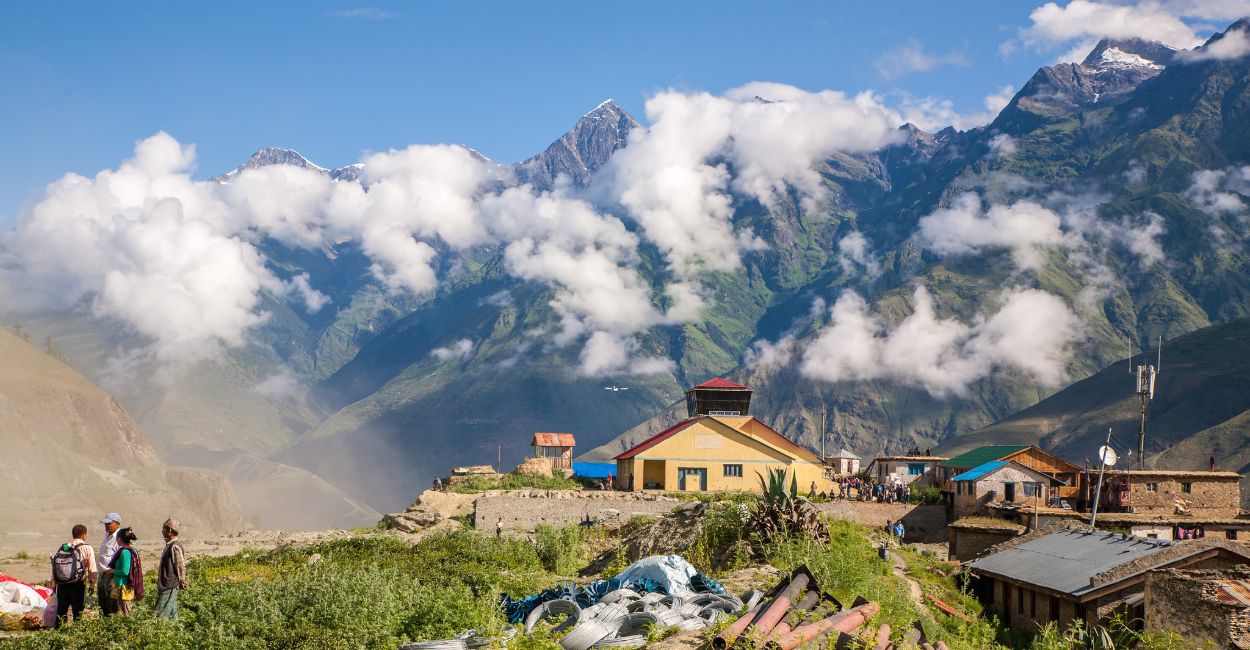
Juphal’s airstrip was only a grass runway until 2017, when it was finally surfaced, improving reliability somewhat. That said, Juphal is one of Nepal’s most weather-sensitive airstrips, and delays and cancellations due to morning fog, wind, or low cloud are a routine feature of the travel experience here.
Building in at least two buffer days at Nepalgunj before the Juphal flight, and at least one buffer day at Juphal before the return flight from Dunai, is not optional caution but standard operational planning for any serious Dolpo expedition. Groups that fail to build these buffers regularly find themselves without downstream connections or scrambling to rebook onward flights planned too tightly around a non-guaranteed airstrip schedule.
The per-person round-trip cost for the full Kathmandu–Nepalgunj–Juphal–Nepalgunj–Kathmandu flight sequence typically ranges from USD 450 to 550, reflecting the premium pricing of STOL services into mountain airstrips. For a trekking group of four to six people, the total flight cost therefore rivals or exceeds the cost of an overland 4WD vehicle hire for the same journey, which is one of the reasons the overland route is worth seriously considering as an alternative for groups willing to invest the additional driving days in exchange for a significantly richer overland experience.
That said, for expeditions focused on maximizing actual trekking time in Upper Dolpo rather than on the approach, the flight route remains the standard choice. Our Kathmandu Airport Transfer handles the Kathmandu end of this logistics chain.
Option Two: The Overland Karnali Highway Jeep Route
The overland route from Kathmandu to Dunai is one of the most demanding and rewarding vehicle-hire journeys in Nepal, covering roughly three to four full days of driving along the Karnali Highway. The general route runs from Kathmandu west to Nepalgunj, then north from Nepalgunj through Surkhet and along the Karnali River corridor toward Dunai, the district headquarters of Dolpa.
Our dedicated Shey Phoksundo Lake Jeep Tour page covers this overland route in detail, including specific stage information and current road conditions along the Surkhet-to-Dunai section of the Karnali Highway, which is the most demanding and most scenically spectacular portion of the drive.
The road to Dunai, completed in 2018 after years of construction, represents a major change from the pre-2018 situation, when trek crews had to walk for five full days from the road end near Surkhet to reach Dunai. Now a jeep can reach Dunai from the south, though the Surkhet-to-Dunai section of the road remains unpaved, narrow, and highly subject to seasonal damage.
The road currently ends at Dunai; no vehicular road extends further north into Upper Dolpo, meaning that any trip beyond Dunai and the Phoksundo lake trail must be completed entirely on foot with porter and guide support. A plan exists to extend the road north up the Tarap Khola valley toward Dho Tarap, but this is a multi-year infrastructure project and not relevant to any trip planning in 2026.

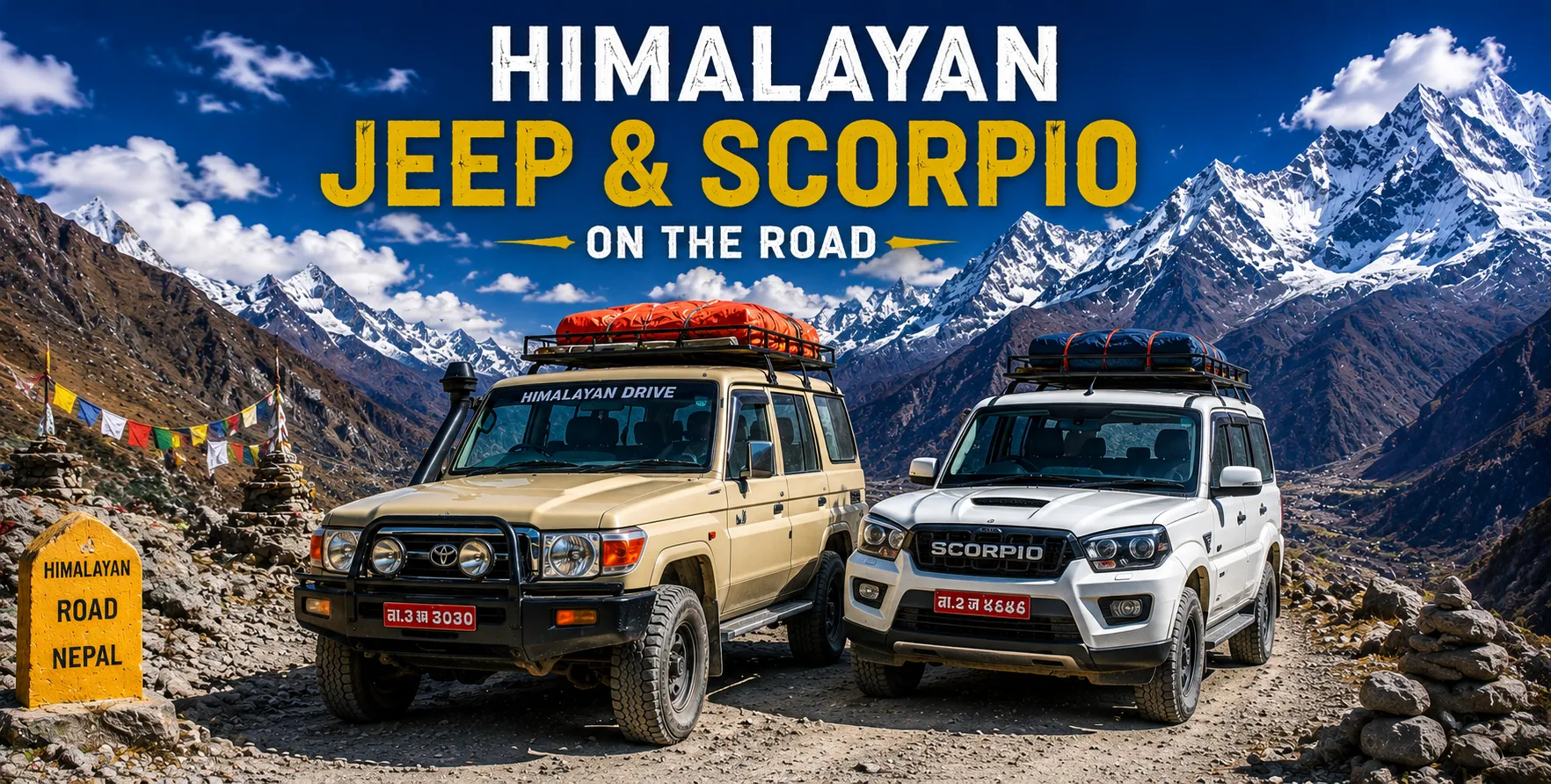
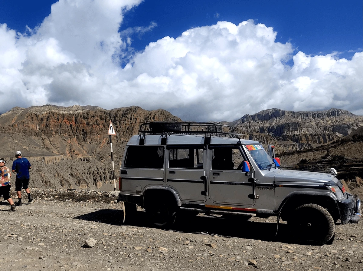
The correct vehicle for the overland route is non-negotiable: a Toyota Hilux, Land Cruiser, or equivalent heavy-duty 4WD is the minimum appropriate vehicle for the Surkhet-to-Dunai section of the Karnali Highway. No other vehicle should be used.
The road features steep grades, river crossings, and completely unpaved sections, making standard jeep categories used on the Annapurna and Langtang routes inadequate for this specific corridor. Our Jeep fleet includes vehicles appropriate for this route, and the overland Karnali Highway trip should be specified at the booking stage so that the correct vehicle category is assigned rather than a standard hill-road jeep.
The overland journey costs approximately NPR 80,000 to 150,000 for a full Kathmandu-to-Dunai vehicle hire, covering a group of four to five passengers, with the wide price range reflecting differences in vehicle quality, fuel costs, driver allowances for the multiday commitment, and whether the booking includes multiday transport or is a one-way drop.
This total is comparable to or lower than the per-group flight cost for the same journey, which is a meaningful consideration for trekking groups of four or more who are already planning to travel together. The overland route adds approximately three to four extra days to the overall trip duration compared to the flight approach. Still, those days are spent driving through some of the most remote and visually dramatic valley scenery in western Nepal, which experienced Dolpo travelers consistently describe as a worthwhile addition rather than wasted time.
The Combined Approach: Drive In, Fly Out
The strategy that experienced Dolpo operators most frequently recommend for travelers with enough time and budget flexibility is a combined approach: drive the Karnali Highway overland to Dunai on the way in, experiencing the full journey through western Nepal, and then fly out from Juphal to Nepalgunj and Kathmandu at the end of the trek, saving the days that would otherwise be spent retracing the driving route on the return leg.
This combination maximizes the overland experience on the approach, avoids the logistical complexity of coordinating a vehicle at Dunai for the return trip, and leaves the flight-delay buffer days to be absorbed at the more comfortable Nepalgunj end rather than the basic Dunai end of the journey. Our Shey Phoksundo Lake Jeep Tour page specifically recommends this combined approach for adventurous travelers wanting the full Dolpa experience.
Permits for Dolpo: The Most Complex Permit Structure in Nepal Trekking
Dolpo has the most layered permit requirement of any trekking destination in Nepal, and getting this wrong has serious consequences: trekkers turned back at checkpoints, expeditions canceled after flights have already been paid for, and significant financial penalties for carrying the wrong documentation. The permit structure differs between Lower Dolpo and Upper Dolpo, and trekkers combining both zones need to understand how the two permit sets interact.
Lower Dolpo Permits
For travel within Lower Dolpo, which includes the Phoksundo Lake trail and the area accessible from Dunai and Juphal without crossing north of the lake, three documents are required. The first is the Lower Dolpo Restricted Area Permit (RAP), priced at USD 20 per person per week, with USD 5 per additional day beyond the first week. The second is the Shey Phoksundo National Park Entry Permit, priced at approximately USD 30 for foreign nationals. The third is a TIMS card, which remains required for far-western Nepal, including the Dolpo corridor, unlike in the Everest and Annapurna regions, where TIMS enforcement has lapsed.
Upper Dolpo Permits
For travel north of Phoksundo Lake into Inner Dolpo, an additional Upper Dolpo Restricted Area Permit is required in addition to all Lower Dolpo documents, since trekkers entering Upper Dolpo must still transit Lower Dolpo to enter and exit. The Upper Dolpo RAP carries the same fee structure as the Upper Mustang permit: USD 500 per person for the first ten days, then USD 50 per additional day.
For a standard 24-to-28-day Upper Dolpo itinerary, the total permit cost per person, including both restricted-area permits and the national park permit, approaches or exceeds USD 570, making Upper Dolpo one of the most expensive trekking destinations in Nepal on a pure permit basis before any other costs are considered.
The 2026 Solo Trekking Rule Update
A significant regulatory change took effect on March 22, 2026: the Government of Nepal officially removed the previous requirement of at least two foreign trekkers per group for restricted-area permits, including Dolpo. Solo trekkers can now obtain a Dolpo Restricted Area Permit provided they are accompanied by a licensed guide and book through a registered trekking agency. This is a meaningful change for independent travelers who previously had to find a second person to meet the minimum group requirement.
Still, it does not change the requirement for agency processing or the guide mandate, both of which remain strictly enforced. All restricted area permits, regardless of group size, must be obtained through a registered trekking agency via the Department of Immigration and cannot be purchased directly by an individual trekker.
Processing Time and Practical Logistics
Restricted area permits for Dolpo require more lead time than standard conservation area permits and should be arranged by your trekking agency as soon as your booking is confirmed, ideally several weeks before departure rather than in the days leading up to travel. Upper Dolpo permits, in particular, are processed by the Department of Immigration and verified against your passport number at multiple checkpoints along the route; permits that have not cleared processing before a trek begins cannot simply be collected en route. All cash for permits, as with all cash for the trip, must be carried from Kathmandu, since there are no banking facilities whatsoever beyond Surkhet in this corridor.
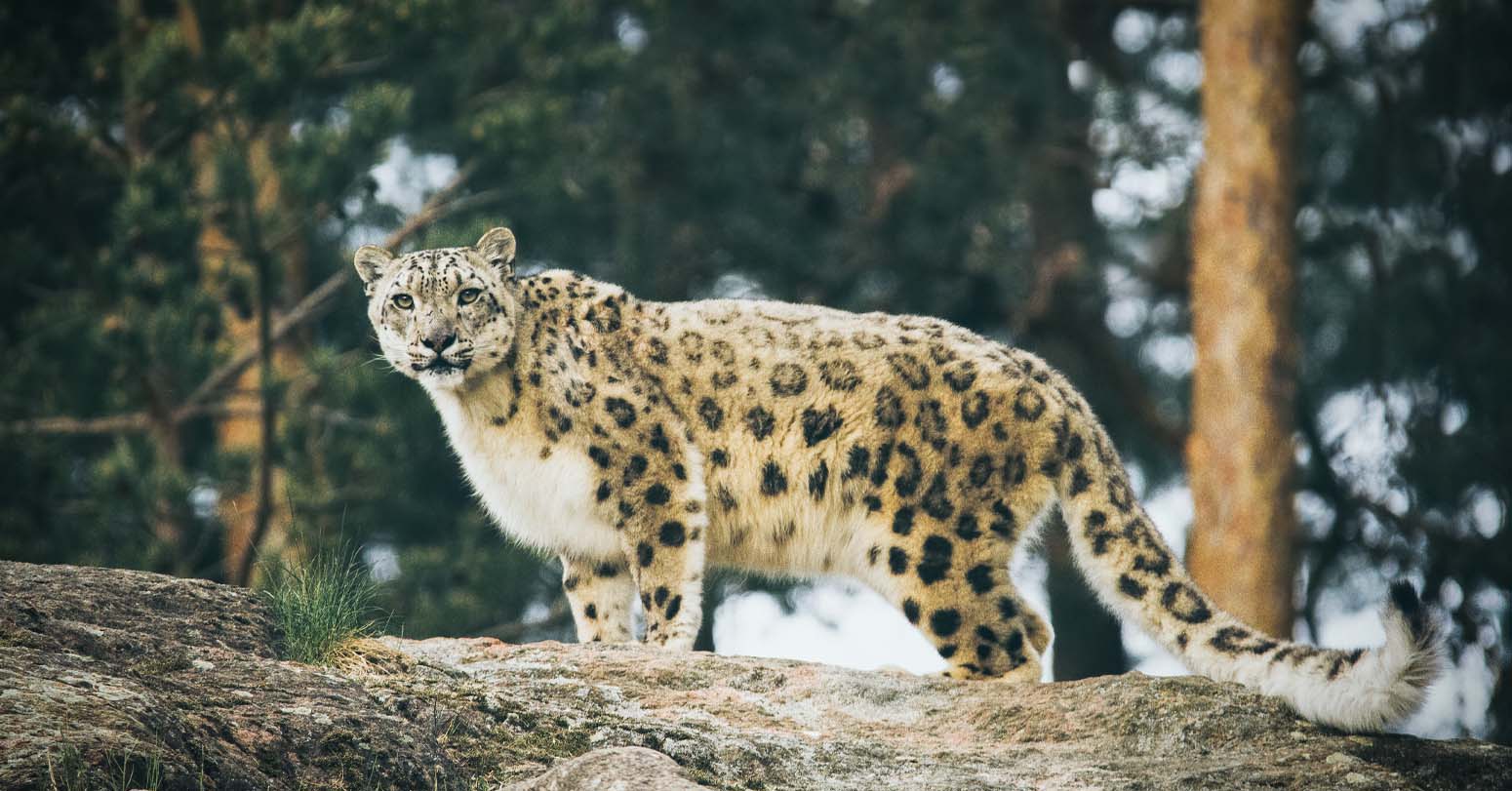
Wildlife in Shey Phoksundo National Park
Shey Phoksundo National Park, covering 3,555 square kilometers, is Nepal’s largest national park and protects one of the most intact and diverse trans-Himalayan ecosystems in the entire Himalayan range. The park’s elevation ranges from 2,130 meters in the lower river valleys to 6,883 meters at the summit of Kanjiroba Himal, encompassing subtropical river gorges, temperate forests, alpine meadows, and permanent snow and ice within a single protected area.
The park’s flagship species is the snow leopard, one of the most elusive and most intensely studied large predators in the world, which hunts the park’s healthy population of Himalayan blue sheep (bharal) across the rocky ridgelines above 4,000 meters. The park is considered one of the most important snow leopard habitats remaining in the Himalayan region. While sightings are never guaranteed, the probability of at least glimpsing this famously elusive cat is higher in Dolpo than in almost any other part of Nepal’s protected area network, particularly for trekkers spending time near the Shey Gompa area in Upper Dolpo. Peter Matthiessen and George Schaller’s 1973 expedition, which inspired The Snow Leopard, was a scientific survey of the blue sheep population in this very area.
Beyond snow leopards, the park harbors Himalayan wolf, Himalayan black bear, musk deer, Himalayan tahr, grey wolf, ghoral (a goat-antelope), and Tibetan gazelle in the higher areas, along with a rich bird community that includes the Himalayan monal pheasant, snow partridge, lammergeier, Himalayan griffon vulture, and a wide range of high-altitude passerine species. The high-altitude wetlands of the park’s northern sections, including the small lakes and seasonal marshes above Dolpo’s main valleys, support migratory waterbird species during spring and autumn passage, adding a birdwatching dimension to what is already one of Nepal’s most ecologically significant landscapes.
The yartsagumba (Cordyceps sinensis), a parasitic fungus that grows from caterpillar larvae at elevations between 3,500 and 5,200 meters, is an important economic resource for Dolpo communities, harvested in enormous quantities each spring and sold at extremely high prices for its reputed medicinal properties in Chinese and Tibetan herbal medicine markets.
Yartsagumba harvesting brings seasonal labor migration from surrounding districts into Dolpo’s high pastures each May and June, temporarily tripling or quadrupling the human population of some areas, and is a significant part of the local economy that travelers will observe directly if passing through the region during the harvest window.
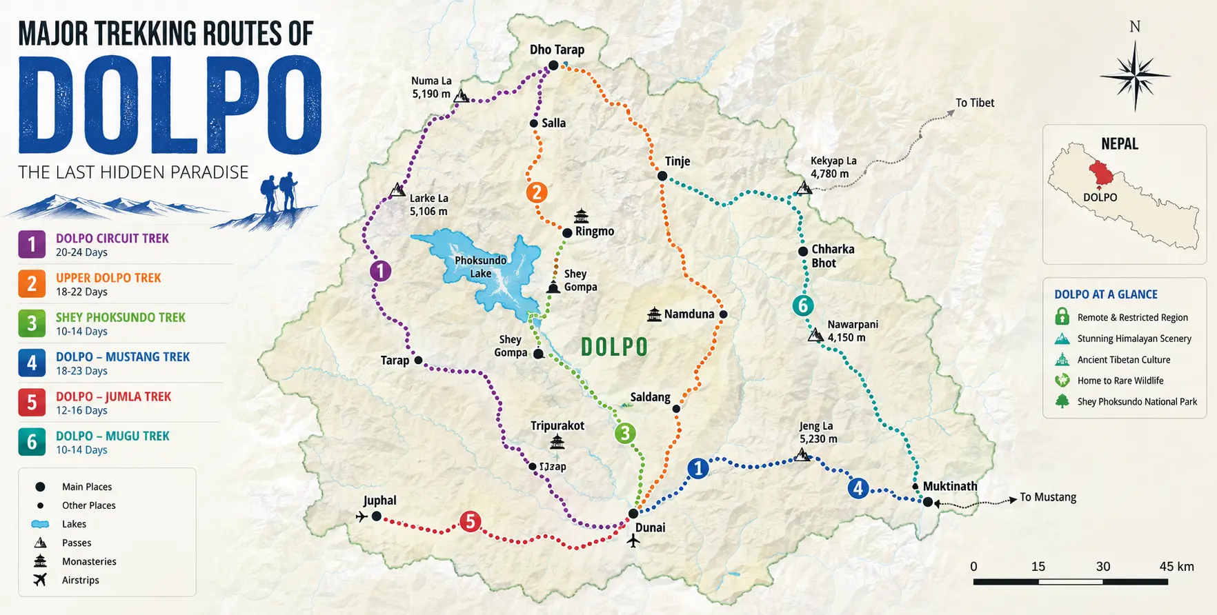
The Major Trekking Routes of Dolpo
The Phoksundo Lake Trek (Lower Dolpo, 8 to 10 Days)
The most accessible Dolpo trekking itinerary focuses on Lower Dolpo and Phoksundo Lake, typically running eight to ten days from Juphal. After the flight from Kathmandu to Juphal via Nepalgunj, or the overland drive to Dunai via the Karnali Highway, covered in detail in our Shey Phoksundo Lake Jeep Tour guide, the trekking route follows the Bheri River from Dunai to Suligad checkpoint, then climbs up the Suli Gad gorge through dense forest to the village of Ringmo and the lake shore. This route does not require the Upper Dolpo RAP and is therefore considerably less expensive than a full Inner Dolpo expedition. Basic teahouse accommodation is available in Ringmo and along the lower trail sections, though the upper trail retains the basic, self-sufficient character of all Dolpo trekking.
The Lower Dolpo Circuit Trek (14 to 18 Days)
The Lower Dolpo Circuit extends the Phoksundo Lake itinerary into a loop that crosses several significant passes, including Numa La (5,190 m) and Baga La (5,070 m), traverses the Tarap Valley, and returns to Dunai via a different route from the approach. This circuit is physically demanding given the high-pass crossings and the fully camping-based logistics required from Phoksundo onward. Still, it covers considerably more cultural and landscape variety than the straight lake-and-back approach.
The Upper Dolpo Circuit Trek (24 to 42 Days)
The full Upper Dolpo expedition is one of Nepal’s most demanding and most extraordinary trekking experiences, crossing multiple passes above 5,000 meters to reach the high valleys of Inner Dolpo: Shey Gompa and the Crystal Mountain pilgrimage circuit, the villages of Saldang and Dho Tarap, the high pastures of Panzang and Nangkhong, and onward connections that can link through to Mustang or the Annapurna region via Sangda La and the Jomsom corridor for trekkers planning a connected far-western Nepal expedition. This route is not a teahouse trek in any sense; it requires full camping equipment, a licensed guide, a kitchen crew, porters or yaks, and extensive preparation, making it an expedition in the true sense of the word rather than a long day hike.
Camping Logistics: Why Upper Dolpo Is a Full Expedition, Not a Teahouse Trek
The single most important practical distinction between a Dolpo trip and a Poon Hill or Langtang valley trek is the complete absence of teahouse accommodation infrastructure in Upper Dolpo and the very limited infrastructure in Lower Dolpo beyond Ringmo. Every Upper Dolpo expedition operates on a fully self-contained camping basis: a dining tent, sleeping tents for all trekkers, a separate kitchen tent, a cook and kitchen staff, and a team of porters or yak handlers to carry all of this equipment plus the food supply for the entire duration of the trek between resupply points.
This camping requirement is not simply a comfort consideration; it is a logistical and safety necessity. Villages in Inner Dolpo are genuinely remote, genuinely small, and genuinely unable to reliably provide a trekking group with food, cooking gas, or accommodation. Carrying everything in from Juphal or Dunai and carefully managing the food supply throughout the full itinerary is an operational skill that experienced Dolpo trekking operators have refined over the years. It is one of the reasons this trip should not be planned as a do-it-yourself exercise by trekkers unfamiliar with expedition-scale logistics, regardless of how experienced they may be on teahouse-standard Nepal treks.
Yaks are the preferred carrying animal in the high sections of Dolpo above 4,000 meters, replacing the lowland porters who typically manage loads on Nepal’s other trekking routes. Yak hire logistics are arranged through local community channels in the valleys adjacent to the high passes and require coordination through a trekking agency with established relationships in the specific valley communities, since yak availability is seasonal, tied to the agricultural and transhumance calendar of the local Dolpo-pa households, and not standardized in the way that porter hiring in Kathmandu or Pokhara is.
When to Go: Seasonal Timing for Dolpo and Vehicle Access
Dolpo’s rain-shadow position gives it a genuinely different seasonal character from the rest of Nepal and meaningfully expands the viable travel window compared to the Annapurna or Everest regions. Because the main Himalayan watershed blocks most monsoon moisture from reaching Dolpo’s high valleys, the region is, in theory, trekkable from spring through autumn, including the June to August monsoon period when most of the rest of Nepal’s trekking network is at its wettest and most difficult.
In practice, the most reliably clear and comfortable window for Upper Dolpo remains April through May and September through October, when high-pass crossings above 5,000 meters carry the least risk of snowfall, and the mountain views are at their clearest. The monsoon months in Dolpo itself are drier than the rest of Nepal. However, not entirely without weather risk: morning cloud cover can still reduce visibility on the high passes, even in July and August. The most significant seasonal constraint is not weather but the condition of the Karnali Highway for the overland approach: the Surkhet-to-Dunai road section is vulnerable to landslide disruption during the monsoon months, and trekkers relying on the overland jeep route should not attempt it between late June and mid-September without current road condition information from a knowledgeable local operator.
Winter, from December through February, closes Upper Dolpo completely for most practical purposes, with deep snow covering the high passes and the Juphal airstrip, which is sometimes snowbound for extended periods. The transition months of March and November are viable for Lower Dolpo and the Phoksundo Lake trail at lower elevations, but remain risky for Upper Dolpo pass crossings, particularly if early-winter or late-spring snowfall has left unexpected accumulations on key passes.
Combining Dolpo With a Wider Western Nepal Itinerary
Dolpo’s position in far-western Nepal makes it a natural complement to several other regional destinations for travelers planning an extended itinerary in western Nepal rather than a single-focus Dolpo expedition. The most obvious connection is to Upper Mustang, which lies immediately east of Dolpo and can be combined with a Dolpo expedition via high-pass routes, including the Sangda La route between the Tarap valley and the Jomsom corridor. Our Kathmandu-to-Mustang private jeep and Upper Mustang 4WD Jeep services cover the Eastern approach to Mustang. At the same time, the Dolpo-to-Mustang connection from the west requires the high-altitude trail between Dolpo and the Kali Gandaki valley above Jomsom.
Rara Lake, Nepal’s largest lake and another of the country’s most remote and spectacular natural destinations, lies in Mugu district adjacent to Dolpa and is increasingly combined with Dolpo in extended far-western Nepal itineraries for travelers with three to four weeks available. The Bardia National Park in the western Terai, easily reached via Nepalgunj, provides a natural wildlife add-on at the beginning or end of a Dolpo trip, since trekkers already flying through Nepalgunj can add a two- or three-day tiger and elephant safari at Bardia without significant additional routing effort. Our broader Nepal Tour Package can incorporate any of these western Nepal combinations into a single coordinated itinerary.
Why Nepal Vehicle Hiring for Your Dolpo Transport
The overland Karnali Highway approach to Dolpo is genuinely not a route for a standard hill-road jeep booking. It requires a heavy-duty 4WD, a driver with specific experience on the Surkhet-to-Dunai section of unpaved road, a pre-trip road condition assessment, and the logistical flexibility to manage multiday driver accommodation and allowances along a route with very limited service facilities. We operate this specific route through our Shey Phoksundo Lake Jeep Tour service, using Toyota Hilux or Land Cruiser vehicles and drivers who know the seasonal risk points along this corridor.
For travelers who prefer the flight approach, we handle the Kathmandu-end logistics, including Kathmandu Airport Transfers to the domestic terminal for the Nepalgunj connection, and we can coordinate with trekking agencies managing the Juphal flight on the Nepalgunj end. Our broader Jeep fleet and route knowledge extend to every major vehicle access point in this far-western Nepal corridor, and our Plan a Trip service can help structure the full transport sequence for a Dolpo expedition, from the first departure from Kathmandu to the final return, as a single coordinated booking.
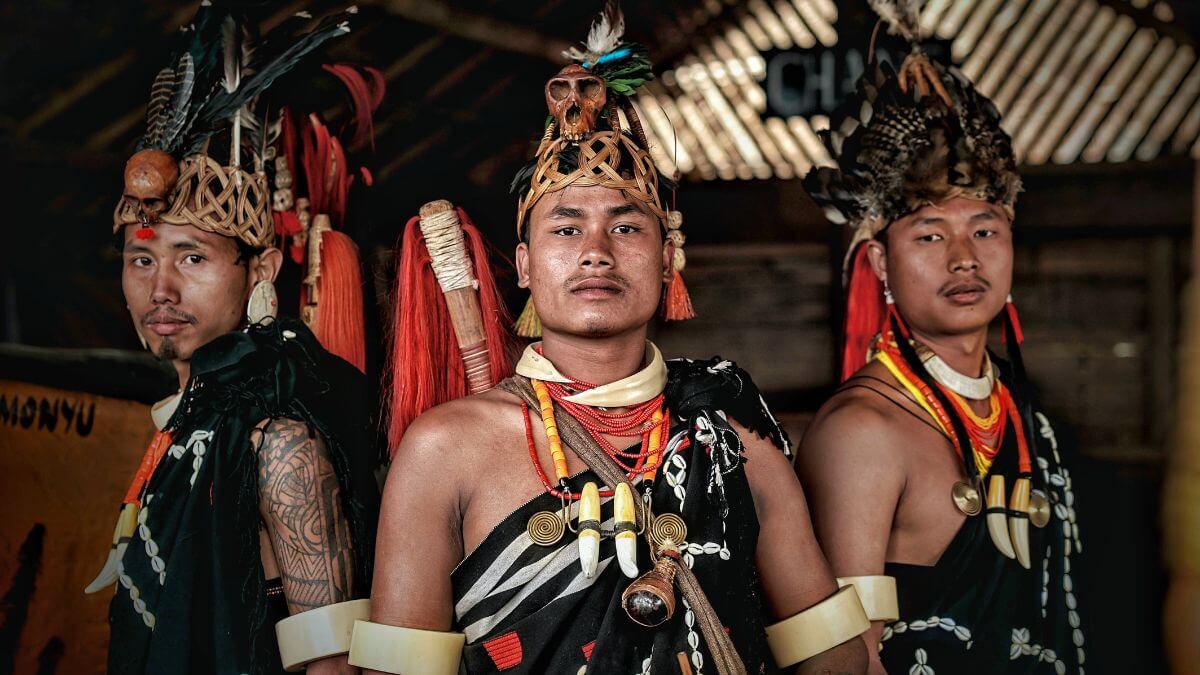
The Dolpo-Pa People: Life at the Edge of the Inhabitable World
Any serious engagement with Dolpo as a travel destination requires understanding something about who actually lives there, since the Dolpo-pa people and their way of life are as much a defining feature of the experience as the landscape or the wildlife. The term Dolpo-pa refers broadly to the Tibetan-descended communities of the Dolpa district. However, the region encompasses several distinct ethnic subgroups, including the Bon-following communities of the high valleys, the more Buddhism-influenced communities of the lower river areas, and the Kaike-speaking Magar communities of the Tarap valley who maintain a distinct linguistic and cultural identity from their Tibetan-descended neighbors.
The fundamental economic and social pattern of Dolpo-pa life is transhumance: a seasonal movement between lower valley winter settlements, where barley, buckwheat, and other cold-adapted crops are grown at around 3,000 to 3,800 meters, and high summer pastures above 4,000 meters, where yak, sheep, and goat herds graze on alpine grasses through the summer months. This movement is not a simple commute; it involves the semi-dismantling and relocation of household operations across an elevation range that would qualify as base camp altitude in most of the world, and it has shaped every aspect of Dolpo-pa material culture, from the design of their portable felt tents to the layout of their stone winter houses built to withstand months of cold and isolation.
Trade with Tibet was historically the economic backbone of Dolpo society, with Dolpo-pa traders carrying salt from the Tibetan plateau south through the high passes to exchange for grain, metal tools, and other lowland goods in the Nepalese market towns. This salt trade, which may have been operating for a thousand years or more, was disrupted by the closing of the Tibet border to informal trade after the Chinese occupation of Tibet in 1950, and communities that had built their entire economic model around it faced severe hardship. The yartsagumba harvest has in many ways replaced the salt trade as the primary cash economy for high-altitude Dolpo-pa communities, bringing seasonal income that now funds the purchase of manufactured goods, school fees, and infrastructure improvements that the salt trade once covered.
The filmmaker and photographer Eric Valli documented the salt trade in his 1999 film Himalaya (also released as Caravan), which was filmed in Dolpo, with local community members playing all roles. The film won the César Award in France, was nominated for the Academy Award for Best Foreign Language Film, and introduced the landscape and people of Dolpo to an international audience previously unaware of the region. Its images of yak caravans crossing high passes against a backdrop of stark Himalayan peaks remain the most widely seen visual representation of Dolpo’s way of life. The film’s locations, particularly the Shey Phoksundo Lake area and the high passes above it, are a specific draw for travelers who encountered Dolpo through this film before ever planning a visit.
Preparing for a Dolpo Expedition: What You Need Beyond a Standard Nepal Trek Kit
A Dolpo expedition requires substantially more preparation than a standard Nepal teahouse trek, and travelers who underestimate this difference consistently struggle in entirely avoidable ways. The following reflects the specific preparation requirements for the overland vehicle approach combined with a Lower or Upper Dolpo trekking itinerary, beyond the general Nepal trekking kit described in our broader guides.
- Sleeping bag rated to -20°C — Upper Dolpo nights at high camp can be significantly colder than the -15°C recommended for Annapurna or Langtang, and a bag rated to -15°C may leave a trekker genuinely cold on the coldest nights above 4,500 meters.
- Full camping kit or confirmed agency provision — there is no teahouse accommodation in Upper Dolpo and very limited options in Lower Dolpo beyond Ringmo. If you are trekking without an organized agency, you must carry your own tent, stove, fuel, and food from Dunai or Juphal. If trekking with an agency, confirm in writing that camping equipment, a kitchen crew, and a cook are included in the package before booking.
- All cash required for the entire trip is drawn in Kathmandu — there are no ATMs or banking facilities anywhere in Dolpa district. The last reliable ATM access point is Surkhet on the overland route or Nepalgunj on the flight route. Carry enough cash for all food, accommodation, permit top-ups, porter wages, emergency expenses, and return transport, plus a meaningful emergency buffer.
- Comprehensive travel insurance explicitly covering helicopter evacuation — helicopter evacuation from Upper Dolpo is logistically complex and extremely expensive, involving a multi-leg flight sequence. Travel insurance that does not explicitly name helicopter evacuation from remote trekking areas as a covered benefit is inadequate for this destination.
- Satellite communicator or personal locator beacon — mobile phone coverage is nonexistent in Upper Dolpo and minimal in most of Lower Dolpo outside Dunai itself. A Garmin inReach or equivalent satellite messenger provides the only reliable emergency communication in the high-valley sections of any Dolpo itinerary.
- Altitude acclimatization preparation — Upper Dolpo pass crossings at 5,100 to 5,350 meters require significantly better acclimatization than typical teahouse treks in the Annapurna or Langtang region. Trekkers should build in acclimatization days at Phoksundo Lake and at Shey Gompa before attempting the highest passes, and should treat any signs of altitude sickness on the high trail with immediate seriousness, given the distances from medical care.
- Sun protection rated for high-altitude UV — the combination of high elevation, reflective snow, and the clear, dry atmosphere of the rain-shadow plateau produces UV exposure significantly higher than at comparable altitudes in more humid mountain environments. SPF 50+ sunscreen, UV-blocking sunglasses, and a wide-brimmed hat are non-negotiable.
Frequently Asked Questions About Dolpo Vehicle Hire and Transport
Can I drive all the way to Phoksundo Lake, or does the road stop before the lake?
The road currently ends at Dunai, the district headquarters of Dolpa, roughly 77 kilometers south of Phoksundo Lake. From Dunai, the trail to the lake follows the Bheri and Suli Gad river valleys on foot, typically taking two to three days of walking each way. No road extends beyond Dunai to the lake, and no road serves any part of Upper Dolpo as of 2026, though infrastructure projects are ongoing.
Is the overland Karnali Highway route suitable year-round?
No. The Surkhet-to-Dunai section is vulnerable to landslide closure during the monsoon months, typically June through mid-September. Outside this period, particularly from October through May, the road is generally motorable in a heavy-duty 4WD vehicle. However, road conditions should always be confirmed with a knowledgeable local operator before departure, given the road’s remote location and limited maintenance resources.
Can I combine the overland drive with a flight out?
Yes, and this is the strategy most experienced operators recommend for travelers with sufficient time. Drive the Karnali Highway overland to Dunai on the approach, trek through Lower or Upper Dolpo as planned, then fly out from Juphal to Nepalgunj and Kathmandu at the end of the expedition, saving the multiday return drive and absorbing any multi-day buffer from the Juphal flight at the more comfortable Nepalgunj end.
Do I still need a minimum group of two for the Dolpo Restricted Area Permit in 2026?
No, as of March 22, 2026, the Government of Nepal has removed the minimum group size requirement for restricted-area trekking. Solo trekkers can now obtain a Dolpo Restricted Area Permit provided they are accompanied by a licensed guide and book through a registered trekking agency. The agency processing requirement and guide mandate both remain in effect.
What is the total vehicle hire cost for the Kathmandu to Dunai overland route?
The overland vehicle hire for a Toyota Hilux or Land Cruiser from Kathmandu to Dunai for a group of four to five passengers typically costs between NPR 80,000 and NPR 150,000 for the full journey, depending on vehicle quality, fuel costs at the time of travel, driver allowances for the multiday trip, and whether the booking is one-way or multiday, and the return leg. For current pricing and vehicle availability, contact us directly via vehiclehiringnepal.com or WhatsApp at +977-9851013196
Plan Your Dolpo Expedition Transport Today
Dolpo is the most logistically demanding destination in Nepal, and every transport decision matters more here than anywhere else in the country. Whether you are planning the overland Karnali Highway approach in a heavy-duty 4WD — three to four full driving days through some of the most dramatic and least-visited river valley scenery in western Nepal — coordinating Kathmandu-end logistics for the Nepalganj-Juphal flight route with its weather-delay buffers and luggage weight constraints, or combining both into a drive-in, fly-out expedition strategy that maximises the overland experience without duplicating the return road, Nepal Vehicle Hiring Pvt Ltd brings the route knowledge, the right vehicles, and the experienced drivers that this specific corridor demands. This is not a destination where a generically booked jeep and an unfamiliar driver will do; the Karnali Highway approach specifically requires preparation, local knowledge, and a vehicle matched to what the road actually demands. Call or WhatsApp us at +977-9851013196 or visit vehiclehiringnepal.com to start planning the most extraordinary vehicle hire in Nepal.
- Dolpo Region Vehicle Hire Nepal
- Understanding Dolpo's Geography: Why Getting There Is Half the Expedition
- The Bon Religion and the Cultural Character of Dolpo
- Shey Phoksundo Lake: The Defining Visual Experience of the Region
- Getting to Dolpo: The Two Transport Strategies and How Vehicle Hire Fits Each
- Permits for Dolpo: The Most Complex Permit Structure in Nepal Trekking
- Wildlife in Shey Phoksundo National Park
- The Major Trekking Routes of Dolpo
- Camping Logistics: Why Upper Dolpo Is a Full Expedition, Not a Teahouse Trek
- When to Go: Seasonal Timing for Dolpo and Vehicle Access
- Combining Dolpo With a Wider Western Nepal Itinerary
- Why Nepal Vehicle Hiring for Your Dolpo Transport
- The Dolpo-Pa People: Life at the Edge of the Inhabitable World
- Preparing for a Dolpo Expedition: What You Need Beyond a Standard Nepal Trek Kit
- Frequently Asked Questions About Dolpo Vehicle Hire and Transport

Related Blog & Articles
Kathmandu to Upper Dolpa Adventure Tour Vehicle Hire
Shey Phoksundo Lake Jeep Tour
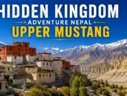
Hidden Kingdom Adventure Nepal Upper Mustang Jeep Tour

4WD Vehicles in Nepal: The Ultimate Hire Guide 2026