Plan a Trip


Chame to Manang Road Guide

Chame to Manang Road Guide: The Ultimate Drive Through the Annapurna Circuit
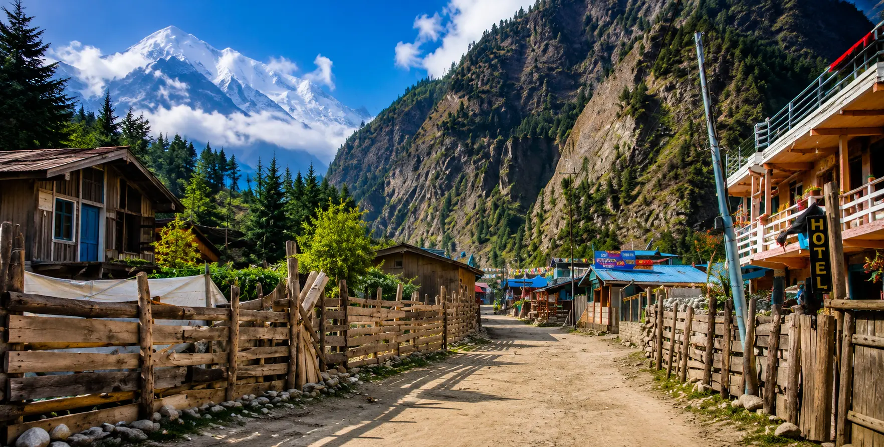
The road from Chame to Manang is one of Nepal’s most dramatic high-altitude drives. Carved through the Marsyangdi River valley deep inside the Manang District of Gandaki Province, this 30-kilometre corridor takes you from a pine-forested alpine village at 2,670 metres to one of the world’s highest permanently inhabited valleys at 3,540 metres — and every kilometre of the way assaults the senses. Sheer rock walls, thousands of metres high, crowd the valley.
The Marsyangdi River roars through gorges below the road. Ancient villages cling to ridgelines that seem impossibly steep. And the Annapurna massif — Annapurna II, III, and IV, plus Gangapurna and Lamjung Himal — announces itself in steadily more commanding fashion as you ascend.
This route is the beating heart of the Annapurna Circuit, one of the most celebrated trekking journeys on Earth. For decades, the only way to travel this corridor was on foot, which is why the circuit became legendary — every meter of altitude was earned by walking. Today, a motorable road reaches Manang and beyond, so you can drive the route in a 4WD jeep and see the same landscapes in a fraction of the time.
Whether you are a trekker using a jeep to shorten the lower circuit and start your walk from Chame or Pisang, a traveller on a private vehicle tour of the Annapurna region, or a driver building your knowledge of this extraordinary mountain road, this guide is your comprehensive companion for the Chame to Manang route.
Nepal Vehicle Hiring Pvt. Ltd., based in Thamel, Kathmandu, offers dedicated 4WD jeep hire in Nepal for this route, driven by experienced mountain-road drivers who know every bend between Besisahar and Manang. This guide covers the full road, key villages and landmarks, trekking trail options, permits, altitude advice, seasonal conditions, and how to book your transport. Let’s begin.
Understanding the Chame to Manang Road: Geography and Context
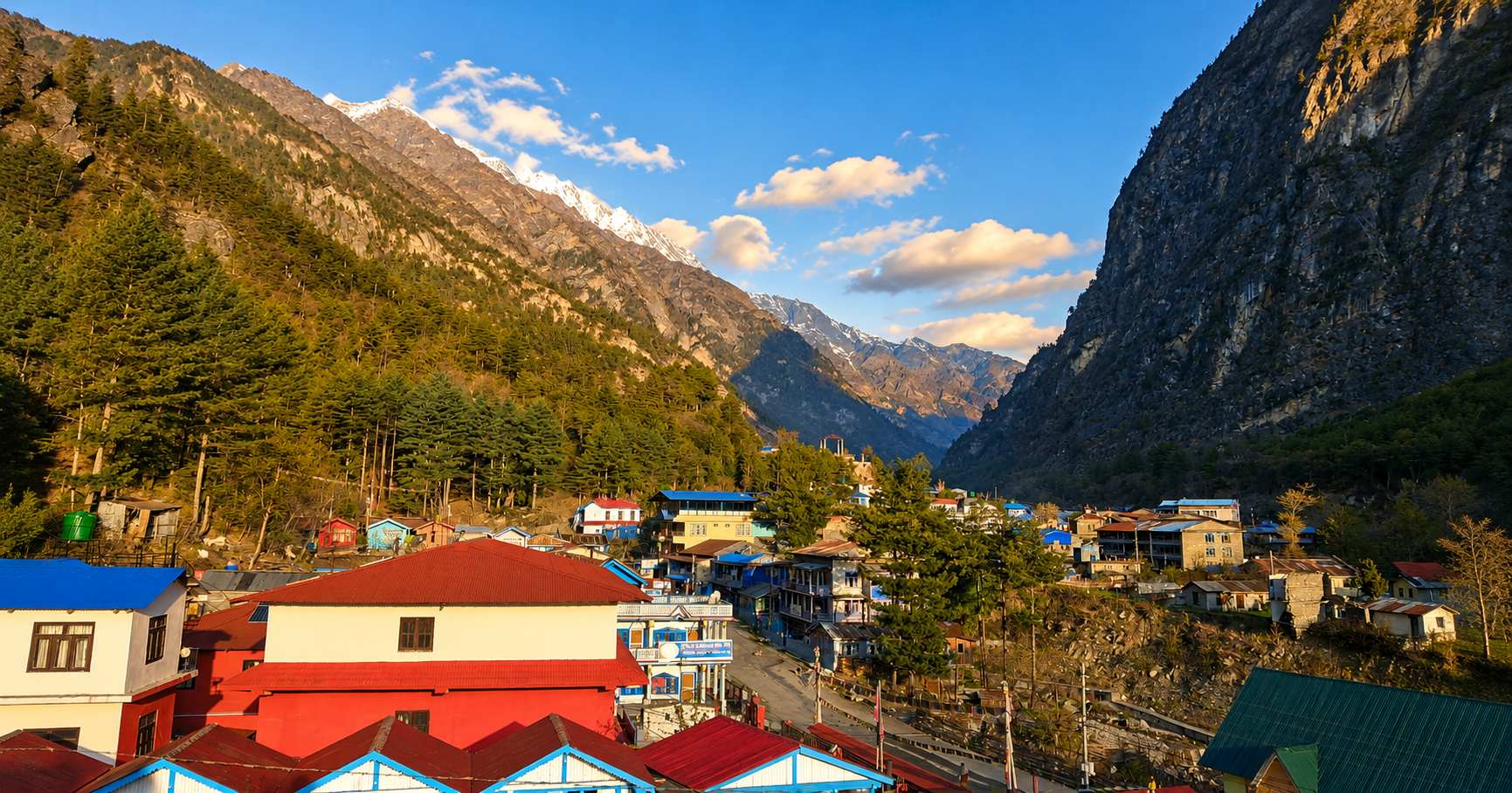
Before diving into the kilometre-by-kilometre detail, it helps to understand the broader geography that shapes this road. The route follows the Marsyangdi River valley, a major river system that originates in the glaciers of the Annapurna range and drains southward to eventually join the Trishuli River. The valley runs roughly south-to-north in its upper reaches, which means the road also runs predominantly north — climbing steadily as it goes deeper into the Annapurna massif.
Chame (2,670 m) is the administrative headquarters of Manang District and the point where the road transitions from the more accessible lower valley into true high-altitude mountain terrain. South of Chame, you are still in the buffer zone between subtropical hills and alpine environment.
North of Chame, the road enters the rain shadow of the Annapurna and Dhaulagiri ranges—one of the most geographically distinctive zones in the Himalayas—where rainfall drops dramatically, the landscape becomes increasingly arid and Tibetan in character, and the surrounding peaks begin to feel genuinely enormous rather than merely impressive.
The total driving distance from Chame to Manang is approximately 30 kilometres, taking 2 to 3 hours in good conditions. However, conditions on this road are rarely described as ‘good’ in the conventional sense — the track is unpaved, subject to washouts, narrow in places, crossed by streams, and shared with trekkers, yaks, and local supply jeeps.
The drive demands a 4WD vehicle with high ground clearance and a driver experienced in mountain road conditions. Regular cars and two-wheel-drive vehicles are completely unsuitable beyond Besisahar, and from Chame onward the road becomes even more demanding.
For context on the full overland approach: most travellers reach Chame after a drive from Kathmandu of approximately 238 kilometres total, with the first 173 kilometres on the paved Prithvi Highway to Besisahar taking 5 to 7 hours, and the remaining 65 kilometres of rough mountain road from Besisahar to Chame adding another 4 to 5 hours.
If you are coming from Pokhara, the distance to Chame is approximately 106 kilometres and takes around 3.5 hours. Our dedicated Kathmandu to Manang jeep service covers the entire route from the capital, and our Besisahar private vehicle service handles the gateway leg for those joining from different start points.
Chame (2,670 m): Where the High Himalayas Begin
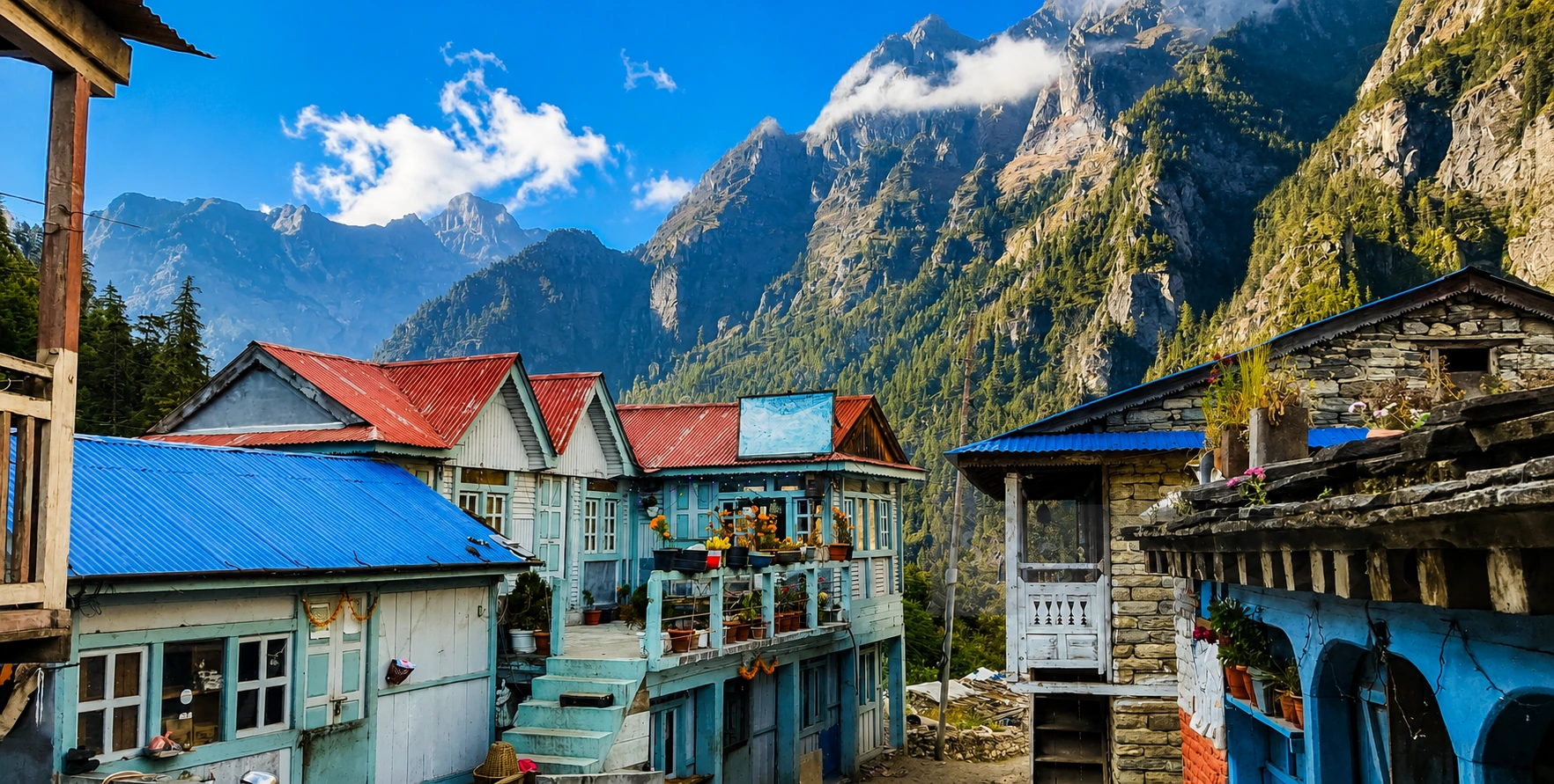
Chame is the first major village on the Annapurna Circuit that feels genuinely Himalayan. Below it, the valleys are lush, the villages predominantly Hindu and Gurung, and the road is lined with rice terraces and tea gardens. Chame belongs to a different world.
The village sits on the northern bank of the Marsyangdi River, surrounded by pine forests, with Annapurna II rising to the northeast like a white wall and Lamjung Himal visible on clear mornings to the south. The air is cooler, drier, and thinner than anything below — and this is where acclimatisation becomes a serious consideration for anyone heading higher.
As the district headquarters of Manang District, Chame has more facilities than most villages at this altitude. Chame has proper lodges with attached bathrooms, a government bank (one of the last banking facilities before Manang), an ACAP permit checkpoint, basic medical facilities, and enough teahouses and restaurants to satisfy every trekker’s appetite. Most lodges offer Wi-Fi, though reliability decreases with altitude. Mobile signal is present but can be patchy depending on your network provider.
Key Attractions in and Around Chame
One of Chame’s most talked-about but least-mapped attractions is its natural hot spring, located about 20 minutes downhill from the village centre. It is not signposted on most trail maps — ask at your teahouse for directions. Soaking tired legs in the thermal waters while looking up at the surrounding peaks makes the descent feel well worth it. A small donation or entry fee may be charged.
Chame’s monastery is small but active, with spinning prayer wheels and faded murals that speak to the Tibetan Buddhist culture that becomes increasingly dominant as you climb higher into the Annapurna watershed. The Manangi people — the local ethnic group of the Manang District — are culturally Tibetan but ethnically distinct, with their own language and customs. Historically, they were traders who crossed the Himalayas to barter wool and goods, and even today they retain government-granted trading privileges that allow them to do business across international borders.
Behind the village, apple orchards on terraced slopes produce fruit used for local apple brandy and dried apple products sold in teahouses along the circuit. The views of Annapurna II from the ridge above Chame are already extraordinary. This 77,937-meterpeak dominates the northeastern skyline and will be your companion for much of the journey to Manang.
Leaving Chame: The Road Divides
As you leave Chame heading north, both the road and the trekking trail begin an approach to one of the most dramatic natural features on the entire circuit. The valley narrows, the walls close in, and the forest thickens. After about 5 km (1.5 to 2 hours of walking, or about 30 minutes of driving), you reach the Bhratang area and first encounter Paungda Danda. This curved rock wall rises 1,500 meters directly above the river in an almost perfectly vertical sweep. It is one of the most jaw-dropping geological features in the Himalayas, and approaching it by road or on foot produces the same effect: a sudden, silent awareness of how enormous these mountains truly are.
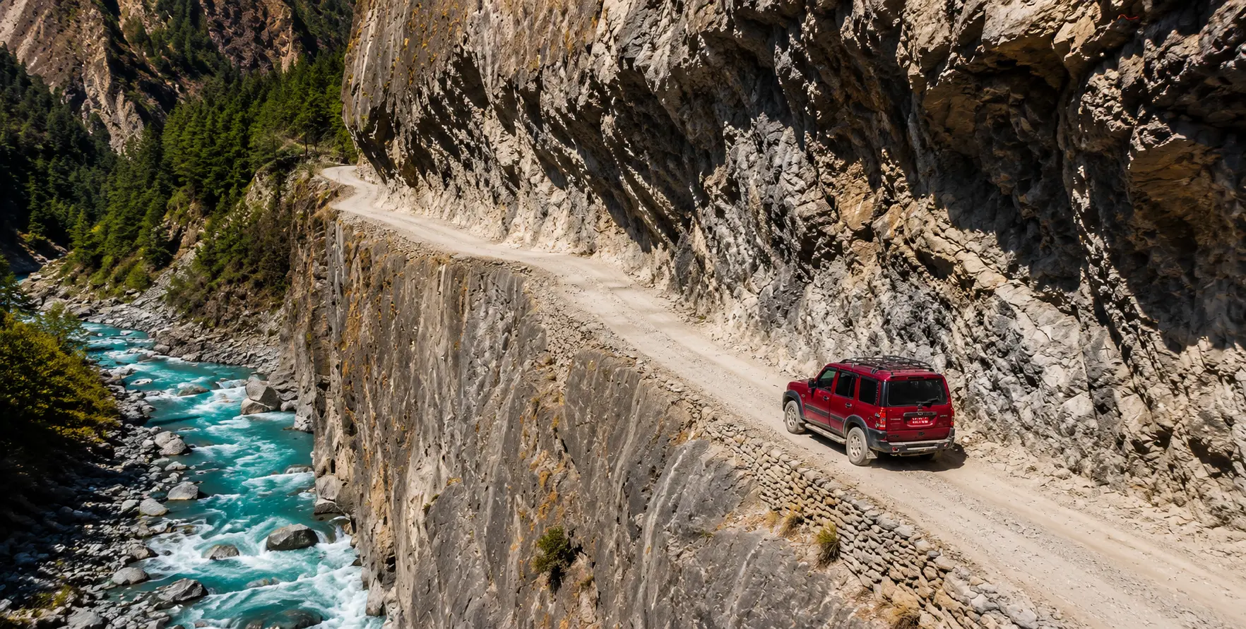
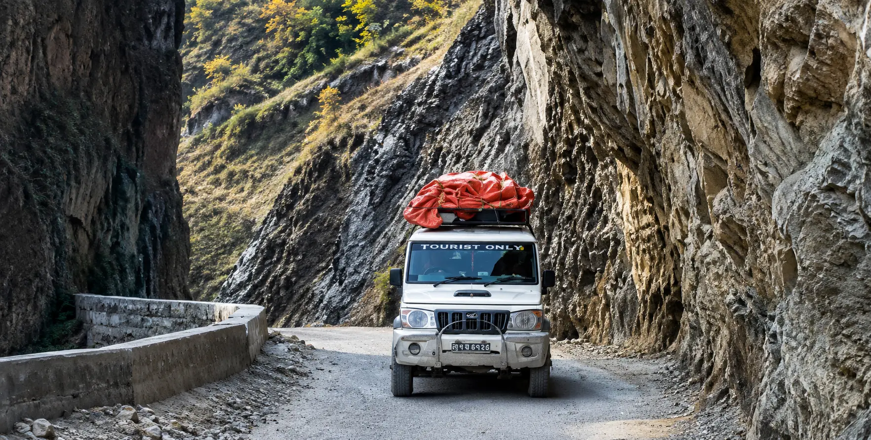
The road through this section is particularly narrow and exposed, carved into the cliff base. High-clearance 4WD is not just recommended here — it is essential. Our jeep hire service uses well-maintained Mahindra Scorpio and Toyota Land Cruiser vehicles, driven by experienced drivers who navigate this stretch daily during the trekking seasons.
Chame to Pisang (14 km): Pine Forests, Rock Faces, and the First Mountain Panorama
The 14-kilometre journey from Chame to Pisang takes about 5 to 6 hours of walking or 45 minutes to 1 hour by car. This section contains some of the finest scenery on the entire Chame-to-Manang road, and the transition in landscape is nothing short of extraordinary — you begin in dense pine and rhododendron forest and emerge into a wide alpine valley with the full sweep of the Annapurna range filling the northern skyline.
From Chame, the road and trail follow the Marsyangdi River northward through the forest. The first major crossing point is the Swargadwari suspension bridge over the Marsyangdi, a wide cable bridge that sways gently but holds firm. From the bridge, looking south toward Chame, the lower valley already looks distant and small beneath the surrounding peaks. Looking north, the valley opens, and the white mass of Annapurna II fills the horizon in a way that is hard to describe without superlatives.
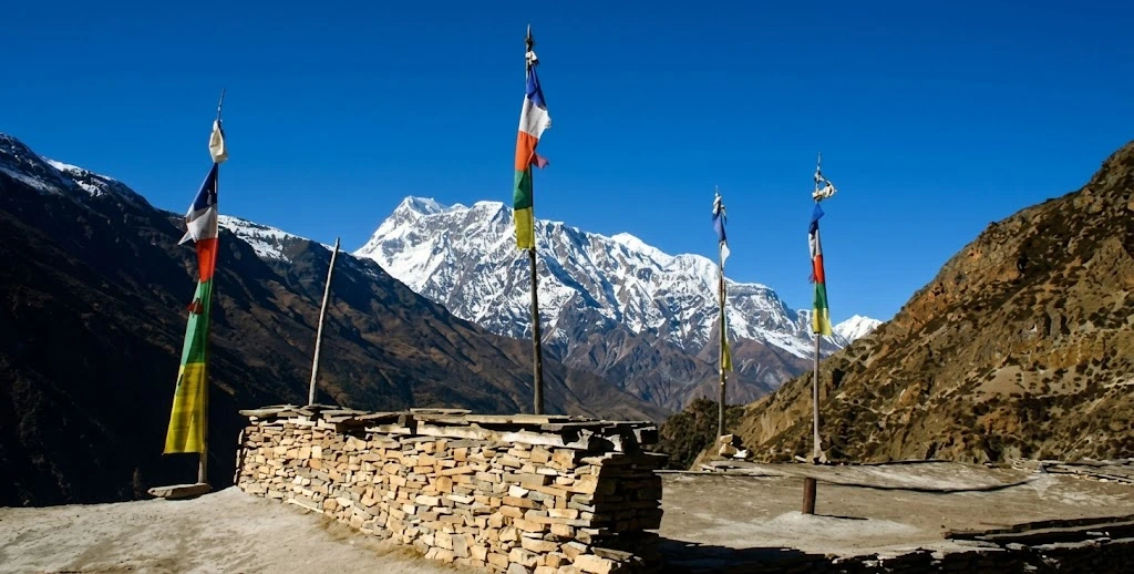
Beyond the bridge, the road climbs steadily through a landscape that becomes increasingly dramatic. Ancient mani walls — long rows of stones carved with Buddhist prayers — line the trail, each stone placed over centuries by pilgrims and locals offering devotion to the mountains and seeking protection on high-altitude journeys. Chortens (Buddhist stupas) mark the ridgelines. Prayer flags snap in the mountain wind. The cultural shift from the Hindu valley culture below to the Tibetan Buddhist highland culture above is complete by the time you reach Pisang.
Bhratang and the Apple Orchards
About 4 km north of Chame, the small settlement of Bhratang sits in a wide section of the valley surrounded by apple orchards that produce some of the finest fruit in the Annapurna region. The apple brandy and dried apples sold at teahouses along the circuit often come from Bhratang’s orchards, and stopping here during the autumn harvest (September to October) lets you buy fresh apples directly from farmers. Bhratang itself is a quiet, atmospheric settlement — a handful of stone houses, prayer wheels at the village entrance, and the constant sound of the river below.
Lower Pisang (3,200 m) and Upper Pisang (3,310 m)
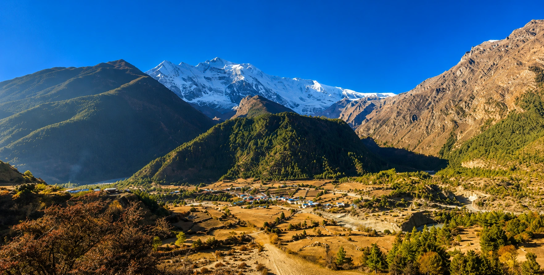
Pisang marks the end of the first section of the Chame-Manang road and the beginning of a critical choice that shapes the next stage of the journey. The village has two parts: Lower Pisang at 3,200 meters sits on the valley floor close to the road, with the most teahouses and the easiest access for jeep passengers.
Upper Pisang at 3,310 meters sits dramatically on a ridge 100 meters above — a Tibetan-style village of stone and whitewash with one of the oldest monasteries in the Manang region and some of the finest views on the entire Annapurna Circuit.
If you are driving from Chame to Manang and have time to stop, Upper Pisang is worth the short climb. The monastery here is a quiet stone witness to more than thirteen centuries of prayer, and the views from the ridge at sunset — with Annapurna II and Annapurna IV directly across the valley and the Marsyangdi far below — are widely regarded as among the finest on the entire Annapurna Circuit. Many experienced trekkers say the Upper Pisang sunset is the most photogenic moment of the circuit, and the road doesn’t offer this view; you have to climb for it.
The Two Routes from Pisang to Manang: Upper vs Lower Trail
This is where the Chame-to-Manang corridor becomes most interesting from a route-planning perspective, because from Pisang onward the road and the best trekking trail diverge significantly. The jeep road follows the lower valley through Humde (where the small airstrip for Manang is located) and Braga before reaching Manang. The upper trekking trail climbs the ridge through Ghyaru and Ngawal, then descends to Braga. This route is universally regarded as the finest stretch of walking on the entire Annapurna Circuit.
The Upper Route: Ghyaru (3,730 m) and Ngawal (3,657 m)
The upper trail from Upper Pisang to Manang via Ghyaru and Ngawal covers about 20 kilometres and takes 6 to 7 hours to walk. It is not accessible by vehicle — this is a foot route only, climbing high above the valley on a ridge that places you level with the faces of Annapurna II, III, and IV across the gorge. By almost universal agreement among experienced circuit trekkers, walking this ridge is the best single day of the entire trek.
From Upper Pisang, the trail rises steeply for about 4 to 5 kilometres to Ghyaru at 3,730 metres, taking about 3 hours. The climb is the hardest part of the day — rocky, steep, and demanding in the thinning air. But the moment you reach the Ghyaru ridge, the effort is instantly justified. You stand at eye level with Annapurna II and Lamjung Himal across the valley, with the entire Marsyangdi watershed below and the high desert plateau of Manang stretching to the north. It is one of the great landscape moments of Himalayan trekking.
From Ghyaru, the trail continues along the ridge to Ngawal at 3,657 meters, a further 5 to 6 kilometres taking about 3 hours. Ngawal is a classic high-altitude Manangi village — stone houses, ancient gompas, yaks grazing on the plateau above the village, and prayer flags strung between houses that snap and flutter in the constant mountain wind. From Ngawal, the trail descends through a forested section to Braga, and then follows the valley floor into Manang.
For trekkers arriving by jeep from Kathmandu or Pokhara, one popular strategy is to drive all the way to Pisang and then walk the upper route to Manang. This saves 2 to 3 days of trekking in the lower valley (which is now largely road-walking anyway) while preserving the best trekking section. Nepal Vehicle Hiring can drop you at Lower Pisang or Chame and meet you again at Jomsom, Pokhara, or wherever your onward journey requires — ask when booking your Kathmandu to Manang jeep.
The Lower Route: Humde and Braga
The lower road from Pisang to Manang runs through the valley floor, passing the Humde airstrip. This small landing strip serves as Manang’s emergency access point and occasionally receives flights from Pokhara, though service is extremely weather-dependent and unreliable. Most trekkers pass Humde without stopping, but if you are travelling with Nepal Vehicle Hiring and want to explore the area, the airstrip viewpoint offers a wide, unobstructed view across the Manang Valley, ideal for early-morning photography.
From Humde, the road continues to Braga (3,475 m), a settlement just a 45-minute walk (or 10-minute drive) south of Manang. Braga is famous for its monastery — Braga Gompa (Braka Gompa) — built dramatically into the cliff face above the village and estimated to be about 500 to 600 years old. It is the most important gompa in the Manang Valley, housing precious clay statues, ancient thangka paintings, and religious manuscripts that date back centuries. The gompa is open to visitors from 8 a.m. to 11 a.m. and 2 p.m. to 5 p.m., with a small entry donation expected—most trekkers who arrive via the lower route stop here before walking the final 30 minutes into Manang.
Braga Monastery is also the starting point for one of the most popular acclimatisation day hikes from Manang—the climb to Ice Lake (4,620 m). This frozen glacial lake offers extraordinary views of Chulu East (6,584 m) and Annapurna III (7,555 m). If you are planning to spend a rest day in Manang, the Ice Lake hike is one of the best options for productive altitude acclimatisation.
Manang (3,540 m): The High Desert Capital of the Circuit
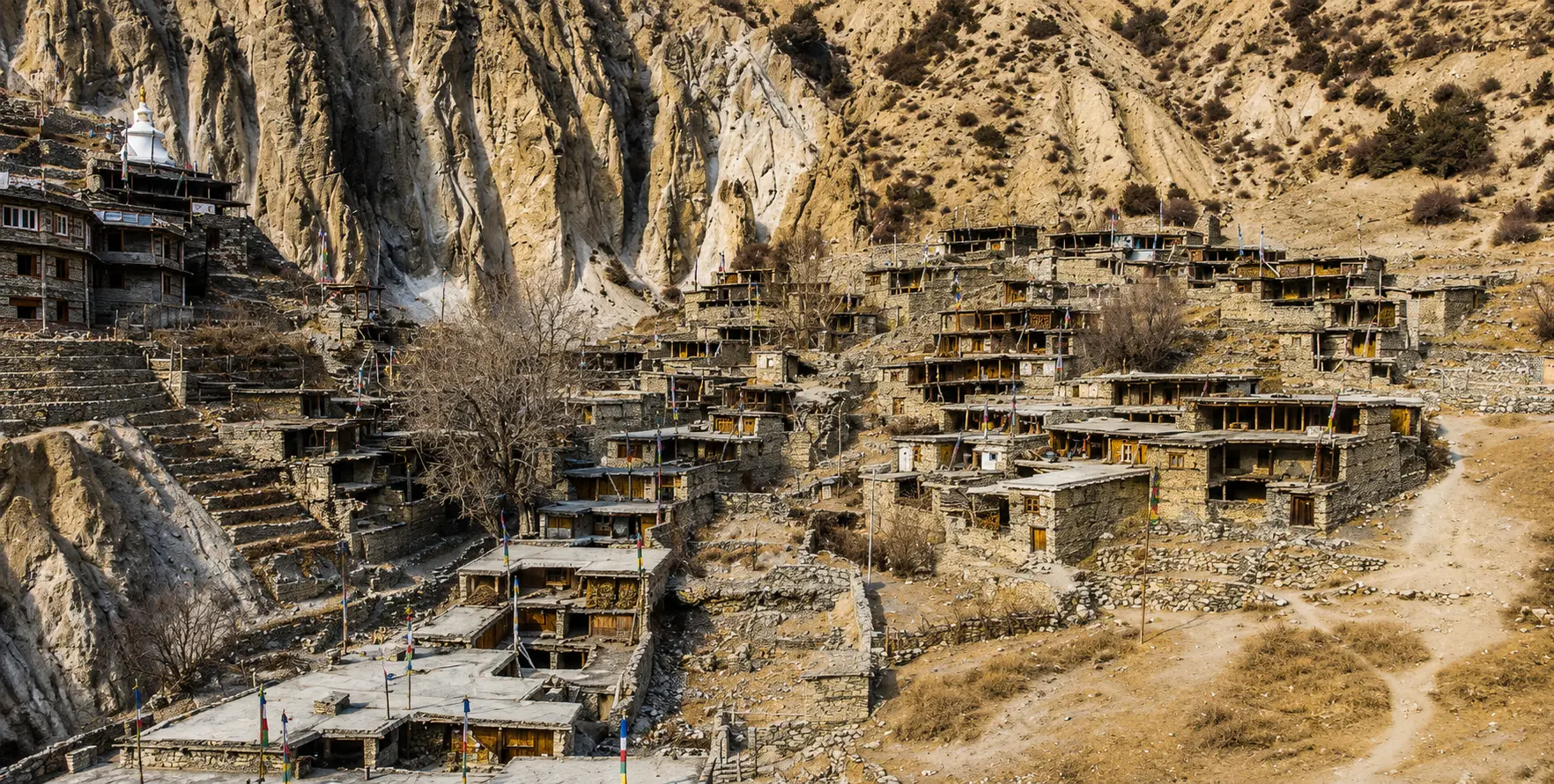
Arriving in Manang for the first time stays with most circuit travellers for a long time. The village sits in a broad glacial valley at 3,540 meters, surrounded by staggering Himalayan peaks. The massive ice wall of Gangapurna (7,455 m) rises directly above town to the northwest. Annapurna III (7,555 m) anchors the eastern skyline. Tilicho Peak (7,134 m) stands to the west. On a clear morning, the entire skyline glows orange before the valley floor warms up — a sunrise panorama that requires no effort beyond stepping outside your teahouse door.
The landscape here is emphatically not what most people imagine when they think of Nepal: no lush forests, no terraced rice fields, no tropical birds. Manang is a high-altitude desert—a rain-shadow plateau where annual precipitation is low, the soil is thin, and vegetation is sparse grasses, scrub juniper, and tough wildflowers. The architecture is Tibetan: flat-roofed stone houses, whitewashed chortens, painted prayer stones, and monastery walls that look as if they have been here forever, because in many cases they have.
Facilities and Amenities in Manang
Manang is the best-equipped village on the Annapurna Circuit between Besisahar and Jomsom, and it needs to be — it serves as the critical acclimatisation stop before Thorong La Pass (5,416 m), and it receives thousands of trekkers each year. The village has 20 to 25 lodges, from basic shared-room teahouses to surprisingly comfortable guesthouses with attached bathrooms and hot showers. Most lodges have dining rooms that double as social hubs where trekkers from different countries trade route information over bowls of dal bhat or cups of lemon tea.
Volunteer doctors staff a Himalayan Rescue Association (HRA) medical clinic in Manang during the main trekking seasons (April to May and September to November). The clinic offers free altitude talks every afternoon — a one-hour presentation on recognising and responding to altitude sickness that is highly recommended for anyone planning to cross Thorong La. Medical consultations cost approximately USD 30 to 50. The HRA clinic’s presence is one of the main reasons Manang is a designated acclimatisation stop: the medical support here is better than anywhere else between Besisahar and Muktinath.
There are no ATMs in Manang. The nearest reliable ATM is in Chame, but even that machine is frequently out of service or out of cash. Besisahar has the last genuinely reliable banking facilities on the entire circuit. Carry enough Nepali rupees from Kathmandu or Pokhara to cover your entire time in the mountains — food, accommodation, park permits, any emergency expenses, and tips for guides and porters. Credit and debit cards are not accepted anywhere on the circuit above Besisahar.
Bakeries in Manang are a genuine surprise and a genuine pleasure. Several village bakeries offer apple pie, cinnamon rolls, espresso coffee, and chocolate cake —a remarkable range of options at 3,540 meters for trekkers who have been eating dal bhat for days. Local specialities include yak cheese (strong and excellent), chang (fermented barley beer) (consumed moderately at altitude), and butter tea made with yak butter, drunk throughout the day for warmth and calories.
Altitude and Acclimatisation on the Chame to Manang: The climb from Chame (2,670 m) to Manang (3,540 m) is about 870 metres; however, this sounds manageable—and it is, if you take it at the right pace. The problem is that most travellers arriving in Manang by jeep from Kathmandu ascend from 1,400 meters (Kathmandu) to 3,540 meters in a single long driving day. That ascent can trigger Acute Mountain Sickness (AMS) even in physically fit individuals.
AMS is not a weakness, and it is not predictable. Fitness level has little correlation with susceptibility — marathon runners have been evacuated from Manang while sedentary tourists have crossed Thorong La without difficulty. The key variables are ascent speed and an individual’s acclimatisation response, neither of which you can know in advance. The standard advice — ‘climb high, sleep low’ — is worth taking seriously if you drift to Manang in one push, plan to spend at least two nights there and take a proper acclimatisation day before proceeding to Thorong Phedi.
Symptoms of Altitude Sickness to Watch For
The most common early symptoms of AMS are headache (particularly behind the eyes or at the back of the skull), nausea, loss of appetite, dizziness, and disturbed sleep. These symptoms typically appear within 6 to 12 hours of arriving at a new high altitude and often improve with rest, hydration, and time. Do not push higher if you have these symptoms — wait until they resolve completely. More serious symptoms of High Altitude Cerebral Oedema (HACE) or High Altitude Pulmonary Oedema (HAPE) include persistent vomiting, inability to walk in a straight line, confusion, and a productive cough with pink or frothy mucus. These require immediate descent and medical attention.
The HRA clinic in Manang offers free altitude lectures every afternoon during trekking season. Attending this talk is one of the best decisions you can make before heading to Thorong La. The HRA doctor covers symptoms, prevention, treatment, and emergency response in detail, and field questions from the audience. Acclimatisation Hikes from Manang
Rather than resting completely on an acclimatisation day, light upward activity at altitude has been shown to improve acclimatisation more effectively than passive rest. The best options from Manang are the hike to Ice Lake (4,620 m) (4 to 5 hours return, starting from Braga), the climb to Praken Gompa viewpoint (3,900 m) above Manang village (2 to 3 hours return), and the short walk to Gangapurna Lake at the foot of the glacier (30 to 45 minutes return from the village). All of these hikes take you to higher elevations than Manang itself before returning for the night—exactly the acclimatisation profile altitude medicine recommends.
The Milarepa Cave (4,200 m), located above Braga, is another popular destination. According to Tibetan Buddhist tradition, the legendary yogi and saint Milarepa meditated in this cave, and it remains a pilgrimage site for Buddhist devotees and an interesting cultural stop for secular trekkers. The path is steep but well-defined, with excellent views across the Manang Valley.
Road Conditions on the Chame to Manang Route: What to Expect
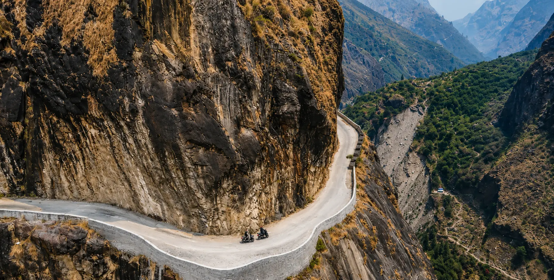
The road between Chame and Manang is entirely unpaved and classified as an off-road mountain track. The surface varies considerably over its 330-kilometre length, shifting between compacted gravel, loose rock, river-crossing sections, and raw Earth that turns muddy after rain. Any vehicle attempting this road needs at least 1200 mm of clearance and 4WD capability—preferably with good suspension and an experienced mountain driver who can read road conditions in real time.
Section by Section: Road Quality from Chame to Manang
The Chame to Bhratang section (approximately 5 km) follows the valley floor along the river and is moderately difficult; it is narrow, passes through dense pine forest, and the Paungda Danda cliff section reduces the road to a single lane carved into the rock face. Passing is impossible in most sections; oncoming traffic requires one vehicle to reverse to a widening point. During the trekking seasons, this section sees regular traffic — supply jeeps, trekking group vehicles, and the occasional motorcycle — so patience is essential.
The Bhratang to Pisang section (approximately 9 km) opens into wider valley terrain and is generally better quality — still unpaved but with fewer extreme narrows. The road here runs through apple orchards and small settlements with regular widening areas for passing.
This is also where the first big mountain views open up, and drivers should be alert for people wanting to stop for photos. The Humde to Humde section (approximately 8 km) follows the valley floor and is generally the smoothest section of the Chame-Manang road — wide, relatively flat, and with good sight lines. The Humde airstrip sits in a broad flat section of the valley and is visible from the road.
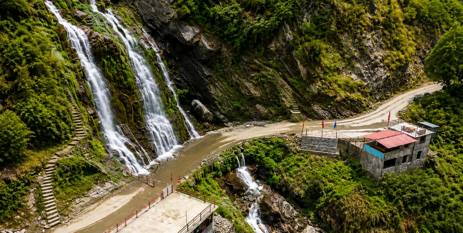
The Humde to Braga and Manang section (approximately 8 km) remains a good-quality valley road until the final approach into Braga and Manang, where stream crossings and rocky sections add difficulty. During the main trekking seasons, the final approach into Manang is muddy and loose.
Seasonal Road Conditions
The best time to drive the Chame-Manang road is during the spring trekking season (March to May) and the autumn trekking season (September to November). In spring, the road is typically dry and compacted from the winter freeze-thaw cycle, and the clear skies offer optimal mountain views. In autumn, post-monsoon clarity produces the finest photographic light of the year, and the road is usually assessed and repaired after monsoon damage.
The monsoon season (June to August) is the most challenging period on this road. Rainfall in Chame and Pisang — though less than in the lower valleys due to the partial rain shadow — can trigger landslides, wash out stream crossings, and turn exposed sections of road to mud. Driving is still possible during monsoon but takes significantly more time and requires flexibility and confidence in your driver’s judgment. Nepal Vehicle Hiring advises calling ahead during monsoon to confirm road status before committing to the drive.
Winter (December to February) brings a different set of challenges: snow and ice from Chame upwards can make the road dangerously slippery, and heavy snowfall can sometimes block the road to Manang entirely. The valley can drop to minus 25 degrees Celsius in midwinter, and most teahouses close.
Permits Required for the Chame to Manang Route
Unlike Upper Mustang, the Chame to Manang corridor does not require a restricted area permit. The Manang District is accessible to all travellers; you only need standard Annapurna Conservation Area permits, which are far simpler and less expensive to obtain.
Annapurna Conservation Area Permit (ACAP)
The ACAP is mandatory for all foreign nationals entering the Annapurna Conservation Area, which encompasses the entire Chame to Manang route. As of 2025, the fee is NPR 3,000 (approximately USD 22–25) per person for foreign nationals; ARC nationals pay NPR 1,000, and citizens are exempt. The ACAP is a one-time fee valid for the duration of your visit — you pay it once regardless of how many days you spend in the conservation area. You can obtain it at the Nepal Tourism Board office in Kathmandu (Bhrikutimandap), at the Besisahar ACAP office, or through a registered Nepal travel agency. Permit authorities check it at checkpoints along the route, including Besisahar, Dharapani, Chame, and Manang, so carry it at all times.
TIMS Card
The TIMS (Trekkers’ Information Management System) card requirement for the Annapurna Circuit was revised in April 2023 and is no longer mandatory for trekkers who have a TIMS card. However, rules can change, and it is always worth confirming the current requirement with your agency before departure. If you are combining the Annapurna Circuit with other trekking regions, a TIMS card may be required for those sections.
Licensed Guide Requirement
Under recent Nepal government regulations, a licensed guide is required on most high-altitude trekking routes in Nepal, including the Annapurna Circuit above Manang. For the driving section from Chame to Manang, no guide is strictly required — your vehicle driver is sufficient for road travel. However, if you plan to trek any section of the route, particularly beyond Manang toward Thorong La, a licensed guide is legally required. Nepal Vehicle Hiring works with partner licensed guide services to arrange complete guided packages for trekking clients who need this support.
When you book transport through Nepal Vehicle Hiring Pvt. Ltd., our team can advise on current permit requirements and, if needed, arrange permit processing in Kathmandu before you depart. This helps prevent checkpoint delays and keeps your journey running smoothly.
The Full Route from Kathmandu to Manang: Planning Your Journey
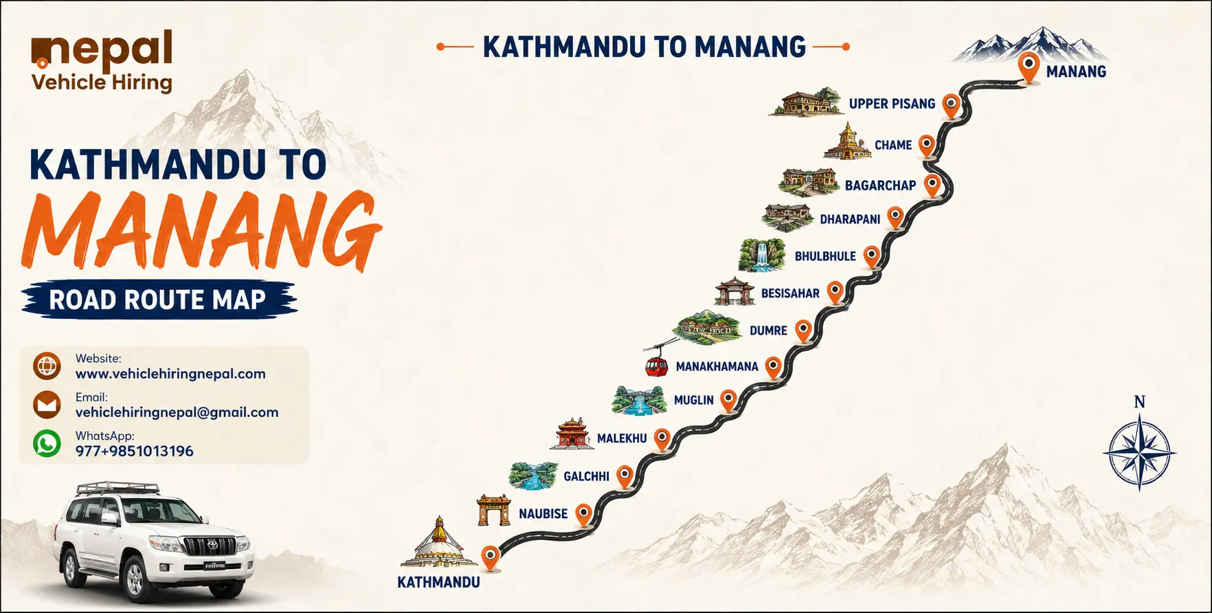
Most international travellers on the Annapurna Circuit start in Kathmandu. The full overland route to Manang involves several distinct legs, each with its own road character and travel experience.
Leg 1: Kathmandu to Besisahar (178 km, 6–7 hours)
The journey begins on the Prithvi Highway, Nepal’s main artery connecting Kathmandu to Pokhara. From Kathmandu, you drive west toward Mugling (approximately 110 km), then turn north at Dumre toward Besisahar. The road is well-maintained blacktop all the way to Besisahar, and the drive is generally comfortable if occasionally slow due to traffic in and around Kathmandu and the Mugling junction. The landscape shifts from the Kathmandu valley’s urban sprawl to river gorges, terraced hillsides, and Himalayan foothills as you push north from Dumre.
Besisahar (760 m) is the gateway town for the Annapurna Circuit — the last reliable place for ATMs, banking, fuel, vehicle servicing, and substantial food shopping before the mountain road begins. You can also get the ACAP permit here if you haven’t already arranged it in Kathmandu. Nepal Vehicle Hiring’s Besisahar private vehicle service and Kathmandu-to-Besisahar bus service cover this leg for different budgets and group sizes.
Leg 2: Besisahar to Chame (65 km, 4–5 hours)
Beyond Besisahar, the road transforms completely. The blacktop ends, the valley narrows, and the off-road adventure begins in earnest. This 65-kilometre section passes through Syange, Jagat, Dharapani, Timang, Koto, and Karte before arriving in Chame — a sequence of increasingly Himalayan villages, each more dramatic than the last. The road climbs steadily alongside the Marsyangdi River, with waterfalls cascading across the track in places, narrow cliff sections requiring careful navigation, and river crossings that test any vehicle’s ground clearance.
This section requires a 4WD vehicle with an experienced driver. Our 4WD hire in Nepal fleet is specifically maintained for these conditions. Notable stops along this leg include the dramatic gorge at Jagat and the Manang District entry checkpoint at Dharapani, where the cultural shift from lower valley to Tibetan highland begins.
Leg 3: Chame to Manang (30 km, 2–3 hours driving)
This is the heart of the guide—the 30 kilometres described in detail above. With an early departure from Chame, you can reach Manang by mid-afternoon, including stops at Bhratang, Pisang, and Braga, leaving time to explore Manang village before evening.
Approaching from Pokhara
Many travellers prefer starting from Pokhara rather than Kathmandu, especially if they have already visited the capital. Pokhara to Besisahar is approximately 105 kilometres and takes 3 to 4 hours on the Prithvi Highway. From Pokhara, the drive to Chame is about 106 kilometres and takes around 3.5 hours. Our Hiace van and car hire services in Nepal cover the Pokhara-Besisahar leg efficiently, with the jeep taking over for the mountain section.
For groups arriving in Pokhara who want to enjoy the city before heading into the mountains, we can also arrange a Sarangkot sunrise tour to start the Annapurna experience with a sunrise panorama over the entire Annapurna range, followed by departure toward Besisahar later that morning.
Trekking vs Driving from Chame to Manang: The Smart Compromise
One of the most debated questions among Annapurna Circuit trekkers today is how much of the route to walk versus drive. The road now reaches all the way to Manang, so walking every step of the circuit is no longer the only option. This has provoked strong opinions on both sides — and both approaches have genuine merit, so the best choice depends entirely on your priorities.
The lower sections of the Annapurna Circuit — from Besisahar through Bhulbhule, Jagat, Dharapani, and Chame — have been substantially impacted by road construction. Today, walking these sections means sharing roads with trucks and motorcycles for long stretches. Long treks still exist through these sections. Still, they cross the road repeatedly, and the atmosphere differs greatly from what circuit veterans describe from the pre-road era. Many experienced trekking guides now recommend taking a jeep from Besisahar or Dharapani to Chame (or even Pisang) and starting the walk there—preserving the finest trekking sections while avoiding the least rewarding ones.
The upper route from Pisang to Manang via Ghyaru and Ngawal remains entirely road-free and represents the absolute best walking on the entire circuit. Anyone who drives from Chame to Manang directly without walking this ridge is missing something genuinely exceptional. Our recommendation, shared by most experienced circuit guides, is to drive to Pisang with Nepal Vehicle Hiring, walk the upper route to Manang over two days (stopping in Ngawal), and then resume driving or trekking as your schedule permits for the section beyond Manang toward Thorong La.
For trekking transport services that match this approach — jeep to Pisang, vehicle meet at Manang or Jomsom — Nepal Vehicle Hiring offers flexible arrangements designed around your itinerary. Discuss your specific plans on our Plan Your Trip page, and we will propose the transport arrangement that best fits your schedule and goals.
Beyond Manang: What Comes Next on the Annapurna Circuit
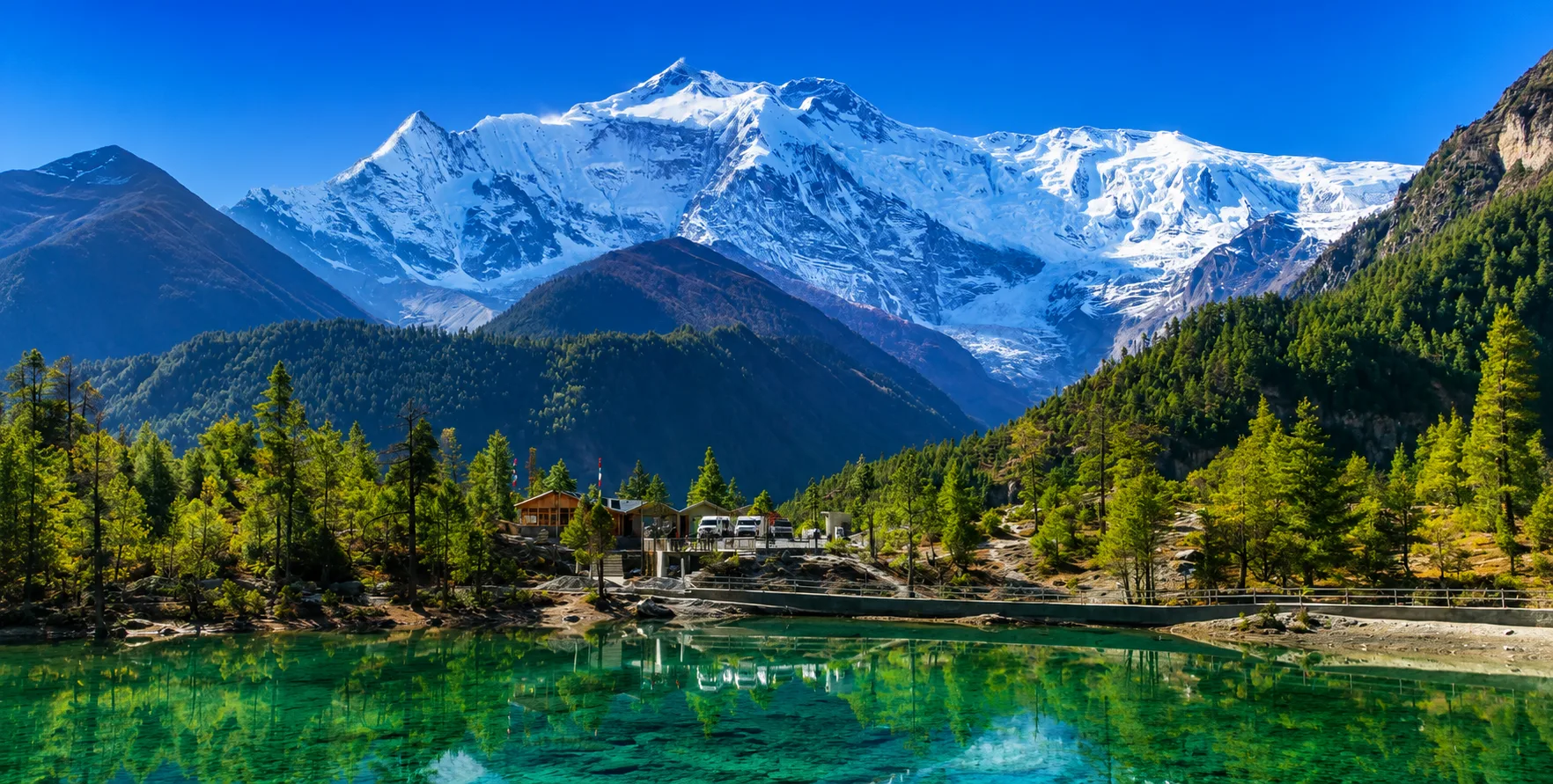
Manang is not the end of the road or the trail — it is the gateway to the most demanding and most spectacular section of the Annapurna Circuit. From Manang, the standard trekking route continues north through Yak Kharka (4,018 m) and Thorong Phedi (4,450 m) before the crossing of Thorong La Pass (5,416 m) — the highest point of the entire circuit and one of the most celebrated high-altitude pass crossings in the world.
The pass crossing day is typically 15 kilometres of walking,g taking 7 to 8 hours, with the ascent from Thorong Phedi to the pass summit covering approximately 1,000 meters of elevation gain on steep, exposed terrain. The descent from the pass to Muktinath (3,710 m) is significant, around 1,600 meters downhill, and can be hard on the knees after the punishing ascent. The reward is access to Muktinath, a sacred pilgrimage site for Hindus and Buddhist alike. The circuit then continues through the Kali Gandaki Valley, via Jomsom, Marpha, and Tatopani, ultimately reaching Pokhara.
For travellerss who want the circuit’s highlights without the full multi-week trek, our Kathmandu to Mustang private jeep offers asingle overland journeye that connects the Annapurna approach with Mustany—taking you through Manang, over the high passes, and into Upper Mustang’s extraordinary landscape. Our Muktinathatra itinerary also includes the Muktinath Temple, one of the world’s most sacred sites.
For those continuing south from Jomsom toward Pokhara, our Pokhara to Nayapul transportation service handles the final leg back to the city, and our Kathmandu to Pokhara bus or private vehicle options connect Pokhara onward to the capital when your circuit is complete.
Combining the Chame to Manang Drive with a Broader Nepal Journey
The Annapurna Circuit road through Chame and Manang is best experienced as part of a broader Nepal journey that takes in the country’s extraordinary diversity. Before or after your mountain road adventure, the Kathmandu Valley offers a concentration of history, culture, and architecture that rewards at least two to three days of exploration.
Our Kathmandu sightseeing service covers Pashupatinath, Boudhanath, Swayambhunath, and the Kathmandu Durbar Square in a single well-paced day. For first-time arrivals at Tribhuvan International Airport, our Kathmandu airport transfer service ensures a smooth start. The Bhaktapur Durbar Square day tour and Nagarkot sunrise tour (accessible via our Kathmandu to Nagarkot vehicle service) round out the valley experience with a dawn panorama of the central Himalayan range.
For a fully curated Nepal holiday that combines the Annapurna Circuit drive with the Kathmandu Valley, Pokhara, and other highlights, explore our Nepal holiday tour packages and Nepal tour package options. If you are considering a larger group journey — family, corporate, pilgrimage — our Coaster bus hire and full bus service can handle the low-altitude legs, with jeeps taking over above Besisahar.
Practical Tips for the Chame to Manang Road Journey
Start Early
Whatever your vehicle and whatever the season, leave Chame as early as possible — ideally by 7 a.m. Mountain roads in Nepal can get windy in the afternoon, and on the higher sections of the Chame-Manang route, afternoon clouds can reduce visibility and worsen road conditions. An early start also gets you there by early afternoon, with time to settle in, explore, and start acclimatising.
Carry Cash
There are no ATMs between Chame and Manang. Carry enough Nepali rupees for accommodation (if not already arranged), any emergency expenses, and tips. NPR 10,000 to 15,000 per person is a reasonable amount for a 2- to 3-day stay in the Manang area, though your spending will vary based on accommodation choices and dining preferences.
Pack for Cold
At Manang’s elevation of 33,540 meters, temperatures drop sharply after sunset even in the warmest months. In April and May, overnight temperatures in Manang typically range from 0 to 8 degrees Celsius. In September and October, expect night temperatures of minus 2 to minus 10 degrees Celsius. In winter, the cold is extreme. Wear or carry thermal base layers, a mid-layer fleece, a down jacket, a warm hat and gloves, and wool socks. Your accommodation will have blankets, but adding a sleeping bag liner adds significant warmth at minimal weight.
Stay Hydrated
Altitude dehydration is a real and underappreciated risk. The dry air of the Manang rain-shadow plateau accelerates moisture loss through breathing, and the cold masks thirst signals. Drink at least 3 to 4 litres of water per day while at altitude — more if you are active. All teahouses offer boiled water for a small charge, and it’s far more sustainable than buying single-use plastic bottles. Water purification tablets are a lightweight backup option.
Respect the Road
The road through the Annapurna Circuit corridor is shared with trekkers, residents, livestock (including yaks, sheep, and goats), and supply vehicles. Yield to trekkers at all times, slow down through villages, and give yak herds as wide a berth as possible — yaks can be unpredictable, and their horns can easily damage vehicles. Never sound the horn aggressively around animals or people on mountain roads; a polite tap is sufficient.
Frequently Asked Questions
Can I drive from Chame to Manang in a regular car?
No. The road from Chame to Manang is an unpaved mountain track with stream crossings, loose rock sections, and narrow cliff passages. A 4WD vehicle with high ground clearance is the minimum requirement. Sedans, hatchbacks, and standard cars should not attempt this road beyond Besisahar.
How long does the drive from Chame to Manang take?
In good conditions during the main trekking seasons, the drive takes 2 to 3 hours. During monsoon or after heavy rain, when streams run high and road surfaces are soft, the journey can take 4 to 5 hours or longer. Always allow extra time on mountain roads.
Is there mobile signal on the route from Chame to Manang?
Mobile signal is present in Chame and Manang, and sporadically along the route. Nepal Telecom generally has better coverage than private operators in these areas. Above Manang, signal becomes unreliable. Download offline maps (Maps.me or Gaia GPS) before leaving Chame.
What permits do I need to drive to Manang?
Foreign nationals need the Annapurna Conservation Area Permit (ACAP), which costs NPR 3,000 per person. No restricted area permit is required for Manang — that applies only to areas above Kagbeni in Upper Mustang. Your vehicle driver’s license is sufficient; no additional driving permit is required beyond standard Nepali vehicle registration.
Can I take a public bus or shared jeep from Besisahar to Manang?
Yes, shared jeeps operate from Besisahar to various points including Chame, Pisang, and occasionally Manang. These vehicles depart when full (usually 7 to 9 passengers) and have no fixed schedule. They are cheaper than private hire but offer no flexibility in stops, departure times, or route. During peak season, shared jeeps can be crowded, and luggage space is limited. A private vehicle from Nepal Vehicle Hiring offers significantly more comfort, flexibility, and reliability.
Can I combine the Annapurna Circuit with the Everest region?
Nepal’s geography makes combining Everest and the Annapurna Circuit in a single trip quite demanding, as they are on opposite sides of the country. However, with good logistics, it is achievable in three weeks. Our Everest Base Camp trek transport handles the eastern approach, and our Annapurna and Manang services handle the western circuit. Contact us through the Plan Your Trip page to design a combined itinerary.
How to Book Your Chame to Manang Transport with Nepal Vehicle Hiring
Nepal Vehicle Hiring Pvt. Ltd. specialises in vehicle hire across Nepal’s mountain road corridors, including the full Annapurna Circuit approach from Kathmandu or Pokhara to Besisahar, Chame, and Manang. Here is how to get started:
- Visit oehiclehiringnepal.com to browse the fleet and service options most relevant to your journey.
- Submit your trip details — dates, group size, starting point, and desired route — through our website or Plan Your Trip. Our Trip team will respond within 24 hours with vehicle options, pricing, and itinerary advice specific to your requirements.
- Confirm your booking, and we will arrange your driver, vehicle, and any required coordination before your departure date.
Contact us directly:
- WhatsApp / Call: +977 981-4227196
- Email: [email protected]
- Website: www.vehiclehiringnepal.com
Our team is based in Thamel, Kathmandu, available seven days a week, and experienced in organising transport for trekkers, families, pilgrims, and independent travellers. The road from Chame to Manang awaits—let us take you there safely and in comfort.
- Chame to Manang Road Guide: The Ultimate Drive Through the Annapurna Circuit
- Understanding the Chame to Manang Road: Geography and Context
- Chame (2,670 m): Where the High Himalayas Begin
- Chame to Pisang (14 km): Pine Forests, Rock Faces, and the First Mountain Panorama
- The Two Routes from Pisang to Manang: Upper vs Lower Trail
- Manang (3,540 m): The High Desert Capital of the Circuit
- Altitude and Acclimatisation on the Chame to Manang: The climb from Chame (2,670 m) to Manang (3,540 m) is about 870 metres; however, this sounds manageable—and it is, if you take it at the right pace. The problem is that most travellers arriving in Manang by jeep from Kathmandu ascend from 1,400 meters (Kathmandu) to 3,540 meters in a single long driving day. That ascent can trigger Acute Mountain Sickness (AMS) even in physically fit individuals.
- Road Conditions on the Chame to Manang Route: What to Expect
- Permits Required for the Chame to Manang Route
- The Full Route from Kathmandu to Manang: Planning Your Journey
- Trekking vs Driving from Chame to Manang: The Smart Compromise
- Beyond Manang: What Comes Next on the Annapurna Circuit
- Combining the Chame to Manang Drive with a Broader Nepal Journey
- Practical Tips for the Chame to Manang Road Journey
- Frequently Asked Questions
- How to Book Your Chame to Manang Transport with Nepal Vehicle Hiring

Related Blog & Articles

Besisahar to Manang Jeep

Besisahar to Dharapani Jeep Hire – Complete 4WD Transfer Guide for Annapurna Circuit Trekkers
Annapurna Circuit Road Conditions