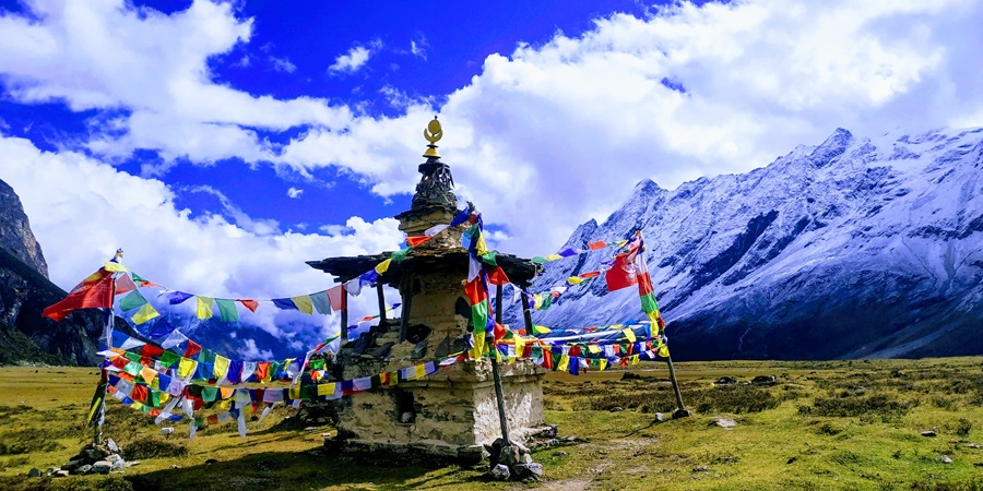
Everest Region Nepal


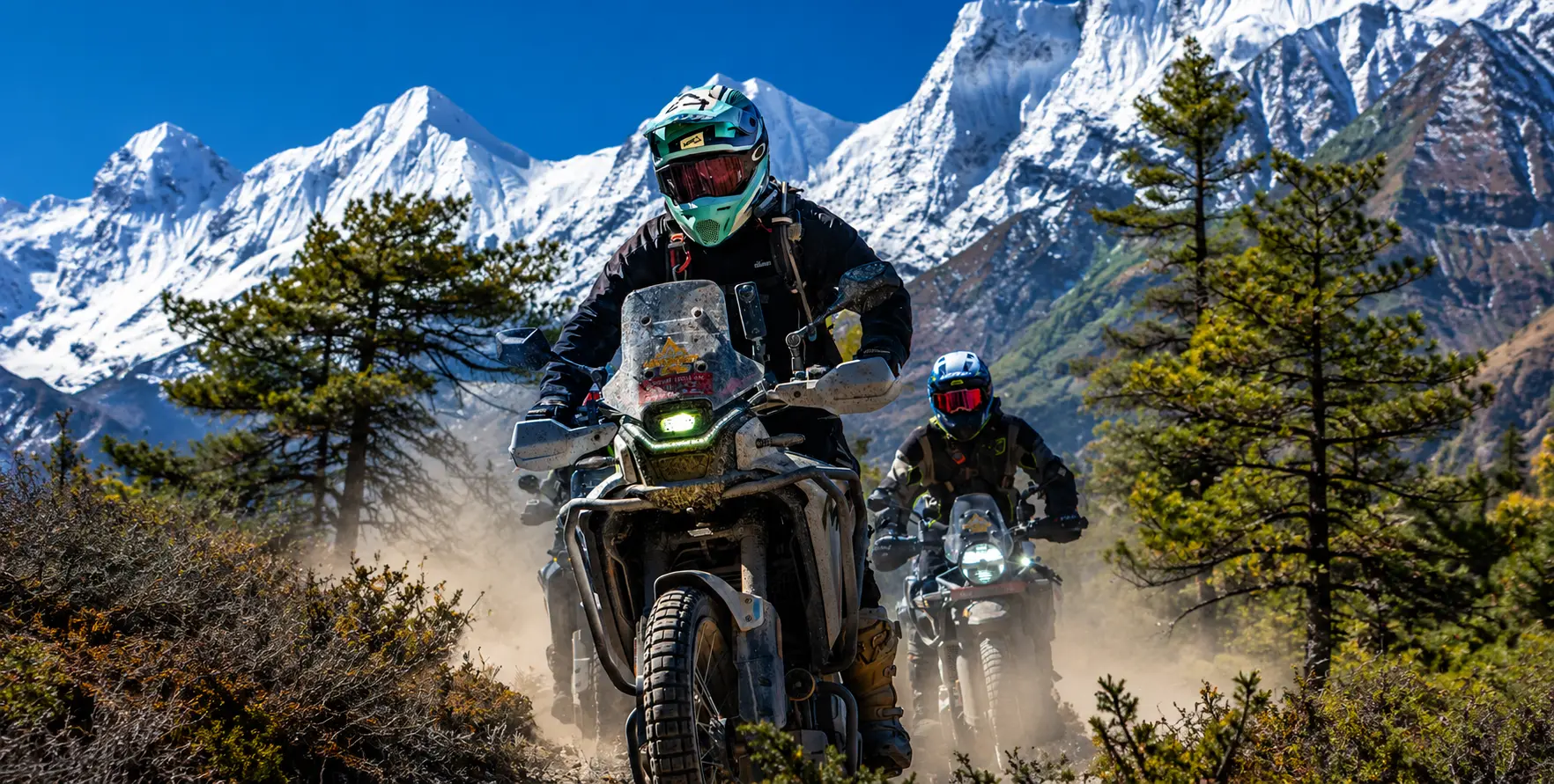
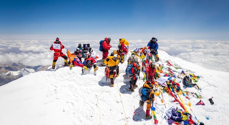
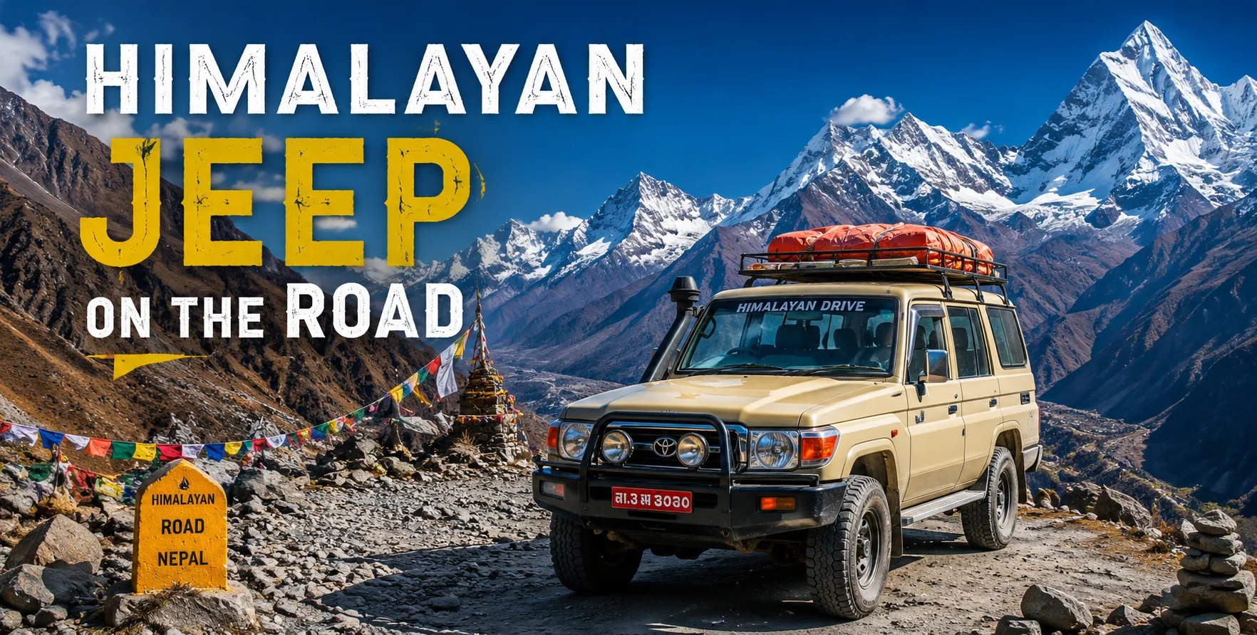
Everest Region Nepal featuring Mount Everest, Lukla Airport, Everest Base Camp Trek, and private jeep transport

Everest region Nepal – The World’s Greatest Mountain Journey

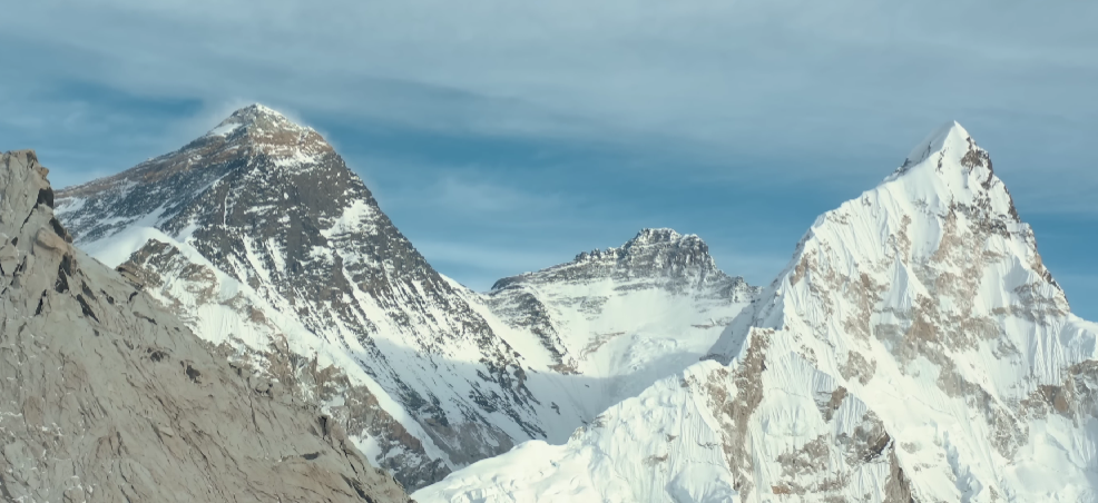
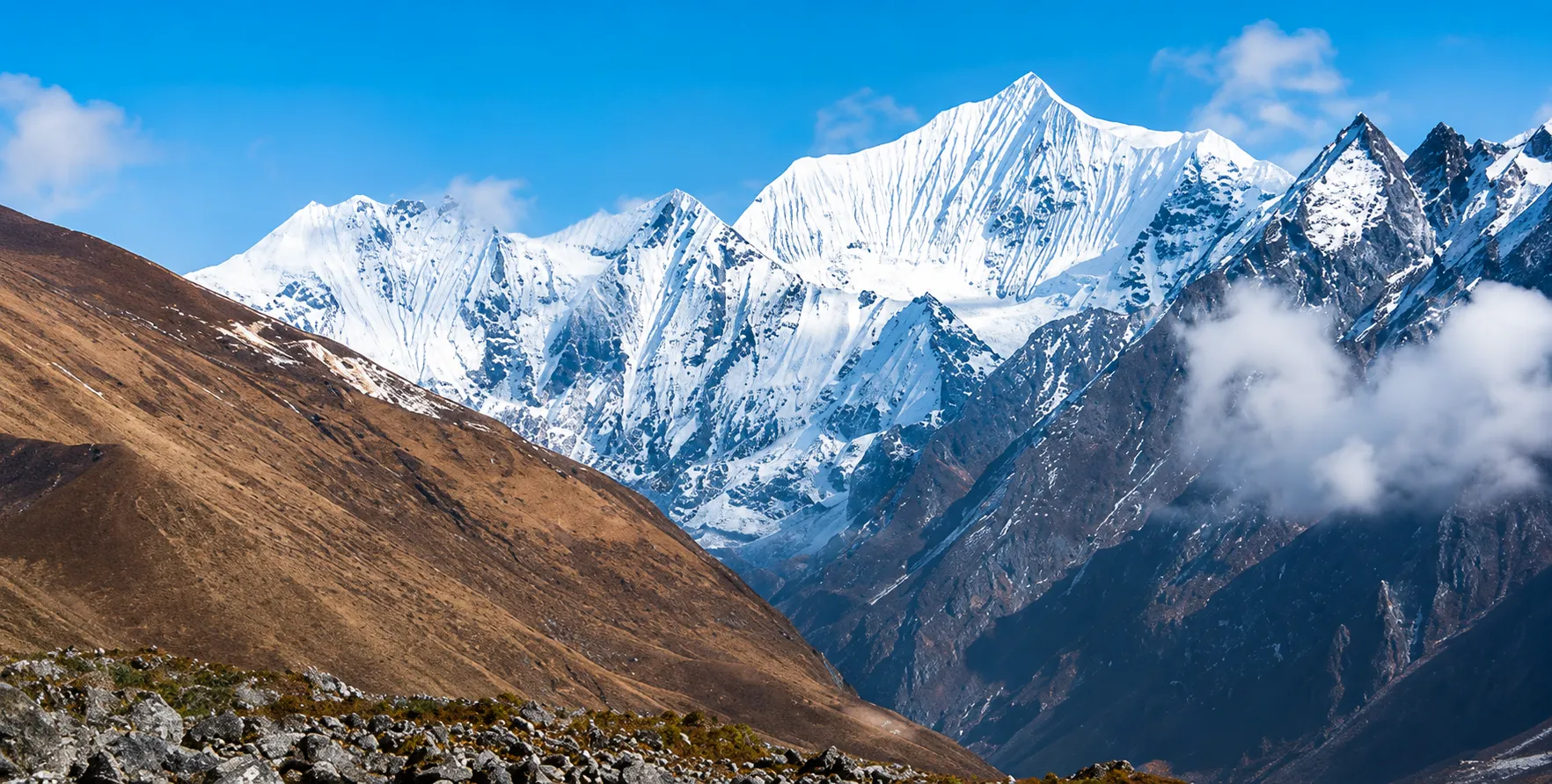
There is a moment, experienced by trekkers the world over, that happens somewhere on the trail between Namche Bazaar and Tengboche — a moment when the forest opens and the full panoramic enormity of the Khumbu Himalaya is suddenly, utterly, overwhelmingly present: Everest (8,849 m) above the Lhotse-Nuptse wall, Ama Dablam’s perfect Matterhorn-like spire filling the left horizon, Thamserku and Kangtega to the right, and the Khumbu Valley floor far below threaded with the silver ribbon of the Dudh Koshi River. Trekkers have been stopping at this viewpoint for six decades, pressing their hands together in the same involuntary gesture of reverence, making the same quiet sounds of disbelief. In 2026, as in 1966, the view has not dimmed by a single degree.

The Everest region (Khumbu) — Nepal’s most iconic and most visited trekking destination — is simultaneously the world’s greatest mountain landscape, the homeland of the extraordinary Sherpa people, a UNESCO World Heritage Site (Sagarmatha National Park, inscribed 1979), and the base from which every attempt on the world’s highest mountain (8,849 m) has been launched since Sir Edmund Hillary and Tenzing Norgay Sherpa’s first summit on May 29, 1953. But the Everest region is far more than one famous peak and one famous base camp — it is a network of Sherpa villages, ancient monasteries, turquoise glacial lakes, soaring high passes, and trekking circuits of varying duration and difficulty that offer some of the most rewarding mountain experiences available anywhere on Earth, at every level from first-time trekker to hardened Himalayan veteran.

This guide is the most comprehensive 2026 resource on the Everest region — covering the complete EBC trek route day by day, the 2026 permit system (including the new digital Trek Card), the Manthali flight situation and Salleri road alternative that Nepal Vehicle Hiring services, the Gokyo Lakes circuit, the Three High Passes Trek, the Sherpa cultural heritage, and the complete vehicle hire coordination that Nepal Vehicle Hiring provides for all Kathmandu to Manthali and Kathmandu to Salleri transfers.

Book your Everest region vehicle transfer: Nepal Vehicle Hiring | Nepal Trekking Packages | Call/WhatsApp: +977 9851013196


Everest region Nepal 2026 – Complete Quick Reference

Gateway AirportLukla / Tenzing-Hillary Airport (2,860 m) – via Manthali (Ramechhap) domestic airport, not Kathmandu TIA (2026)
Manthali Drive Time4–5 hours from Kathmandu (depart 2:00–3:00 AM for morning Lukla flights)
EBC AltitudeEverest Base Camp: 5,364 m (17,598 ft)
Kala Patthar Altitude5,545–5,643 m (18,192 ft) – highest point of standard EBC trek; best Everest viewpoint
Standard EBC Duration12–14 days from Lukla and back to Lukla
Trek DifficultyModerate-Strenuous. No technical climbing. 5–7 hours of walking daily at high altitude is required
Permits 2026Sagarmatha National Park Entry: NPR 3,000 + 13% VAT | Khumbu Pasang Lhamu Municipality: NPR 2,000–3,000 (digital Trek Card with QR code)
Guide RequirementLicensed guide mandatory (enforced at Monjo and Lukla checkpoints in 2026). TIMS card is no longer required for the Everest region.
Best SeasonOctober–November (Autumn) and March–May (Spring)
Road AlternativeKathmandu to Salleri/Phaplu by private Nepal VH jeep (270 km, 8–10 hrs), then trek for 2–3 days to Lukla.
Insurance MandatoryTravel insurance with helicopter evacuation coverage is required. Enforced at Lukla and checkpoints.
Nepal VH Contact+977 9851013196 | vehiclehiringnepal.com

Everest Region Nepal featuring Mount Everest, Lukla Airport, Everest Base Camp Trek, and private jeep transport


TheEverest region, Nepal – Geography, Scale, and Why It Is Different

Sagarmatha National Park – A UNESCO World Heritage Himalayan Ecosystem

The Everest region’s trekking circuits take place within Sagarmatha National Park (1,148 sq. km), inscribed as a UNESCO World Heritage Site in 1979 for its outstanding natural significance — containing the world’s highest peaks, extraordinary alpine biodiversity, and the traditional cultural landscape of the Sherpa people in a single protected area. The park’s altitudinal range, from the lower Khumbu valleys at 2,800 m to the summit of Everest at 8,849 m, encompasses every vegetation and climate zone, from subtropical forest to permanent ice, within a single, concentrated geography. This biodiversity profile includes Himalayan Musk Deer, Red Pandas (below 3,000 m), Snow Leopards, Himalayan Tahr, Langur monkeys, over 150 bird species, including the Himalayan Monal pheasant (Nepal’s national bird), and rare high-altitude plant species found nowhere else on Earth.

The park’s lower valleys — particularly the forests between Lukla and Namche and around Tengboche — are beautifully forested with birch, pine, rhododendron, and fir trees, creating an approach to the high Khumbu wilderness that is far more varied and alive than the barren glacier approaches to 8,000 m peaks in other mountain ranges. The Tengboche Monastery at 3,867 m, framed by Ama Dablam and sitting in a clearing above the treeline with Everest, Lhotse, and Nuptse visible behind it, is one of the most dramatically sited monasteries in the world — and one of the most photographed single scenes in all of Nepal.

The Peaks – What You Are Walking Towards

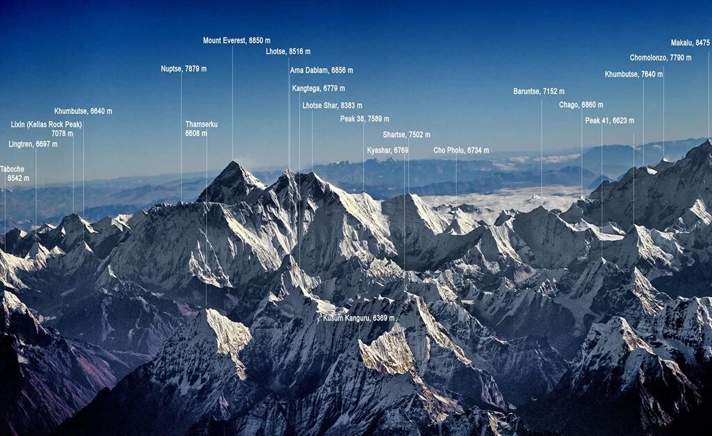
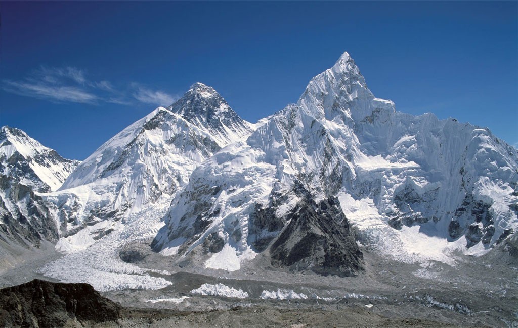
The Khumbu Valley contains five of the world’s fourteen 8,000+ meter peaks: Everest (8,849 m, world No. 1), Lhotse (8,516 m, No. 4), Makalu (8,485 m, No. 5), Cho Oyu (8,201 m, No. 6), and Kangchenjunga, nearby in the broader region. The standard EBC trekking route passes directly below four of these giants — a concentration of extreme altitude within a single trekking circuit that is unique in world mountaineering geography. The peaks visible from standard EBC viewpoints include not only these giants but also the aesthetically magnificent Ama Dablam (6,812 m) — widely considered the most beautiful mountain in the world by mountaineers and photographers — whose shark-fin profile appears over the shoulder of every view of the upper Khumbu.

Viewpoint / PeakAltitudeTrekWhat You See
Kala Patthar5,545 mEBC StandardThe closest full view of the Everest summit available without technical climbing. Also: Lhotse, Nuptse, Pumori, Ama Dablam. Sunrise from here is the single greatest morning of most trekkers’ lives.
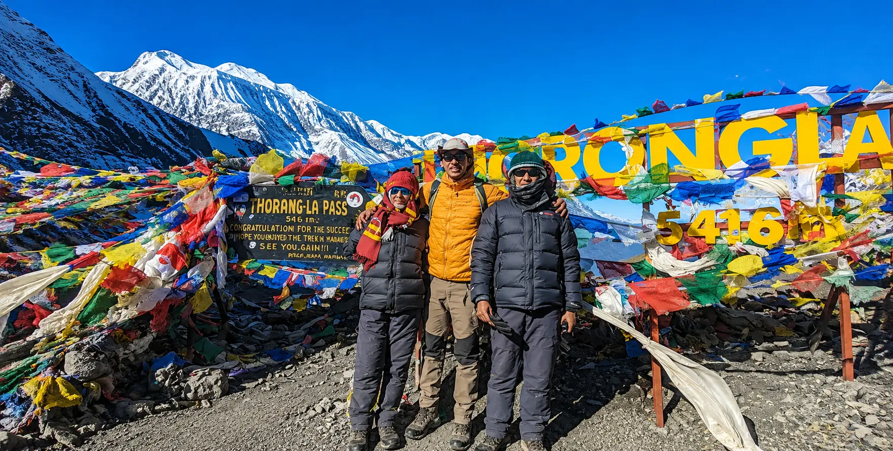
Gokyo Ri5,357 mGokyo / Three Passes360-degree panorama including four 8,000 m peaks simultaneously: Everest, Lhotse, Makalu, Cho Oyu. Gokyo turquoise lakes below. Often considered the finest mountain panorama in all Nepal.
Chukhung Ri5,550 mThree Passes / EBC optionQuieter alternative to Kala Patthar. Close-up views of Lhotse South Face (4th highest peak), Ama Dablam, Makalu, Island Peak—dramatic eastern perspective on Khumbu.
Hotel Everest View3,880 mNamche acclimatization hikeWorld’s highest-altitude hotel (Guinness-certified). Perfectly framed view of Everest, Lhotse, and Ama Dablam over the Khumbu Valley—an ideal acclimatization-day destination from Namche.
Island Peak (Imja Tse)6,189 mIsland Peak ClimbingMost popular trekking peak in Nepal. Technical climbing with fixed ropes, crampons, and an ice axe is required. Extraordinary summit panorama. 3–5 days climbing extension on EBC itinerary.


Getting to the Everest Region – The Manthali Flight and the Road Alternative

The Lukla Flight Situation in 2026 – Manthali, Not Kathmandu
Everest Region Nepal featuring Mount Everest, Lukla Airport, Everest Base Camp Trek, and private jeep transport

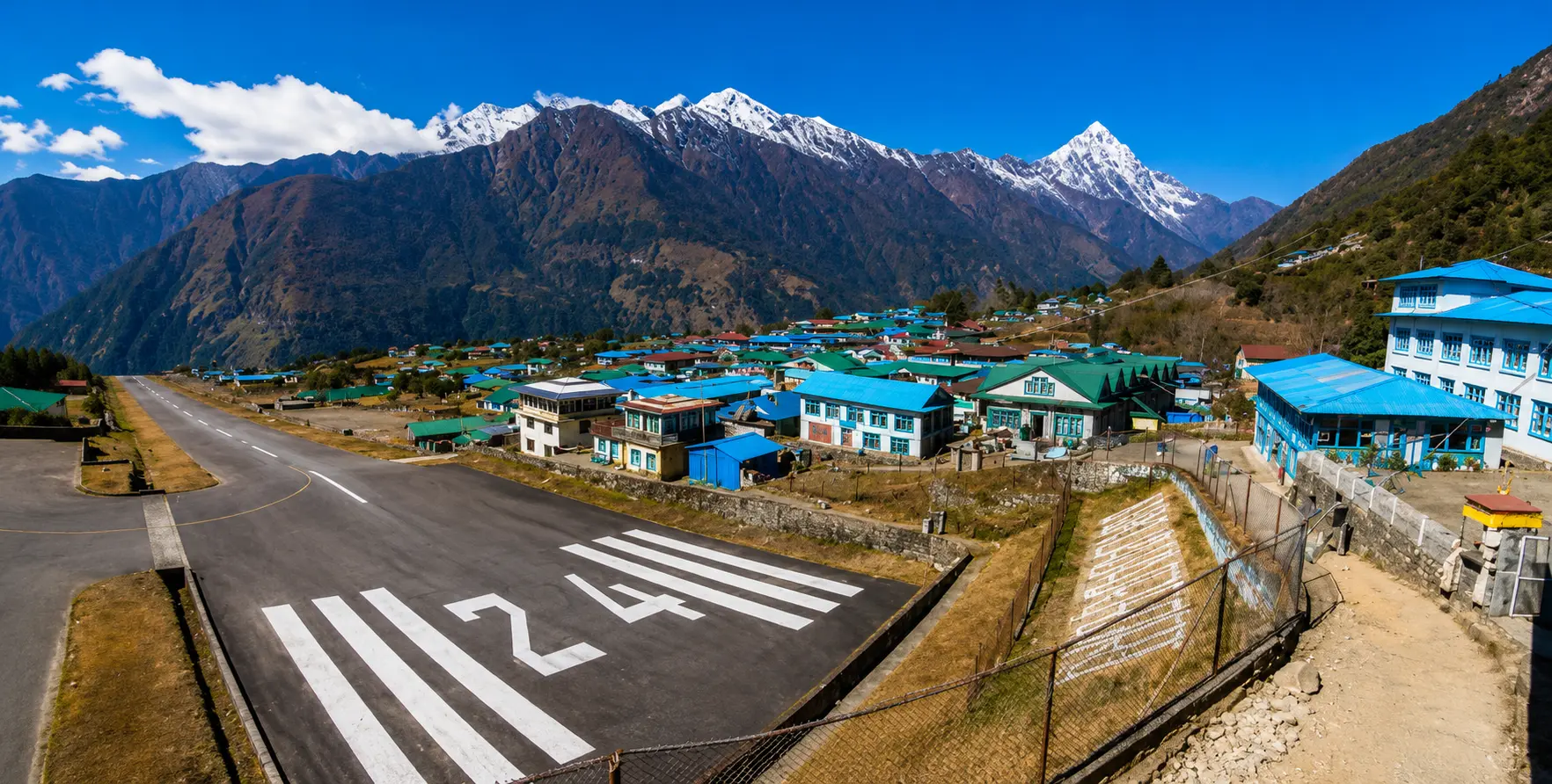
One of the most practically significant 2026 updates for any Everest region trekker is a logistics change that has been in place since 2019 but continues to catch first-time visitors off guardAll Lukla flights depart from Manthali (Ramechhap) domestic airport, not from Kathmandu’s Tribhuvan International Airport. As one respected 2026 Everest travel specialist confirms: “All Lukla flights continue to depart from Manthali (Ramechhap), not from Kathmandu’s Tribhuvan International Airport. This change, implemented in 2019, requires a five-hour pre-dawn drive from Kathmandu to the domestic airport before the flight to Lukla.”

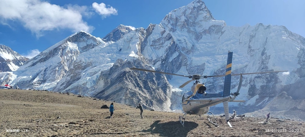
The practical implication: trekkers must depart their Kathmandu hotel between 2:00–3:00 AM to complete the 4–5-hour drive to Manthali in time for the morning flight window (Lukla flights operate only in the early morning when weather conditions are stable — typically 6:00–10:00 AM). Nepal Vehicle Hiring provides 24/7 Kathmandu hotel to Manthali airport transfer — the pre-dawn departure is our most frequently booked Everest region service, and our drivers are experienced with the early-morning highway conditions on the Kathmandu-Manthali route. The 20-minute mountain flight from Manthali to Lukla is one of aviation’s great experiences — a twin-otter approach between mountain walls to the 527-meter sloped runway cut into the Khumbu hillside, landing at Lukla’s Tenzing-Hillary Airport (2,860 m) in a descent that brings trekkers instantly, physically, and emotionally into the Himalayan world.

The Road Alternative – Kathmandu to Salleri and Phaplu by Nepal Vehicle Hiring Jeep

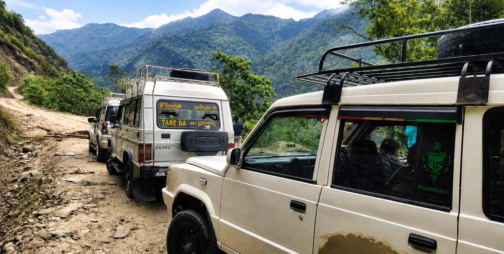
As Lukla flight cancellations due to weather have disrupted itineraries for thousands of trekkers over the years, the road alternative via Salleri and Phaplu is rapidly gaining popularity — and Nepal Vehicle Hiring’s Kathmandu-to-Salleri/Phaplu private jeep service is one of our most requested Everest region offerings. The road journey from Kathmandu to Salleri covers approximately 270 km via the Madhya Pahadi Highway, passing through Bhaktapur, Dhulikhel, Khurkot, and Ghurmi, taking 8–10 hours by private vehicle.

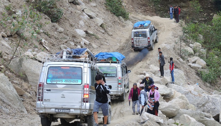
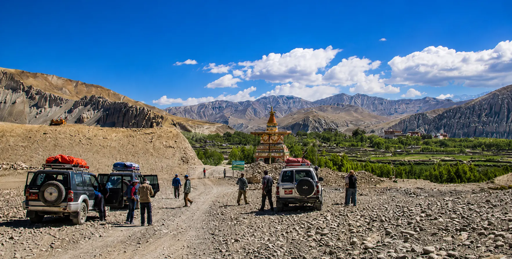
From Salleri (2,398 m) or Phaplu (2,413 m), trekkers follow the original Everest route before Lukla Airport existed — the trail walked by Hillary’s 1953 expedition, passing through traditional Rai and Sherpa cultural landscapes of the lower Solu region before joining the main Khumbu trail at Namche Bazaar in approximately 3–4 days of trekking. This road option offers several advantages in 2026: it is immune to flight cancellations, provides 2–3 extra acclimatization days on the lower trail, passes through less-visited lower Solu cultural landscapes, and costs significantly less than the Lukla flight. The major seasonal limitation is that the Madhya Pahadi Highway is not recommended during monsoon season (June–September) when the gravel road surface becomes dangerously muddy. For October–May travel, the Salleri road is a genuinely excellent Lukla alternative.

Nepal Vehicle Hiring can also arrange an extended drive beyond Salleri to Kharikhola and Surke (within a 2–3-hour walk of Lukla) — the most direct road-accessible point to Lukla itself, useful for groups who have experienced flight cancellations and need to re-enter the Khumbu trail as close to Lukla as possible by vehicle. Contact our operations team at +977 9851013196 for current road conditions and vehicle options.
 

Everest Region Nepal featuring Mount Everest, Lukla Airport, Everest Base Camp Trek, and private jeep transport

The Classic Everest Base Camp Trek – Day-by-Day Guide 2026

The standard Everest Base Camp trek is a 12–14 day, 130+ km round trip from Lukla that has been described by trekkers, mountaineers, and travel writers as the most magnificent walk in the world. Its combination of extraordinary mountain scenery, rich Sherpa cultural heritage, living Buddhist monasteries, and the unique emotional charge of approaching the base of the world’s highest mountain creates an experience that is genuinely unlike any other trekking journey on Earth.

DayStageAltitudeDistance / TimeKey Highlights
1Kathmandu to Manthali drive, then fly to Lukla2,860 m4–5 hr drive + 20 min flight2–3 AM departure KTM; dramatic Lukla runway landing; Sherpa porters and guides assemble
1–2Lukla to Phakding to Namche Bazaar3,440 m~15 km / 7–8 hrsDudh Koshi gorge; Hillary Suspension Bridge; first Everest glimpse; ACAP and Khumbu permit checks at Monjo
3–4Namche Bazaar – ACCLIMATISATION (2 nights)3,440 mDay hike 4–5 hrsSherpa Capital; day hike to Hotel Everest View (3,880 m) for first full Everest view; Sherpa Museum; Saturday market
5Namche to Tengboche3,867 m~13 km / 5–6 hrsAma Dablam fills the horizon; descent to Dudh Koshi then forest climb; Tengboche Monastery – evening puja
6Tengboche to Dingboche4,410 m~11 km / 5–6 hrsPangboche Monastery (oldest in Khumbu); transition to alpine desert above treeline; Island Peak and Lhotse views
7Dingboche – ACCLIMATISATION (2nd rest day)4,410 mChukhung Ri side tripMandatory rest day; optional Chukhung Ri hike (5,550 m) for Ama Dablam and Lhotse South Face views
8Dingboche to Lobuche4,910 m~10 km / 5–6 hrsKhumbu Glacier lateral moraine; Sherpa memorials (expedition fatalities); stark high-alpine terrain
9Lobuche to Gorak Shep to EBC to Gorak Shep5,364 m~15 km / 8–9 hrsEVEREST BASE CAMP; Khumbu Icefall above; Nuptse, Lhotse, Pumori close; return to Gorak Shep overnight
10Gorak Shep – Kala Patthar (pre-dawn) – descent to Pheriche5,545 m~15 km / 8–9 hrs3:30–4 AM start; KALA PATTHAR SUNRISE – Everest summit gold-lit; 360-degree panorama; descend to Pheriche
11Pheriche to Namche Bazaar3,440 m~22 km / 7–8 hrsLong descent; knees tested; atmosphere thickens; Namche hot shower and celebration dinner
12Namche to Lukla2,860 m~19 km / 7–8 hrsFull descent day; final suspension bridges; Lukla arrival – group celebration with crew
13Fly Lukla to Manthali + drive to Kathmandu1,350 m20 min flight + 4–5 hr driveMorning flight weather-dependent; Nepal VH vehicle waiting at Manthali for KTM hotel drop

Everest Region Nepal featuring Mount Everest, Lukla Airport, Everest Base Camp Trek, and private jeep transport

Namche Bazaar – The Sherpa Capital

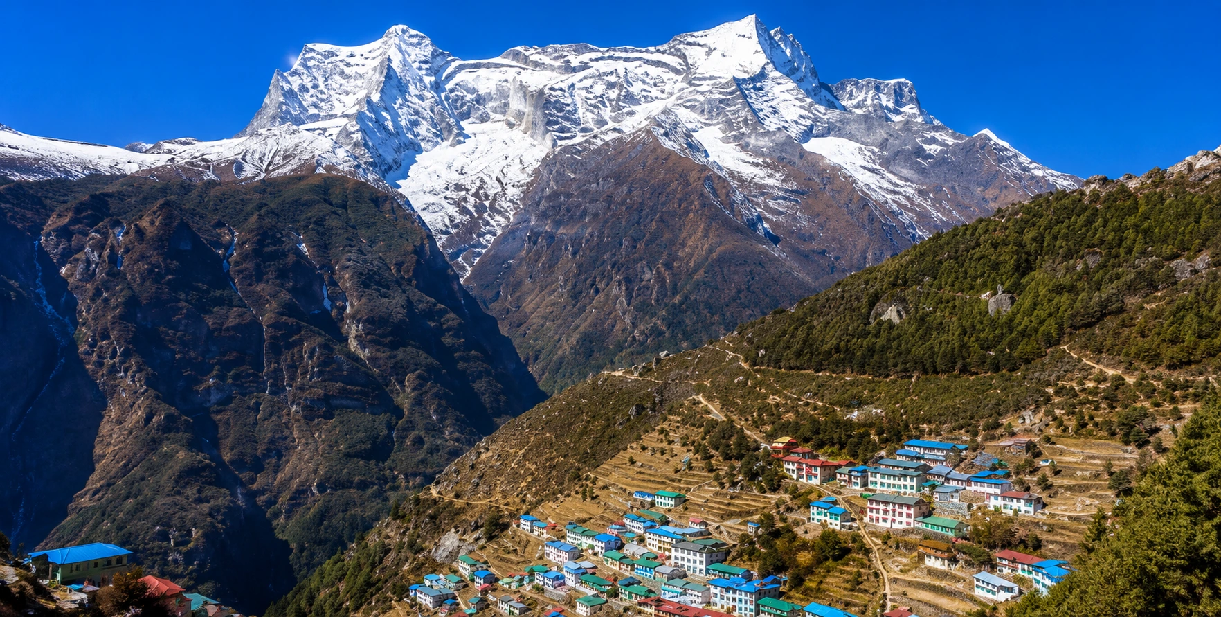
Namche Bazaar (3,440 m) is the beating heart of the Khumbu trekking world — an amphitheater-shaped town of brightly painted buildings clinging to a dramatic hillside curve above the Bhote Koshi and Dudh Koshi confluence. As the largest Sherpa settlement in the Khumbu region, Namche is simultaneously a traditional cultural hub and a remarkably sophisticated mountain-resort town — offering high-speed satellite WiFi (in 2026), ATMs, excellent bakeries, climbing equipment shops, well-stocked pharmacies, the Sherpa Culture Museum, a Sagarmatha National Park visitor centre, cafes serving espresso and apple pie, and pubs alongside the prayer wheels, mani walls, and BuddhistMonasteryy that represent its more ancient identity. The Saturday Market at Namche — where villagers from the surrounding Khumbu communities gather to trade crops, household goods, and Tibetan handicrafts — is one of the most authentic and colorful market experiences in Nepal, operating essentially unchanged since the Malla period.

The mandatory acclimatization at Namche (2 nights) is not merely a safety protocol — it is an invitation to understand what the Khumbu actually is before proceeding higher. The day hike to Hotel Everest View (3,880 m) — the world’s highest-altitude hotel (Guinness-certified) — provides the first full frontal view of Everest itself above the Khumbu Valley, framed alongside Lhotse, Nuptse, Ama Dablam, and Thamserku. The Khumjung village nearby — home of Hillary’s School and Hospital, built with Sir Edmund Hillary’s Himalayan Trust funding, and the Khumjung Monastery with its famous Yeti scalp — is a 2–3-hour walk from Namche and offers the most rewarding Sherpa cultural immersion available on the standard acclimatization day.

Tengboche – The Spiritual Heart of the Khumbu

Tengboche Monastery (3,867 m) occupies one of the most dramatically beautiful positions of any religious building anywhere in the world: a forest clearing on a ridge above the Imja Khola valley, with Ama Dablam rising directly behind it and Everest, Lhotse, Nuptse, Kwangde, Thamserku, and Kangtega surrounding it on three sides in a panorama that has inspired everyone from seasoned mountaineers to first-time trekkers to moments of profound stillness. TMonasteryery is the largest in the Khumbu region, founded in 1916, and an active center of Sherpa Nyingma Buddhist practice — the same branch of Tibetan Vajrayana Buddhism that provides the spiritual and cultural framework for the Sherpa communities throughout the Khumbu.

Evening puja (prayer ceremony) at Tengboche Monastery, when it is open to respectful visitors, is one of the most moving spiritual experiences available on the EBC trekmonks in maroon robes chanting in the candlelit interior, butter lamps glowing, the deep resonance of Tibetan horns and drums, and outside the Monastery windows, the enormous black silhouettes of the surrounding peaks cutting the star-filled sky. This is the Khumbu at its most profoundly itself — a place where the sacred and the magnificent are genuinely, physically the same thing.
Everest Region Nepal featuring Mount Everest, Lukla Airport, Everest Base Camp Trek, and private jeep transport

Kala Patthar – The Greatest Sunrise on Earth

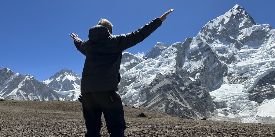
Every trekker who reaches the Everest region eventually confronts the same paradox: the summit of Everest is not visible from Everest Base Camp itself. The massive south face of Nuptse blocks the view. The summit appears only as a small triangle of rock above the Lhotse-Nuptse ridge. The place where Everest is truly seen — summit to snowfields, its full pyramidal enormity revealed — is Kala Patthar (5,545 m), the black rocky ridge above Gorak Shep that has become the single most celebrated viewpoint in the Himalaya.

The standard approach to Kala Patthar for the dawn panorama begins at 3:30–4:00 AM from Gorak Shep — a two-hour headtorch ascent through pre-dawn darkness and cold, arriving at the rocky summit as the first pink light strikes Everest’s summit triangle, turning it from grey to gold, then to blazing white as the sun rises behind the Lhotse-Nuptse massif. The experienced trekking specialist confirms: “The pre-dawn ascent under stars, followed by a sunrise erupting gold across the Khumbu, is the single greatest morning of most trekkers’ lives.” The 360-degree panorama from Kala Patthar includes Everest, Lhotse, Nuptse, Pumori, Ama Dablam, Cho Oyu, and the full sweep of the Khumbu glacier below — a view that no photograph ever fully captures and no one who has stood there ever forgets.


The 2026 Permit System – Everything That Has Changed

The Everest region permit system has undergone significant changes in the last three years, and 2026 introduces further digital tracking requirements. Here is the current, accurate picture as of 2026:

PermitCost 2026Where to GetNotes
Sagarmatha National Park Entry PermitNPR 3,000 + 13% VAT = NPR 3,390NTB Kathmandu OR Monjo checkpointGetting to Kathmandu – long queues at Monjo in peak season. Digital QR Trek Card issued.
Khumbu Pasang Lhamu Rural Municipality PermitNPR 2,000–3,000 (~USD 15–22)Lukla (on arrival) or Monjo checkpointCannot get to Kathmandu. New since 2023. Digital Trek Card with QR code. Scanned at Namche and Pangboche.
TIMS CardNOT required for Everest region (2026)N/A for EverestTIMS is required for the Annapurna and Langtang regions and has not been required for EBC since 2025.
Licensed GuideVia trekking agency packageHire through a registered Nepal trekking agencyMandatory and enforced at Monjo and Lukla checkpoints (2026). Cannot solo trek without a guide.
Travel Insurance (helicopter evacuation)Varies – confirm helicopter coverPurchase before departure from NepalMandatory. Must cover helicopter evacuation to a minimum of 6,000 m. Checked at Lukla and Namche by insurers.
FNMIS RegistrationFreeOnline via DOI before travelAll tourists visiting Nepal from January 1, 2026, must register on FNMIS (Foreign National Management Information System) through the Department of Immigration before arrival.


The New Digital Trek Card System – QR Code Tracking

A major 2026 development is the digitalization of the Khumbu Pasang Lhamu Rural Municipality permit into a Trek Card with a QR code, as one boots-on-ground Kathmandu operator reports: “In 2026, this permit has gone digital. You will be issued a Trek Card with a QR code. This code is scanned at various points along the trail to track your location for safety. There are scanners in Namche and Pangboche.” Trekkers must ensure their Trek Card QR codes are scanned at the designated points — skipping a scan can trigger a missing-person alert in the safety system, causing unnecessary concern for both the trekker and their emergency contacts. Nepal Vehicle Hiring advises all Everest region clients to carry permits in a waterproof, easily accessible location and to present them promptly at all checkpoints.

Licensed Guide Mandatory – Enforced at Monjo and Lukla 2026

Since the Nepal Tourism Board’s mandatory guide policy (2023), solo trekking without a licensed guide has been increasingly enforced in the Everest region in 2026. While the Khumbu local government had historically resisted the national guide mandate, checkpoints at Monjo and Lukla are now checking guide credentials more strictly. Solo trekkers attempting to proceed without a guide are increasingly required to hire a local guide at the gate or join a group. Nepal Vehicle Hiring partners with registered trekking agencies that can arrange licensed, English-speaking Khumbu-experienced guides alongside vehicle hire bookings — contact us at +977 9851013196 for combined transport and guide arrangements.
Everest Region Nepal featuring Mount Everest, Lukla Airport, Everest Base Camp Trek, and private jeep transport

The Gokyo Lakes Circuit – The Everest Region’s Most Beautiful Secret

While the Everest Base Camp route carries the name recognition and the majority of trekkers, the Gokyo Valley is widely regarded by experienced Himalayan trekkers as the most scenically extraordinary section of the entire Everest region — and the route to Gokyo Ri (5,357 m) is considered by many to offer the finest accessible mountain panorama in Nepal, surpassing even Kala Patthar for the sheer range of its views.

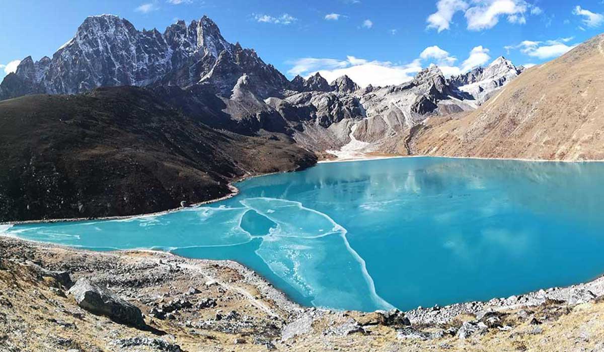
The Gokyo Lakes — a chain of six glacially-fed turquoise lakes at altitudes between 4,700 and 5,000 m alongside the Ngozumpa Glacier, Nepal’s largest glacier — sit in a landscape of such concentrated beauty that trekkers who have visited both EBC and Gokyo consistently rate Gokyo’s visual impact as the greater of the two. The lakes themselves are sacred in Hinduism and Buddhism — bathing in them is believed to cleanse spiritual impurity, and they draw Hindu pilgrims as well as trekkers during the Janai Purnima festival each August. The emerald and turquoise water against the black moraine, the white glacier, and the overwhelming peaks above creates a scene that multiple Himalayan travel writers have described as the most beautiful single landscape in Nepal.

From Gokyo Ri’s summit (5,357 m), the panorama includes four 8,000 m peaks simultaneously — Everest (8,849 m), Lhotse (8,516 m), Makalu (8,485 m), and Cho Oyu (8,201 m) — framed above the turquoise lakes below. This is the only readily accessible viewpoint anywhere in the Himalaya from which four 8,000 m peaks are simultaneously visible — a fact that makes Gokyo Ri one of the most photographically and experientially extraordinary points available to any non-technical mountaineer in the world. The Gokyo circuit typically adds 3–5 days to a standard EBC itinerary (for a total of 17–19 days from Kathmandu) or can be trekked independently in 10–12 days as a pure Gokyo circuit without the standard EBC approach.


The Three High Passes Trek – The Complete Everest Circuit 2026

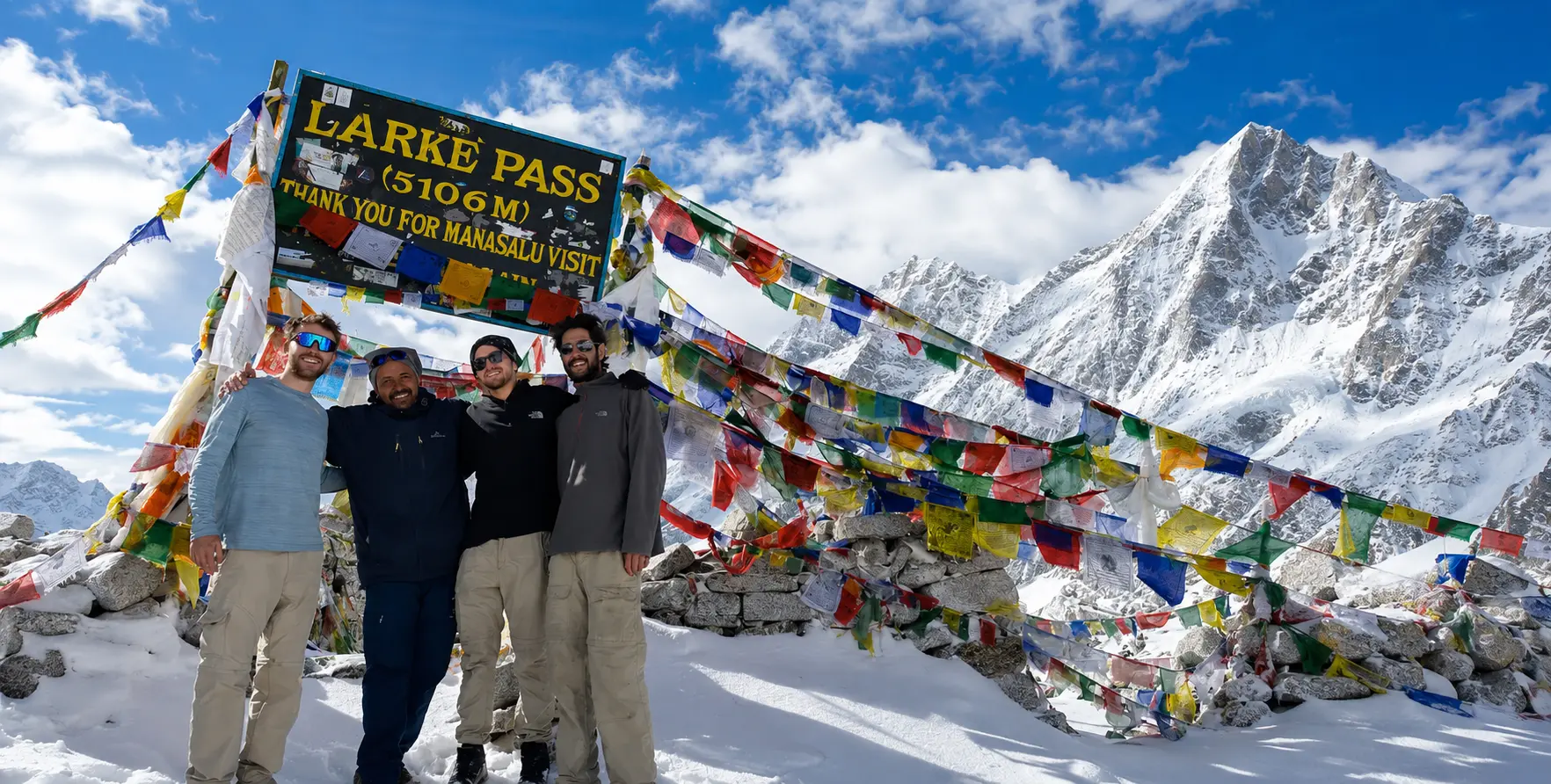
The Everest Three High Passes Trek — crossing Kongma La (5,535 m), Cho La (5,420 m), and Renjo La (5,360 m) in a single circuit — is the most comprehensive and demanding trekking adventure available in the Everest region without technical climbing. The 18–21 day circuit encompasses every major experience the Khumbu has to offer: EBC, Kala Patthar, Gokyo Lakes, Gokyo Ri, the Ngozumpa Glacier, three high passes, ancient Sherpa trade routes, and both the famous and completely off-the-beaten-path sections of the Khumbu — including the Thame Valley (birthplace of Tenzing Norgay) and the remote Imja and Gokyo valleys that see only a fraction of the traffic of the main EBC corridor.

PassAltitudeTrekConnectsDifficulty & Character
Kongma La5,535 mThree PassesChukhung to LobucheThe highest of the three. Steep icy ascent. Moraine crossing. Memorial chortens of Sherpa climbers. Tough but not technical.
Cho La5,420 mThree PassesDzongla to Thangnak (Gokyo side)Rocky and icy descent. Small glacier crossing – crampons helpful. Connects EBC route to Gokyo Valley.
Renjo La5,360 mThree PassesThame Valley to Gokyo ValleyMost scenic of the three. Emerald Gokyo Lakes visible below; Everest, Cho Oyu, Makalu panorama from summit. Quietest pass.


Kongma La – The Highest and Most Demanding Pass

At 5,535 m, Kongma La is the highest of the three passes and the one most likely to involve genuine physical difficulty — steep icy ascents, rocky moraine crossings, and significant altitude exertion on an approach where trekkers will already have spent 8–10 days above 4,000 m. The pass connects Chukhung in the Imja Valley to Lobuche on the EBC route, crossing a ridge with memorial chortens honoring Sherpa climbers and expedition members who have died on Everest and surrounding peaks — a sobering and profoundly moving reminder that this beautiful landscape carries a genuine human cost alongside its magnificent surface. The views from the Kongma La summit include Makalu, Lhotse, Nuptse, Ama Dablam, and the full sweep of the Khumbu glacier.

Cho La – The Ice and Gokyo Gateway

The Cho La (5,420 m) is the most technically challenging of the three passes for most trekkers — its short glacier crossing and icy, rocky descent require careful footwork and, ideally, crampons or microspikes, particularly in the pre-dawn cold when trekkers traditionally attempt it. The pass connects the EBC route (Dzongla) to the Gokyo Valley (Thangnak) — and the moment of crossing brings one of the most dramatic landscape transitions on any Nepal trekking circuit: the rocky, glacier-dominated EBC approach disappears behind, and the serene, lake-dotted Gokyo Valley opens ahead.

Renjo La – The Scenic Pinnacle

The Renjo La (5,360 m) is the most scenically rewarding of the three passes and also the quietest — connecting the Thame Valley to the Gokyo Valley via a historically significant old trade route used by Sherpa traders and Tibetan merchants for centuries. From the Renjo La summit, the view of the Gokyo Lakes directly below — turquoise against the dark moraine — combined with the panorama of Everest, Cho Oyu, and Makalu is regarded by experienced Himalayan photographers as one of the most visually perfect compositions in Nepal’s mountain landscape.


Sherpa Culture – The Human Heart of the Everest Region

The Sherpa people — the Tibetan Buddhist ethnic community who have inhabited the Khumbu Valley for approximately 400–500 years, having migrated from the Kham region of eastern Tibet — are the human dimension of the Everest region, transforming a mountain landscape into a living cultural world. Their name in Tibetan means ‘people from the east’ (Shar = east, Pa = people), and their cultural identity is inseparably woven with the Khumbu landscape they inhabit — the sacred peak Khumbila (5,765 m) is the guardian deity of the Khumbu Valley, never climbed out of respect for its sacred status, watching over the entire region from above Namche Bazaar.

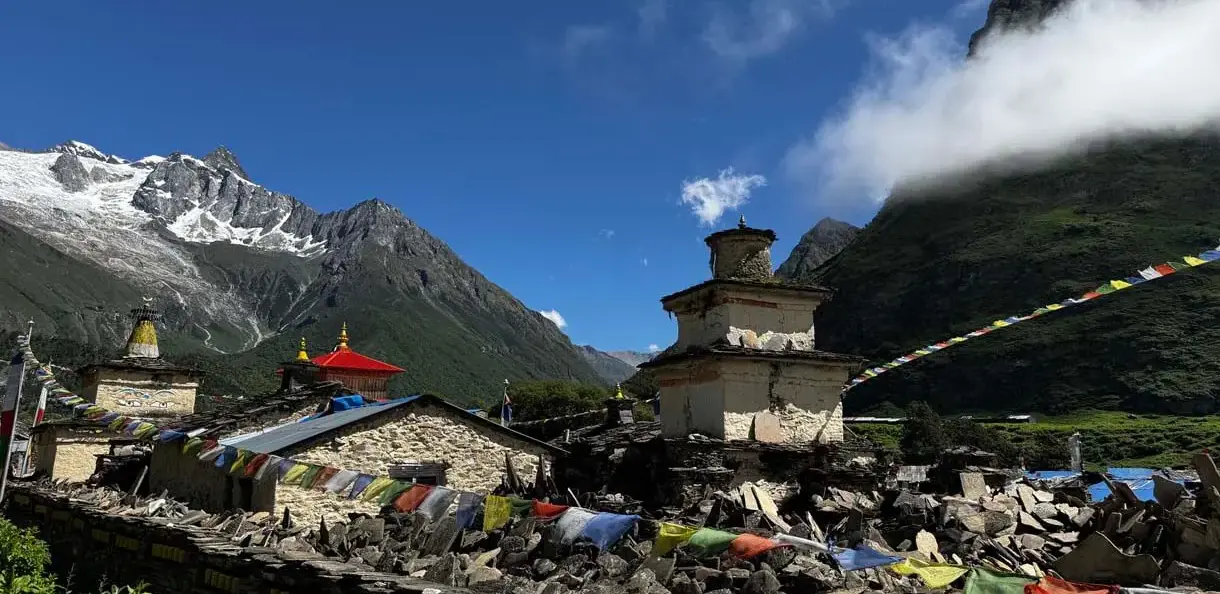
Sherpa culture is Nyingma Tibetan Buddhism practiced in the Himalayan environment — with mani walls (stones carved with Om Mani Padme Hum), chortens (Buddhist stupas), prayer flags, monastery complexes, and the annual Mani Rimdu festival at Tengboche and Thame monasteries defining the cultural and spiritual texture of every village on the trek. The Pangboche Monastery — the oldest in the Khumbu Valley — houses relics of a skull and a hand believed to be from a Yeti and is among the most culturally significant sites on the entire trail.

The Sherpa relationship with mountaineering is the best-known dimension of their culture internationally — and with reason. Since Tenzing Norgay Sherpa’s first Everest summit alongside Hillary in 1953, Sherpas have carried, guided, fixed ropes, managed logistics, and summited Everest more times than any other group, setting records that redefine what is physically possible at extreme altitude. The memorial chortens above Namche and along the high trail record the human cost of this achievement — and the Sherpa Culture Museum in Namche Bazaar provides essential context for the entire climbing history of the Everest region, from the 1953 expedition to the present summit season. The most significant act of cultural respect any EBC trekker can offer is to learn the names and histories of the Sherpa guides who accompany them, to engage with monastery and village cultures along the trail, and to understand that the mountains they visit are not merely a landscape but a living, sacred homeland.


When to Go – Everest Region Seasonal Guide 2026

SeasonMonthsTrail ConditionWeather / ViewsAdvice
AutumnOct–NovDry and stableCrystal clear; best views; cold nights above 4,500 mBEST SEASON. Book teahouses and guides 4–6 weeks ahead. Namche requiresa  6-week lead in Oct.
SpringMar–MayGood; melting snow above 5,000 mGood views; morning clear; afternoon cloud; spring flowers2nd-best season; also the peak climbing season. Busier on upper trail Apr–May. Book 3–4 weeks ahead.
WinterDec–FebSnow above 4,000 m; Kala Patthar icyColdest; severe at night (-20C above 5,000 m); very clear daysOnly experienced winter trekkers. Most teahouses above Dingboche close. Requires a down sleeping bag rated to -25C.
MonsoonJun–SepMuddy lower trails; unstable above 4,500 mCloud; limited views; heavy rain below NamcheNot recommended. Upper Khumbu above 4,000 m is drier in the monsoon but not reliably clear.


Autumn (October–November) – The Definitive Khumbu Season

October is the single most popular and most competitive month for Everest region trekking in Nepal. As Everest Holiday confirms, Namche Bazaar lodges require a 6-week booking in October, compared to same-day availability in September. Teahouse accommodation at Tengboche, Dingboche, Lobuche, and Gorak Shep fills weeks in advance during peak October-November season — with the premium teahouses (those with attached bathrooms and better beds at altitude) booked months in advance by organized tour groups. Nepal Vehicle Hiring advises: book all Manthali transfers and Salleri road transfers at least 3–4 weeks ahead for October and November. The Khumbu Icefall’s condition at Everest Base Camp is at its most photogenic in October — the autumn climbing post-monsoon season sees expedition teams still at base camp in early October, and the tents, lines, and activity create a dramatically alive scene at the EBC itself.

Spring (March–May) – The Climbing Season

Spring is the primary Everest summit season — when hundreds of expedition teams from dozens of countries establish their camps on the South Col route, creating a unique atmosphere in the upper Khumbu of extreme-altitude professional preparation that adds a compelling dimension to the trekking experience. The Everest Base Camp in late April and May 2026 will be busy with expedition teams — tents, fixed lines, radio communications, and the occasional helicopter rotation — creating a completely different atmosphere from the quiet post-season base camp of October. Spring mountain views are excellent in the mornings before the clouds build from midday; the rhododendron forests between Lukla and Namche bloom magnificently in March and April. Book teahouses and vehicles 3–4 weeks in advance for the spring season.
Everest Region Nepal featuring Mount Everest, Lukla Airport, Everest Base Camp Trek, and private jeep transport

Physical Preparation – What the Research Says You Actually Need

The EBC trek requires no technical climbing skills — but it demands sustained aerobic fitness and mental resilience over 12–14 days at progressively increasing altitude. As experienced Kathmandu operators confirm, you need to be able to walk for two weeks, drink 3–4 liters of water a day, skip the alcohol above Lukla, and trust your guide when they tell you to slow down. The most common reason EBC treks end early is not inadequate fitness — it is rushing the acclimatization schedule.

  • Cardiovascular Base: 6–8 weeks of consistent Zone 2 (moderate aerobic) training before departure. Long slow walks with a weighted pack (10–15 kg), cycling, or swimming 4–5 times per week. Build to 4–5 hours of continuous activity at moderate intensity.
  • Knee and Hip Strength: The descent from Kala Patthar to Namche and Lukla involves thousands of meters of altitude loss. Lunges, step-ups, single-leg squats, and core work reduce knee impact. Begin knee strengthening at least 3 months before departure.
  • Altitude Preparation: If possible, spend 1–2 nights at altitude above 2,500 m before the trek begins. Kathmandu (1,350 m) provides minimal acclimatization benefit; Nagarkot (2,175 m), overnight via Nepal Vehicle Hiring jeep hire, offers a small but meaningful step in altitude preparation.
  • Altitude Medication: Consult your doctor about Diamox (Acetazolamide) for AMS prevention. Standard protocol is 125 mg twice daily from 24 hours before ascent above 3,000 m. Not a substitute for proper acclimatization, but can assist adjustment.
  • Oxygen Saturation Monitoring: Good trekking operators carry pulse oximeters and check blood oxygen saturation twice daily from Namche onward. Normal SpO2 at sea level: 98–100%. At Namche (3,440 m, 85–95% is normal. Below 75% at any altitude = descend immediately and seek medical assessment.

Altitude Sickness – The Most Important Safety Information on the EBC Trek

Acute Mountain Sickness (AMS) is the primary safety challenge on the EBC trek — and the most common reason treks are cut short. It is caused by ascending too quickly for the body’s acclimatization to keep pace. At Everest Base Camp (5,364 m), the air contains approximately 50% of the oxygen available at sea level. The body adjusts to this through acclimatization — increasing red blood cell production, breathing more deeply, and making physiological changes that take a minimum of 2–3 days per 1,000 m of sleeping altitude gain above 3,000 m.

  • AMS Symptoms (mild): Persistent headache, fatigue, nausea, loss of appetite, disturbed sleep, dizziness. Normal response: rest at current altitude. Do NOT ascend until all symptoms resolve.
  • HACE (High-Altitude Cerebral Edema): Severe headache unresponsive to paracetamol, loss of coordination (ataxia), altered consciousness, drowsiness. Emergency. Descend immediately and call for helicopter evacuation.
  • HAPE (High-Altitude Pulmonary Edema): Breathlessness at rest, dry persistent cough, pink/frothy sputum, bluish lips. Emergency. Descend immediately – HAPE is the most common cause of altitude-related death in Nepal.
  • The Golden Rule: NEVER ascend when you have AMS symptoms. NEVER. No mountain view, no itinerary pressure, no group decision-making is worth your life. The mountain will be there tomorrow.
  • Emergency Resources: HIMS (Himalayan International Mountain Sickness) clinics at Namche Bazaar and Pheriche on the EBC route. Nepal Police: 100. Tourist Police: +977-1-4700750. CIWEC Hospital Kathmandu: +977-1-4435232. Helicopter evacuation covered by comprehensive travel insurance.
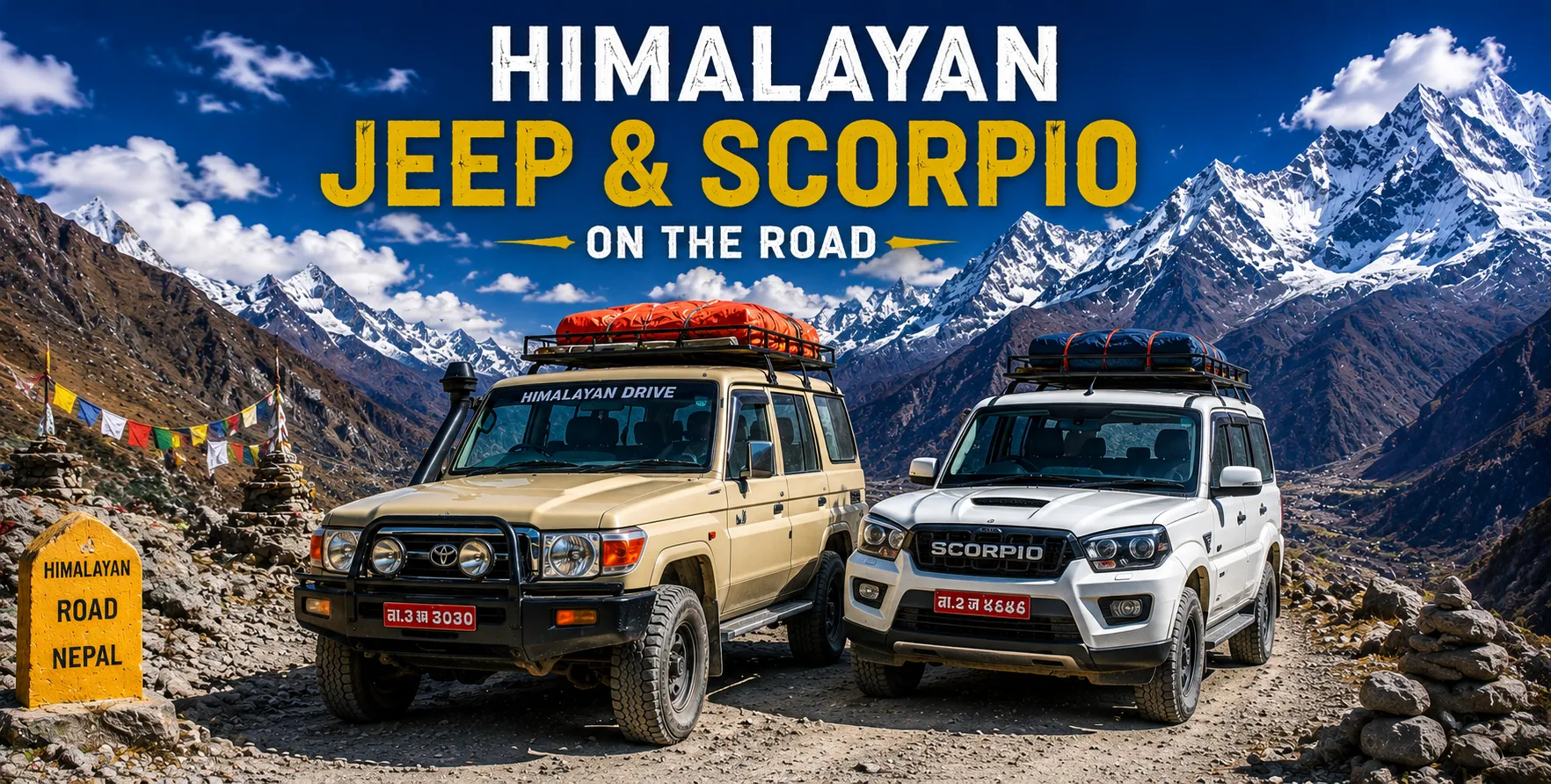
Everest Region Nepal featuring Mount Everest, Lukla Airport, Everest Base Camp Trek, and private jeep transport

Nepal Vehicle Hiring – Everest Region Transfer Services 2026

Nepal Vehicle Hiring provides the complete private vehicle transfer solution for all Everest region access routes in 2026:

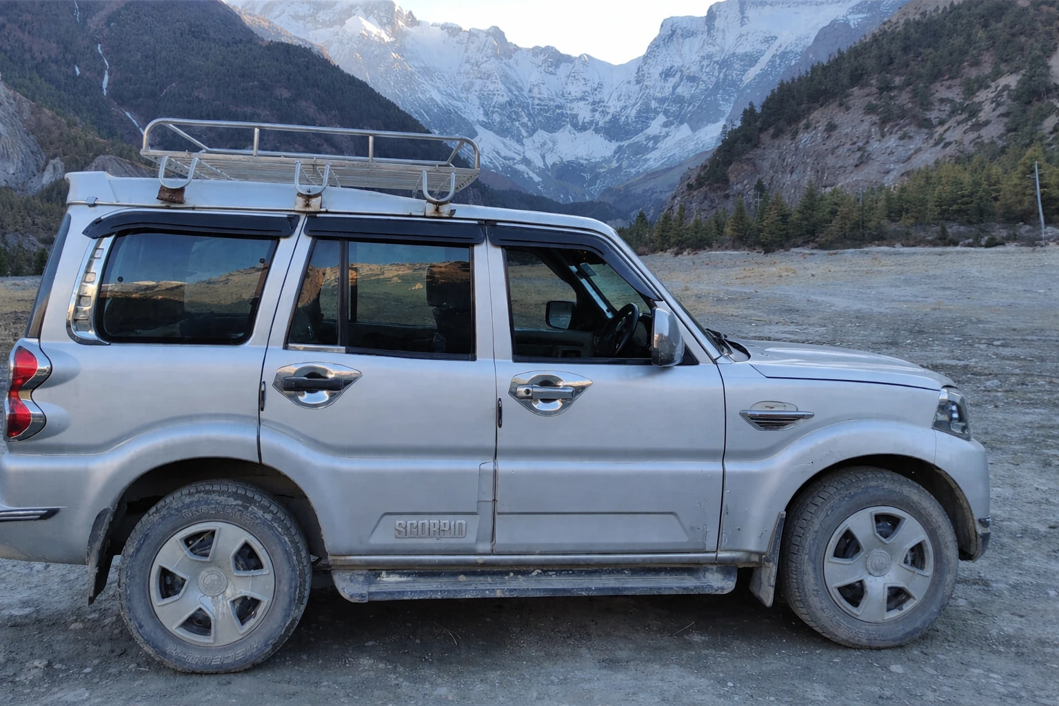
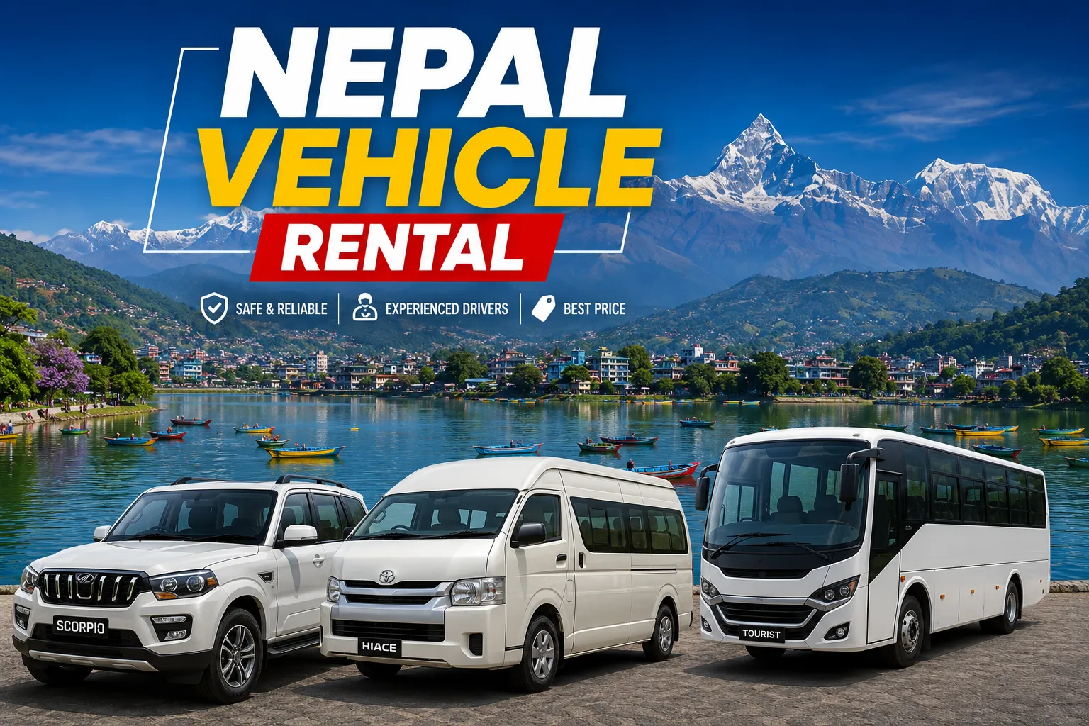
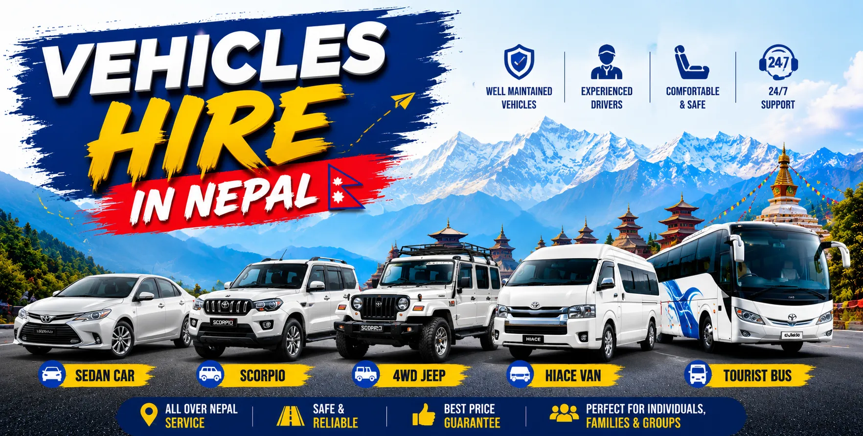
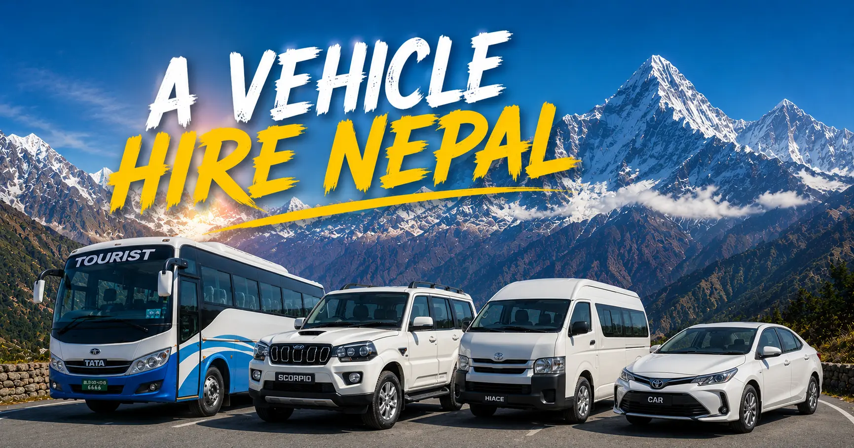
  • Kathmandu Hotel to Manthali (Ramechhap) Airport Transfer: The essential pre-dawn service. Departs 2:00–3:00 AM from any Kathmandu hotel. Private car, Scorpio, or Hiace van available. All vehicles are air-conditioned. Driver experienced with Manthali road under early-morning conditions. Journey time: 4–5 hours.
  • Manthali Airport to Kathmandu Hotel (Return Transfer): Nepal Vehicle Hiring vehicles wait at Manthali for returning trekkers’ Lukla flight arrival. Post-trek return to Kathmandu hotel. Journey time: 4–5 hours. Fully coordinated with flight timings.
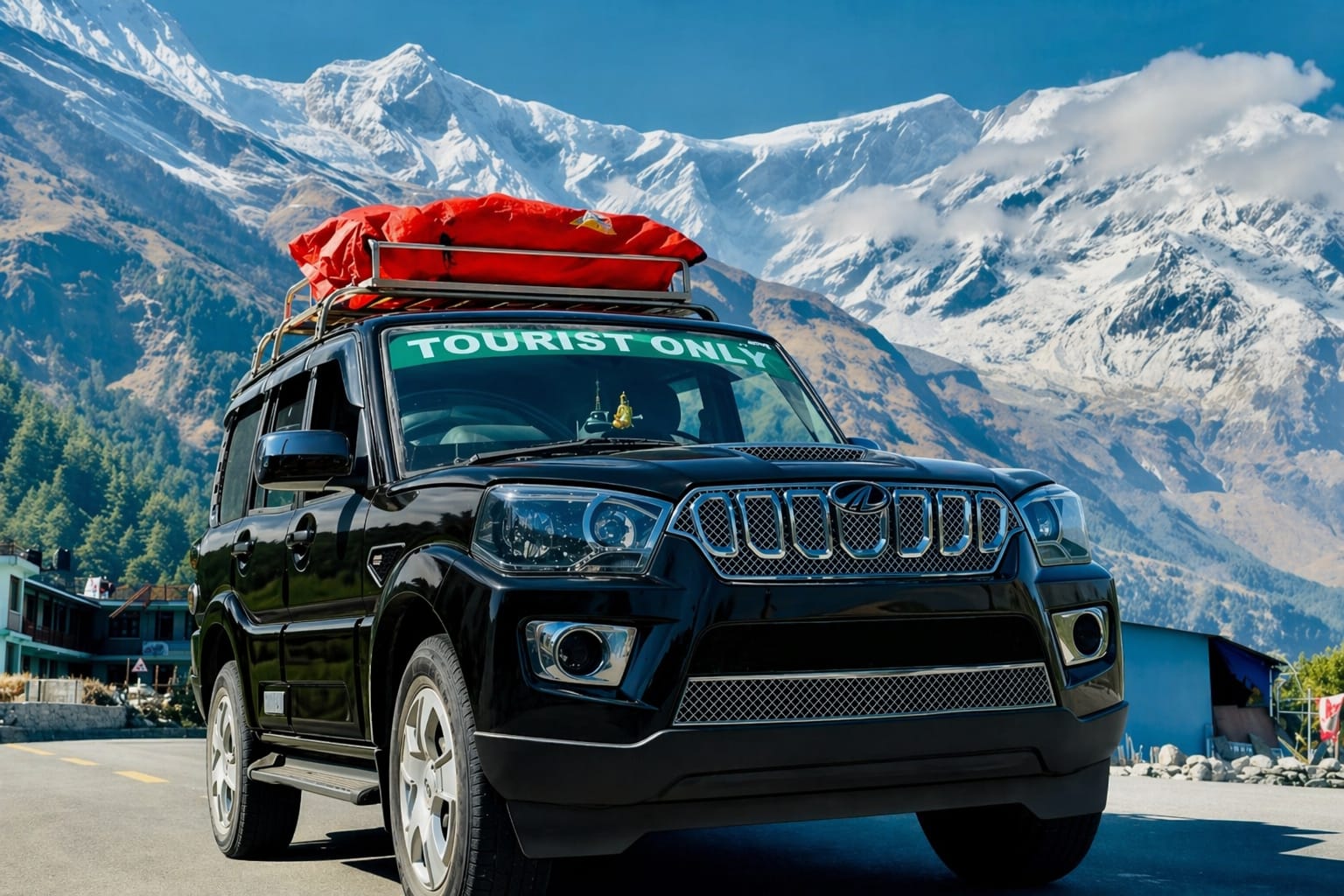
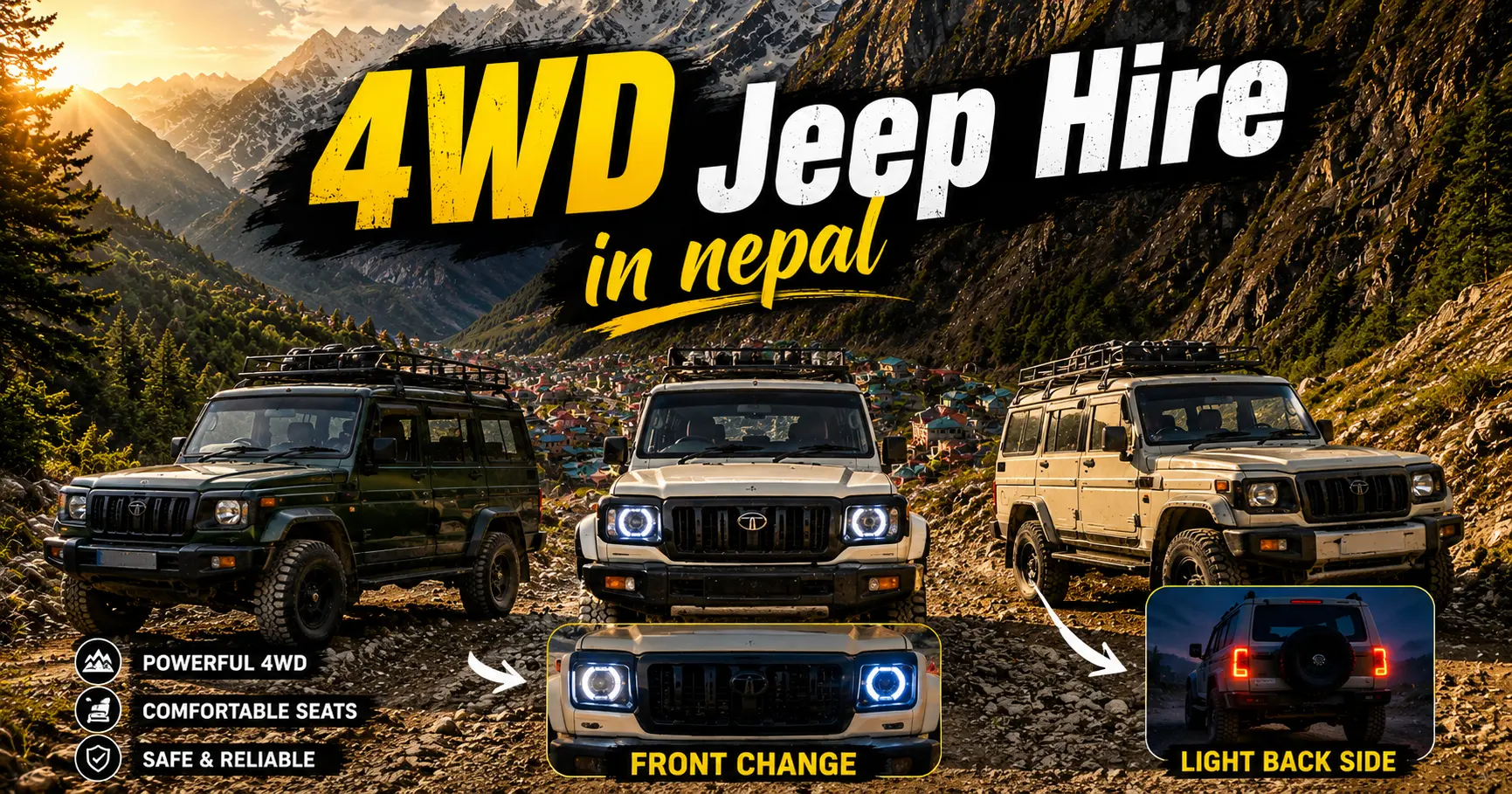
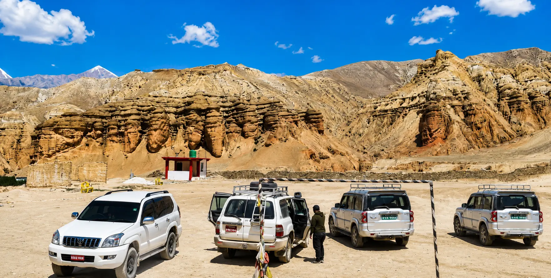
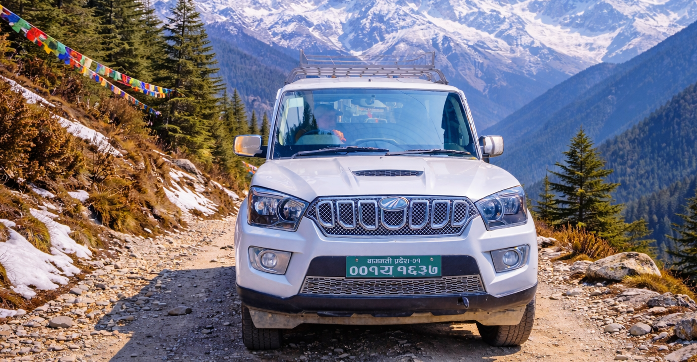
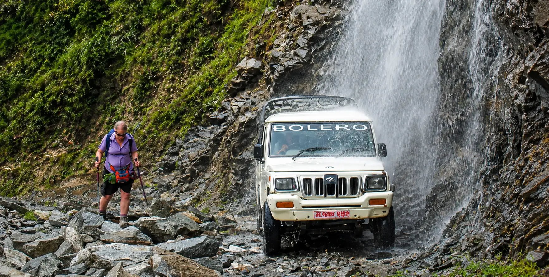
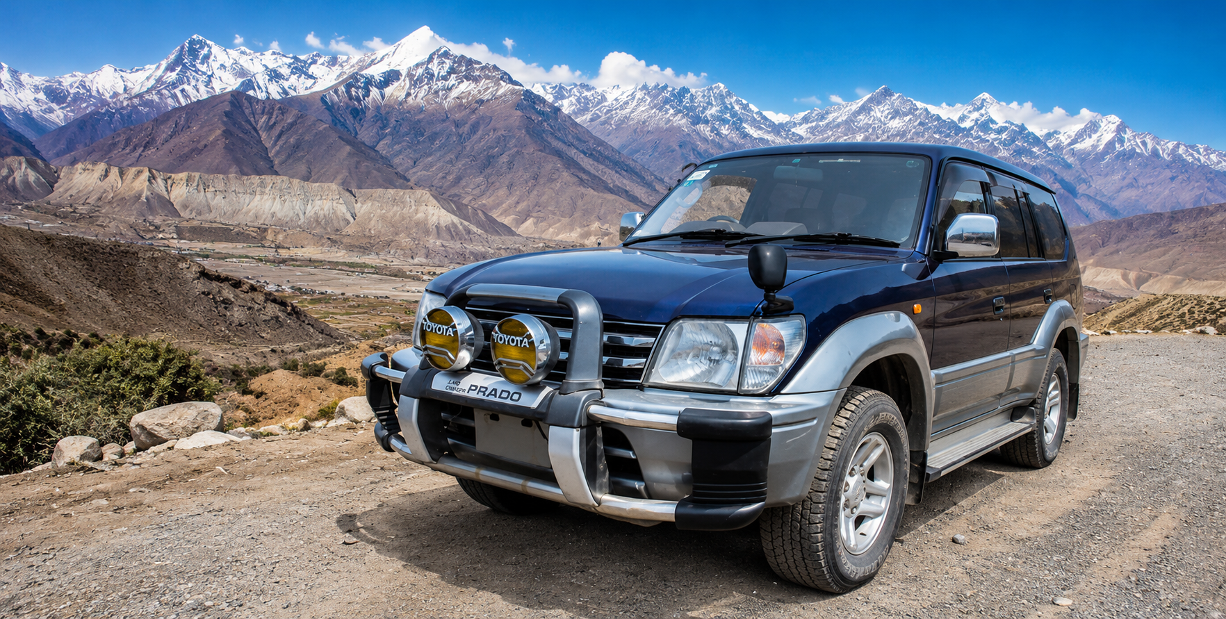
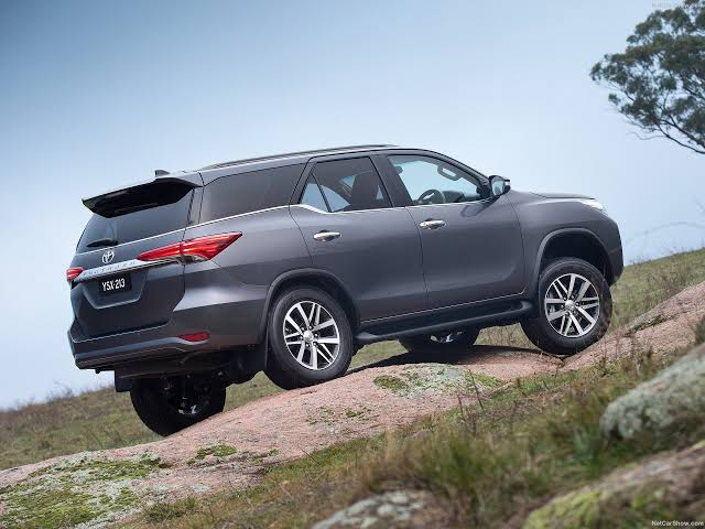
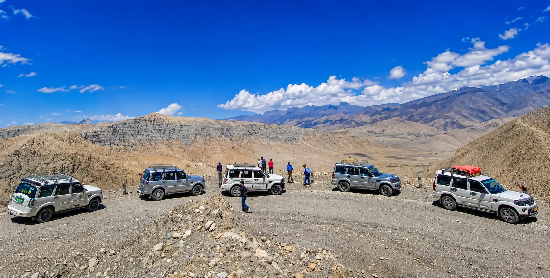
  • Kathmandu to Salleri / Phaplu (Road Alternative): 270 km, 8–10 hours via Madhya Pahadi Highway. Private Scorpio or Land Cruiser recommended. Available October–May only (not during monsoon). Nepal Vehicle Hiring’s Scorpio/Bolero 4WDs handle the entire route, including the rough sections near Salleri.
  • Kathmandu to Kharikhola / Surke (Extended Road): Extended road alternative that puts trekkers within a 23-hour walk of Lukla. Available on request with Nepal Vehicle Hiring for groups avoiding flight disruption.
  • Flight Delay / Cancellation Emergency Response: Nepal Vehicle Hiring’s 24/7 operations line (+977 9851013196) coordinates alternative transport arrangements for Manthali-based trekkers when Lukla flights are canceled — including activation of the emergency Salleri road option.


Frequently Asked Questions – Everest Region Nepal 2026

Can I still fly directly from Kathmandu to Lukla in 2026?

No — as of 2026, all Lukla flights depart from Manthali (Ramechhap) Airport, not Kathmandu’s Tribhuvan International Airport. Trekkers must complete a 4–5-hour pre-dawn drive from Kathmandu to Manthali (departing around 2:00–3:00 AM) before the 20-minute Lukla flight. Nepal Vehicle Hiring provides 24/7 Manthali transfer service for all EBC-bound trekkers.

What permits are required for the Everest Base Camp trek in 2026?

Two permits are required: (1) Sagarmatha National Park Entry Permit – NPR 3,390 (incl. VAT) — obtain at NTB Kathmandu before departure or at Monjo checkpoint; (2) Khumbu Pasang Lhamu Rural Municipality Permit – NPR 2,000–3,000 — issued only in Lukla or Monjo, in digital Trek Card with QR code format. TIMS is no longer required for the Everest region.

What is the difference between EBC and Kala Patthar – which is better?

Both are essential — but they offer different experiences. Everest Base Camp (5,364 m) is historically and emotionally significant — standing on the launchpad of every Everest expedition, with the Khumbu Icefall directly above. However, the summit of Everest is not visible from EBC (Nuptse blocks it). Kala Patthar (5,545 m) provides the closest, clearest full view of Everest’s summit available without technical climbing, plus the finest 360-degree Khumbu panorama. The standard itinerary visits both on consecutive days — always include both.

Is the road to Salleri a viable alternative to the Lukla flight?

Yes — the Kathmandu to Salleri / Phaplu road route (270 km, 8–10 hours) is a genuine and increasingly popular Lukla flight alternative, particularly for October–May travel. It provides 2–3 extra acclimatization days on the lower Solu trail, is flight-cancellation-proof, and costs less. Nepal Vehicle Hiring’s Scorpio or Land Cruiser jeep hire covers the entire Kathmandu-to-Salleri route. The road is not recommended during the monsoon (June–September).

How difficult is the Everest Base Camp trek?

The EBC trek is rated Moderate-Strenuous. It requires no technical climbing skills, no ropes or crampons (except on Three Passes variants), and is accessible to any reasonably fit adult with 6–8 weeks of cardiovascular preparation. The challenges are: duration (12–14 days of 5–7 hours daily hiking), altitude (5,545 m at Kala Patthar, where 50% of sea-level oxygen is available), and mental endurance. The acclimatization schedule is non-negotiable — rushing it causes the most premature trek endings.

What makes the Gokyo Lakes worth visiting instead of just EBC?

The Gokyo circuit visits the Ngozumpa Glacier (Nepal’s largest), five sacred turquoise glacial lakes, and Gokyo Ri (5,357 m) — the only accessible viewpoint in the Himalaya from which four 8,000 m peaks are simultaneously visible. Many experienced Himalayan trekkers rate the view from Gokyo Ri as surpassing even that of Kala Patthar in scenic impact. The Three Passes Trek combines EBC and Gokyo into a single circuit, offering the complete Everest region experience in 18–21 days.

Can Nepal Vehicle Hiring coordinate both Manthali transfers and guide arrangements?

Yes — Nepal Vehicle Hiring provides integrated Everest region transport coordination: Kathmandu hotel to Manthali (pre-dawn), Manthali to Kathmandu on return, and Salleri road transfers. We partner with registered Kathmandu trekking agencies for guide and permit arrangements and can coordinate the complete logistics chain for your Everest trek as a single booking. Contact Nepal Vehicle Hiring at +977 9851013196 or vehiclehiringnepal.com.


Begin Your Everest Region Journey with Nepal Vehicle Hiring

The Everest region is Nepal’s greatest gift to the trekking world — a landscape of overwhelming mountain scale and beauty, inhabited by one of the world’s most extraordinary cultural communities, accessible to any committed trekker willing to invest the time and preparation and to respect the journey’s demands. The walk to Everest Base Camp is not merely a physical achievement — it is a transformation: a sustained encounter with human insignificance in the face of the planet’s grandest geography and with human capability in the face of extreme altitude, leaving everyone who completes it fundamentally changed.

Nepal Vehicle Hiring Pvt Ltd’s Everest region transfer services — Manthali pre-dawn transfers, Salleri road alternatives, and return Manthali pickups — are the logistical foundation on which every Nepal Vehicle Hiring EBC trekking journey is built. Our 24/7 operations team, experienced pre-dawn drivers, 4WD jeep fleet, and emergency response coordination ensure that your Everest journey begins and ends without transport stress — leaving you free to focus entirely on one of the greatest walks of your life.

Call / WhatsApp: +977 9851013196  |  Website: vehiclehiringnepal.com  |  Book Manthali Transfer  |  Nepal Trekking Packages
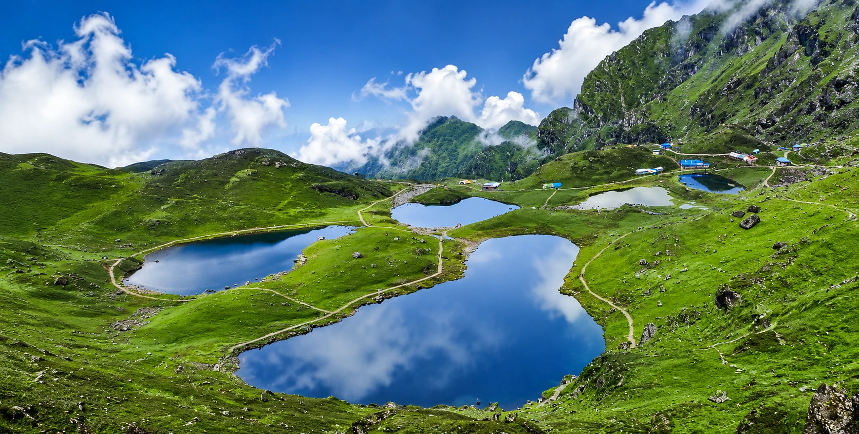
 

Panch Pokhari Pilgrimage Trek Transport & Trail Guide

Panch Pokhari Trek Transport Guide-Book reliable transport for the Panch Pokhari Trek with private 4WD jeeps, Scorpio SUVs, and experienced drivers for a safe and comfortable journey from Kathmandu to the trek starting point.Panch Pokhari Trek Transport Guide: The Complete Transport and Trail Guide
In a country already dense with sacred lakes, ancient temples, and pilgrimage trails, Panch Pokhari stands apart. Five crystalline glacial lakes, each named for and dedicated to Lord Shiva, are clustered on a high ridge at 4,100 meters in the remote Sindhupalchok district, northeast of Kathmandu, with the Jugal Himal, Langtang, Rolwaling, and Ganesh Himal ranges visible on the horizon in every direction. The name means simply Five Lakes in Nepali, but that plainness undersells the reality: each lake catches the sky differently, the surrounding alpine meadow fills with wildflowers in spring, and on the full moon of Janai Purnima in August, the hillsides and the lake shore come alive with thousands of pilgrims who have climbed here on foot specifically to bathe in these waters and change their sacred Janai thread in the presence of Shiva.

This guide is written specifically for travelers planning to visit Panch Pokhari in 2026, whether as pilgrims, trekkers, or both. It covers everything: the legend and religious significance of the five lakes, every road access option from Kathmandu, precise driving times and road conditions along the Araniko Highway and Sindhupalchok district roads, the two main trekking routes to the lakes and their day-by-day stages, permits and what checkpoints to expect, seasonal timing and how the Janai Purnima festival changes the logistics, wildlife and biodiversity within Langtang National Park, accommodation realities, packing requirements for this high-altitude but rarely commercialized trail, and how to combine the Panch Pokhari trek with a wider Kathmandu Valley itinerary using Nepal Vehicle Hiring Pvt Ltd for every transport leg.

Unlike the famous trekking circuits of Annapurna, Everest, and Langtang, Panch Pokhari is still largely outside the international trekking mainstream. The Trekking Agencies’ Association of Nepal formally explored and opened this route only in 2012, and even today, the trail infrastructure remains basic, the teahouse network thin, and the signage incomplete compared to Nepal’s more commercialized trekking corridors. That is, emphatically, a feature rather than a drawback for the right traveler, and this guide is built to give you everything you need to arrive at those five sacred lakes fully prepared and correctly transported, without any of the avoidable logistical surprises that catch under-prepared visitors on this route. The Panch Pokhari trail rewards preparation more than almost any other trek in the Kathmandu region precisely because so little of what you need can be sourced along the way; everything from your sleeping bag to your cash to your permits must be sorted before you leave Kathmandu, and a well-planned vehicle transfer to the correct trailhead is the first and most foundational step in making that preparation work.

The Legend and Sacred Significance of the Five Lakes

Panch Pokhari’s religious importance is inseparable from one of the most significant stories in Hindu mythology. During the Samudra Manthan, the churning of the cosmic ocean described in the Bhagavata Purana and the Mahabharata, a poison called Halahala emerged from the depths, threatening to destroy all creation. Lord Shiva, the destroyer and protector, swallowed the poison to save the universe. The venom burned his throat with intense heat and thirst, and where his trident struck the Earth in an act of relief, five springs of pure, cool water burst from the ground. These five sources are said to be the origin of the five lakes of Panch Pokhari.

Book reliable transport for the Panch Pokhari Trek with private 4WD jeeps, Scorpio SUVs, and experienced drivers for a safe and comfortable journey from Kathmandu to the trek starting point.Book reliable transport for the Panch Pokhari Trek with private 4WD jeeps, Scorpio SUVs, and experienced drivers for a safe and comfortable journey from Kathmandu to the trek starting point.

Each of the five lakes has a distinct name connected to Shiva’s divine nature and the Shaivite spiritual tradition, and devotees who bathe in them during auspicious periods are believed to be purified of sins accumulated across multiple lifetimes. The temple at the lake shore, dedicated to Lord Shiva, serves as the ritual center during Janai Purnima, when priests and local shamans lead ceremonies that draw participants from across Nepal and from across the border in India.

The Buddhist dimension of Panch Pokhari’s significance is also genuine and should not be treated as incidental. The lakes are considered a residence of Jambhu Lama, a local protective deity in the Tibetan Buddhist tradition, and the communities through which the trekking trail passes, including the Tamang and Yalmu people of Sindhupalchok, are predominantly Buddhist and have maintained shrines, mani walls, and small monasteries along the route for generations. In this sense, the Panch Pokhari pilgrimage trail reflects the characteristic blending of Hindu and Buddhist sacred traditions that defines religious life across much of Nepal’s hill region, where the same landscape holds meaning for both traditions simultaneously and the same traveler, whether Hindu pilgrim or Buddhist meditator, is walking a trail that has been spiritually charged for centuries.

For trekkers without a specific religious motivation, this layered sacred character adds a dimension of cultural depth that purely scenic treks lack. Arriving at Panch Pokhari during a non-festival period, a trekker will still find two pilgrim houses near the shore, the Lord Shiva temple, ritual offerings left by recent visitors, and the quieter, more personal form of devotion that characterizes the non-festival season, when individual pilgrims and small family groups make their own private pilgrimages to the lakes outside the peak August festival crowd.

Where Panch Pokhari Is and Why It Is Harder to Reach Than It Looks

Panch Pokhari sits in the northeastern corner of Sindhupalchok district, one of Nepal’s 77 districts, in the Bagmati Province. Administratively, it falls within the boundaries of Langtang National Park, which also encompasses parts of Rasuwa and Nuwakot districts, and is classified as a protected area under Nepal’s national conservation framework. The straight-line distance from Kathmandu to Panch Pokhari is not large. Still, the mountainous terrain between them makes road access circuitous, and the final trekking approach is steep enough that the total journey time is considerably longer than the map distance implies.

Sindhupalchok district is connected to Kathmandu via the Araniko Highway. The same corridor runs northeast from Kathmandu toward the Tibet border at Rasuwagadhi (now the primary Nepal-Tibet crossing, following the closure of the older Kodari crossing after the 2015 earthquake). The Araniko Highway is a paved, reasonably maintained road as far as Bahrabise and beyond toward the border, and this corridor is the primary vehicle access route for the Panch Pokhari trek. From various points along or just off the Araniko Highway, district roads branch toward the two main trekking trailheads: Chautara and Chimchi.

The 2015 Gorkha earthquake heavily affected Sindhupalchok district, as it lies close to the earthquake’s epicenter and suffered significant landslide damage and infrastructure losses. In the years since, road reconstruction and trail rebuilding have continued. Conditions have improved substantially, but travelers should understand that the Sindhupalchok road network remains subject to landslide risk during and after monsoon season more than most other districts in the Kathmandu region, and that road conditions can vary significantly depending on whether post-monsoon repairs have been completed before a visit.

Book reliable transport for the Panch Pokhari Trek with private 4WD jeeps, Scorpio SUVs, and experienced drivers for a safe and comfortable journey from Kathmandu to the trek starting point.

Kathmandu to Panch Pokhari: All Vehicle Access Options

Route One: Kathmandu to Chautara, the Southern Trailhead

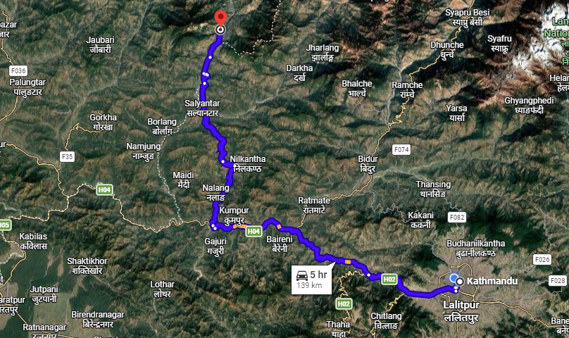
The most common starting point for the Panch Pokhari trek is Chautara, the administrative headquarters of Sindhupalchok district, reached via the Araniko Highway northeast of Kathmandu. The driving distance from Kathmandu to Chautara is approximately 77 kilometers by road, and the journey typically takes between five and seven hours in a private jeep, reflecting the winding, hilly character of the final stretch from the Araniko Highway toward Chautara town. A public bus on this route exists but takes considerably longer, involves a transfer, and is not a reliable option for trekkers carrying significant gear. For a private jeep transfer, our Kathmandu-to-Sindhupalchok Jeep service covers this corridor and can drop trekkers directly at the trailhead rather than at the town center.

From Chautara, the trekking trail toward Panch Pokhari begins by climbing north through Sano Okhreni and a series of terraced villages, then ascends through dense rhododendron and oak forests as it gains altitude. This southern approach is the longer of the two main routes to the lakes and typically takes five to six days of walking to reach Panch Pokhari from Chautara, passing through communities of Tamang, Sherpa, Brahmin, and Chhetri households across the Sindhupalchok hill belt before breaking through the tree line into alpine meadow terrain in the final two days of approach.

Route Two: Kathmandu to Chimchi (Chhimti), the Shorter Northern Approach

A shorter alternative begins from Chimchi village, also spelled Chhimti, reached via a branch road off the Araniko Highway at Melamchi. The Melamchi junction is well known as the site of the Melamchi Water Supply Project, a major infrastructure project connecting the Melamchi River in Sindhupalchok to the Kathmandu Valley’s water supply system. From the Melamchi junction, a district road climbs northeast toward Chimchi, which sits at roughly 1,350 meters and serves as the starting point for a faster, more direct approach to Panch Pokhari that can reach the lakes in as few as four to five days of trekking compared to the six days typically required from Chautara. Our Kathmandu Jeep service can drop trekkers at the Chimchi trailhead on request, with the Melamchi corridor being a regular operating route for our drivers.

From Chimchi, the trail climbs through Tuppi Danda and Nashympati before making the final approach to the lakes. This shorter itinerary is particularly suited to trekkers operating on a tighter schedule or those focused specifically on the pilgrimage destination rather than on a long, gradual approach through multiple communities. The trade-off is that the ascent from Chimchi to Panch Pokhari is steeper and more compressed, which is important to factor into planning for trekkers who may not be fully acclimatized before beginning the trek.

Alternative Starting Points Along the Araniko Highway Corridor

Some longer itineraries, particularly those designed by trekking agencies seeking to include more village cultural exposure, begin in Simpal, a small roadside settlement on the Araniko Highway, or in Bahrabise, farther northeast, adding trekking days in exchange for a more gradual, village-rich approach from a lower altitude. For trekkers arriving from Kathmandu specifically, these longer approaches are less commonly booked by independent travelers but suit organized group trips that want a more immersive, multi-community experience before reaching the high-altitude lakes. Our Kathmandu to Langtang region jeep network already operates this general Araniko Highway corridor for Langtang and Kerung border transfers, making the Sindhupalchok approach road a natural extension of routes our drivers already run regularly.


Road Conditions and What to Expect on the Drive

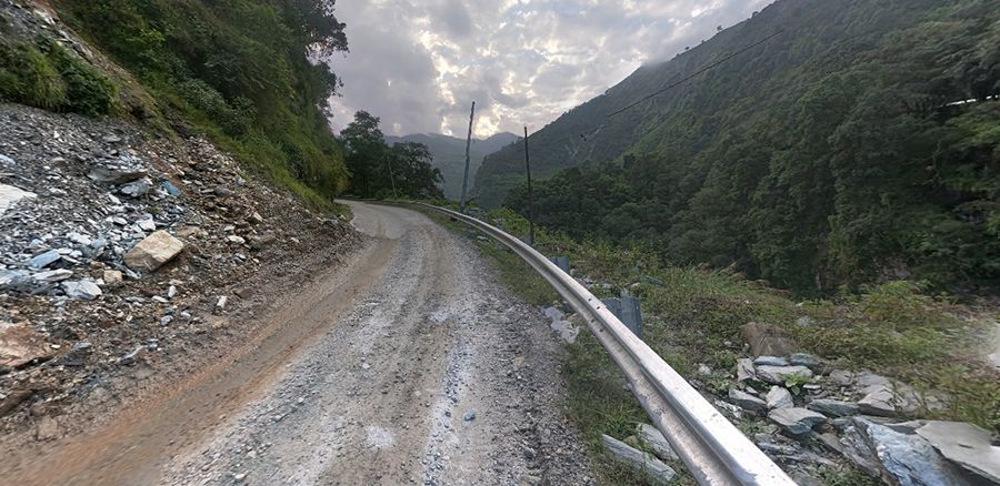
The Araniko Highway out of Kathmandu is a paved, well-maintained road corridor for most of its length through the Sindhupalchok district. However, it climbs steadily through the Bhote Koshi gorge. It passes several sections that have historically been vulnerable to landslides during the monsoon and to flash flooding on the lower riverside stretches. After the 2015 earthquake, several sections of the Araniko Highway required significant repair and reconstruction. While the main highway is now generally motorable year-round, the district branch roads that peel off toward Chautara, Chimchi, and the lesser-used trailhead villages remain more variable in quality, with unpaved sections, seasonal washouts, and narrow single-lane stretches that require careful driving.

Private 4WD jeep and Scorpio transporting trekkers to the Panch Pokhari Trek through the scenic mountain roads of Sindhupalchok

A 4WD jeep is the correct vehicle for any transfer beyond the main Araniko Highway onto the district roads serving the Panch Pokhari trailheads. Sedans and standard cars lack the ground clearance and drivetrain confidence for the steeper, rougher sections of the Chautara approach road and the Chimchi branch road, particularly during or after rain. Our reasoning on this is explained in more detail in our dedicated piece on why a 4WD jeep is the right choice for Nepal’s mountain roads, and the Sindhupalchok district road network is a textbook example of the road conditions to which that reasoning applies.

Travelers planning their Panch Pokhari trip during or immediately after the monsoon season (June through September) should factor in the possibility of road closures due to landslides on the final stretch toward Chautara and on the Chimchi access road. Our drivers monitor these conditions as part of standard pre-trip planning. For any Sindhupalchok trip booked through Nepal Vehicle Hiring, we will flag any known road disruptions before departure and advise on the best available trailhead access point given current conditions. During peak pilgrimage season around Janai Purnima in August, road traffic on the Araniko Highway and the Chautara approach increases dramatically, and an early-morning departure from Kathmandu is strongly advisable to clear the valley and the lower highway before traffic builds.

The Trail: Stage-by-Stage from Trailhead to Sacred Lakes

Chautara to Tuppi Danda

The opening stage from Chautara climbs immediately into the Sindhupalchok hill terrain through a landscape of terraced farms, small Tamang villages, and gradually thickening forest as the trail gains elevation. This lower section of the trail is the most populated, with households of Brahmin, Chhetri, and Tamang communities along the trail where basic food and water are available. Trail conditions here are typical of Nepal’s middle-hill terrain: a mix of stone stairways, earthen paths, and occasional dirt tracks between the villages.

Tuppi Danda to Nashympati and Pauwa Bas

As the trail climbs beyond the lower settlement zone, it enters denser rhododendron and oak forest, with views of the Jugal Himal appearing on the northern horizon when the canopy opens at ridge crossings. This section passes through Nashympati, a small forest-edge settlement used as an overnight stop, and the trail begins to feel more remote, with fewer households and longer gaps between water sources. Pauwa Bas roughly marks the transition from mid-hill to high-altitude terrain, and nights here can be noticeably colder than in the lower trailhead villages.

Pauwa Bas to Hile Bhanjyang

The stage to Hile Bhanjyang involves a significant climb followed by a steep descent, passing through an area of largely uninhabited forest, with the trail narrowing and receiving far less maintenance than the lower sections. Mountain views from the ridgeline crossings on this stage extend to the Langtang, Jugal, Rolwaling, and Ganesh Himal ranges, and on clear days the summits of Dorje Lakpa (6,966 m), Madiya (6,257 m), Phurbi Chhyachu (6,637 m), and Gaurishankar (7,134 m) are visible. This stretch is where the remoteness of the Panch Pokhari trail becomes most tangible for trekkers accustomed to the well-supplied, well-trafficked trails of the Annapurna or Everest regions.

Private 4WD jeep and Scorpio transporting trekkers to the Panch Pokhari Trek through the scenic mountain roads of Sindhupalchok

Hile Bhanjyang to Panch Pokhari (4,100 m)

The final approach to the lakes climbs through increasingly rocky, open terrain above the tree line, with the trail crossing alpine meadows and boulder fields before the five lakes come into view. The approach follows a steady ascent through Nashympati to the lake basin, and the first sight of the five glacial lakes against the backdrop of the Jugal Himal is consistently described by trekkers as the most striking visual moment of the entire route. The Lord Shiva temple and two pilgrim houses sit on the lake shore, where trekkers and pilgrims alike make camp or settle into basic overnight accommodations.

The Viewpoint Above the Lakes

From the lake basin, a short one-hour hike to the viewpoint ridge above Panch Pokhari opens a full-circle panorama that encompasses the Dorje Lakpa massif, Gaurishankar, the full Jugal Himal chain, the distant Rolwaling range, the Ganesh Himal group to the west, and the Langtang range to the northwest. Several itineraries build in an extra day at the lakes specifically to make this sunrise viewpoint hike in stable early-morning light, when visibility is typically at its clearest, and the 8,000-meter peaks on the horizon catch the dawn before the valleys below them do.

Janai Purnima: The Festival That Transforms the Trail

The single event that most dramatically changes the character of a Panch Pokhari trip is Janai Purnima, the full-moon festival of Shrawan, which falls in late July or August, depending on the lunar calendar. During this festival, the normally quiet trail to Panch Pokhari becomes a genuine mass pilgrimage, with thousands of Hindu devotees climbing from surrounding villages and towns to the lakes specifically to perform the ritual bathing and the renewal of the Janai, the sacred thread worn by twice-born Hindu men, in the presence of the five sacred waters.

Shamans, known as dhami-jhankri in Nepali, are particularly numerous at Panch Pokhari during Janai Purnima, arriving with their ritual drums, chanting, and trance-state ceremonies that represent a much older layer of spiritual practice than either mainstream Hinduism or Tibetan Buddhism, and which draw significant attention from travelers with an interest in indigenous religious traditions. The sight of hundreds of shamans drumming and dancing simultaneously at a high-altitude sacred lake while thousands of pilgrims bathe and pray is not something easily replicated anywhere else in Nepal, and travelers specifically interested in this experience should plan their trip to coincide with the Janai Purnima window rather than treating it as a complication to be avoided.

That said, the festival period does create significant practical complications for vehicle transport and accommodation. The Chautara approach road becomes extremely busy with pilgrim traffic in the days before and after the festival, and both trailheads see far more simultaneous footfall than at any other time of year. Accommodation at the lake shore fills up quickly; camping may be necessary even for trekkers who expected teahouse accommodation, and the jeep transfer from Kathmandu should be booked well in advance rather than arranged on short notice. Returning to Kathmandu immediately after the festival also requires careful planning, since the return traffic surge on the Araniko Highway and the district roads can produce significant delays.

For travelers not specifically motivated by the Janai Purnima pilgrimage, the spring window of March to May and the autumn window of September to November offer the clearest mountain views, the most stable road and trail conditions, and a significantly quieter experience at the lakes themselves. These are the same seasons that serve the broader Langtang and Annapurna trekking regions covered in our unlimited tour and trek vehicle hire guide, and the same seasonal logic applies here.

Permits Required for the Panch Pokhari Trek

Because Panch Pokhari lies within Langtang National Park, trekkers require a Langtang National Park Entry Permit, which is distinct from the ACAP permit required for the Annapurna region. This permit is obtainable at the Nepal Tourism Board offices in Kathmandu or at park checkpoints along the approach trail, and the fee structure follows the standard national park entry framework: higher for non-SAARC foreign nationals, lower for SAARC nationals, and a specific rate for Nepali citizens.

In addition to the national park permit, a TIMS card (Trekkers’ Information Management System) is currently required for the Panch Pokhari trail. Unlike the Everest region, where a local municipality fee has effectively replaced the TIMS, and unlike the Annapurna region, where enforcement has become inconsistent, the TIMS card remains a standard requirement for the routes in Sindhupalchok and Langtang National Park. It should be arranged before departure in Kathmandu. Both the park permit and the TIMS card can typically be obtained on the same day at the Nepal Tourism Board’s Pradarshani Marg office in Kathmandu.

Panch Pokhari does not fall under Nepal’s restricted area regulations, which means it requires no special restricted area permit, no minimum group size, and no compulsory government-licensed guide for the trek itself, though carrying a local guide is strongly advisable given the trail’s remoteness, limited signage, and basic infrastructure compared to Nepal’s more developed trekking corridors. A guide familiar with the Sindhupalchok hill trails makes a meaningful difference in both navigation and understanding of the cultural and religious sites encountered along the way.

Wildlife, Flora, and the Ecological Significance of the Lakes

Panch Pokhari holds a unique designation in the world of wetland ecology: it is classified as the ninth-highest-altitude wetland, reflecting both the extreme elevation of the five lakes and the ecological rarity of functioning glacial lake ecosystems at this altitude. The lake basin and surrounding alpine meadow support a range of high-altitude flora that changes visibly with the season, from wildflower-carpeted meadows in spring and early summer to frost-rimmed grass and bare rock in winter.

The forested slopes of the approach trail, from roughly 1,500 to 3,500 meters, pass through the transition zones between subtropical broadleaf forest at the lower elevations, mixed temperate forest including rhododendron, oak, and alder, and subalpine rhododendron and juniper scrub that characterizes the forest immediately below the tree line. This transition is one of the most varied altitudinal vegetation gradients on any single trekking route in Nepal’s Bagmati Province, and spring trekkers in particular encounter the rhododendron bloom, which transforms large sections of the trail into shades of crimson, pink, and white in March and April.

Wildlife along the trail includes species typical of Langtang National Park’s protected forest: the endangered red panda has been recorded in the park’s forest zones including the Sindhupalchok sections, alongside Himalayan tahr, musk deer, leopard, Himalayan black bear, and a wide range of high-altitude bird species including the Himalayan monal pheasant, Nepal’s national bird, which frequents alpine meadow edges at elevations approaching and exceeding the lake basin itself. The lakes serve as a watershed for the Indravati River system, contributing to regional water supply in a way that gives the ecological protection of the lake basin significance beyond the immediate trekking and pilgrimage context. The ninth-highest altitude wetland designation, which the Panch Pokhari lake system carries, also reflects a broader reality: high-altitude wetlands are among the most ecologically fragile and least understood ecosystems on Earth, and the relative remoteness of Panch Pokhari compared to more heavily visited sacred lake sites has so far helped preserve the ecological integrity of the lake basin in a way that more popular destinations have sometimes struggled to maintain as visitor numbers have grown. This ecological value is an argument, alongside the cultural and religious ones, for thoughtful, well-prepared trekking rather than poorly organized mass access to the site.

Accommodation and Food Along the Panch Pokhari Trail

The Panch Pokhari trail is honest about its infrastructure limitations, and trekkers expecting the well-supplied teahouse network of the Everest Base Camp or Annapurna Base Camp routes will find the reality here considerably more basic. The lower sections of the trail, through the Sindhupalchok hill villages between the trailhead and roughly 2,500 meters, have small local tea shops and very basic guesthouses or homestays that provide simple meals and a bed in a private household rather than a purpose-built trekking lodge. Dal bhat, eggs, potatoes, and seasonal vegetables are the standard menu throughout; specialty trekking dishes common on the more commercial routes are largely unavailable.

Above roughly 2,500 meters, accommodation becomes even more limited, with some stages of the trail requiring either a tented camp or a stay in a basic pilgrim shelter rather than any form of commercial teahouse. The two pilgrim houses at the lake shore itself are available for overnight stays during and around the Janai Purnima festival period. Still, they may not be reliably staffed outside festival season, which is a key reason organized group trekking on the Panch Pokhari trail typically involves carrying camping equipment by porters rather than relying on finding open teahouse accommodation at every stage.

This accommodation reality is not a criticism of the trail; it is simply a reflection of how new and how non-commercial the Panch Pokhari route remains compared to Nepal’s established trekking circuits. It means that trekkers planning an independent trip without an organized agency need to be genuinely self-sufficient from the upper trail stages onward, carrying a good sleeping bag, some emergency rations, and water purification capability, and ideally coordinating with a local guide who knows which community homestays are currently operating at each stage.


A Complete Sample Itinerary: Kathmandu to Panch Pokhari and Back

The following itinerary uses the Chimchi approach for efficiency. It is structured around a private jeep transfer from Kathmandu for the road legs, with porter and guide support for the trekking sections. All vehicle transfers are bookable through our Plan a Trip page.

  • Day 1 — Arrive in Kathmandu. Collect the Langtang National Park permit and TIMS card from the Nepal Tourism Board. Check gear and obtain any remaining cash; ATMs are unavailable on the trail.
  • Day 2 — Early morning private jeep transfer from Kathmandu along the Araniko Highway to the Chimchi/Chhimti trailhead, approximately five to six hours. Overnight at a basic teahouse or homestay in Chimchi.
  • Day 3 — Trek from Chimchi to Tuppi Danda (2,320 m), roughly seven hours through terraced farmland and lower forest. Overnight in a basic teahouse.
  • Day 4 — Trek from Tuppi Danda to Nashympati or Hile Bhanjyang (3,400 m), around five to six hours through dense rhododendron forest. Mountain views begin opening at ridgeline crossings. Overnight in a tent camp or basic shelter.
  • Day 5 — Trek from Hile Bhanjyang to Panch Pokhari (4,100 m), around four to six hours. Ascending through rocky alpine terrain, arriving at the five sacred lakes. Visit the Lord Shiva temple and the lake shore. Overnight in the pilgrim house or tent at the lake.
  • Day 6 — Optional early sunrise hike to the viewpoint above the lakes for panoramic views of Dorje Lakpa, Gaurishankar, the Jugal Himal, Rolwaling, and Langtang ranges. Return to the lakes for rest. Overnight at Panch Pokhari for a second night, or begin descent.
  • Day 7 — Descend via Nashympati and Tuppi Danda back toward the Chimchi trailhead. Descent is faster but still a full day’s walking on steep, uneven terrain.
  • Day 8 — Complete descent to Chimchi. Private jeep pickup and return transfer to Kathmandu along the Araniko Highway. Overnight in Kathmandu.

This eight-day round trip can be extended by taking the Chautara southern approach for a richer village experience, or shortened by one day if trekkers opt not to spend two nights at the lakes. On return to Kathmandu, the same vehicle and driver can continue with any subsequent legs of a wider Nepal itinerary — valley sightseeing via our Kathmandu Sightseeing Tour or an onward transfer to Pokhara via the Kathmandu to Pokhara Bus for trekkers extending their Nepal trip into the Annapurna region.

Combining Panch Pokhari With a Wider Nepal Itinerary

Because Panch Pokhari is located northeast of Kathmandu rather than north or west, it fits naturally at the beginning or end of a broader Nepal itinerary rather than as a mid-trip leg. Travelers arriving in Kathmandu and wanting to begin with a spiritually significant, off-the-beaten-path experience before the better-known circuits often place Panch Pokhari first, returning to Kathmandu before continuing to Pokhara for the Annapurna region or flying to Lukla for the Everest trek. Our Kathmandu to Syabrubesi Jeep Transfer and Kathmandu to Dhunche Jeep serve a similar northeast Kathmandu corridor and can be usefully combined with a Panch Pokhari trip for travelers wanting to explore more of the Sindhupalchok and Rasuwa districts in a single extended Kathmandu-based trip.

For travelers interested in the Helambu trekking area, which lies in the same general northeast quadrant of Kathmandu as Panch Pokhari, the two destinations can be combined into a longer loop itinerary that returns to Kathmandu via a different route from the one used on the approach, providing more variety within a single continuous trip. For visitors interested in rafting on the Bhote Koshi River, one of Nepal’s most renowned whitewater stretches, the Araniko Highway corridor that serves as the jeep access route for Panch Pokhari also passes directly alongside this famous rafting destination, making a Bhote Koshi rafting day a natural add-on to the vehicle hire for any Panch Pokhari transfer.


What to Pack and How to Prepare for Panch Pokhari

Panch Pokhari requires more careful packing than many of Nepal’s more commercial trekking routes, because the limited infrastructure along the trail means you cannot count on resupplying food or equipment beyond the lower trailhead villages, and because the 4,100-meter altitude of the destination makes cold-weather preparation non-negotiable even in the nominally milder spring and autumn seasons.

  • Sleeping bag rated to -15°C or lower — nights at the lake basin can be genuinely cold at any time of year, and the pilgrim house accommodation does not provide bedding.
  • Full waterproof layering system — base layer, fleece or down mid-layer, and windproof and waterproof outer shell. Afternoon weather at altitude can change rapidly.
  • Sturdy, broken-in trekking boots — the trail includes rocky, steep sections that are hard on ankle stability and harder still on new footwear.
  • Water purification — UV purifier or iodine tablets, as stream water along the upper trail should not be drunk untreated and bottled water is unavailable beyond the lower villages.
  • Emergency food supplies — energy bars, nuts, or other calorie-dense portable food for the upper trail stages where teahouse menu options are severely limited.
  • Headlamp and spare batteries — essential for sunrise viewpoint hikes, early morning departures, and basic teahouse or tent camp evening use.
  • Trekking poles — the steep descents from Hile Bhanjyang and from the lakes themselves are considerably easier on the knees with pole support.
  • Cash in sufficient quantity — no ATMs exist beyond the Araniko Highway and Chautara town; carry enough for the entire trekking portion of the trip.
  • Travel insurance confirming helicopter evacuation coverage — the Panch Pokhari trail is remote enough that an injury or severe altitude-related illness requiring evacuation would involve a helicopter, which is not covered by standard travel insurance.

The Communities Along the Trail: Tamang, Sherpa, and the Sindhupalchok Hill People

One of the most distinctive and underappreciated aspects of the Panch Pokhari trail is the cultural and ethnic diversity of the communities it passes through. Sindhupalchok district is one of Nepal’s most ethnically heterogeneous districts. The northern hill section of the trekking trail, between the lower trailhead villages and the high-altitude lake basin, passes through settlements where Tamang, Sherpa, Yalmu, Brahmin, and Chhetri households often sit within a few minutes’ walk of one another, each maintaining distinct but overlapping cultural and religious traditions.

The Tamang people, the most numerous community along most of the trail’s mid-altitude section, are one of Nepal’s largest ethnic groups and are predominantly Buddhist, with a culture deeply influenced by Tibetan traditions, including their language, which belongs to the Tibeto-Burman family and is closely related to Tibetan, their monastic architecture, and their festival calendar. Tamang villages along the Panch Pokhari trail often feature mani walls, carved stone tablets bearing the Om Mani Padme Hum mantra, small gompa shrines, and prayer flag lines strung between houses and ridge crossings, all of which add a tangible visual and spiritual texture to the walking day that is absent from the purely teahouse-focused trekking infrastructure of more commercial routes.

The Yalmu people, a smaller community also present in this part of Sindhupalchok, maintain a particularly close traditional relationship with the Panch Pokhari lake site itself, and their community has historically played a custodial role in the lake’s religious observances alongside the Brahmin priests who lead the formal Hindu rituals during Janai Purnima. Encountering this layered community relationship, where a Buddhist Tamang village, a Hindu Brahmin priesthood, and a Yalmu custodial tradition all converge around the same set of five sacred lakes, is one of the most intellectually interesting aspects of the Panch Pokhari experience for travelers interested in Nepal’s complex religious and ethnic landscape.

Interactions with households along the lower trail offer a level of genuine, unscripted cultural contact that is harder to achieve on Nepal’s more commercially developed trekking corridors, where the teahouse economy has, over decades, created a mediated, hospitality-business relationship between trekker and host rather than a genuine household encounter. On the Panch Pokhari trail, where the homestay and small community tea shop model still dominates over the purpose-built trekking lodge, the hospitality tends to be more direct, more personal, and more reflective of daily life in Sindhupalchok’s hills than a visitor would encounter in a Namche Bazaar or Ghorepani teahouse.

Book reliable transport for the Panch Pokhari Trek with private 4WD jeeps, Scorpio SUVs, and experienced drivers for a safe and comfortable journey from Kathmandu to the trek starting point.

Panch Pokhari Versus Gosaikunda: Choosing Between Nepal’s Two Great Sacred Lake Treks

Travelers researching sacred lake pilgrimage destinations in Nepal will quickly encounter Gosaikunda and Panch Pokhari, and the two sites invite a direct comparison that is worth addressing clearly. Gosaikunda, at 4,380 meters in the Rasuwa district north of Kathmandu, is the older and more internationally famous of the two sacred lake destinations, served by a well-developed trail network that connects it to both the Langtang Valley and the Helambu circuit. Our Kathmandu to Dhunche Jeep and Kathmandu to Syabrubesi Jeep Transfer services both approach from the Rasuwa side, covering the general Gosaikunda access corridor.

The key differences between the two destinations are trail development, crowd levels, cultural context, and approach flexibility. Gosaikunda is served by a well-marked, teahouse-equipped trail from Dhunche or Syabrubesi that has been in use by international trekkers for decades, meaning reliable accommodation at most stages and a level of trail infrastructure that makes independent trekking straightforwardly feasible. Panch Pokhari, by contrast, has only been formally opened as a trekking destination since 2012, has a significantly thinner teahouse network, requires more self-sufficiency on the upper trail, and is consequently quieter, less tramped, and more genuinely off the beaten path in character.

Gosaikunda is also associated with Janai Purnima, drawing its own large pilgrimage during the same August festival window, so both sites see their peak pilgrimage crowds simultaneously. Travelers specifically seeking to avoid festival-period crowds at a sacred lake destination will find neither site entirely quiet during Janai Purnima. Still, Panchh Pokhari remains meaningfully less crowded than Gosaikunda in absolute numbers even during the peak pilgrimage period. For the non-festival trekking season, Panch Pokhari offers greater solitude throughout.

In summary: trekkers and pilgrims wanting a well-established, teahouse-supported trail with flexible length options and the option to combine with the Langtang Valley circuit should choose Gosaikunda. Those specifically seeking a more remote, community-based, and less commercially developed sacred lake experience with fewer other trekkers on the trail should choose Panch Pokhari. Both are exceptional destinations for their respective purposes, and travelers with enough time in Nepal can realistically fit both into a longer itinerary centered on the northeast Kathmandu district cluster, using the same general jeep corridor out of Kathmandu for both legs and only diverging at the specific junction toward Rasuwa for Gosaikunda or Sindhupalchok for Panch Pokhari. The fact that the two destinations share a broadly similar vehicle access corridor means a combined itinerary can be handled by a single vehicle hire booking rather than two separate arrangements, which keeps logistics simple and costs proportionally lower than booking each leg independently.

Frequently Asked Questions About the Panch Pokhari Trek

Is the Panch Pokhari trek suitable for beginners?

It is classified as moderate to challenging rather than beginner-friendly. Thedestination’s altitude of 4,100 meters, combined with the steep approach, basic accommodation, and remoteness of the upper trail, makes it more demanding than Nepal’s most accessible short treks, such as Poon Hill. Trekkers with reasonable fitness, prior hiking experience, and careful preparation can complete it successfully. Still, first-time high-altitude trekkers without prior experience above 3,000 meters should consider acclimatizing in Kathmandu for at least one to two days before beginning and taking the slower Chautara approach rather than the shorter but steeper Chimchi route.

Do I need a guide for this trek?

While Panch Pokhari does not legally require a government-licensed guide under Nepal’s current trekking regulations for this specific route, the trail’s limited signage, basic infrastructure, and genuine remoteness make a local guide strongly advisable in practice. Navigation errors on the upper trail could lead to a significant safety situation, given the distances between settlements and the lack of mobile signal on most of the upper route.

When is the absolute best time to visit Panch Pokhari?

For mountain views and trail conditions, October and November are generally considered the best months, offering post-monsoon clarity and stable weather. For the Janai Purnima pilgrimage experience, August is the time to go, accepting the trade-off of busier trails, more variable weather, and the possibility of monsoon-related road disruption on the approach. Spring from March to May is the best time for rhododendron blooms and a strong second choice for mountain views.

Can I drive all the way to Panch Pokhari, or is trekking mandatory?

No road reaches Panch Pokhari itself. The vehicle access ends at the trailheads of Chautara or Chimchi, and the approach from either point requires several days of foot travel. There is no shortcut, cable car, or partial road access beyond these trailheads.

Book reliable transport for the Panch Pokhari Trek with private 4WD jeeps, Scorpio SUVs, and experienced drivers for a safe and comfortable journey from Kathmandu to the trek starting point.

Why Choose Nepal Vehicle Hiring for Your Panch Pokhari Transport

The Araniko Highway corridor northeast of Kathmandu is a route our driver regularly runs for Langtang National Park transfers, Kerung border crossings, and access to the broader Sindhupalchok district, meaning we bring genuine route familiarity rather than a generic hill-road experience to the Panch Pokhari transfer. We know the road conditions on the branch road to Chautara, the Melamchi junction turn for the Chimchi approach, and the seasonal landslide-risk sections that require either an early-morning start or a contingency trailhead plan during monsoon season. We also understand the specific logistical demands of the Janai Purnima pilgrimage window, including the dramatically increased road traffic on the approach corridor during that period and the importance of an early-morning departure from Kathmandu to clear the valley before the pilgrim convoys build up on the highway. Our full Jeep fleet covers every 4WD route in this corridor, and our Plan a Trip service can coordinate the Panch Pokhari jeep transfer with any wider Nepal itinerary that comes before or after.

For trekkers combining Panch Pokhari with a Langtang Valley trip, our Kathmandu to Syabrubesi Jeep Transfer and Kathmandu to Dhunche Jeep share the same general northeast approach via the Kathmandu highway and can be booked consecutively with a single operator. For a broader picture of how our vehicle network covers every trekking region in Nepal, our complete guide to unlimited tour and trek vehicle hire and our Complete Nepal Tourism Guide provide the full context.

Book Your Kathmandu to Panch Pokhari Jeep Transfer Today

Whether you are arriving as a Hindu pilgrim for Janai Purnima, as a trekker seeking solitude and genuine high-altitude wilderness, or as a cultural traveler drawn to the Tamang and Sherpa village trail and the extraordinary convergence of Hindu and Buddhist sacred traditions at the five glacial lakes of Sindhupalchok, Nepal Vehicle Hiring Pvt Ltd can arrange a comfortable, well-maintained 4WD jeep with an experienced driver who knows the Araniko Highway corridor and the Sindhupalchok district roads that lead to the Panch Pokhari trailheads. From your first morning departure out of Kathmandu, through the winding hill road climb to Chautara or the Melamchi junction turn toward Chimchi, and back to Kathmandu at the end of the trek, every vehicle leg of your Panch Pokhari journey is in capable and well-prepared hands. Call or WhatsApp us at +977-9851013196 or visit vehiclehiringnepal.com to plan your pilgrimage.

Lumbini to Sunauli Border Vehicle Service

Lumbini to Sunauli Border Vehicle Service

Lumbini to Sunauli Border Vehicle Service

Lumbini — the sacred birthplace of Siddhartha Gautama, the Buddha — sits remarkably close to one of the busiest and most historically significant land border crossings between Nepal and India: the Sunauli/Belahiya border. For pilgrims, backpackers, and overland travelers moving between the two countries, the short22-to-30-kilometere stretch connecting Lumbini to this border crossing is one of the most frequently traveled — and most frequently mismanaged — short transfers in the entire Nepal-India travel corridor.

Despite its short distance, the Lumbini to Sunauli route involves real logistical decisions: which vehicle to take, where exactly to be dropped off or picked up (Sunauli, Belahiya, and Bhairahawa are three distinct but closely linked points that confuse many first-time travelers), what documents are required for the border crossing, and how to connect onward to Kathmandu, Pokhara, or Chitwan once across. A private vehicle removes all of this uncertainty in a single, comfortable, door-to-door journey.

This complete 2026 guide covers everything about the Lumbini to Sunauli border vehicle service: the exact route and distances, all transport options and costs, border crossing documentation, connections from major Indian cities, onward travel options deeper into Nepal, and why Nepal Vehicle Hiring Pvt Ltd is the most reliable private vehicle partner for this essential cross-border gateway journey.

Understanding the Geography — Lumbini, Bhairahawa, Belahiya, and Sunauli

One of the most common points of confusion for travelers planning the Lumbini-Sunauli route is the cluster of closely related place names in this small corner of the Nepal Terai. Understanding the geography in advance makes the entire journey far less stressful.

  • Lumbini: The sacred zone and surrounding bazaar — Buddha’s birthplace, the Maya Devi Temple, the international monastery zone, and the area’s hotels and guesthouses.
  • Bhairahawa (officially Siddharthanagar): The district headquarters of Rupandehi District and the area’s main commercial and transport hub, roughly midway between Lumbini and the border. Most long-distance buses to Kathmandu, Pokhara, and Chitwan originate or stop here.
  • Belahiya: The actual Nepal-side border town and immigration/customs post — located at the edge of Bhairahawa, this is the Nepali checkpoint travelers pass through when crossing to or from India.
  • Sunauli: The Indian-side border town directly across from Belahiya — together, Belahiya and Sunauli form what nearly everyone, on both sides of the border, calls ‘the Sunauli border.’

In practice, when a traveler or travel agent says ‘Sunauli,’ they are almost always referring to the combined Belahiya-Sunauli border crossing point. Nepal Vehicle Hiring Pvt Ltd’s Lumbini-Sunauli vehicle service drops off. It picks up passengers directly at the Belahiya immigration checkpoint — the precise point where the road journey ends and the walk across the international boundary line begins.

Key Facts at a Glance — Lumbini to Sunauli 2026


Route DetailInformation
Distance — Lumbini to Sunauli/Belahiya22–30 km (commonly cited as 26 km)
Travel Time by Private Vehicle30 to 45 minutes
Border TownsBelahiya (Nepal side) / Sunauli (India side) — jointly called the Sunauli border.
Nearby Hub TownBhairahawa (Siddharthanagar) — Rupandehi District HQ, 22 km from Lumbini
Nearest AirportGautam Buddha International Airport, Bhairahawa — 16 km from Lumbini
Road TypeFully paved — Siddhartha Highway / Mahendra Highway link road
4WD Required?No — flat Terai plains road, any vehicle suitable
Border Crossing HoursOpen 24 hours for pedestrians; vehicle/immigration desks have practical hours.
Visa for Indian NationalsNot required — Indo-Nepal Treaty of Peace and Friendship 1950
Visa for Other Foreign NationalsNepal visa on arrival available at border (most nationalities) — carry USD cash + photo
Distance — Sunauli to Kathmandu267–272 km
Distance — Sunauli to Pokhara169–185 km
Distance — Sunauli to Chitwan (Sauraha)131–140 km


Good News: Unlike Nepal’s mountain trekking trailhead transfers, the Lumbini-Sunauli route is through the flat Terai plains on a fully paved road. No 4WD is required — any standard sedan, jeep, or van comfortably and quickly completes this short transfer.

All Transport Options — Lumbini to Sunauli 2026


Transport OptionCapacity2026 CostTravel TimeBest For
Private Sedan Car1–3 passengersNPR 2,500–4,000 / USD 19–3030–45 minCouples, small families, quick transfer
Private Jeep / Scorpio4–6 passengersNPR 3,500–5,500 / USD 26–4230–45 minGroups, pilgrim families with luggage
Private Hiace Van7–14 passengersNPR 5,500–8,500 / USD 42–6435–50 minLarge pilgrim or tour groups
Shared Taxi (Bhairahawa stand)Per seatNPR 100–200 per person40–60 minBudget solo travelers
Local Bus (Bhairahawa–Sunauli)Many passengersNPR 50–100 per person45–60 minTightest budget — slow, frequent stops
E-Rickshaw (border to Lumbini Bazaar)2–3 passengersNPR 300–600 (negotiated)45–60 minLight luggage, short solo hop

For travelers crossing the India-Nepal border with luggage, on a schedule, or in a group, a private vehicle from Nepal Vehicle Hiring Pvt Ltd is by far the most comfortable and reliable way to cover the short distance between Lumbini and Sunauli. Door-to-door pickup from your Lumbini hotel, a direct 30- to 45-minute drive on a good paved road, and drop-off at the precise immigration checkpoint — with no transfers, no negotiation with strangers, and no uncertainty about where exactly you need to be.

  • 2026 cost: NPR 2,500–4,000 (sedan) or NPR 3,500–5,500 (jeep) for the full vehicle, one way
  • Travel time: 30 to 45 minutes
  • Includes: Driver, fuel — door-to-door from your Lumbini hotel to the Belahiya border post
  • Best for: Pilgrims, families, anyone with luggage, time-sensitive onward train or flight connections in India

Private Hiace Van — Groups and Tour Parties

For larger Buddhist pilgrimage groups or tour parties crossing together, a private Hiace van comfortably transports 7 to 14 passengers with luggage in a single vehicle — far more convenient than splitting a large group across multiple shared taxis.

  • 2026 cost: NPR 5,500–8,500 for the full vehicle, one way
  • Best for: Pilgrimage groups, monastery delegations, tour operators moving groups across the border

Shared Taxi — Budget Option from Bhairahawa

Shared taxis operating from the Bhairahawa taxi stand carry passengers to the Belahiya/Sunauli border for a per-seat fare. This is the most economical option for solo budget travelers who are comfortable sharing a vehicle with strangers and waiting for the taxi to fill up.

  • 2026 fare: NPR 100–200 per person
  • Limitation: No hotel pickup from Lumbini directly — requires getting to Bhairahawa first; departs only when full

Local Bus — Cheapest Option

Local buses run frequently between Bhairahawa and the Sunauli/Belahiya border, and less frequently direct from Lumbini Bazaar. This is the cheapest option but involves the most uncertainty, waiting, and physical effort with luggage.

  • 2026 fare: NPR 50–100 per person
  • Best for: Solo backpackers with light luggage and maximum time flexibility

The Border Crossing — What to Expect at Sunauli/Belahiya

The Sunauli/Belahiya crossing is the busiest land border between Nepal and India and one of the most established overland crossing points in South Asia. The border itself is a single road running through the twin towns, with the Nepal immigration and customs post (Belahiya) on the Nepal side and the Indian immigration post (Sunauli) a short walk away on the Indian side.

Crossing on Foot

The actual border crossing is done on foot — vehicles typically do not cross the international boundary itself (Indian-registered private vehicles can cross with the correct documentation and a temporary permit, but most travelers, especially those using hired Nepali vehicles, walk across). Your Nepal Vehicle Hiring Pvt Ltd driver will drop you directly at the Nepal immigration building in Belahiya; from there, the walk to the Indian immigration post in Sunauli takes only a few minutes.

Border Hours

The Sunauli/Belahiya border is open 24 hours a day for pedestrian crossing, though immigration and customs desks operate with somewhat reduced staffing late at night. For a smooth and fully staffed crossing experience — particularly important if you need a Nepal visa stamped or require any documentation processing — daytime crossing (roughly 6:00 AM to 10:00 PM) is strongly recommended.

Night Crossing Caution: While the border remains technically open through the night, onward bus and shared transport options on both the Nepal and India sides become very limited after dark. If your overall journey involves an overnight arrival at the border, plan to stay in Belahiya, Sunauli, or Bhairahawa rather than attempting to find onward transport in the middle of the night.

Immigration and Visa Processing

For Indian nationals, no visa is required to enter Nepal. Under the 1950 Indo-Nepal Treaty of Peace and Friendship, Indian citizens holding a valid passport or other approved photo identification (such as a Voter ID card) may cross the border freely. Nepali nationals enjoy the same reciprocal privilege of entering India.

For other foreign nationals, Nepal visa-on-arrival is available at the Belahiya border post for most nationalities — requiring a valid passport, a passport-sized photo, and payment of the visa fee in US dollars in cash. Always verify current visa fees and eligible nationalities before travel, as the Nepal government occasionally revises these.

Documents Required for the Border Crossing


Traveler TypeDocuments RequiredVisa Needed?
Indian NationalsPassport, Voter ID card, or government photo IDNo visa required (1950 Treaty)
Nepali NationalsCitizenship certificate or passportNo visa required (reciprocal)
SAARC NationalsValid passportVisa on arrival — reduced/free per agreement varies by country
Other Foreign NationalsValid passport + passport photo + visa fee (USD cash)Visa on arrival at border (most nationalities)
Vehicles entering Nepal (Indian-registered)RC (registration certificate), driving license, pollution certificate, insuranceTemporary permit issued at the border customs


Document Tip: Carry physical printed or original copies of all required documents — phone photos of documents are generally not accepted by immigration officials at land border crossings. Carry small USD bills for visa fees if you are a foreign national requiring a Nepal visa on arrival.

Connecting from India — Major City Routes to Sunauli


Indian CityDistance to SunauliTravel TimeTypical Sedan Taxi Fare (INR)
Gorakhpur90 km2–2.5 hrs₹1,800–2,500
Varanasi290 km5–6 hrs₹3,000–3,500 (to border)
Delhi (via Agra/Kanpur)770 km12–14 hrsVolvo AC bus ₹2,300 (Delhi–Kathmandu via Sunauli)
Lucknow270 km5–6 hrs₹3,500–4,500
Nautanwa (railhead)8 km15–20 min₹150–300 (local transport)


Varanasi, one of India’s most visited spiritual cities, sits approximately 290 km from the Sunauli border — a 5 to 6 hour drive via Gorakhpur. Direct AC buses run between Varanasi and Kathmandu via Sunauli, and many Buddhist pilgrims combine a Varanasi-Bodhgaya-Kushinagar-Lumbini circuit, crossing at Sunauli as the final leg connecting India’s Buddhist heritage sites with Lumbini in Nepal.

From Gorakhpur — The Nearest Railhead

Gorakhpur, approximately 90 km from Sunauli, is the nearest major Indian railway junction to the Nepal border and the gateway used by most overland travelers arriving by train from Delhi, Mumbai, Kolkata, and other major Indian cities. From Gorakhpur railway station, local transport (bus or taxi) covers the remaining distance to Sunauli in approximately 2 to 2.5 hours via Nautanwa, the small Indian town closest to the actual border line.

From Delhi

Direct AC Volvo bus services run from Delhi’s Dr. Ambedkar Stadium Bus Terminal to Kathmandu via Sunauli — a long overland journey of 12 to 14 hours covering approximately 770 km via Agra and Kanpur. This is a budget option for travelers without time constraints; most visitors find flying directly to Kathmandu or Bhairahawa more time-efficient when starting from Delhi.

Onward Travel — From Lumbini/Sunauli Deeper into Nepal


Onward DestinationDistance from Sunauli/LumbiniVehicle2026 Private Hire Cost
Lumbini Bazaar (sacred garden)~22–28 km from the borderSedan / JeepNPR 2,500–5,500
Bhairahawa city~22 km from the borderSedan / JeepNPR 2,000–4,000
Chitwan (Sauraha)~131–140 kmSedan / HiaceNPR 12,000–18,000
Pokhara~169–185 kmSedan / Scorpio / HiaceNPR 16,000–24,000
Kathmandu~267–272 kmSedan / Hiace / CoasterNPR 20,000–32,000
Tansen (Palpa)~75 kmSedan / JeepNPR 6,000–9,000


Continuing to Chitwan National Park

Many travelers crossing at Sunauli combine their visit to Lumbini with a Chitwan wildlife safari before continuing to Kathmandu or Pokhara. Chitwan (Sauraha) is approximately 131 to 140 km from Lumbini/Sunauli — a comfortable 3.5- to 4.5-hour drive on the paved East-West Highway and connecting roads. Nepal Vehicle Hiring Pvt Ltd provides direct private vehicle transfers from Lumbini or the Sunauli border to the entrance of Sauraha resorts.

Continuing to Pokhara

Pokhara is approximately 169 to 185 km from Lumbini/Sunauli — a 4.5- to 5.5-hour drive via Butwal and Tansen or the Siddhartha Highway, joining the Prithvi Highway for the final approach into Pokhara. This route also passes near Tansen (Palpa) — a beautiful hilltop heritage town worth a stop for travelers with extra time.

Continuing to Kathmandu

Kathmandu is approximately 267 to 272 km from Lumbini/Sunauli — a 7- to 8-hour drive via the Siddhartha Highway and Prithvi Highway (via Butwal, Tansen, and Mugling) or via the East-West Highway and Narayanghat. Nepal Vehicle Hiring Pvt Ltd provides private sedan, Hiace, and Coaster bus service for this longer onward journey, with the flexibility to break the trip with an overnight stop in Pokhara or Chitwan if preferred.

Lumbini — Brief Overview for Border Travelers

For travelers passing through the Sunauli border specifically to visit Lumbini before continuing their journey, here is a quick overview of the key sacred sites within the Lumbini complex, all closely clustered and easily covered in a half-day to full-day visit:


Sacred SiteDistance from BorderSignificance
Maya Devi Temple~24–30 kmExact birthplace marker of Siddhartha Gautama, 623 BCE
Ashoka Pillar~24–30 km (same complex)3rd century BCE inscription confirming Buddha’s birthplace
Sacred Garden & Puskarni Pool~24–30 km (same complex)Bodhi tree, bathing pool of Queen Maya Devi
World Peace Pagoda~26–31 kmJapanese-built monument for global peace, on Lumbini’s edge
International Monastery Zone~25–30 kmBuddhist monasteries from Japan, China, Korea, Thailand, Germany & more
Gautam Buddha International Airport~16 km from Lumbini / ~30 km from borderDomestic + select international flights


For a complete, detailed guide to Lumbini’s sacred sites, monasteries, and Buddhist heritage, please see our comprehensive blog on the Lumbini pilgrimage and heritage. This guide focuses specifically on the Sunauli border vehicle transfer logistics.

Season Guide — Best Time for the Border Crossing


SeasonMonthsRoad & Border ConditionsRecommendation
AutumnOct–NovExcellent — dry, mild Terai heatBest season — pleasant temperature
WinterDec–FebGood — cool mornings, clearVery good — comfortable daytime travel
SpringMar–MayGood but increasingly hotGood — travel early morning to avoid the heat
MonsoonJun–SepHumid, occasional flooding on Terai roadsManageable — Terai plains are less landslide-prone than hills


The Terai plains around Lumbini and Sunauli are considerably hotter and more humid than Nepal’s hill and mountain regions — particularly from April through June, when daytime temperatures can exceed 40°C. Early-morning departures are strongly recommended in the hot months to avoid the most intense midday heat on the journey.

Practical Tips for the Lumbini to Sunauli Journey

  • Confirm your exact drop-off point when booking — Belahiya (Nepal border post) is the correct destination for crossing into India; Bhairahawa town center is different and roughly 4 km farther from the actual border.
  • Carry your passport (or an approved photo ID for Indian/Nepali nationals) so it’s accessible at all times — not packed away in checked luggage.
  • If you require a Nepal visa on arrival when entering from India, carry the exact USD cash fee — card payment is not reliably available at the border counter.
  • Cross during daylight hours (ideally before 4:00 PM) to ensure full immigration staffing and the availability of onward transport on whichever side you arrive.
  • If continuing onward to Kathmandu, Pokhara, or Chitwan the same day, book your onward private vehicle in advance — Nepal Vehicle Hiring Pvt Ltd can coordinate a single seamless booking from the Sunauli border all the way to your final Nepal destination.
  • Carry small NPR cash for incidental costs at the border area — tea, snacks, porter assistance with luggage across the pedestrian crossing zone.
  • Avoid booking onward bus tickets from agents on the Indian side claiming to sell through-tickets to Nepali destinations—these are frequently unreliable; purchase onward Nepal transport only after crossing into Nepal.
  • If visiting Lumbini en route, allow a minimum of 3 to 4 hours for a meaningful visit to the Sacred Garden, Maya Devi Temple, and at least a few of the international monasteries.

Why Choose Nepal Vehicle Hiring Pvt Ltd

  • Precise Border Drop-off: Our drivers take you directly to the Belahiya immigration post — not a general Bhairahawa drop-off that leaves you to find further transport to the actual border.
  • Door-to-Door from Lumbini: Hotel pickup anywhere in the Lumbini bazaar area or sacred garden vicinity.
  • All Vehicle Types: Sedan for small groups, Jeep for families with luggage, Hiace van for pilgrimage groups — the right vehicle for your group size.
  • Onward Journey Coordination: Book your Sunauli border transfer together with onward travel to Chitwan, Pokhara, or Kathmandu in a single seamless reservation.
  • Transparent Pricing: Driver and fuel are included in every quote — no hidden charges or roadside renegotiation.
  • 24/7 Booking: WhatsApp or phone at +977-9851343204 — instant confirmation, including for early morning or late evening border crossing schedules.

Frequently Asked Questions — Lumbini to Sunauli Border Vehicle Service

How far is Lumbini from the Sunauli border?

Lumbini is approximately 22 to 30 km from the Sunauli/Belahiya border, depending on the exact route and starting point within the Lumbini complex. A private vehicle covers this distance in 30 to 45 minutes.

What is the difference between Sunauli and Belahiya?

Belahiya is the Nepal-side border town and immigration/customs post; Sunauli is the India-side border town directly across the international boundary line. Together, they form the crossing point that almost everyone refers to as ‘the Sunauli border.’ Nepal Vehicle Hiring Pvt Ltd drops passengers at the Belahiya immigration post on the Nepal side.

What is the 2026 cost of a private vehicle from Lumbini to Sunauli?

A private sedan car costs approximately NPR 2,500 to NPR 4,000 (USD 19 to USD 30) for the full vehicle, one way. A private jeep costs NPR 3,500 to NPR 5,500 (USD 26 to USD 42). Both include driver and fuel with door-to-door hotel pickup from Lumbini.

Do Indian nationals need a visa to cross into Nepal at Sunauli?

No. Under the 1950 Indo-Nepal Treaty of Peace and Friendship, Indian nationals do not require a visa to enter Nepal. A valid passport or an approved government photo ID (such as a Voter ID card) is sufficient for crossing.

Can foreign tourists get a Nepal visa at the Sunauli border?

Yes — Nepal visa-on-arrival is available at the Belahiya border post for most foreign nationalities. You will need a valid passport, a passport-sized photo, and the visa fee payable in US dollars in cash. Always verify current eligible nationalities and fees before travel.

Is the Sunauli border open 24 hours?

The border is technically open 24 hours for pedestrian crossing. Still, immigration and customs desks have reduced staffing late at night, and onward transport options on both sides become very limited after dark. Daytime crossing (6:00 AM to 10:00 PM) is strongly recommended.

How do I get from Sunauli to Kathmandu or Pokhara after crossing the border?

Nepal Vehicle Hiring Pvt Ltd provides private vehicle transfers directly from the Sunauli/Belahiya border to Kathmandu (267–272 km, 7–8 hours), Pokhara (169–185 km, 4.5–5.5 hours), or Chitwan/Sauraha (131–140 km, 3.5–4.5 hours). Book your onward journey at the same time as your border transfer for seamless single-booking convenience.

Can I drive my own Indian-registered vehicle across the Sunauli border?

Yes, with proper documentation — vehicle registration certificate (RC), driving license, pollution certificate, and valid insurance, plus a temporary permit issued at the border customs office. Most individual travelers and pilgrims, however, cross on foot and use Nepal-side hired vehicles such as those provided by Nepal Vehicle Hiring Pvt Ltd for onward travel within Nepal.

Conclusion

The short journey between Lumbini and the Sunauli border may be one of the shortest transfers in this guide series — but it sits at the meeting point of two countries, two cultures, and for many travelers, the beginning or end of a profound spiritual pilgrimage to the birthplace of the Buddha. Getting this small but important leg right — knowing exactly where to go, what documents to carry, and how to connect onward — makes the difference between a smooth, dignified border crossing and a stressful scramble.

Nepal Vehicle Hiring Pvt Ltd provides precise, reliable, and comfortable private vehicle service for the Lumbini-to-Sunauli border route — door-to-door pickup from your Lumbini hotel, a direct drop-off at the Belahiya immigration post, and seamless coordination for onward travel to Chitwan, Pokhara, or Kathmandu for those continuing deeper into Nepal. Whatever the purpose of your journey across this historic border, we are ready to make the crossing simple.

Book your Lumbini–Sunauli transfer — Call or WhatsApp: +977-9851013196

Website: www.vehiclehiringnepal.com

Kathmandu to Kakarbhitta Border Transport

Book Kathmandu to Kakarbhitta Border Transport with a private car, SUV, Scorpio, Hiace, or 4WD jeep for a safe, comfortable, and hassle-free journey across Nepal.

Kathmandu to Kakarbhitta Border Transport

At the far eastern tip of Nepal, where the Mechi River marks the international boundary with India’s West Bengal state, lies Kakarbhitta — the most important land border crossing in eastern Nepal and one of the busiest gateways on the entire Indo-Nepal frontier. For travelers heading toward Darjeeling’s tea gardens, Sikkim’s Himalayan monasteries, the kingdom of Bhutan, or simply continuing an overland journey deeper into India, Kakarbhitta is the threshold through which this entire corner of the eastern Himalayan world becomes accessible.

The journey from Kathmandu to Kakarbhitta is, by Nepali standards, a genuinely long one — approximately 432 to 457 kilometers depending on the route chosen, crossing from the hill country of the Kathmandu Valley down through the Terai plains to Nepal’s far southeastern corner. It is a journey that can be completed in a single demanding day or comfortably split across two days, by overnight tourist bus, by private vehicle, or — for those who value their time above all else — by a 50-minute domestic flight to nearby Bhadrapur Airport.

This is one of the longest and most detailed transport guides in our entire series, and deliberately so: the Kathmandu to Kakarbhitta corridor involves real route decisions, genuine trade-offs between speed and comfort, an international border crossing with its own particular procedures, and onward connections into some of the most spectacular corners of the eastern Himalaya — Darjeeling, Kalimpong, Gangtok, and beyond to Bhutan.

This complete 2026 guide covers every dimension of the journey: the two main route options, all transport choices and their 2026 costs, a full stop-by-stop route breakdown, the Panitanki border crossing experience, onward connections into India and beyond, recommended multi-day itineraries, required documentation, and why Nepal Vehicle Hiring Pvt Ltd is the right transport partner for this substantial cross-country journey.

Book Kathmandu to Kakarbhitta Border Transport with a private car, SUV, Scorpio, Hiace, or 4WD jeep for a safe, comfortable, and hassle-free journey across Nepal.

Kakarbhitta — Nepal’s Gateway to the Eastern Himalaya

Kakarbhitta (also spelled Kakarvitta or Kakadvitta) is a bustling border town in Jhapa District, at the easternmost edge of Nepal’s Koshi Province. Geographically, it sits at the point where Nepal’s flat Terai plains finally give way to the Indian state of West Bengal — and from this single crossing point, an entire region of extraordinary diversity opens up: the tea estates and colonial hill stations of Darjeeling, the Buddhist monasteries and high mountain landscapes of Sikkim, the dense forests of North Bengal, and ultimately the gateway into the Kingdom of Bhutan.

For decades, Kakarbhitta has functioned as Nepal’s principal overland connection to Northeast India and beyond. Long before any domestic airport existed in eastern Nepal, traders, pilgrims, and travelers crossed here on foot and by bullock cart between the hill kingdoms of Nepal and Sikkim and the British colonial tea plantations of Darjeeling. Today, the crossing retains this historic role as the primary corridor linking Nepal’s eastern region with the rest of the eastern Himalayan world — carrying everyday cross-border trade, Nepali workers commuting to and from jobs in India, Indian tourists visiting Nepal’s eastern destinations, and a steady stream of international backpackers threading together a multi-country Himalayan itinerary that takes in Nepal, Darjeeling, Sikkim, and Bhutan in a single overland circuit.

Why Travelers Make This Journey

  • Onward travel to Darjeeling: The historic British hill station and India’s most celebrated tea-growing region, just 95 km from Kakarbhitta.
  • Onward travel to Sikkim: The Himalayan Buddhist state of Gangtok, Pelling, and Yumthang Valley, reached via Siliguri and Rangpo.o
  • Onward travel to Bhutan: Many overland travelers combine Nepal and Bhutan in a single trip, crossing through Kakarbhitta-Siliguri-Jaigaon to reach Phuentsholing
  • Cross-border trade: Significant volumes of everyday commercial trade flow through Kakarbhitta between eastern Nepal and West Bengal
  • Connecting to Northeast India: For travelers continuing further east into Assam, Meghalaya, and beyond
  • Visiting eastern Nepal: Travelers based in Kathmandu or Pokhara visiting Jhapa, Ilam (Nepal’s famous tea district), and Koshi Tappu Wildlife Reserve sometimes combine this with a Kakarbhitta border stop

Key Facts at a Glance — Kathmandu to Kakarbhitta 2026


Route DetailInformation
Total Road Distance432–457 km (Kathmandu to Kakarbhitta, depending on route)
Kakarbhitta LocationJhapa District, Koshi Province — far southeastern Nepal
Border Town (India side)Panitanki, West Bengal — separated by the Mechi River bridge
Travel Time by Private Vehicle (1 day)10 to 13 hours — long single-day drive
Travel Time by Private Vehicle (2 days)6–7 hrs Day 1 + 5–6 hrs Day 2 — recommended with overnight stop
Travel Time by Tourist Bus13.5 to 16 hours (overnight bus, multiple rest stops)
Flight OptionKathmandu (TIA) to Bhadrapur Airport (BDP) — 50 min to 1 hr 15 min
Flight Cost (2026)USD 120–180 per person, one way
Recommended RouteKathmandu → BP Highway → Bardibas → East-West (Mahendra) Highway → Itahari → Birtamod → Kakarbhitta
Alternative RouteKathmandu → Mugling → Narayanghat → Hetauda → East-West Highway → Itahari → Kakarbhitta
Road TypeMixed — hill roads (BP Highway/Mugling) + flat Terai plains (East-West Highway)
4WD Required?No — fully paved roads throughout; standard sedan, jeep, or van all suitable
Bridge to IndiaMechi Bridge — connects Kakarbhitta (Nepal) to Panitanki (India)
Onward India ConnectionsSiliguri (~22 km), Darjeeling, Kalimpong, Gangtok (Sikkim), Phuentsholing (Bhutan)


This is a Genuinely Long Journey: At 432-457 km, the Kathmandu-Kakarbhitta drive is among the longest single domestic routes commonly traveled in Nepal. Unlike shorter mountain transfers, this journey deserves careful planning — either as a single very long driving day with an early start, or, as Nepal Vehicle Hiring Pvt Ltd generally recommends, split comfortably across two days with an overnight stop in the Itahari or Dharan area.


Two Route Options — Which Road to Take

There are two principal road routes connecting Kathmandu to Kakarbhitta, and the choice between them significantly affects both journey time and the character of the drive.

The BP Highway  (formerly B.P. Koirala Highway, also known as the Sindhuli Road) connects Kathmandu directly to the Terai plains at Bardibas, bypassing the older and more circuitous route through Mugling and Narayanghat entirely. From Bardibas, the journey joins the East-West Highway (Mahendra Highway) — Nepal’s principal Terai artery — and proceeds east through Lahan, Itahari, and Birtamod to Kakarbhitta.

This route is now generally the faster and more direct option for eastbound Terai travel from Kathmandu, having significantly reduced journey times since its completion compared to the older route via Narayanghat. The BP Highway itself, however, crosses genuine hill terrain through Sindhuli District — a winding, scenic, but slower-paced road before it descends to the flat Terai plains at Bardibas, after which the drive becomes fast, straight, and comfortable for the long eastward stretch.

  • Total distance: Approximately 432 to 445 km
  • Character: Hill road (Kathmandu to Bardibas) + flat Terai highway (Bardibas to Kakarbhitta)
  • Recommended for: Most travelers — generally the faster overall option in 2026

Route 2 — The Traditional Route via Mugling and Narayanghat

The older, traditional route follows the Prithvi Highway from Kathmandu to Mug. The Narayangadh-Mugling road south to Narayanghat (Bharatpur), continuing via Hetauda before joining the East-West Highway and proceeding the long distance east through Itahari to Kakarbhitta. This route is longer overall and was historically the only paved option before the BP Highway’s completion.

  • Total distance: Approximately 450 to 485 km, depending on the exact path through Hetauda or alternative connectors
  • Character: More familiar route to most Nepali drivers; passes through Chitwan region
  • Recommended for: Travelers wanting to combine the journey with a stop in Chitwan National Park along the way

Nepal Vehicle Hiring Pvt Ltd’s Recommendation: For most travelers, the BP Highway route via Bardibas is the faster and generally preferred option in 2026. However, if you wish to break the journey with a stop at Chitwan National Park (an excellent option for a 3-day itinerary), the traditional route via Narayanghat naturally accommodates this detour.

Book Kathmandu to Kakarbhitta Border Transport with a private car, SUV, Scorpio, Hiace, or 4WD jeep for a safe, comfortable, and hassle-free journey across Nepal.

All Transport Options — Kathmandu to Kakarbhitta 2026


Transport OptionCapacity2026 CostTravel TimeBest For
Private Sedan Car1–3 passengersNPR 35,000–48,000 / USD 260–36010–13 hrs (1 day) or split over 2 daysSmall groups wanting flexibility + comfort
Private Jeep (Scorpio/Hilux)4–6 passengersNPR 45,000–62,000 / USD 340–46510–13 hrs (1 day) or split over 2 daysFamilies, groups with luggage
Private Hiace Van7–14 passengersNPR 55,000–75,000 / USD 415–56511–14 hrs (1 day) or split over 2 daysLarger groups, tour parties, trade delegations
Tourist Sofa/Deluxe Bus25–45 passengersNPR 1,600–2,000 per person13.5–16 hrs (overnight)Budget solo/group travelers
Local Night BusMany passengersNPR 900–1,400 per person15–22 hrs (with transfers)Tightest budget — slow, multiple stops
Domestic Flight (KTM–Bhadrapur)Per seatUSD 120–180 per person50 min–1 hr 15 min flightFastest option — then a short transfer to the border
Flight + Private Transfer ComboPer seat + full vehicleUSD 120–180 + NPR 2,000–3,500 (Bhadrapur–Kakarbhitta)2 hours totalBest combination of speed and comfort

Book Kathmandu to Kakarbhitta Border Transport with a private car, SUV, Scorpio, Hiace, or 4WD jeep for a safe, comfortable, and hassle-free journey across Nepal.

Private Vehicle — Maximum Comfort and Flexibility

Given the substantial distance involved, a private vehicle hire from Nepal Vehicle Hiring Pvt Ltd is the recommended option for travelers who value comfort, flexibility, and the ability to break the journey at will. A private sedan, jeep, or Hiace van allows complete control over departure time, rest stops, meal breaks, and — critically for a journey of this length — the decision whether to drive through in one very long day or split comfortably across two with an overnight stop.

  • Private sedan (1–3 passengers): NPR 35,000–48,000 (USD 260–360) for the full one-way journey
  • Private jeep (4–6 passengers): NPR 45,000–62,000 (USD 340–465) for the full one-way journey
  • Private Hiace van (7–14 passengers): NPR 55,000–75,000 (USD 415–565) for the full one-way journey
  • Includes: Driver, fuel, all road tolls — all-inclusive pricing from Nepal Vehicle Hiring Pvt Ltd
  • Two-day package (with driver overnight): Add approximately NPR 5,000–6,000 for driver accommodation if splitting the journey

Per-Person Value for Groups: For a group of 6 sharing a private Hiace van at NPR 65,000 total, the per-person cost is approximately NPR 10,830 (USD 82) — for a fully private, flexible, door-to-door journey across nearly the entire length of Nepal, with complete control over stops, pace, and timing.

Private car, Scorpio, and 4WD jeep traveling from Kathmandu to Kakarbhitta Border on Nepal's East-West Highway
Kathmandu To Chitwan Sofa Bus

Tourist Sofa / Deluxe Bus — The Standard Budget Option

Several established operators run daily tourist bus services on the Kathmandu-Kakarbhitta route, typically departing in the afternoon (around 3:00 PM) from Kathmandu and arriving in Kakarbhitta the following morning after an overnight journey of 13.5 to 16 hours. These buses follow the East-West Highway corridor via Mugling, Narayanghat, Hetauda, Itahari, and Birtamod, with multiple rest and meal stops along the way.

  • 2026 fare: NPR 1,600–2,000 per person (sofa/deluxe seating)
  • Departure: Typically 3:00 PM from Kathmandu (Kalanki/Balkhu area) — arriving Kakarbhitta around 9:00 AM the next morning
  • Drop-off: Most operators drop passengers within walking distance (or a short taxi ride) of the Kakarbhitta border crossing area
  • Best for: Budget travelers comfortable with an overnight bus journey

Book Kathmandu to Kakarbhitta Border Transport with a private car, SUV, Scorpio, Hiace, or 4WD jeep for a safe, comfortable, and hassle-free journey across Nepal.

Domestic Flight — The Fastest Option

For travelers prioritizing speed over budget, a domestic flight from Kathmandu’s Tribhuvan International Airport to Bhadrapur Airport (BDP) — located approximately 22 km from Kakarbhitta — covers the same distance in under an hour and a half door-to-door, compared to 10+ hours by road.

  • Airlines: Yeti Airlines, Buddha Air, and other domestic carriers operate multiple daily flights
  • Flight time: Approximately 50 minutes to 1 hour 15 minutes
  • 2026 fare: USD 120–180 per person, one way
  • Onward transfer: Bhadrapur Airport to Kakarbhitta border — approximately 22 km, 30–40 minutes by private vehicle

Best Combination for Time-Pressed Travelers: Fly from Kathmandu to Bhadrapur (under 1.5 hours), then book a Nepal Vehicle Hiring Pvt Ltd private vehicle for the short 22 km transfer from Bhadrapur Airport directly to the Kakarbhitta border crossing point—total door-to-door time: approximately 2 to 2.5 hours, versus 10+ hours by road.

Local Night Bus — Cheapest but Slowest

Local (non-tourist) buses connecting Kathmandu to the eastern Terai and onward to Kakarbhitta are the most economical option but involve multiple vehicle changes, longer waiting times, and considerably less comfort than the dedicated tourist sofa bus services.

  • 2026 fare: NPR 900–1,400 per person (with transfers)
  • Travel time: 15 to 22 hours, including transfers and waiting time
  • Best for: Extremely budget-constrained travelers with maximum time flexibility

Book Kathmandu to Kakarbhitta Border Transport with a private car, SUV, Scorpio, Hiace, or 4WD jeep for a safe, comfortable, and hassle-free journey across Nepal.

The Route — Step by Step (BP Highway Option)


StopDistance from KTMRoadKey Notes
Kathmandu (Thamel/Koteshwor)StartCity roadsDeparture — hotel pickup
Sindhuli / BP Highway summit85–100 kmBP Highway (hill road)Winding Hill Road: scenic but slower section
Bardibas165–180 kmBP Highway ends — joins East-West HighwayMajor junction town — fuel, food stops
Lahan210 kmEast-West (Mahendra) HighwayFlat Terai — faster driving begins
Rajbiraj turn-off240 kmEast-West HighwaySaptari District — flat highway continues
Itahari330 kmEast-West HighwayMajor junction — Biratnagar turn-off; common overnight stop
Dharan turn-off340 kmEast-West HighwayEastern hill town nearby — Sunsari District
Birtamod410 kmEast-West HighwayJhapa District commercial hub — last major town before the border
Kakarbhitta432–445 kmEast-West Highway terminusNepal’s easternmost border town — Mechi Bridge crossing


Kathmandu to the Sindhuli Hills (BP Highway)

The journey begins on the BP Highway, climbing out of the Kathmandu Valley through the hill districts of Kavrepalanchok and Sindhuli. This section is genuinely mountainous — winding roads through forested hills, occasional sweeping valley views, and a driving pace considerably slower than the flat highway sections that follow. The BP Highway, completed in stages over the past two decades with significant Indian government support, was specifically built to create a more direct connection between Kathmandu and Nepal’s eastern Terai, avoiding the longer detour via Mugling and Narayanghat that the older route required.

Bardibas — Where Hills Meet Plains

Bardibas, in Mahottari District, is the critical junction point where the BP Highway descends from the hills and meets the East-West Highway (Mahendra Highway) — Nepal’s principal Terai artery running the entire length of the country’s southern plains from Mechi in the far east to Mahakali in the far west. From Bardibas onward, the character of the drive transforms completely: a flat, straight, fast Terai highway replaces the winding hill roads, and the remaining 250+ kilometers to Kakarbhitta are covered at a considerably faster average pace.

Lahan, Rajbiraj, and the Eastern Terai Plains

East of Bardibas, the East-West Highway passes through a succession of Terai market towns — Lahan, the turn-off toward Rajbiraj and Saptari District, and onward through the rich agricultural plains of eastern Nepal. This stretch of highway runs through some of Nepal’s most fertile farmland — rice paddies, sugar cane fields, and mustard crops stretching to the horizon, with the distant blue line of the Mahabharat hill range visible to the north on clear days.

Itahari — The Major Eastern Junction

Itahari, in Sunsari District, is the most significant transport junction in eastern Nepal — the point where the East-West Highway meets the road north to Dharan and the Koshi Highway, which connects to Biratnagar, Nepal’s second-largest city and a major industrial and commercial center. Itahari has extensive hotel, restaurant, and fuel facilities, making it the natural overnight stop for travelers splitting the Kathmandu-Kakarbhitta journey over two days.

Birtamod and the Final Approach to Kakarbhitta

Birtamod, in Jhapa District, is the last major commercial town before Kakarbhitta itself — a bustling market centre serving the tea-growing areas of Jhapa and nearby Ilam District (one of Nepal’s premier tea-producing regions, often compared favourably to Darjeeling tea by connoisseurs). From Birtamod, the East-West Highway continues its final stretch to its eastern terminus at Kakarbhitta, where it ends at the Mechi River and the international border.

Private car, Scorpio, and 4WD jeep traveling from Kathmandu to Kakarbhitta Border on Nepal's East-West Highway

The Border Crossing — Kakarbhitta to Panitanki

The Kakarbhitta-Panitanki crossing is the principal land border between Nepal and India’s West Bengal state — a relatively compact and straightforward crossing point compared to the larger Sunauli crossing further west, but every bit as important for travelers heading toward Darjeeling, Sikkim, and the eastern Himalaya.

The Mechi Bridge

The actual international boundary is marked by the Mechi River, with a bridge connecting Kakarbhitta on the Nepal side to Panitanki on the Indian side. The crossing itself — walking across the bridge — takes only a few minutes. From wherever your vehicle drops you in Kakarbhitta town, the walk (or short rickshaw ride) to the Nepal immigration office across the bridge and on to the Indian immigration office at Panitanki typically takes 10 to 15 minutes in total.

Nepal Immigration (Exiting Nepal)

If you are a foreign national who entered Nepal on a visa, you will need to process your exit at the Nepal immigration office in Kakarbhitta before crossing the bridge. This is generally a quick and straightforward process — present your passport, confirm your visa status, and receive your exit stamp.

Indian Immigration (Entering India at Panitanki)

On the Indian side at Panitanki, foreign nationals (other than Indian and Nepali citizens, who do not require visas under the 1950 bilateral treaty) must present a valid Indian visa obtained in advance — Indian visas are NOT issued on arrival at this land border crossing. This is a critical planning point for international travelers: secure your Indian visa well before arriving at Kakarbhitta, as there is no on-the-spot visa facility here.

Critical Indian Visa Warning: Unlike Nepal, which offers visa-on-arrival to most foreign nationalities at land borders, including Kakarbhitta, India does NOT offer visa-on-arrival at the Panitanki land crossing for most nationalities. If you are a non-Indian, non-Nepali traveler planning to cross into India here, you must obtain your Indian e-Visa or regular visa well in advance of your trip. Attempting to cross without a pre-arranged visa will result in being turned back.

Indian Nationals and Nepali Nationals

Under the 1950 Indo-Nepal Treaty of Peace and Friendship, Indian and Nepali citizens cross freely in both directions without a visa, using a valid passport or other approved government photo identification such as a Voter ID card. This reciprocal arrangement is what makes Kakarbhitta (like Sunauli further west) such a heavily trafficked crossing for everyday cross-border movement, trade, and family connections between the two countries.

Customs and Cross-Border Trade

Kakarbhitta is also a significant customs point for cross-border commercial trade — substantial volumes of goods move through this crossing daily between eastern Nepal and West Bengal. Travelers should be prepared for the customs and immigration area to feel busier and more commercially active than some of Nepal’s quieter mountain border crossings, with cargo trucks, traders, and daily commuters forming a steady backdrop to the tourist and traveler crossing experience.

Onward Travel — What Kakarbhitta Connects You To


Destination (India/Region)Distance from KakarbhittaTravel TimeWhy Visit
Siliguri, West Bengal22 km (via Panitanki)30–45 minMajor transport hub — gateway to the entire eastern Himalaya
Darjeeling, West Bengal95 km3–4 hrsTea gardens, Himalayan Railway (UNESCO), Tiger Hill sunrise
Kalimpong, West Bengal85 km3–3.5 hrsHill town, monasteries, flower nurseries, Kanchenjunga views
Gangtok, Sikkim125 km4–5 hrsCapital of Sikkim — monasteries, Himalayan views, Indian permit required
Phuentsholing, Bhutan (via Siliguri/Jaigaon)165 km from Kakarbhitta6–7 hrsBhutan border town — gateway for Bhutan visa processing
Bagdogra Airport, India25 km35–45 minNearest major Indian airport — flights to Kolkata, Delhi, Guwahati


Siliguri — The Regional Transport Hub

Siliguri, approximately 22 km from Kakarbhitta via Panitanki, is the principal transport and commercial hub of North Bengal — the gateway through which virtually all onward travel into Darjeeling, Sikkim, and the Northeast Indian states must pass. Siliguri has extensive bus, shared jeep, and taxi connections fanning out to every destination in the region, and Bagdogra Airport (the nearest major airport to Kakarbhitta) offers flights to Kolkata, Delhi, Guwahati, and other major Indian cities.

Darjeeling — The Queen of the Hills

Darjeeling, the legendary British colonial hill station and India’s most celebrated tea-growing region, is approximately 95 km away and a 3- to 4-hour drive from Kakarbhitta via Siliguri. The town’s tea estates, the UNESCO-listed Darjeeling Himalayan Railway (the famous ‘toy train’), and the sweeping Himalayan panorama from Tiger Hill — including, on exceptionally clear days, views of Mount Everest itself alongside the much closer Kanchenjunga massif — make Darjeeling one of the most rewarding onward destinations from a Nepal trip via Kakarbhitta.

Kalimpong — The Quieter Hill Town

Kalimpong, approximately 85 km from Kakarbhitta, offers a quieter, less touristed alternative to Darjeeling, with its own charm: monasteries, flower nurseries (Kalimpong is a major center for orchid and gladiolus cultivation), colonial architecture, and excellent Kanchenjunga views. Many travelers combine a Darjeeling-Kalimpong loop as part of their post-Nepal eastern Himalaya itinerary.

Gangtok and Sikkim — The Himalayan Buddhist State

Gangtok, the capital of Sikkim, lies approximately 125 km from Kakarbhitta and is reached via Siliguri and the Rangpo checkpoint, where the mandatory Sikkim Inner Line Permit (ILP) is processed for both foreign and domestic Indian visitors. Sikkim’s extraordinary Buddhist monastery culture, its position beneath Kanchenjunga (the world’s third-highest mountain), and increasingly developed tourism infrastructure make it an excellent extension for travelers willing to handle the additional permit requirement.

Bhutan — The Final Frontier

For travelers with sufficient time, Kakarbhitta can be the starting point for an extended overland journey to the Kingdom of Bhutan, via Siliguri and the Indian border town of Jaigaon, crossing into Phuentsholing on the Bhutan side. This onward leg covers approximately 165 km andtakes  6 to 7 hours from Kakarbhitta. Entry into Bhutan requires advance arrangements through a licensed Bhutan tour operator — independent travel within Bhutan is not permitted for most foreign nationalities, and the necessary visa and tour arrangements should be confirmed well before reaching the region.

Documents Required


Traveler TypeDocuments RequiredVisa Needed?
Indian NationalsPassport, Voter ID card, or government photo IDNo visa required (1950 Treaty)
Nepali NationalsCitizenship certificate or passportNo visa required (reciprocal)
Foreign Nationals (entering Nepal)Valid passport + photo + visa fee (USD cash)Nepal visa on arrival at most borders incl. Kakarbhitta
Foreign Nationals (entering India at Panitanki)Valid Indian visa obtained IN ADVANCEIndian visa CANNOT be obtained on arrival at this land border
Travelers continuing to SikkimInner Line Permit (ILP) for SikkimRequired — arranged at the Siliguri or Rangpo checkpoint
Travelers continuing to BhutanBhutan visa/permitArranged via a licensed Bhutan tour operator before travel

Plan Your Visas Before You Travel: Unlike many of Nepal’s other land borders, the Kakarbhitta-Panitanki crossing requires non-Indian, non-Nepali travelers to have their Indian visa fully arranged BEFORE arrival. There is no on-arrival facility here. If your itinerary includes Sikkim, arrange the Inner Line Permit in Siliguri or at the Rangpo checkpoint. If Bhutan is part of your plan, confirm your arrangements with a licensed Bhutan operator well in advance.


DayRouteDrive TimeOvernightNotes
Day 1Kathmandu → Itahari (via BP Highway, Bardibas)6–7 hrsItahari or DharanMost comfortable overnight break point
Day 2Itahari → Kakarbhitta border crossing2–2.5 hrsCross into India / SiliguriArrive at the border well-rested for immigration


Given the substantial distance involved, Nepal Vehicle Hiring Pvt Ltd recommends splitting the Kathmandu-to-Kakarbhitta journey over two days wherever possible, with an overnight stop in the Itahari or Dharan area. This approach transforms what would otherwise be a grueling 10- to 13-hour single-day drive into two comfortable and far more enjoyable half-day journeys, allows proper rest for both the driver and passengers, and provides flexibility to handle any unexpected delays without the pressure of needing to complete the entire distance before nightfall.

Why Itahari is the Ideal Overnight Stop: Itahari offers good-quality hotels, abundant restaurants, easy highway access for an early Day 2 departure, and sits at the natural two-thirds point of the journey — leaving only a comfortable 2- to2.5-hourr final stretch to the Kakarbhitta border on Day 2, with plenty of time for the crossing and onward connections.

Season Guide — Best Time for the Journey


SeasonMonthsRoad & Border ConditionsRecommendation
AutumnOct–NovExcellent — dry, clear, comfortable Terai heatBest season — ideal for the long drive
WinterDec–FebGood — cool, occasional morning fog in TeraiVery good — fog can delay early morning starts
SpringMar–MayGood but hot in the lower TeraiGood — start early to avoid midday heat
MonsoonJun–SepVariable — heavy rain risk, occasional flooding on Terai sectionsCaution — verify road conditions, especially near rivers


The Terai plains sections of this route (the majority of the distance) are considerably hotter and more humid than Kathmandu — particularly from April through June, when daytime temperatures in Itahari, Birtamod, and Kakarbhitta can exceed 38–40°C. Early-morning departures are strongly advisable during these months, both for comfort and to avoid the most intense heat on the long highway sections.

Practical Tips for the Kathmandu to Kakarbhitta Journey

  • Decide early whether you will drive through in one day or split the journey — book your overnight accommodation in Itahari or Dharan in advance if choosing the two-day approach.
  • If continuing into India, confirm your Indian visa is fully arranged BEFORE departure — there is no visa-on-arrival facility for foreign nationals at Panitanki.
  • If your itinerary includes Sikkim, research the Inner Line Permit (ILP) requirement in advance — it is processed at Siliguri or the Rangpo checkpoint, not at Kakarbhitta itself.
  • Carry adequate NPR cash for the journey — while ATMs are available in major towns along the route (Bardibas, Itahari, Birtamod), having cash on hand for fuel stops, meals, and incidental costs makes the long journey easier.
  • If flying to Bhadrapur instead of driving, book your onward private vehicle transfer from Bhadrapur to Kakarbhitta in advance with Nepal Vehicle Hiring Pvt Ltd for a seamless connection.
  • Pack snacks, water, and entertainment for the journey — even with the BP Highway’s improvements, this remains one of Nepal’s longest domestic road journeys.
  • Cross the border during daylight hours for the smoothest immigration and customs processing and the best availability of onward transport on the Indian side.
  • If combining this journey with a Chitwan stop, consider the traditional route via Narayanghat rather than the BP Highway — Nepal Vehicle Hiring Pvt Ltd can plan either route based on your specific itinerary.
  • Carry a printed copy of your Indian visa (if applicable) in addition to the digital version — printed documentation is often required at land border immigration counters.
  • For Bhutan-bound travelers: confirm all tour arrangements, visa processing, and entry logistics with your licensed Bhutan operator well before reaching Kakarbhitta — Bhutan entry cannot be arranged spontaneously at the border.

Why Choose Nepal Vehicle Hiring Pvt Ltd

  • Long-Distance Route Expertise: Our drivers have extensive experience along the full Kathmandu-to-Kakarbhitta corridor — both the BP Highway route and the traditional Mugling-Narayanghat route — and can advise on the best choice for your specific itinerary.
  • Flexible One-Day or Two-Day Planning: We can arrange the journey as a single very long driving day for time-pressed travelers, or as a comfortable two-day journey with an overnight stop in Itahari — including driver accommodation in our package pricing.
  • All Vehicle Types: Private sedan, jeep, or Hiace van — sized correctly for your specific group, with full luggage capacity for longer cross-country and cross-border journeys.
  • Bhadrapur Airport Transfers: For travelers flying to Bhadrapur, we provide reliable, prompt private vehicle transfer for the short onward leg to the Kakarbhitta border.
  • Transparent All-Inclusive Pricing: Driver, fuel, and road tolls are included in every quote — clear pricing for a journey that covers a substantial portion of Nepal’s entire length.
  • 24/7 Booking: WhatsApp or phone at +977-9851343204 — book this longer journey with confidence, with full itinerary planning support included.

Frequently Asked Questions 

How far is Kathmandu from Kakarbhitta?

The road distance from Kathmandu to Kakarbhitta is approximately 432-457 km, depending on the route taken. The newer BP Highway route via Bardibas is generally shorter and faster than the traditional route via Mugling and Narayanghat.

How long does it take to drive from Kathmandu to Kakarbhitta?

By private vehicle, the journey takes approximately 10 to 13 hours if driven in a single day. Nepal Vehicle Hiring Pvt Ltd recommends splitting the journey across two days with an overnight stop in Itahari — approximately 6 to 7 hours on Day 1 and 5 to 6 hours on Day 2. Overnight tourist buses take 13.5 to 16 hours, including rest stops.

What is the fastest way to get from Kathmandu to Kakarbhitta?

Flying from Kathmandu (TIA) to Bhadrapur Airport (BDP) takes approximately 50 minutes to 1 hour 15 minutes, followed by a30-0 to40-minutee private vehicle transfer covering the remaining 22 km to the Kakarbhitta border — a total door-to-door time of approximately 2 to 2.5 hours, compared to 10+ hours by road.

What is the 2026 cost of a private vehicle from Kathmandu to Kakarbhitta?

A private sedan costs approximately NPR 35,000 to NPR 48,000 (USD 260 to USD 360) for the full one-way journey. A private jeep costs NPR 45,000 to NPR 62,000 (USD 340 to USD 465). A Hiace van for larger groups costs NPR 55,000 to NPR 75,000 (USD 415 to USD 565). All rates include driver and fuel.

Can foreign tourists get an Indian visa at the Kakarbhitta-Panitanki border?

No. Unlike Nepal’s visa-on-arrival policy at most land borders, India does NOT offer visa-on-arrival for most foreign nationalities at the Panitanki land crossing. Foreign travelers planning to enter India must obtain their Indian e-Visa or regular visa in advance, before arriving at the border.

Do Indian and Nepali citizens need a visa to cross at Kakarbhitta?

No. Under the 1950 Indo-Nepal Treaty of Peace and Friendship, both Indian and Nepali nationals cross freely in both directions without a visa, using a valid passport or approved government photo identification.

What can I visit after crossing into India at Kakarbhitta?

Kakarbhitta connects via Siliguri (22 km) to Darjeeling (95 km, tea gardens and the UNESCO Himalayan Railway), Kalimpong (85 km, monasteries and Kanchenjunga views), Gangtok and Sikkim (125 km, requires Inner Line Permit), and onward to Bhutan via Jaigaon-Phuentsholing (165 km, requires licensed Bhutan tour operator arrangements).

Should I take the BP Highway or the Mugling-Narayanghat route to Kakarbhitta?

The BP Highway route via Bardibas is generally faster and the recommended option for most travelers in 2026. The traditional Mugling-Narayanghat route is longer but allows an easy stop at Chitwan National Park along the way — a good option if you want to combine the eastern journey with a wildlife safari.

 Is a 4WD vehicle necessary for the Kathmandu to Kakarbhitta route?

No. Both route options are fully paved throughout — a standard sedan, jeep, or van is entirely suitable. The journey does not require 4WD capability, unlike many of Nepal’s mountain trekking trailhead transfers.

Conclusion

The journey from Kathmandu to Kakarbhitta is one of Nepal’s longest and most consequential overland routes — a 432 to 457 kilometre traverse from the hill capital to the flat eastern Terai, ending at a border crossing that opens onto an entire world of onward adventure: the tea-scented hill stations of Darjeeling and Kalimpong, the Buddhist monasteries and high mountain landscapes of Sikkim, and ultimately the remote Kingdom of Bhutan itself.

Whether your purpose in making this journey is cross-border trade, a multi-country eastern Himalayan adventure, or simply the practical necessity of reaching Nepal’s far southeastern corner, the choice between the modern BP Highway route and the traditional Narayanghat corridor, between a single demanding driving day and a comfortable two-day approach, and between road, bus, and flight options all deserve careful consideration given the substantial distance involved.

Nepal Vehicle Hiring Pvt Ltd brings extensive experience, flexible itinerary planning, and a full range of private vehicles to this significant cross-country journey — ensuring that wherever your onward adventure beyond Kakarbhitta takes you, the journey to get there is as comfortable, well-planned, and reliable as the destination deserves.

Book your Kathmandu to Kakarbhitta transfer — Call or WhatsApp: +977-9851013196


Top Adventure Destinations in Nepal

Top adventure destinations in Nepal featuring trekking, rafting, paragliding, mountain climbing, and scenic Himalayan landscapes

Top Adventure Destinations in Nepal: Why Nepal Is the World’s Adventure Capital

Nepal is not simply an adventure destination. It is the adventure destination — the single country on earth that packs more extreme, diverse, and breathtaking adrenaline experiences into one bordered territory than anywhere else on the planet. In Nepal, the geography itself is the adventure: a landscape that rises from the subtropical Terai lowlands at barely 60 meters above sea level to the summit of Mount Everest at 8,849 meters — the highest point on earth — within a horizontal distance of just 200 kilometers. Nowhere else in the world does terrain change so dramatically, so rapidly, and so spectacularly.

This extraordinary geographic diversity creates an adventure landscape of unmatched variety. The same country that offers world-class paragliding over a Himalayan lake also offers the planet’s most iconic high-altitude trekking, some of Asia’s finest white-water rafting rivers, the world’s highest bungee jumping locations over Himalayan gorges, one-horned rhinoceros encounters in subtropical jungle, mountain biking across ancient desert plateaus at 4,000 metres, and the ultimate human challenge — standing on the summit of the world’s highest mountain.

And yet, despite this extraordinary range of experiences, Nepal remains one of the world’s most accessible and affordable adventure destinations. A tandem paragliding flight over Phewa Lake with the whole Annapurna range stretched behind you costs USD 35 to 40 — the same activity in New Zealand costs USD 200 plus. The bungee jump at The Last Resort — 160 meters over the Bhote Koshi gorge, one of the most dramatic bungee setups in Asia — costs USD 90 to 110. Nepal’s adventure activities are not budget compromises — they are world-class experiences at a fraction of the cost of comparable activities in Europe, Australasia, or North America.

In 2026, Nepal’s adventure tourism is experiencing a genuine renaissance. Roads are improved, paths are highlighted, and new adventures — like skydiving next to the Himalayas or mountain biking through Mustang’s desert — are attracting a young crowd of explorers. New zip lines, improved rafting infrastructure, expanded paragliding routes, and a growing network of adventure lodges across the country are making Nepal’s adventure experiences more accessible than ever. At the same time, the landscapes and the adrenaline levels remain as extraordinary as they have always been.

This complete 2026 guide to Nepal’s top adventure destinations covers every major thrill on offer — from the sky above Pokhara to the gorges of the Bhote Koshi, from the summit approaches of the world’s highest mountains to the whitewater rapids of rivers fed by Himalayan glaciers. And with Nepal Vehicle Hiring Pvt. Ltd. — Nepal’s most trusted private vehicle hire company — providing seamless transport to every adventure starting point in the country, nothing stands between you and the greatest adventure of your life.

 Nepal Adventure Quick Reference 2026
 Paragliding: Pokhara (Sarangkot) — USD 35–60 | 30 min tandem flight with Annapurna views
 Bungee Jumping: Last Resort (160 m) — USD 90–110 | Kushma (228 m, Asia’s highest) — USD 80–100
White Water Rafting: Trishuli (Grade 3–4), Sun Koshi (Grade 5), Karnali (Grade 5) — 1 day to 12 days
Trekking: Everest Base Camp (14–18 days), Annapurna Circuit (15–21 days), Poon Hill (4 days)
Mountain Biking: Upper Mustang (10–14 days), Kathmandu Valley (1–3 days), Pokhara region
Wildlife Safari: Chitwan NP (rhino, tiger, elephant), Bardia NP (more remote, wild)
Zip Line: Pokhara Zip Flyer (600 m vertical drop, one of the world’s fastest) — USD 95–110
Rock Climbing: Nagarjun Forest / Balaju cliffs near Kathmandu — day sessions available
Mountaineering: Everest (8,849 m), Annapurna I (8,091 m), Manaslu (8,163 m) — expedition level
Adventure Transport: Nepal Vehicle Hiring Pvt. Ltd. | +977 9851013196 | vehiclehiringnepal.com

Top adventure destinations in Nepal featuring trekking, rafting, paragliding, mountain climbing, and scenic Himalayan landscapes

Pokhara — Top Adventure Destinations in Nepal

Why Pokhara Leads Every Adventure List

Pokhara is not merely Nepal’s most popular tourist city — it is the epicenter of Nepal’s adventure tourism industry and one of the finest adventure hubs in Asia. Pokhara is the adventure capital of Nepal, with the city’s proximity to the Annapurna mountain range and Phewa Lake providing stunning panoramic views as a backdrop to virtually every activity on offer. The combination of a dramatic Himalayan backdrop (the Annapurna range, Machapuchare, and Dhaulagiri are all visible from the city on clear days), the beautiful Phewa Lake setting, the surrounding hills and gorges, and the excellent logistical infrastructure of hotels, operators, and guides makes Pokhara the natural base for a staggering range of adventure experiences.

What makes Pokhara especially compelling as an adventure destination is the extraordinary density of world-class activities available within a small geographic area. In a single day based in Pokhara, you could paraglide in the morning, take an ultralight flight in the afternoon, and kayak on Phewa Lake at sunset. In a week based in Pokhara, you could add white-water rafting on the Seti and Kali Gandaki rivers, the Poon Hill or Mardi Himal trek, mountain biking through the Annapurna foothills, and the world-class Pokhara zip line. No other city in Nepal — and few cities anywhere in Asia — can match this concentration of adventure opportunities.

Top adventure destinations in Nepal featuring trekking, rafting, paragliding, mountain climbing, and scenic Himalayan landscapes

Paragliding at Pokhara — The Defining Nepal Adventure Experience

Of all the adventure activities available in Nepal, tandem paragliding from Sarangkot above Pokhara is the single most popular, the most universally acclaimed, and the one most frequently cited by travelers as the highlight of their entire Nepal visit. Taking off from Sarangkot, a hilltop offering sweeping views of Phewa Lake and the majestic Annapurna Range, you soar high above the landscape and enjoy a unique perspective of the region’s stunning beauty. The combination of clear skies, breathtaking mountain vistas, and the serene lake below makes this paragliding experience unforgettable.

The Pokhara paragliding experience typically lasts 25–45 minutes for a standard flight and up to 2 hours for a thermal soaring experience when conditions allow. The launch site at Sarangkot (1,592 m) provides an immediate and dramatic transition from the hilltop to open air — you are airborne within seconds of your running launch, and the entire Pokhara Valley opens below you as you gain altitude. The landing zone is at Phewa Lake — a gentle touchdown near the water that makes the experience accessible to literally anyone, regardless of age or fitness level.

The best time for Pokhara paragliding is October–November and February–April — the periods of clearest mountain visibility and most stable thermal conditions. In 2026, the Pokhara zipline will be one of the steepest and fastest in the world, featuring a vertical drop of 600 meters and offering another air-based option for those who prefer their aerial adventure at higher speeds.

Paragliding Details 2026: Tandem flight with certified pilot, NPR 5,000–8,000 (USD 35–58). Minimum age is typically 5 years. Maximum weight is typically 100–110 kg. No experience required — the instructor handles all technical aspects. Best booked directly with operators in Pokhara Lakeside — compare operators and ask about pilot certification. Video and photo packages are available at an additional cost.

Top adventure destinations in Nepal featuring trekking, rafting, paragliding, mountain climbing, and scenic Himalayan landscapes

Pokhara Zip Flyer — The World’s Most Dramatic Zip Line

For speed freaks, the Pokhara zipline is one of the steepest and fastest in the world, featuring a vertical drop of 600 meters. The High Ground Adventures zip line (locally known as the Zip Flyer or Zip World) operates from the Sarangkot ridge. It drops riders 1.8 km to the valley floor — the fastest commercially operated zip line in Asia and one of the fastest in the world, reaching speeds of up to 120 km/h. The combination of speed, height, distance, and the extraordinary backdrop of the Annapurna range and Phewa Lake makes this one of Nepal’s most unforgettable adventure experiences.

The zip line experience lasts approximately 1–2 minutes for the actual ride — one of those experiences where the combination of sensory input (wind, speed, altitude, mountain views) is so overwhelming that riders consistently report feeling both impossibly fast and suspended in time. Pokhara is widely recognized as the Adventure Capital of Nepal, offering a 2026 lineup of high-adrenaline sports that utilize the city’s stunning lakeside setting and its proximity to the Annapurna Massif.

Zip Line Details 2026: NPR 12,000–15,000 (USD 87–109). Minimum age is 10 years. Minimum weight 40 kg, maximum 120 kg. Duration: approximately 2 minutes of flying time. Located at Sarangkot — accessible by vehicle from Pokhara (30 min). Nepal Vehicle Hiring Pvt. Ltd. can arrange transport to Sarangkot from your hotel.

Top adventure destinations in Nepal featuring trekking, rafting, paragliding, mountain climbing, and scenic Himalayan landscapes

Ultra-Light Aircraft and Microlight Flights

For those who want a longer, more controlled aerial exploration of the Pokhara Valley and Annapurna foothills, ultra-light aircraft and microlight flights from Pokhara Airport provide a remarkable perspective on the landscape. Flights typically last 30–60 minutes, with routes including the full Pokhara Valley circuit, the Annapurna foothills approach, and — for longer premium flights — a route toward the Annapurna Base Camp direction that brings the high peaks dramatically close.

Ultra-light flights provide a more intimate and serene aerial experience than paragliding — you are enclosed in a small aircraft with your pilot, able to converse and appreciate the landscape at a pace that allows genuine observation rather than the sensory overwhelm of a fast zip line or the dynamic movement of a paragliding flight. For photography enthusiasts, ultra-light flights offer exceptional stability and altitude for mountain landscape photography.

Kayaking and Boating on Phewa Lake

Phewa Lake — the beautiful second-largest natural freshwater lake in Nepal, situated at the heart of Pokhara — offers a more serene but genuinely enjoyable water adventure in itself. Wooden rowboats can be hired by the hour from the lakeside, paddling out across the reflective surface toward the Tal Barahi Temple island shrine in the middle of the lake. The reflection of the Annapurna range (when visible) in Phewa Lake’s calm waters is one of Nepal’s most iconic and photographed scenes.

Sea kayaking on Phewa Lake is also available through several Pokhara operators — a more active water experience that allows you to explore the lake’s quieter northern shores and the forested hills that frame its western edge. For experienced kayakers, one-day whitewater kayaking sessions on the Seti River near Pokhara offer more challenging conditions.

Top adventure destinations in Nepal featuring trekking, rafting, paragliding, mountain climbing, and scenic Himalayan landscapes

Getting to Pokhara — Nepal Vehicle Hiring Service

Pokhara is approximately 200 km from Kathmandu — a 5–6-hour drive along the scenic Prithvi Highway. Nepal Vehicle Hiring Pvt. Ltd. provides private vehicle hire from Kathmandu to Pokhara in Cars, 4WD Jeeps, and Hiace Vans, with hotel pickup from Kathmandu and door-to-door delivery to your Pokhara hotel. Contact us via WhatsApp at +977 9851013196 to arrange your Kathmandu-to-Pokhara transfer.

Bhote Koshi River Valley — Nepal’s Greatest Adrenaline Gorge

Where the Most Extreme Nepal Adventures Converge

Approximately 90 km northeast of Kathmandu, following the Arniko Highway toward the Nepal-Tibet border, the Bhote Koshi River cuts one of the most dramatic gorges in the Himalayan foothills — a deep, near-vertical canyon of grey granite and tropical vegetation through which a powerful glacial river thunders with extraordinary force. This gorge is the setting for two of Nepal’s most extreme and celebrated adventure experiences: bungee jumping and white-water rafting on one of the world’s most challenging commercial rivers.

Top adventure destinations in Nepal featuring trekking, rafting, paragliding, mountain climbing, and scenic Himalayan landscapes

Bungee Jumping at The Last Resort — 160 Meters Over the Gorge

Most bungee jumping destinations in the world use cranes or artificial towers. Nepal is different here. Your jump takes you over natural river gorges, ancient suspension bridges, and Himalayan landscapes, making the experience unforgettable even before you leave the platform. The Last Resort bungee jump — the most famous and most celebrated bungee experience in Nepal — is conducted from a suspension bridge spanning the Bhote Koshi gorge at a height of 160 meters above the river. This is not a theme park ride: it is a genuine high-altitude jump over a wild mountain river in one of Asia’s most spectacular natural settings.

The Last Resort facility is a beautifully designed adventure lodge complex set within the gorge, accessible via a vehicle transfer from Kathmandu (approximately 3 hours) followed by a short hike. The bungee jump itself is the main attraction, but the resort also offers the canyon swing — a variation in which the jumper is released in a pendulum arc across the gorge at high speed — and a zip line across the gorge. The canyon swing at The Last Resort launches from the same bridge as the bungee, but instead of dropping straight down, you swing outward in a wide pendulum arc across the gorge at around 150 km/h — a different kind of fear from the bungee, bigger and more sustained.

Last Resort Bungee Details 2026: NPR 12,000–15,000 (USD 87–109). Includes transport from Kathmandu (day trip available). Age restriction is typically 16+ years—weight: minimum 40 kg, maximum 120 kg. Open year-round — closed during extreme monsoon flooding (August). Booking recommended. Canyon swing: NPR 14,000–17,000. Combined packages (bungee + canyon swing + zipline) are available at a discount.

Top adventure destinations in Nepal featuring trekking, rafting, paragliding, mountain climbing, and scenic Himalayan landscapes

Kushma Bungee — Asia’s Highest Bungee Jump

For the ultimate adventure experience, Kushma in Gandaki Province offers bungee jumping at a thrilling height. The Kushma-Gyadi suspension bridge bungee jump, located approximately 280 km from Kathmandu in the Parbat District near Pokhara, offers a jump height of 228 meters — the highest commercially operated bungee jump in Asia and one of the highest in the world. The bridge itself (the Kushma-Gyadi Bridge) is one of Nepal’s great engineering achievements — a 567-meter span at a dizzying height above the Modi Khola and Kali Gandaki rivers.

The Kushma bungee is a relatively new addition to Nepal’s adventure portfolio but has quickly established itself as one of the most impressive and talked-about experiences in the country. The jump height of 228 meters provides a significantly longer freefall than the Last Resort’s 160 meters — enough additional time in freefall to move from pure terror to a state of extraordinary physical and psychological intensity that bungee jumpers consistently describe as transformative.

Kushma Bungee Details 2026: NPR 11,000–14,000 (USD 80–102)—age 16+. Maximum weight is 110 kg. Located near Kushma town — accessible from Pokhara (approximately 2 hours by vehicle). Nepal Vehicle Hiring Pvt. Ltd. can arrange private vehicle hire from Pokhara to Kushma.

Top adventure destinations in Nepal featuring trekking, rafting, paragliding, mountain climbing, and scenic Himalayan landscapes

White Water Rafting on the Bhote Koshi River

The Bhote Koshi River itself offers Nepal’s most extreme commercially operated white-water rafting experience — a one- or two-day raft journey through the gorge on water rated Grade 4–5, recommended only for experienced rafters or those specifically seeking the most intense water experience available. The rapids on the Bhote Koshi are continuous and powerful, the canyon walls close, and the volume and speed of the glacial water at peak season create conditions of exceptional drama and intensity.

For experienced rafters, the Bhote Koshi is one of the most physically demanding and thrillingly beautiful river journeys accessible within a few hours of Kathmandu. The section from the Chinese border area to Khadichour is typically covered in two days, with overnight camping on the riverbank adding a dimension of wilderness adventure. The return to Kathmandu is by road transfer — Nepal Vehicle Hiring Pvt. Ltd. can arrange a return vehicle from the Bhote Koshi take-out point.

Nepal’s White Water Rafting Rivers — World-Class Rapids from Grade 2 to Grade 5

Why Nepal Is a White Water Rafting Paradise

Nepal is one of the world’s premier white-water rafting destinations — a country blessed with dozens of glacier-fed rivers that descend from the world’s highest mountains through spectacular gorges and valleys, creating conditions for rafting experiences ranging from gentle, family-friendly introductions to multi-day Grade 5 expeditions that push experienced paddlers to their absolute limits. Some of the popular rafting destinations in 2026 are the Trishuli River, the Sun Koshi River, the Karnali River, the Bhote Koshi River, the Marsyangdi River, and so on.

The variety of Nepal’s rafting rivers is extraordinary. On the same day that a family with children is having a delightful Grade 2-3 float down the upper Trishuli, a team of expert kayakers is navigating continuous Grade 5 rapids on the Karnali in western Nepal — the two groups inhabiting completely different water worlds within the same country. This range of difficulty and character means that Nepal genuinely has a rafting experience suited to every level of adventure seeker, from the complete first-timer to the most seasoned white-water professional.

Top adventure destinations in Nepal featuring trekking, rafting, paragliding, mountain climbing, and scenic Himalayan landscapes

Trishuli River — Perfect for First-Timers and Families

The Trishuli River is Nepal’s most popular rafting destination — the best-organized, most accessible, and most beginner-friendly of the country’s major rafting rivers. Running from Betrawati (approximately 70 km from Kathmandu) to Narayanghat in the Terai, the Trishuli offers Grade 3–4 rapids, excellent scenery, good riverside camping sites, and well-established operator infrastructure. The one-day Trishuli rafting trip (typically run from Baireni or Charaudi to Fishling) is one of Nepal’s most popular adventure day trips — easily combined with a Kathmandu or Chitwan itinerary.

The scenery of Trishuli’s gorge is excellent — the river cuts through the same spectacular gorge that the Prithvi Highway follows, and looking up from river level at the highway clinging to the cliff face above offers an entirely different perspective on the drive most visitors take between Kathmandu and Pokhara. Trishuli rafting on the easier sections is another good start for beginners — it works for people who have never been in a raft.

Trishuli Rafting Details 2026: NPR 3,500–6,000/person (1-day trip). 2-day trips: NPR 8,000–12,000/person (includes camping). Best season: October–December and February–April. Grade: 3–4. Minimum age is typically 12 years. Transport from Kathmandu is included in most organized tour packages. Nepal Vehicle Hiring Pvt. Ltd. can provide private vehicle transfer to the Trishuli launch point.

Sun Koshi River — The Legendary Multi-Day River

The Sun Koshi (River of Gold) is Nepal’s most celebrated multi-day rafting expedition — a 9–12-day journey from Dolalghat (east of Kathmandu) to the Terai lowlands near the Indian border that covers approximately 270 km of river with over 100 rapids of Grade 3–5 difficulty. The Sun Koshi is consistently listed among the world’s top ten river journeys by white-water organizations and adventure travel publications — a multi-day wilderness experience of extraordinary scope, combining the excitement of continuous big-water rapids with the peaceful beauty of remote riverside camping under Himalayan skies.

The Sun Koshi expedition is a genuine wilderness journey — for most of its length, the river passes through remote gorges with no road access, and the only way out is down the river. This remoteness is part of the appeal to experienced rafters who want to leave the organized world entirely behind for 10 days. The campsites on the river’s sandbars are spectacular, the evening cooking over campfires is a community experience, and the dawn light on the river and its surrounding hills creates photographic opportunities of lasting beauty.

Sun Koshi Details 2026: USD 700–1,100/person (full 9–12-day expedition, all-inclusive). Recommended for intermediate to experienced rafters. Best season: October–December. Grade: 3–5 (increases with water level). Operators arrange transport to the Dolalghat starting point (70 km from Kathmandu).

Karnali River — Nepal’s Most Extreme Rafting Expedition

The Karnali River in western Nepal is the country’s most remote and most technically demanding commercial rafting river — a multi-day Grade 5 expedition recommended only for experienced white-water rafters and widely considered one of the ten most challenging commercial river journeys in the world. The Karnali originates on the Tibetan Plateau and cuts through a series of spectacular gorges in the remote Humla and Mugu districts before reaching the Terai lowlands near Bardia National Park. For the experienced, try rafting on the Karnali River.

The Karnali expedition typically runs 10–14 days in total (including travel to the remote starting point) and covers approximately 180 km of river with continuous Grade 4–5 rapids, significant scouting requirements, and sections that push even expert paddlers to their technical limits. The remoteness of the experience — no mobile coverage for most of the journey, no road access, and helicopter evacuation as the only emergency option — adds a dimension of genuine wilderness commitment that makes the Karnali special among the world’s commercial rafting expeditions.

Karnali Rafting Details 2026: USD 1,200–1,800/person (full expedition, all-inclusive). Experienced rafters only — strong swimming ability required. Best season: October–November and March–May. Remote access — flight to Nepalgunj + additional transport required. Full operator organization is essential.

Marsyangdi River — The Annapurna Circuit’s Wild Water

The Marsyangdi River — whose name means ‘raging river’ in Nepali — is the river that the Annapurna Circuit road follows northward from Besisahar, and it offers one of Nepal’s finest combined trekking-and-rafting adventure experiences. After completing the Annapurna Circuit (or a section of it), trekkers can join the Marsyangdi for a 3–4-day Grade 4–5 rafting journey back toward Pokhara — a spectacular transition from high-altitude mountain walking to turbulent glacial white-water that makes for an extraordinarily complete adventure itinerary.


RiverGradeDurationBest ForApprox. Cost (per person)Season
Trishuli3–41–2 daysBeginners, families, day tripsNPR 3,500–12,000Oct–Dec, Feb–Apr
Bhote Koshi4–51–2 daysExperienced rafters, extreme thrillNPR 8,000–18,000Oct–Dec, Feb–Apr
Sun Koshi3–59–12 daysMulti-day adventure, intermediate+USD 700–1,100Oct–Dec
Karnali4–510–14 daysExpert rafters, remote wildernessUSD 1,200–1,800Oct–Nov, Mar–May
Marsyangdi4–53–4 daysPost-Annapurna Circuit extensionUSD 400–600Oct–Nov, Mar–May
Seti River (Pokhara)2–31 dayComplete beginners, relaxed floatNPR 3,000–5,000Year-round


Nepal’s Trekking Destinations — The Original Adventure

Why Trekking Is Still Nepal’s Greatest Adventure

Long before paragliding, bungee jumping, and zip lines appeared in Nepal’s adventure portfolio, trekking was — and remains — the country’s defining adventure experience. Nepal’s trekking trails were the original reason adventure travelers began arriving in the 1950s and 1960s, and despite five decades of tourism development and a vastly expanded portfolio of activities, trekking remains the most profound, transformative, and comprehensive Nepal adventure available.

What trekking in Nepal provides that no other adventure activity can match is time — time spent in the landscape, in the villages, and with the mountain cultures that make Nepal extraordinary. A paragliding flight gives you 30 minutes over Pokhara’s lake and mountains. A ten-day trek in the Annapurna region gives you ten days of being genuinely immersed in that world: waking up in a teahouse at 3,500 metres, walking through rhododendron forests in the morning mist, crossing suspension bridges over glacial rivers, eating dal bhat with Gurung families who have been welcoming trekkers into their homes for generations, and watching the Himalayan sunrise from a viewpoint that not one in a thousand people on earth will ever stand on. The depth of experience is incomparable.

Nepal’s trekking routes range from gentle 3-day introductions suitable for ordinary fitness levels to the extreme high-altitude challenges of the 8,000-meter peaks that push human endurance and technical skill to their absolute limits. The duration of the adventure may range from a few days to several weeks, with trekking altitudes from 1,000 m to 5,500 m+. The following are Nepal’s most celebrated trekking destinations — the routes that have defined Himalayan adventure for generations.

Top adventure destinations in Nepal featuring trekking, rafting, paragliding, mountain climbing, and scenic Himalayan landscapes

Everest Base Camp Trek — The World’s Most Famous Walk

The Everest Base Camp (EBC) Trek is the most famous trekking route in the world — a 14–18-day journey from Lukla airport (accessible by the dramatic 35-minute flight from Kathmandu) through the Sherpa heartland of the Khumbu region to the base camp of the world’s highest mountain at 5,364 meters. The route passes through the legendary Sherpa trading hub of Namche Bazaar (3,440 m), the monastery of Tengboche (3,860 m) with its dramatic mountain backdrop, the high-altitude villages of Pheriche and Dingboche, the Khumbu Glacier, and finally the barren, ice-carved valley of Everest Base Camp itself.

The EBC trek is not technically a mountaineering expedition — no ropes, ice axes, or technical climbing skills are required on the standard route. But it is a serious high-altitude undertaking that demands good physical fitness, acclimatization rest days (mandatory at Namche and Dingboche), and genuine respect for the altitude. The rewards are extraordinary: the Sherpa cultural landscape, the high-altitude wildlife (including the charismatic yak herds that still move through the Khumbu valley), and the mountain scenery — dominated by Everest, Lhotse, Nuptse, Ama Dablam, Pumori, and Cho Oyu — create a trekking environment that has no equal on earth.

EBC Trek Details 2026: Duration: 14–18 days (from Lukla). Altitude: maximum 5,545 m (Kala Patthar viewpoint). Difficulty: Moderate to Challenging. Permits: Sagarmatha National Park (NPR 3,000) + TIMS + Khumbu Pasang Lhamu Trekking Fee (NPR 2,000). Best season: October–November and March–May. Lukla flight from Kathmandu: approximately USD 180–220 one way.

Top adventure destinations in Nepal featuring trekking, rafting, paragliding, mountain climbing, and scenic Himalayan landscapes

Annapurna Circuit — The World’s Greatest Trek Loop

The Annapurna Circuit — a complete loop around the entire Annapurna massif crossing the 5,416-metre Thorong La Pass — is widely regarded as the greatest trekking circuit in the world: a 15–21 day journey of staggering landscape diversity, from subtropical forest and terraced Gurung villages in the lower valleys to the austere high-altitude desert of the Upper Mustang approach, with the crowning drama of the Thorong La Pass crossing connecting the two halves of the circuit.

The Annapurna Circuit’s greatest strength is its diversity — no two consecutive days of this trek look or feel the same. The vegetation, the architecture of the villages, the cultural group of the inhabitants, the climate, the altitude, and the character of the mountains all change continuously as the circuit progresses. The Malla-period trading villages of the Marsyangdi valley give way to the Buddhist communities of Manang, which give way to the Mustangi villages of the Kali Gandaki, which give way to the Hindu towns of the southern descent — each chapter of the route telling a different story about the extraordinary human cultures of the Himalayan world.

Annapurna Circuit Details 2026: Duration: 15–21 days. Max altitude: 5,416 m (Thorong La Pass). Difficulty: Moderate to Challenging. Permits: ACAP (NPR 3,000) + TIMS. Vehicle access to Besisahar trailhead from Kathmandu: 170 km, 4–5 hours. Nepal Vehicle Hiring Pvt. Ltd. provides private jeep hire services to Besisahar for groups of all sizes.

Top adventure destinations in Nepal featuring trekking, rafting, paragliding, mountain climbing, and scenic Himalayan landscapes

Poon Hill Trek — The Perfect Short Himalayan Adventure

For trekkers with limited time — or for those who want their first Himalayan experience to be beautiful, achievable, and genuinely rewarding without being overwhelming — the Poon Hill Trek (also known as the Ghorepani–Poon Hill Trek) is the single best choice in Nepal. The Poon Hill trek is three to four days, with a manageable gradient, and the sunrise view from the top over Dhaulagiri and the Annapurna range is the kind of thing people bring up for years afterward.

The route begins at Nayapul (accessible by vehicle from Pokhara in 1.5 hours). It ascends through the traditional Magar and Gurung villages of Hile, Tikhedhunga, and Ulleri before reaching the rhododendron-forest ridge village of Ghorepani (2,860 m). The pre-dawn hike from Ghorepani to the Poon Hill viewpoint (3,210 m) — arriving at the summit in darkness and watching the sunrise progressively illuminate the full Annapurna and Dhaulagiri ranges in shades of pink, gold, and white — is one of the most emotionally moving sunrise experiences available to any trekker anywhere in the world.

Poon Hill Trek Details 2026: Duration: 3–4 days. Max altitude: 3,210 m (Poon Hill summit). Difficulty: Easy to Moderate. Permits: ACAP (NPR 3,000) + TIMS. Vehicle from Pokhara to Nayapul: 42 km, 1.5 hours. Nepal Vehicle Hiring Pvt. Ltd. provides vehicle service from Pokhara to Nayapul.

Top adventure destinations in Nepal featuring trekking, rafting, paragliding, mountain climbing, and scenic Himalayan landscapes

Langtang Valley — The Valley of Glaciers Near Kathmandu

The Langtang Valley Trek is the finest accessible trek from Kathmandu — a 7–10-day journey into the extraordinary Langtang National Park that begins just 120 km from the capital. The valley is bounded by the Langtang Lirung (7,227 m) and the Tibetan border peaks to the north, and its floor rises from the subtropical forest of Syabrubesi (1,460 m) through temperate forests and alpine meadows to the extraordinary Kyanjin Gompa (3,870 m) and its surrounding glaciers.

The Langtang trek is deeply special for two reasons beyond its scenic quality: the Tamang cultural landscape it passes through (the Tamang villages of the valley are among the most authentic and welcoming in Nepal, rebuilt with remarkable resilience after the 2015 earthquake destroyed much of the valley), and the accessible high-altitude viewpoints from Kyanjin — including the Kyanjin Ri (4,773 m) and Tserko Ri (5,033 m) day hikes — that provide some of the finest high-altitude panoramic views in the entire trekking region.

Langtang Trek Details 2026: Duration: 7–10 days. Max altitude: 5,033 m (Tserko Ri optional). Difficulty: Moderate. Permits: Langtang National Park (NPR 3,000) + TIMS + Mandatory Licensed Guide. Vehicle from Kathmandu to Syabrubesi: 120 km, 5–7 hours. Nepal Vehicle Hiring Pvt. Ltd. provides 4WD jeep service to Syabrubesi.

Chitwan National Park — Wildlife Adventure in the Jungle

Chitwan-Top adventure destinations in Nepal featuring trekking, rafting, paragliding, mountain climbing, and scenic Himalayan landscapes
Chitwan

Nepal’s Premier Wildlife Safari Destination

Nepal’s adventure portfolio is not limited to the mountains. In the subtropical Terai lowlands of south-central Nepal, Chitwan National Park offers a completely different category of adventure: the wildlife safari. Chitwan is Nepal’s oldest and most celebrated national park — a UNESCO World Heritage Site covering 952 square kilometers of sal forest, grassland, and riverine habitat that supports one of Asia’s finest concentrations of large mammals, including the Indian one-horned rhinoceros, Bengal tiger, Asian elephant, gharial crocodile, and dozens of deer and antelope species.

The Chitwan wildlife experience is genuinely extraordinary. Jeep safaris through the dense sal forest in the golden morning light, with rhinos grazing just meters from the vehicle, are moments of wildlife encounters that stay with visitors for decades. Elephant-back safaris (traditional, though some visitors prefer the jeep option on animal-welfare grounds) offer a different perspective across tall grasslands. Canoe trips on the Rapti and Narayani rivers bring close encounters with mugger crocodiles, gharials, and waterbirds. And birding in Chitwan — with over 540 bird species recorded in the park — is world-class, attracting serious ornithologists from across the globe.

Chitwan is approximately 170 km from Kathmandu — a 4–5-hour drive along the Prithvi Highway and Narayanghat road. Nepal Vehicle Hiring Pvt. Ltd. provides private vehicle hire from Kathmandu to Chitwan (Sauraha) in all vehicle types, making the drive a comfortable and scenic journey rather than the exhausting long-haul bus experience that budget travelers endure.

Chitwan Details 2026: National Park entry: NPR 2,000 for foreigners. Distance from Kathmandu: 170 km, 4–5 hours. Best season: October–April (the park is open year-round, but it is very hot June–August). Accommodation: ranges from budget guesthouses (NPR 1,500–3,000/night) to luxury jungle lodges (USD 150–300/night). Private vehicle from Kathmandu: NPR 18,000–28,000.


Top adventure destinations in Nepal featuring trekking, rafting, paragliding, mountain climbing, and scenic Himalayan landscapes

Bardia National Park — The Wild West

For those who want a Chitwan-level wildlife experience with substantially fewer visitors and a more authentic wilderness feel, Bardia National Park in far-western Nepal is the answer. Bardia is Nepal’s largest national park in the Terai — a vast 968 square kilometer expanse of sal forest and grassland that supports Bengal tiger (in greater density per square kilometer than Chitwan, some researchers believe), one-horned rhinoceros, Asian elephant, wild water buffalo, swamp deer, and the Gangetic dolphin in the Karnali River that flanks the park.

Reaching Bardia requires either a 10–12-hour drive from Kathmandu (along the Mahendra Highway across the Terai) or a flight to Nepalgunj, followed by a 3-hour drive. The distance deters most Chitwan visitors, keeping Bardia refreshingly uncrowded and genuinely wild in character. Nepal Vehicle Hiring Pvt. Ltd. provides private vehicle hire for the full Kathmandu-to-Bardia journey on request — a long but scenic drive through Nepal’s diverse southern landscapes.

Mountain Biking — Two-Wheeled Adventures Across Nepal

Nepal’s Mountain Biking Scene in 2026

Nepal’s mountain biking has experienced dramatic growth in recent years, evolving from a niche activity for adventurous cyclists into a well-organized adventure sport with dedicated trails, professional guiding services, and a growing infrastructure for bike rental, repair, and logistics support. The combination of Nepal’s extreme variety of terrain — from city streets to Himalayan jeep tracks to high-altitude desert plateaus — and the improving road network that allows access to ever more remote starting points makes Nepal one of Asia’s most exciting mountain biking destinations.

Top adventure destinations in Nepal featuring trekking, rafting, paragliding, mountain climbing, and scenic Himalayan landscapes

For the ultimate bucket-list experience, Everest skydiving lets elite adventurers jump from a helicopter at 23,000 feet, directly in front of Mount Everest. But for mountain bikers, the equivalent ‘ultimate’ Nepal experience is the Upper Mustang mountain biking expedition — a 10–14-day route through the ancient Forbidden Kingdom that combines the visual drama of the Kali Gandaki gorge and the red-cliff landscape of Upper Mustang with the technical challenge of off-road desert tracks at 3,000–4,000 meters altitude.


Upper Mustang Mountain Biking — The Epic Desert Route

The Upper Mustang mountain biking expedition follows the jeep track from Pokhara northward through Jomsom and Kagbeni, into the restricted zone of Upper Mustang, all the way to the ancient walled city of Lo Manthang at 3,840 meters. The route is a mix of paved road (Pokhara to Jomsom), rough gravel track (Jomsom to Kagbeni), and unpaved desert off-road terrain (Kagbeni to Lo Manthang) — a progression from challenging mountain cycling to genuine technical off-road riding in one of the world’s most spectacular landscape settings.

The Upper Mustang bike route passes through the same extraordinary ochre and red cliff landscape, the same ancient monasteries, and the same Tibetan-culture villages as the vehicle-based tours of the region — but is experienced on two wheels, with the physical engagement of pedaling through the terrain and the freedom to stop wherever the view or a crumbling monastery wall demands a closer look. Support vehicles (4WD jeep or Hilux) are essential companions for this route — carrying luggage, food, water reserves, spare bike parts, and providing emergency transport if a rider or bike is unable to continue. Nepal Vehicle Hiring Pvt. Ltd. provides support vehicle hire for Upper Mustang biking expeditions.

Top adventure destinations in Nepal featuring trekking, rafting, paragliding, mountain climbing, and scenic Himalayan landscapes

Kathmandu Valley and Surrounding Hills — Day and Weekend Biking

For cyclists based in Kathmandu who want excellent biking without a multi-day expedition commitment, the Kathmandu Valley’s surrounding hills and the roads to Nagarkot, Dhulikhel, Namobuddha, and Kakani offer fine cycling terrain — a mix of paved hill roads and dirt tracks through forests, terraced farmland, and traditional villages, with consistently rewarding mountain and valley views. The valley rim circuits (ascending to viewpoints at 2,000–2,200 m and descending through the forest on the far side) are popular with local cycling clubs and can be done as challenging day rides from Kathmandu.

The Pokhara region also offers excellent day mountain biking — the road to Kande via Naudanda, the descent to the Seti River gorge, and the tracks through the Annapurna foothills all provide rewarding cycling terrain with a Himalayan backdrop. Nepal Vehicle Hiring Pvt. Ltd. can provide vehicle support and bike transport for group mountain biking days in both the Kathmandu Valley and the Pokhara region.

Mountaineering and High-Altitude Trekking Peaks

The Ultimate Nepal Adventure — The 8,000-Metre Summits

For a specific category of extreme adventurer — those with the technical skills, the physical conditioning, the financial resources, and the psychological fortitude — Nepal offers the ultimate human physical challenge: the ascent of the world’s highest mountains. Nepal is home to eight of the world’s fourteen peaks above 8,000 meters, including the undisputed king of all mountains, Everest (8,849 m). Each of these peaks is an extreme mountaineering objective that has claimed the lives of some of the world’s most experienced climbers while simultaneously inspiring the greatest feats of human endurance and determination.

Top adventure destinations in Nepal featuring trekking, rafting, paragliding, mountain climbing, and scenic Himalayan landscapes

Everest expeditions in 2026 remain the most famous and most sought-after mountaineering objectives in the world. The Nepal Government’s Everest permit costs USD 11,000 per person (2026 rate), and a standard commercial expedition (including logistics, base camp support, sherpa team, oxygen, and agency fees) typically costs USD 45,000–65,000 per person. Despite these substantial costs, demand for Everest permits consistently exceeds supply during peak season, and the mountain sees hundreds of summit attempts each year by climbers with widely varying levels of experience and ability.

For most Nepal adventure travelers, the 8,000-meter peaks are best experienced as a spectacular backdrop rather than as a personal summit objective. But for those who want a genuine mountaineering experience without the full commercial Everest commitment, Nepal’s trekking peaks — 27 peaks of 5,500–6,500 meters designated by the Nepal Mountaineering Association as accessible for amateur climbers with appropriate training and permits — offer a genuine high-altitude summit experience at a fraction of the 8,000-meter cost.

Popular Trekking Peaks 2026: Island Peak/Imja Tse (6,189 m) — Most popular trekking peak; requires basic crampon and ice axe skills; permit NPR 25,000. Mera Peak (6,476 m) — Highest trekking peak accessible without technical climbing; longest approach in Nepal; permit NPR 35,000. Lobuche East (6,119 m) — Near Everest Base Camp; excellent acclimatization summit before higher objectives; permit NPR 25,000. Chulu Far East (6,059 m) — Classic Annapurna region trekking peak accessible from Manang; permit NPR 25,000.

Nepal Adventure Activities — Complete Cost Guide 2026


ActivityLocationDurationApprox. Cost (Foreigner)DifficultyBest Season
Tandem ParaglidingPokhara (Sarangkot)30–45 minNPR 5,000–8,000 (USD 35–58)Easy — no exp. neededOct–Nov, Feb–Apr
Zip Line (Zip Flyer)Pokhara2–3 minNPR 12,000–15,000 (USD 87–109)EasyOct–May
Bungee Jump (Last Resort)Bhote Koshi (90 km from KTM)1 hour totalNPR 12,000–15,000 (USD 87–109)Easy — no exp.Oct–May, excluding Aug
Bungee Jump (Kushma)Kushma, Gandaki Province1–2 hoursNPR 11,000–14,000 (USD 80–102)EasyOct–May
Canyon Swing (Last Resort)Bhote Koshi1 hour totalNPR 14,000–17,000Easy — no exp.Oct–May
Rafting: Trishuli (1 day)Trishuli River1 dayNPR 3,500–6,000/personGrade 3–4 / BeginnerOct–Apr
Rafting: Sun Koshi (9 days)Sun Koshi River9–12 daysUSD 700–1,100/personGrade 3–5 / IntermediateOct–Dec
Rafting: KarnaliWest Nepal10–14 daysUSD 1,200–1,800/personGrade 5 / ExpertOct–Nov, Mar–May
EBC TrekKhumbu Region14–18 daysUSD 1,500–3,000 totalChallengingOct–Nov, Mar–May
Poon Hill TrekAnnapurna Region3–4 daysUSD 300–600 totalEasy–ModerateOct–May
Annapurna CircuitAnnapurna Region15–21 daysUSD 1,200–2,500 totalModerate–ChallengingOct–Nov, Mar–May
Chitwan Jungle SafariChitwan NP2–3 daysUSD 150–400/personEasyOct–Apr
Mountain Biking (Mustang)Upper Mustang10–14 daysUSD 1,500–2,500/personExpertMay–Oct
Ultralight FlightPokhara30–60 minNPR 8,000–15,000Easy — passengerOct–May
Everest SkydiveEverest Region1 dayUSD 25,000+Extreme — elite onlyApr, Oct


Adventure Safety in Nepal — Essential Information

Insurance — The Non-Negotiable

Most professional operators require proof of travel insurance that specifically covers high-risk activities and helicopter evacuation. Standard policies often exclude extreme sports, so ensure your plan explicitly covers paragliding, rafting, or trekking up to 6,000 meters to avoid massive out-of-pocket costs in an emergency. This is critical: a helicopter evacuation from a high-altitude trekking emergency in Nepal can cost USD 3,000–8,000 — a cost that standard travel insurance policies typically do not cover if the policy excludes ‘extreme sports.’

Before embarking on any Nepal adventure activity, verify that your insurance policy explicitly covers: the specific activity you are doing (paragliding, rafting, trekking above [specific altitude], mountaineering), helicopter evacuation from remote areas, emergency medical treatment in Nepal, and repatriation if necessary. World Nomads and Safety Wing are two insurance providers commonly recommended by Nepal adventure operators for their comprehensive adventure sports coverage.

Choosing Reputable Operators

  • Always book adventure activities with licensed, registered operators — verify their Nepal Tourism Board (NTB) registration and, for rafting, their Nepal Rafting Association membership.
  • Check safety equipment before participating — rafting life jackets and helmets should be CE- or US Coast Guard-certified; paragliding harnesses and reserve parachutes should have current inspection certificates.
  • For trekking, always use a licensed guide (mandatory in many areas since April 2023) and register your trek with the appropriate authority (TIMS card).
  • For high-altitude trekking and mountaineering, have a basic understanding of altitude sickness (AMS) symptoms and always carry a pulse oximeter above 3,500 m.
  • Carry a first-aid kit appropriate to your activity and altitude, and ensure your operator has emergency communication capability (e.g., a satellite phone for remote areas).

Best Season for Nepal Adventure Activities


SeasonConditionsBest ActivitiesActivities to Avoid
Oct–Nov (Autumn)Clear skies, stable weather, cool — BEST OVERALLAll activities at maximum — trekking, rafting, paragliding, biking, safariNone — this is peak season for all activities
Dec–Feb (Winter)Cold, clear, dry — good visibilityLower altitude activities, Chitwan safari, Pokhara day trips, moderate treksHigh-altitude trekking (very cold), Bhote Koshi (lower water)
Mar–May (Spring)Warm, pre-monsoon, clear morningsTrekking (rhododendrons), paragliding, Chitwan, biking, lower riversNone — good season for most activities
Jun–Sep (Monsoon)Heavy rain, high rivers — challengingHigh-volume rafting (expert only), Upper Mustang (rain shadow), wildlifeTrekking in lower areas (leeches, mud), paragliding (unsafe conditions)

Top adventure destinations in Nepal featuring trekking, rafting, paragliding, mountain climbing, and scenic Himalayan landscapes

Nepal Vehicle Hiring Pvt. Ltd. — Your Adventure Transport Partner

Every great Nepal adventure begins and ends with a vehicle journey — from your hotel in Kathmandu or Pokhara to the activity starting point, and back again. Nepal Vehicle Hiring Pvt. Ltd. has been the trusted vehicle hire partner for adventure travelers across all of Nepal’s adventure destinations, providing reliable, comfortable, and professionally driven transport to and from every major adventure activity site in the country.

Whether you need a private car for the 30-minute drive to Sarangkot for morning paragliding, a 4WD jeep for the 3-hour run to the Last Resort bungee jump, a Hiace van for a group rafting trip to the Trishuli launch point, or a Land Cruiser for a multi-day mountain biking support journey through Upper Mustang — Nepal Vehicle Hiring Pvt. Ltd. has the right vehicle, the right driver, and the right experience to make every adventure transport seamless.

 Nepal Vehicle Hiring — Adventure Transport Services
8,000+ satisfied customers | 5.0 TripAdvisor | 200+ verified 5-star reviews
Paragliding Transport: Pokhara hotel to Sarangkot and return — NPR 1,500–3,000
Bungee Transport: Kathmandu to Last Resort (90 km) — NPR 8,000–14,000 (private vehicle)
Rafting Transport: Kathmandu to Trishuli launch / Sun Koshi put-in — all vehicle types
Trekking Transport: Besisahar, Nayapul, Syabrubesi, Salleri — all trailheads covered
Chitwan Safari: Kathmandu to Sauraha (170 km) — 4–5 hours, all vehicle types
Mountain Biking Support: 4WD jeep/Hilux support for Upper Mustang, Annapurna Circuit biking
24/7 WhatsApp: +977 9851013196 | Book any adventure transport instantly
Fleet: Car | 4WD Jeep | Hiace Van | Coaster | Land Cruiser — every group size covered
Licensed & Registered | Reg. No. 219204 | vehiclehiringnepal.com


Adventure ActivityNearest CityDistance from CityVehicle NeededNepal Vehicle Hiring Cost
Paragliding (Sarangkot)Pokhara10 km / 25 minCar or JeepNPR 1,500–3,000 return
Zip Line (Zip Flyer)Pokhara10 km / 25 minCar or JeepNPR 1,500–3,000 return
Bungee (Last Resort)Kathmandu90 km / 2.5 hrsCar or JeepNPR 8,000–14,000 return
Bungee (Kushma)Pokhara100 km / 2.5 hrsCar or JeepNPR 8,000–13,000 return
Trishuli RaftingKathmandu70 km / 1.5 hrsCar, Jeep, or VanNPR 5,000–9,000 to launch
Chitwan Safari (Sauraha)Kathmandu170 km / 4–5 hrsCar, Jeep, or VanNPR 14,000–22,000
Annapurna Circuit (Besisahar)Kathmandu170 km / 4–5 hrs4WD JeepNPR 18,000–26,000
Poon Hill (Nayapul)Pokhara42 km / 1.5 hrsCar or JeepNPR 2,500–5,000
Langtang (Syabrubesi)Kathmandu120 km / 5–7 hrs4WD JeepNPR 18,000–28,000
Upper Mustang (Jomsom)Pokhara180 km / 6–8 hrs4WD Land CruiserNPR 35,000–55,000


Frequently Asked Questions — Nepal Adventure Activities

What is the best adventure activity in Nepal for beginners?

For complete beginners seeking a genuine, memorable adventure without prior training or fitness requirements, tandem paragliding from Sarangkot in Pokhara is the unanimous recommendation. The paragliding operators in Pokhara run beginner courses every single day — the instructor manages everything, and you will land already thinking about how soon you can go again. No experience, training, or fitness level beyond basic health is required — the certified pilot handles all technical aspects of the flight. The cost is approximately USD 35–58, the duration is 30–45 minutes, and the combination of Phewa Lake and the Annapurna range below you creates a setting that is simply incomparable.

When is the best time for adventure activities in Nepal?

October to November (post-monsoon autumn) is the best overall period for the widest range of Nepal adventure activities — clear skies, stable weather, excellent mountain visibility, and optimal water levels for rafting. March to May (spring) is equally excellent for most activities. December to February is good for lower-altitude activities (Chitwan safari, Pokhara day activities) but cold for high-altitude trekking. June to September (monsoon) is challenging for most activities, except high-volume rafting (expert-only) and the Upper Mustang adventure (which lies in the rain shadow).

Is Nepal adventure tourism safe?

Nepal’s established adventure operators maintain high safety standards — licensed by the Nepal Tourism Board, using certified equipment, and employing trained instructors and guides. The most important safety action any visitor can take is to book with reputable, NTB-registered operators (rather than the cheapest option found on a street corner), to verify that their travel insurance explicitly covers the activities they plan to do, and to follow all safety briefings and instructions provided by their operators. All reputable operators provide a thorough safety briefing and instructions before every adventure activity.

What is the cheapest adventure activity in Nepal?

The best-value adventure experiences in Nepal — in terms of the ratio of experience quality to cost — are the Trishuli River 1-day rafting trip (NPR 3,500–6,000 per person), the Poon Hill trek (total cost USD 300–600 for 4 days including guide, teahouses, and transport), and tandem paragliding in Pokhara (NPR 5,000–8,000). All three deliver world-class adventure experiences at a fraction of the cost of equivalent activities elsewhere in the world. Nepal is not cheap in the way that budget travel sometimes implies low quality — it is more that the dollar goes very far here.

Do I need prior experience for white water rafting in Nepal?

For beginner-appropriate rivers like the Trishuli (Grade 3–4) and the Seti River near Pokhara (Grade 2–3), no prior rafting experience is required. All rafting trips have experienced,d qualified guides who take safety precautions. The guide will brief you on paddle commands, swimming positions, and emergency procedures before the trip begins. For the more challenging rivers (Bhote Koshi Grade 4–5, Sun Koshi Grade 5, Karnali Grade 5), prior rafting experience and strong swimming ability are strongly recommended.

How do I get to the starting points for adventure activities in Nepal from Kathmandu or Pokhara?

Nepal Vehicle Hiring Pvt. Ltd. provides private vehicle hire to all major Nepal adventure activity starting points — from the 30-minute drive to Sarangkot for paragliding to the 5-day journey to Bardia National Park. Contact our team via WhatsApp at +977 9851013196, share your activity, group size, and preferred date, and we will arrange the most appropriate vehicle from our fleet (Car, 4WD Jeep, Hiace Van, Land Cruiser) for your specific adventure transport needs. All vehicles include a professional driver, fuel, and hotel pickup from Kathmandu or Pokhara.

Is the Everest Base Camp trek suitable for someone with no trekking experience?

The Everest Base Camp trek is suitable for healthy adults with reasonable fitness, even without prior trekking experience — but it requires serious preparation. The altitude (maximum 5,545 m at Kala Patthar) is the primary challenge, not technical difficulty. Acclimatization rest days (mandatory at Namche and Dingboche) must be respected. A licensed guide (mandatory since 2023), proper gear (layered clothing, trekking boots, sleeping bag rated to -10°C), and adequate travel insurance are essential. Training walks of 5–10 km on hilly terrain in the months leading up to the trek are strongly recommended for first-timers.

Conclusion: Nepal’s Adventure Awaits — From the Sky to the Summit

Nepal in 2026 is the world’s most complete adventure destination. This country offers the full spectrum of human thrill-seeking possibility, from the 30-minute tandem paragliding flight that requires nothing more than a willingness to step off a hilltop with a certified pilot, to the multi-month 8,000-meter mountaineering expedition that represents the absolute limit of human physical and psychological endurance.

Between these two extremes lies an extraordinary range of world-class adventure experiences: white-water rivers that range from gentle beginner floats to Class 5 expert expeditions; trekking routes from the 3-day Poon Hill circuit to the 21-day Annapurna Circuit and the legendary Everest Base Camp trek; bungee jumps over some of the world’s most dramatic gorges; zip lines with a 600-metre vertical drop over a Himalayan lake; mountain biking routes through ancient desert kingdoms at 4,000 metres; and wildlife encounters in jungles where rhinoceros and tiger share the same grassland.

What unites all of these experiences is Nepal itself — the extraordinary country that provides the backdrop, the cultural context, and the human warmth that elevates every adventure here beyond the merely physical into something that feels genuinely meaningful and transformative. You do not simply go rafting in Nepal. You raft through a gorge carved by glaciers descending from the world’s highest mountains, through a country where the rivers are sacred, past communities who have lived alongside these waters for generations. That context — the deep, layered reality of Nepal — is what makes every adventure here unforgettable.

Nepal Vehicle Hiring Pvt. Ltd. is honored to be the vehicle hire partner that gets you to every one of these extraordinary experiences — from the morning drive to Sarangkot for paragliding to the multi-day journey to the Upper Mustang biking expedition to the trailhead transfer for the Everest Base Camp trek. Contact our team today, share your adventure plans, and let us handle the transport so you can focus entirely on the extraordinary experiences ahead.

Top adventure destinations in Nepal featuring trekking, rafting, paragliding, mountain climbing, and scenic Himalayan landscapes

Book Your Adventure Transport with Nepal Vehicle Hiring Pvt. Ltd.

Website: www.vehiclehiringnepal.com
Phone / WhatsApp: +977 9851013196 (24/7 — Instant Response)
Email: [email protected]
Office: Bhagawatisthan, Thamel, Kathmandu, Nepal
Fleet: Car | 4WD Jeep | Hiace Van | Coaster | Land Cruiser — every adventure route covered
Adventure Routes: Sarangkot | Last Resort | Trishuli | Besisahar | Syabrubesi | Chitwan | Mustang
8,000+ Happy Customers | 5.0 TripAdvisor | 200+ Verified Reviews
Hotel Pickup from Kathmandu & Pokhara | Transparent Pricing | 24/7 Support
Mountain Biking Support Vehicles | Trekking Trailhead Transfers | Multi-Day Expedition Support
Licensed & Registered | Company Reg. No. 219204 | Best Price Guaranteed


Kathmandu to Manaslu Circuit Jeep Transfer

Book a Kathmandu to Manaslu Circuit Jeep Transfer with a private Scorpio or 4WD jeep for a safe, comfortable, and reliable journey to the Manaslu Circuit Trek gateway.

Kathmandu to Manaslu Circuit Jeep Transfer

The Manaslu Circuit is Nepal’s most compelling answer to a single trekking challenge: how do you deliver the dramatic high-altitude scenery, authentic Himalayan culture, and classic pass-crossing adventure of the Everest and Annapurna routes without the crowds that have, in recent peak seasons, made those trails feel more like queues than wilderness journeys? The answer, consistently given by experienced Nepal trekkers and operators alike, is the Manaslu Circuit — a 12-to 18-day loop around the world’s eighth-highest mountain, through the Nubri valley’s Tibetan Buddhist communities and over the demanding 5,106-meter Larkya La pass, with the full teahouse comfort of Nepal’s established routes but a fraction of the foot traffic.

But the Manaslu Circuit comes with a logistical reality that many first-time visitors underestimate: the jeep transfer from Kathmandu to the trailhead at Soti Khola or Machha Khola is a 7- to 10-hour road journey on terrain that becomes genuinely rough beyond the town of Arughat, requiring a 4WD vehicle for its final and most demanding section. This is not a minor travel formality — it is a substantive journey in its own right, one that deserves careful planning, the right vehicle, and a driver with specific experience on a road corridor that is both one of Nepal’s most scenically rewarding and most demanding long-distance transfers.

This comprehensive 2026 guide covers everything about the Kathmandu-to-Manaslu Circuit jeep transfer: the full route, the evolving trailhead question, all transport options and their costs, the return journey from Dharapani, road conditions by season, and why Nepal Vehicle Hiring Pvt Ltd is the right private 4WD partner for this journey.


The Trailhead Question — Soti Khola, Machha Khola, or Jagat?

One of the most frequently changing and most practically important facts about the Manaslu Circuit jeep transfer is precisely where the vehicle journey ends, and the trekking begins. The answer has shifted progressively farther into the mountains as road construction has extended the drivable route beyond what was, until recently, a clear end of the road at Arughat Bazaar.

The original Manaslu Circuit trailhead, when the route first opened to foreign trekkers in 1991, began at Arughat itself — meaning the first several days of any Manaslu Circuit itinerary consisted primarily of walking along what is now a rough but drivable track, through terrain that most trekkers today would regard as an approach road rather than a highlight of the trekking experience. Progressive road extension has changed this significantly: Soti Khola, at 710 meters and approximately 126 km from Kathmandu, became the standard trailhead for most of the 2010s, representing a substantial saving in walking days compared to the original Arughat start. More recently still, continued road extension has reached Machha Khola, approximately 870 meters and 140 to 160 km from Kathmandu, which is now the starting point preferred by many operators and independent trekkers precisely because it shaves another full day of relatively unremarkable valley-floor walking from the trek’s opening section.

Beyond Machha Khola, the situation becomes more fluid: road construction has,s at various points,s extended tracks approaching Jagat at 1,340 meters. This starting point would save trekkers yet another day of walking. However, this upper extension is subject to weather damage, seasonal closure, and the genuine unpredictability of ongoing construction on terrain that monsoon landslides can significantly disrupt. As of 2026, most operators treat Machha Khola as the reliable standard starting point, with access to Jagatss treated as a bonus available only when road conditions specifically allow and confirmed by the driver on the morning of the journey.

Current Recommendation (2026): Nepal Vehicle Hiring Pvt Ltd confirms vehicle to Machha Khola as the standard booking — our drivers check current road extension status and will advise on the morning of departure whether conditions allow a further push toward Jagat, without charging extra if the road is passable.


Key Facts at a Glance


Route DetailInformation
FromKathmandu (1,400 m)
To (outward)Soti Khola (710 m) or Machha Khola (870 m)
Return routeDharapani (1,860 m) to Besisahar to Kathmandu
Road distance (to Soti Khola)126 km
Road distance (to Machha Khola)140-160 km (sources vary)
Drive time by private jeep7-8 hrs to Soti Khola; 8-10 hrs to Machha Khola
Drive time by local bus8-10 hrs to Arughat; additional shared jeep from Arughat
Recommended vehicle4WD Scorpio or Hilux — mandatory after Arughat
Road characterPrithvi Highway (paved, smooth) + Dhading Besi turn-off + Arughat corridor (rough off-road)
Return from Dharapani7-8 hrs to Kathmandu; 4-5 hrs to Pokhara (via Besisahar)
Best season for the roadOctober-November and March-May; monsoon increases landslide risk after Arughat


Book a Kathmandu to Manaslu Circuit Jeep Transfer with a private Scorpio or 4WD jeep for a safe, comfortable, and reliable journey to the Manaslu Circuit Trek gateway.

The Route — Kathmandu to Machha Khola Step by Step


CheckpointDistance from KTMRoad TypeNotes
Kathmandu (Thamel)Start (1,400 m)City roadsHotel pickup — depart 6:00-7:00 AM
Mugling Junction110 kmPrithvi Highway (paved)Common breakfast stop; junction for Pokhara vs Manaslu route
Dhading Besi75-80 km via direct Dhading roadPaved highwayAlternative route via Dhading; avoids Mugling — faster in some conditions
Arughat Bazaar120-130 kmPaved to hereGorkha District HQ area; last reliable fuel + ATM + services
Soti Khola126 km (710 m)Rough off-road begins at ArughatOriginal Manaslu Circuit starting point; most operators stop here
Lububesi / Machha Khola140-160 km (870 m)Rough 4WD trackRoad now extended to here; saves ~1 day of walking on the trek
Jagat (road occasionally reaches)Beyond Machha Khola (1,340 m)Very rough — road extension ongoingCheck current conditions; it saves another trekking day if passable


Kathmandu to the Prithvi Highway Junction

The journey begins with the morning departure from your Kathmandu hotel, typically between 6:00 and 7:00 AM, to make full use of daylight on what is a long driving day. The standard route follows the Prithvi Highway westward from Kathmandu — the same artery used by the Pokhara road — until the fork that routes Manaslu-bound vehicles north through Dhading Besi, toward Arughat and the Budhi Gandaki river corridor, rather than continuing west toward Pokhara. This initial section on the Prithvi Highway is smooth, fast, and comfortable — the paved highway at its best, with good visibility and manageable traffic even during early morning departure.

Dhading Besi and the Turn North

From the Prithvi Highway, the route turns north toward Dhading Besi, the administrative headquarters of Dhading District — a town with reasonable facilities, including fuel stations and basic restaurants, making it a natural early road stop for vehicles departing Kathmandu before 7:00 AM. Beyond Dhading Besi, the road continues north along the Budhi Gandaki river corridor toward Arughat. This section remains largely paved but progressively narrower and more winding as it climbs into the initial Gorkha hills terrain.

Arughat — The Last Reliable Services

Arughat Bazaar, typically reached in 5 to 6 hours from Kathmandu, is the last town on the route with reliable fuel, ATMs, and comprehensive restaurant facilities. This is where the character of the road journey changes fundamentally: the relatively smooth paved approach from the south gives way, beyond Arughat, to the rough, unpaved off-road track that continues to the trekking trailheads. Nepal Vehicle Hiring Pvt Ltd recommends a proper lunch and rest stop in Arughat — refueling both the vehicle and the passengers — before the rougher final section begins.

ATM Alert: There are no functioning ATMs beyond Arughat on the Manaslu Circuit route. Withdraw sufficient NPR cash in Arughat or Kathmandu before departure to cover the entire trek plus a buffer — ATMs reappear only after the circuit exit at Besisahar or Pokhara.

Arughat to Soti Khola and Machha Khola — The Off-Road Final Stretch

The road beyond Arughat is where a 4WD vehicle transitions from a preference to a practical necessity. The track follows the Budhi Gandaki River through increasingly dramatic gorge terrain, crossing rough river-bank sections, navigating exposed cliff-edge stretches, and managing the kind of deteriorated surface that monsoon rainfall and landslide activity regularly damage and that dry-season driving gradually loosens into a deep-dust, loose-stone corrugation. A standard sedan or Hiace van can manage this road in optimal dry-season conditions but struggles significantly on any section affected by recent rain or surface deterioration.

A Scorpio or Hilux 4WD, with appropriate ground clearance and low-range capability, handles the same road comfortably and safely regardless of conditions — the specific reason Nepal Vehicle Hiring Pvt Ltd recommends 4WD for all Manaslu Circuit trailhead transfers without exception.

Book a Kathmandu to Manaslu Circuit Jeep Transfer with a private Scorpio or 4WD jeep for a safe, comfortable, and reliable journey to the Manaslu Circuit Trek gateway.

All Transport Options — Kathmandu to the Manaslu Trailhead 2026


OptionCost (2026)TimeBest For
Private Scorpio/Hilux 4WD (Kathmandu-Machha Khola)NPR 18,000-25,000 / USD 135-190 (full vehicle)7-10 hrsGroups of 4-6; comfort + luggage + flexibility
Private Hiace Van (Kathmandu-Soti Khola)NPR 22,000-30,000 / USD 165-225 (full vehicle)7-9 hrsGroups of 7-13; larger trekking parties
Shared Jeep (Kathmandu-Machha Khola)NPR 2,600-3,900 / USD 20-30 per person8-10 hrsBudget travelers are comfortable sharing
Local Bus (Kathmandu-Arughat) + shared jeepNPR 800-1,000 bus + NPR 2,000-2,500 jeep per person10-13 hrs totalTightest budget; multiple transfers
Return: Private Jeep (Dharapani-Kathmandu)NPR 18,000-28,000 / USD 135-210 (full vehicle)7-8 hrsComfortable, direct return after trek
Return: Shared Jeep (Dharapani-Besisahar)NPR 2,000-3,000 / USD 15-23 per person4-5 hrs to BesisaharBudget return to Besisahar, then onward bus


Why Private Jeep Is the Standard Professional Choice

The Manaslu Circuit’s trailhead transfer consistently occupies a different category from most other Nepal trekking transfers, not because the route is uniquely difficult but because the combination of long distance, rough final terrain, and the very specific start-of-trek logistics that follow makes the quality of the vehicle and driver choices matter more than on shorter or simpler transfers. Groups arriving at Soti Khola or Machha Khola, exhausted, late, and stressed from a difficult public transport journey, start their multi-week trek with a deficit that takes days to recover from.

Groups arriving by private 4WD with a professional driver, on schedule, with their luggage properly secured and their breakfast stop properly timed, start the same trek refreshed and exactly where they planned to be.

For groups of 4 to 6 sharing a private Scorpio or Hilux at NPR 18,000 to 25,000 (USD 135 to 190 for the full vehicle), the per-person cost compares very favourably with shared transport options once the full journey is costed — particularly when the additional cost of arranging separate onward transport from Arughat to the actual trailhead, which shared and public transport typically requires, is factored into the shared-transport total.

The Return Transfer from Dharapani

One of the most important and most frequently overlooked aspects of Manaslu Circuit transport planning is that the return journey follows a completely different route from the outward one. Because the circuit crosses the Larkya La pass and descends into the Annapurna Conservation Area, it exits not through the same Arughat corridor it entered by, but through Dharapani, Tal, and Besisahar — a descent into the standard Annapurna Circuit territory where frequent local jeep and bus connections run back toward Kathmandu or onward to Pokhara.

Nepal Vehicle Hiring Pvt Ltd coordinates the return pickup from Dharapani or Besisahar as part of a single booking with the outward transfer — meaning that when you step off the trail after crossing Larkya La, your return vehicle is already arranged and waiting, rather than requiring a negotiation with local transport at the end of an exhausting trek.

Book a Kathmandu to Manaslu Circuit Jeep Transfer with a private Scorpio or 4WD jeep for a safe, comfortable, and reliable journey to the Manaslu Circuit Trek gateway.

Road Conditions — What Actually Changes by Season

The Arughat-to-trailhead section of this transfer is one of the most monsoon-sensitive road sections covered anywhere in this blog series. Unlike the broad, well-maintained national highways serving routes like Kathmandu to Pokhara or Kathmandu to Chitwan, the track beyond Arughat is a community and construction road that depends on regular maintenance to remain passable and can be severely damaged by a single heavy monsoon downpour.

Several specific hazards recur with particular consistency: the river-bank crossings near Soti Khola that require careful line selection after any significant rise in the water level, the cliff-edge sections where road narrowing and surface erosion can appear without warning, and the dust-and-mud alternation of a road surface that has seen neither rain nor grading for several weeks.

During peak season — October and November for autumn, March to early May for spring — road conditions are generally at their best: dry surface, good visibility, and the consistency that comes from regular light traffic gradually consolidating the loose material.

During the monsoon from June to September, the risk of landslide-related road closures or significant surface damage between Arughat and the trailhead is elevated, and any monsoon Manaslu transfer should include explicit verification of current road conditions on the morning of departure. Nepal Vehicle Hiring Pvt Ltd actively monitors conditions through our driver network and will proactively advise clients on any day when the Arughat-onward section poses an unusual risk.

Winter departures — December through February — present conditions opposite to the monsoon: dry, clear roads with good surface consolidation, but cold temperatures that can create frost on exposed high-section road surfaces overnight, making an early-morning departure slightly more cautious than the same route warrants later in the day. Winter is also genuinely quiet in the Manaslu region, with permit offices sometimes operating with reduced staff compared to peak season —a logistical consideration worth confirming with your trekking agency when planning an off-peak departure.

Book a Kathmandu to Manaslu Circuit Jeep Transfer with a private Scorpio or 4WD jeep for a safe, comfortable, and reliable journey to the Manaslu Circuit Trek gateway.

Planning Your Departure — The Details That Make the Difference

The Manaslu Circuit jeep transfer rewards planning more than almost any other Nepal trekking transfer, specifically because several logistics elements interact closely in ways that can compound into significant problems if any one of them is managed carelessly.

  • Departure timing: A 6:00 to 7:00 AM departure from the Kathmandu hotel is standard and strongly recommended. This allows a proper mid-journey lunch stop in Arughat and ensures arrival in Machha Khola with sufficient daylight for the trailhead accommodation arrangement and any initial trek preparations. A later departure after 8:00 AM risks a post-sunset arrival on the rough final road section, which is significantly less safe than driving in daylight.
  • Permits before departure: All Manaslu Circuit permits — the Restricted Area Permit, MCAP, and ACAP — must be obtained in Kathmandu before the trailhead departure. There is absolutely no permit processing facility at Arughat or beyond. Our dedicated MCAP permit guide covers this in full, but the practical point for transfer planning is that the permit day and departure day should never fall on the same day.
  • Luggage management: A Manaslu Circuit trek typically involves full expedition duffel bags, day packs, and sometimes additional porter loads. Nepal Vehicle Hiring Pvt Ltd vehicles have roof racks with securing ropes specifically for this kind of load — pack sensibly but do not under-pack for fear of overloading the vehicle. Proper luggage securing matters more on the rough final section than on any paved highway route.
  • Fuel: The vehicle is fuelled in Kathmandu before departure and, if needed, again at Arughat. There are no fuel stations beyond Arughat on the approach to the trailhead. For the return journey via Dharapani, fuel is available in Besisahar. Our drivers know these logistics precisely and manage them as a standard part of the transfer.
  • Communication: Mobile network coverage becomes unreliable after Arughat on the Soti Khola approach. If you have last-minute communication needs with your trekking agency or guide, arrange these before or during the Arughat stop, not after.

Book a Kathmandu to Manaslu Circuit Jeep Transfer with a private Scorpio or 4WD jeep for a safe, comfortable, and reliable journey to the Manaslu Circuit Trek gateway.

The Return Journey — Dharapani to Kathmandu or Pokhara

The Manaslu Circuit ends at Dharapani in the Annapurna Conservation Area, a point on the main Annapurna Circuit trail from which onward road infrastructure to Besisahar and the broader Gandaki highway network is considerably more developed than the Arughat corridor used on the outward journey. From Dharapani, a private jeep to Kathmandu takes approximately 7 to 8 hours via Besisahar, Dumre, and the Prithvi Highway — a journey that, while still long, travels predominantly on paved roads and is generally easier to drive than the outward Arughat approach.

Alternatively, many trekkers choose to end their circuit in Pokhara rather than Kathmandu. This route takes roughly 2 to 3 hours by car and brings the trekker to Nepal’s most pleasant lakeside city for a well-earned rest after the Larkya La crossing.

The key planning point for the return is that Dharapani’s local transport options — shared jeeps to Besisahar, local buses, and occasional tourist vehicles — are workable but unpredictable at the end of a demanding multi-week trek. A pre-arranged private vehicle pickup from Dharapani, coordinated as part of the same booking as the outward Kathmandu-Machha Khola transfer, removes this uncertainty entirely.

Nepal Vehicle Hiring Pvt Ltd routinely manages this combined outward-and-return booking as a single transaction — your return vehicle is confirmed before you even begin the trek, with the driver’s contact number shared in advance so that, as you approach Dharapani on the final day, communication and timing can be adjusted in real time if the trek’s schedule has shifted.


Why Choose Nepal Vehicle Hiring Pvt Ltd

  • Manaslu-Specific 4WD Expertise: Our drivers have specific, repeated personal experience on the Kathmandu-to-Arughat-to-Soti Khola-and-Machha Khola corridor — including real-time knowledge of current road conditions, the best trailhead day rest stops, and how to navigate the rough final section in any season safely.
  • Verified 4WD Fleet: Scorpio and Hilux 4WD exclusively for Manaslu transfers — we never send a sedan or 2WD vehicle on this route.
  • Combined Outward and Return Booking: One booking covers Kathmandu to Machha Khola outward and Dharapani (or Besisahar) to Kathmandu or Pokhara return — all arranged before your trek begins.
  • Flexible Trailhead Updates: On the morning of departure, our driver confirms current road conditions and whether the track has been extended beyond Machha Khola toward Jagat — no extra charge if conditions allow a further push.
  • Transparent All-Inclusive Pricing: Driver, fuel, and road tolls in every quote — the price agreed is the price paid.
  • 24/7 Booking: WhatsApp +977-9851013196— book your Manaslu Circuit jeep transfer with full itinerary support.


Frequently Asked Questions

How far is Kathmandu from the Manaslu Circuit trailhead?

Soti Khola, the traditional trailhead, is approximately 126 km from Kathmandu. Machha Khola, now the preferred starting point for most trekkers, is approximately 140-160 km away. The drive to Soti Khola takes 7 to 8 hours by private 4WD jeep, and to Machha Khola 8 to 10 hours, depending on road and traffic conditions.

Is a 4WD vehicle necessary for this transfer?

Yes, strongly recommended and effectively mandatory for a safe and reliable transfer. The road from Arughat onward to Soti Khola and Machha Khola is unpaved, rough, and in places steep and narrow. A 4WD vehicle with adequate ground clearance handles this section safely in all dry-season conditions. A standard sedan or Hiace van struggles and carries a real risk of becoming stuck or damaged on deteriorated sections.

What is the 2026 cost of a private jeep from Kathmandu to the Manaslu trailhead?

A private Scorpio or Hilux 4WD costs approximately NPR 18,000 to 25,000 (USD 135 to 190) for a one-way trip to Machha Khola. This price includes driver, fuel, and road tolls with door-to-door hotel pickup in Kathmandu.

Should I start at Soti Khola or Machha Khola?

Most operators now recommend Machha Khola as the standard starting point, saving approximately one day of relatively uninteresting low-valley walking compared to Soti Khola. The vehicle transfer costs are similar for both. Nepal Vehicle Hiring Pvt Ltd books to Machha Khola as standard and checks on the day of departure whether conditions allow a further push toward Jagat.

How do I return from the Manaslu Circuit to Kathmandu?

The Manaslu Circuit exits via Dharapani in the Annapurna region, from where a private jeep to Kathmandu takes approximately 7 to 8 hours via Besisahar and the Prithvi Highway. Many trekkers instead continue to Pokhara, reducing the return journey by 2 to 3 hours. Nepal Vehicle Hiring Pvt Ltd coordinates this return pickup alongside the outward booking.

When is the best time for the Kathmandu-to-Manaslu transfer?

October to November (autumn) and March to early May (spring) offer the best road conditions on the Arughat-onward rough section. Monsoons from June to September increase the risk of landslides. Winter, from December to February, is generally clear and dry but cold, with reduced staffing at permit offices in some locations.


Conclusion

The Kathmandu to Manaslu Circuit jeep transfer is more than a logistics footnote to one of Nepal’s finest trekking experiences — it is a genuine overland journey in its own right, covering nearly kilometers from the urban density of Kathmandu through the transitional hill country of Dhading and Gorkha to the rough river-gorge track that delivers trekkers to one of the Himalaya’s most rewarding and least crowded circuits. Done well, in a properly maintained 4WD with an experienced driver and a sensible departure time, it sets exactly the right tone for the multi-week adventure that follows. Done carelessly, it can leave trekkers at the trailhead exhausted, late, and already behind schedule.

Nepal Vehicle Hiring Pvt Ltd provides a private 4WD transfer that makes the difference — with tour experience, certified vehicles, and a flexible booking structure that coordinates the outward Machha Khola transfer and the Dharapani return pickup into a single seamless arrangement before your trek even begins.

Book your Manaslu Circuit jeep transfer — Call or WhatsApp: +977-9851013196

Website: https://vehiclehiringnepal.com/

Jeep or SUV

Jeep and SUV? Choosing the Right Hire Vehicle for Nepal’s Mountain Roads

4WD Jeep and SUV driving on Nepal's mountain roads, comparing the best hire vehicles for Himalayan travel

Every trekker, expedition team, and overland traveler who has ever planned a journey into Nepal’s mountains eventually faces the same question: should I hire a jeep or will an SUV do the job? It sounds like a simple decision, but in a country where road conditions can shift from smooth tarmac to boulder-strewn riverbeds within the space of a single kilometer, the answer carries real weight. Choose the wrong vehicle, and you may find yourself stranded on a landslide-prone mountain track, paying for repairs to a vehicle that was never designed for the terrain, or simply enduring a far less comfortable journey than necessary. Choose the right vehicle, and the drive to your trailhead becomes part of the adventure rather than an obstacle.

At Nepal Vehicle Hiring Pvt Ltd, we field this exact question almost daily from travelers planning everything from a short cultural tour around the Kathmandu Valley to a multi-day expedition into the high passes of Upper Mustang or Manang. The honest answer is that there is no single correct choice for every journey. The right vehicle depends entirely on where you are going, how many people are traveling with you, how much luggage you are carrying, what time of year you are traveling, and how much comfort you are willing to trade for cost savings. This guide walks through every dimension of that decision in detail, so that by the end, you will know with confidence whether a jeep or an SUV is the right hire vehicle for your specific journey in Nepal.

Before diving into the comparison itself, it helps to clarify exactly what we mean by ‘jeep’ and ‘SUV’ in the Nepal context, because the terminology here can be confusing for international visitors. In everyday Nepali usage, the word ‘jeep’ rarely refers to the American Jeep brand. Instead, it is used as a catch-all term for rugged, body-on-frame four-wheel-drive vehicles built for off-road work — most commonly the Mahindra Scorpio, Mahindra Bolero, Toyota Land Cruiser, and similar utilitarian vehicles. These are the vehicles you will see lined up. Jeeps stand in Besisahar, Syabrubesi, and Pokhara, ready to climb into the hills. The word ‘SUV’, on the other hand, is generally used in Nepal to describe more comfort-oriented, often unibody or semi-monocoque vehicles such as the Toyota Fortuner, Toyota Prado, Hyundai Tucson, or Mahindra XUV700 — vehicles that blend off-road capability with a noticeably more refined ride, better sound insulation, and a more car-like driving experience.

This guide treats ‘jeep’ as shorthand for the rugged, traditionally built 4WD vehicles favored for genuinely rough mountain tracks, and ‘SUV’ as shorthand for the more comfort-focused 4WD and AWD vehicles favored for highways, semi-paved roads, and shorter excursions. Understanding this distinction is the first step toward making the right choice for your trip.


Jeep or SUV? Choosing the Right Hire Vehicle for Nepal's Mountain Roads

Understanding Nepal’s Road Conditions Before You Choose

It is impossible to make a sensible decision between a jeep and an SUV without first understanding the sheer diversity of road conditions you might encounter in Nepal. The country’s road network can be loosely divided into three broad categories, and the vehicle you need changes dramatically depending on which category your journey falls into.

The first category is the paved highway network connecting major cities — Kathmandu to Pokhara, Kathmandu to Chitwan, Pokhara to Lumbini, and similar well-trodden routes. These roads are generally asphalted, though often narrow, winding, and shared with slow-moving trucks, buses, motorcycles, and the occasional herd of goats. On these routes, almost any vehicle will get you from point A to point B without drama. A sedan, a van, an SUV, or a jeep will all perform adequately, and the choice here often comes down to comfort, passenger capacity, and budget rather than necessity.

The second category is the semi-improved district road network — roads that connect district headquarters to more remote towns, often paved in sections but reverting to gravel, dirt, or broken tarmac elsewhere. Examples include the road from Pokhara to Besisahar, much of the route from Kathmandu to Syabrubesi, and the lower stretches of road toward Arughat in the Manaslu region. These roads demand a vehicle with reasonable ground clearance and a sturdy suspension, even if full low-range four-wheel drive is not strictly necessary for the entire journey. A capable SUV can often handle these roads competently, though a jeep will always feel more at home.

The third category is the true mountain track — unpaved, narrow, frequently affected by landslides, river crossings, and steep switchback climbs that gain hundreds of meters of elevation within a few kilometers. This category includes the road from Besisahar to Chame and onward to Manang, the final approach to Lo Manthang in Upper Mustang, and stretches of road in the Manaslu and Dolpo regions. On these tracks, there is no substitute for a properly built 4WD jeep with low-range gearing, strong underbody protection, and an experienced driver who knows exactly how to read the terrain ahead. Attempting these roads in a standard SUV — let alone a sedan or van — is not simply uncomfortable; it can be genuinely unsafe and may result in the vehicle becoming stuck, damaged, or unable to proceed at all.

Recognizing which category your planned route falls into is the single most important factor in deciding between a jeep and an SUV. Many travelers make the mistake of choosing a vehicle based on comfort preferences alone, without first determining whether the road itself will even allow a less rugged vehicle to pass safely.

Discover whether a Jeep or SUV is the best hire vehicle for Nepal's mountain roads by comparing comfort, road performance, safety, and suitability for Himalayan adventures.

What Exactly Is a ‘Jeep’ in Nepal, and Why Does It Dominate Mountain Routes?

The vehicles Nepali drivers and trekkers call ‘jeeps’ share a handful of defining characteristics that make them uniquely suited to the country’s most demanding roads. First and foremost is ground clearance. A typical Mahindra Scorpio or Bolero sits noticeably higher off the ground than a passenger car or even many crossover SUVs, allowing it to pass over rocks, ruts, and washouts that would otherwise scrape or damage the undercarriage of a lower vehicle. This single feature is often the deciding factor between a vehicle that completes a mountain journey and one that does not.

Second is the construction style. Most jeeps used in Nepal’s hire fleet are built on a traditional body-on-frame chassis, similar to a pickup truck, rather than the unibody construction used in most modern SUVs and crossovers. Body-on-frame construction is inherently more resistant to the twisting and flexing stresses that occur when one wheel is lifted high on a rock while another dips into a rut — a common occurrence on Nepal’s roughest tracks. This robustness comes at the cost of a stiffer, bumpier ride on smooth roads, but it is precisely what allows these vehicles to survive years of punishing mountain use without structural damage.

Third is the drivetrain. Genuine 4WD jeeps used on Nepal’s mountain routes typically include a proper low-range transfer case, allowing the driver to select a gear ratio suited to crawling over obstacles at very low speeds with maximum torque. This is fundamentally different from the ‘all-wheel drive’ systems found in many crossover SUVs, which are designed primarily to improve traction on slippery paved roads rather than to provide genuine rock-crawling capability. When a driver needs to ease a vehicle down a steep, loose-surface switchback above a river gorge, low-range gearing makes the difference between controlled descent and a frightening loss of control.

Fourth, and often overlooked by first-time visitors, is repairability. The jeeps used throughout Nepal — predominantly Mahindra and Toyota models — are mechanically simple by modern automotive standards, and spare parts plus mechanics familiar with these vehicles are available even in fairly remote district towns. If something goes wrong on a remote mountain road, a local mechanic in a town like Besisahar or Jomsom is far more likely to have the knowledge and parts needed to fix a Mahindra Scorpio than a more complex, electronically sophisticated modern SUV. This practical consideration matters enormously when you are days away from the nearest city.

Taken together, these characteristics explain why genuine jeeps remain the default and recommended vehicle for nearly all of Nepal’s classic trekking trailhead routes — Besisahar to Chame and Manang on the Annapurna Circuit, the road to Jomsom and Lo Manthang in Upper Mustang, the approach to Soti Khola and Arughat for the Manaslu Circuit, and similar rugged corridors. Any provider who suggests a standard SUV for these specific routes is either unfamiliar with current road conditions or willing to compromise your safety and comfort for a marginal cost saving.

Discover whether a Jeep or SUV is the best hire vehicle for Nepal's mountain roads by comparing comfort, road performance, safety, and suitability for Himalayan adventures.

What Exactly Is an ‘SUV’ in Nepal, and Where Does It Excel?

If jeeps are defined by their ruggedness, SUVs in the Nepal hire market are defined by their balance — a deliberate compromise between off-road capability and everyday comfort. Vehicles such as the Toyota Fortuner, Toyota Prado, Mahindra XUV700, and similar mid-size SUVs sit at an interesting midpoint: many do retain genuine four-wheel-drive systems and respectable ground clearance, but they are engineered first and foremost around passenger comfort, refined handling on paved roads, and a smoother, quieter ride than a traditional jeep can offer.

This makes SUVs the superior choice for a large proportion of Nepal travel scenarios that do not involve the very roughest mountain tracks. Consider a family flying into Kathmandu for a two-week holiday that includes sightseeing around the Kathmandu Valley, a scenic drive to Pokhara, a few days relaxing by Phewa Lake, and perhaps a half-day excursion to Sarangkot for sunrise views. None of this itinerary requires the rock-crawling capability of a true jeep. What it does require is a comfortable, air-conditioned cabin, smooth highway manners, decent luggage space, and a pleasant ride for several hours at a stretch. An SUV delivers exactly this and does so with considerably more comfort than a traditional jeep, whose stiffer suspension and more basic interior trim are keenly felt on longer paved-road journeys.

SUVs also tend to offer better noise insulation, more comfortable seating with proper lumbar support, and often features like rear air-conditioning vents, which matter a great deal on a four- or five-hour highway drive. For travelers whose itinerary is centered on cultural tourism, shorter treks accessible by good roads (such as Nayapul for Annapurna Base Camp or Ghorepani Poon Hill), wildlife safaris in Chitwan, or general sightseeing circuits, an SUV is often the more sensible and more pleasant choice.

Where SUVs begin to show their limitations is on the genuinely rough mountain tracks described earlier. While premium SUVs like the Toyota Prado do offer serious off-road hardware and can, with a skilled driver, handle many of Nepal’s rougher roads competently, the lower-cost mid-range SUVs more commonly available in hire fleets — and certainly any vehicle marketed as an SUV but built on a car-like unibody platform with modest ground clearance — are not engineered for the punishment of routes like Besisahar to Chame or the final stretches into Upper Mustang. Travelers who insist on an SUV for these specific roads, perhaps out of a preference for comfort, often face slower progress, a higher risk of underbody damage, and, in some cases, are unable to continue and must transfer to a jeep partway through the journey.

Discover whether a Jeep or SUV is the best hire vehicle for Nepal's mountain roads by comparing comfort, road performance, safety, and suitability for Himalayan adventures.

The Fundamental Trade-Off: Comfort Versus Capability

At the heart of the jeep-versus-SUV decision lies a trade-off that cannot be fully escaped, no matter how much a hire company markets a particular vehicle. Capability and comfort sit, broadly speaking, at opposite ends of a spectrum. The very features that make a Jeep capable of surviving Nepal’s harshest mountain tracks — stiff, heavy-duty suspension, a tall and narrow stance, basic interior trim, firm seats designed to withstand years of abuse — are the same features that make it a less comfortable vehicle to sit in for hour after hour on a smooth highway. Conversely, the features that make an SUV pleasant on a long paved drive — softer, more compliant suspension tuning, sound-deadening materials, plush seating — are often the very features that limit its ability to absorb the punishment of a genuinely rough mountain road without component failure or driver discomfort from excessive body roll and impact harshness.

This is not a marketing exaggeration or a simplification designed to sell one vehicle category over another; it reflects genuine engineering reality. A vehicle’s suspension, chassis, and ground clearance are tuned during design and manufacture toward a particular use case, and few vehicles excel equally at both ends of the spectrum. Even the most expensive and capable SUVs, which can certainly handle moderate off-road conditions well, will still find genuine high-mountain tracks more punishing than a purpose-built jeep, simply because their underlying engineering philosophy prioritizes a different set of outcomes.

Understanding this trade-off helps travelers set realistic expectations. If your journey is entirely on paved or well-graded roads, you can enjoy the comfort benefits of an SUV without any meaningful capability compromise, because the road conditions never demand more than the SUV can deliver. If your journey includes any meaningful stretch of genuine mountain track, you must accept that a jeep will deliver superior safety and reliability, even though the ride itself may be noticeably firmer and louder than you would experience in a more comfort-oriented vehicle. No vehicle perfectly satisfies both ends of this spectrum, and recognizing this honestly, rather than hoping for an unrealistic compromise, leads to far better trip planning.

Off-Road Jeep 4WD Jeep and SUV driving on Nepal's mountain roads, comparing the best hire vehicles for Himalayan travel

Cost Considerations: Is a Jeep Always More Expensive Than an SUV?

Many first-time visitors assume that a rugged 4WD jeep must automatically cost more to hire than a comfort-oriented SUV. Still, the reality in Nepal’s vehicle hire market is considerably more nuanced. Pricing depends far more on the specific route, the season, vehicle age and condition, and the particular model within each category than on whether the vehicle is broadly classified as a jeep or an SUV.

On routes that genuinely require a jeep — such as Besisahar to Chame, Pokhara to Jomsom overland, or Kathmandu to Arughat for the Manaslu Circuit — jeep hire often costs more than an equivalent SUV would on an easier route, not because jeeps are inherently more expensive vehicles, but because these routes are longer, more time-consuming, more fuel-intensive, and place greater wear on the vehicle and driver. A driver navigating eight hours of rough mountain track earns and deserves a higher day rate than a driver completing a comfortable four-hour highway transfer, and this is reflected in the final hire cost regardless of vehicle category.

On routes where both a jeep and an SUV are viable options — for instance, Kathmandu to Pokhara — a mid-range SUV will often cost somewhat more to hire than a basic jeep of similar age, because SUVs generally have a higher purchase price, more expensive parts, and are marketed toward a customer base willing to pay a premium for comfort. A premium SUV like a Toyota Prado, hired for a multi-day sightseeing tour, can in fact be considerably more expensive than a Mahindra Scorpio jeep covering the same distance, simply because the vehicle itself sits at a higher price point in the market.

The most reliable way to think about cost is not ‘jeep versus SUV’ in the abstract, but rather ‘which specific vehicle, on which specific route, for how many days, in which season.’ A Mahindra Bolero jeep hired for a short transfer in the dry season will almost always be cheaper than a Toyota Fortuner SUV hired for the same transfer, but that same Bolero jeep hired for a demanding multi-day mountain expedition in monsoon season, requiring an experienced driver and additional contingency time, may end up costing more than a comfort-oriented SUV used for an easy highway tour. Always request a route-specific quote from Nepal Vehicle Hiring Pvt Ltd rather than assuming a fixed price applies to both vehicle categories.


4WD Jeep and SUV driving on Nepal's mountain roads, comparing the best hire vehicles for Himalayan travel

Passenger Capacity, Luggage Space, and Group Dynamics

Beyond road suitability and cost, the practical question of how many people and how much luggage you are traveling with plays a significant role in the jeep-versus-SUV decision. Most traditional jeeps used in Nepal’s hire fleet, such as the Mahindra Scorpio or Bolero, are configured to seat four to six passengers comfortably. However, they are sometimes advertised with higher nominal seating capacities that become genuinely uncomfortable once luggage, trekking gear, and the realities of mountain road conditions are taken into account. Toyota Land Cruiser jeeps, often used for premium mountain hire, typically offer a comfortable four- to six-passenger capacity with considerably more luggage space in the rear.

Mid-size SUVs like the Toyota Fortuner generally offer comparable seating, often configured for five to seven passengers across three rows. However, the third row in most SUVs is best reserved for children or shorter journeys, as legroom becomes cramped for adults on longer drives. Premium SUVs like the Toyota Prado tend to offer a more genuinely comfortable seven-seat configuration with better third-row space and more sophisticated luggage management, though at a correspondingly higher hire cost.

For trekking groups carrying duffel bags, trekking poles, and expedition equipment in addition to personal luggage, both jeeps and SUVs can struggle to accommodate the load if the group size approaches the maximum seating capacity. A group of six trekkers with full gear will often find that hiring two smaller jeeps, rather than one larger vehicle, provides more realistic comfort and luggage space, even though this approach costs more overall. This is a conversation worth having directly with your vehicle hire provider before finalizing a booking, since group size and luggage volume can completely change which vehicle configuration makes sense, independent of the jeep-versus-SUV question.

Solo travelers and couples enjoy considerably more flexibility, since either a jeep or an SUV will comfortably accommodate two passengers and a reasonable amount of luggage with room to spare. In these cases, the decision can be made almost entirely based on road conditions and personal comfort preferences, without worrying about passenger capacity constraints.

4WD Jeep and SUV driving on Nepal's mountain roads, comparing the best hire vehicles for Himalayan travel

Why the Driver Often Matters More Than the Vehicle Itself

It is worth pausing to make a point that experienced travelers in Nepal often learn the hard way: the skill and local knowledge of your driver frequently matter as much as, or more than, the precise vehicle category you have hired. A highly experienced driver who has navigated theBesisahar-to-Chamee road hundreds of times will extract noticeably better performance, safety, and passenger comfort from even a modest jeep than an inexperienced driver would in the same vehicle. Conversely, an inexperienced or overly cautious driver in a capable SUV may struggle with sections of road that a skilled mountain driver would handle confidently and smoothly.

This is one of the central reasons Nepal Vehicle Hiring Pvt Ltd places such heavy emphasis on driver experience and route-specific knowledge when assigning vehicles to bookings. Our drivers are matched to routes based on their familiarity with that particular road — its seasonal quirks, known trouble spots, best rest stops, and the optimal driving technique for its unique combination of surface, gradient, and width. A driver who regularly covers the Kathmandu-to-Syabrubesi route will instinctively know exactly how to approach the Ramche landslide zone near Dhunche, when traffic tends to back up at narrow points, and which sections demand extra caution during or after rainfall.

When evaluating a vehicle hire quote, it is therefore worth asking not just ‘what vehicle will I be travelling in’ but also ‘how experienced is the driver with this specific route.’ A slightly less premium vehicle paired with a highly experienced, route-specific driver will almost always deliver a safer and more satisfying journey than a premium vehicle paired with a driver unfamiliar with the road’s particular challenges.

4WD Jeep and SUV driving on Nepal's mountain roads, comparing the best hire vehicles for Himalayan travel

How Season Changes the Jeep-and-SUV Equation

Nepal’s dramatic seasonal variation adds another layer of complexity to the vehicle choice decision, one that many first-time visitors fail to appreciate until they are already fully on the road. During the dry, stable conditions of autumn (September through November) and spring (March through May), many semi-improved roads that would otherwise demand a jeep become passable, with some caution, in a capable SUV. Firm, dry road surfaces, predictable conditions, and the absence of standing water or fresh landslide debris mean that the margin for vehicle choice widens considerably during these peak trekking seasons.

Monsoon season (June through August) changes this calculation entirely. Heavy rainfall transforms previously manageable gravel and dirt roads into slick, rutted, landslide-prone hazards almost overnight. Roads that an SUV might handle comfortably in October can become genuinely dangerous, or entirely impassable, during a heavy monsoon downpour in July. During this period, the safety margin provided by a proper jeep’s low-range gearing, superior ground clearance, and robust construction becomes far more valuable, even on routes that might otherwise be considered suitable for SUVs in drier months. Nepal Vehicle Hiring Pvt Ltd routinely recommends upgrading to a full jeep for monsoon-season travel on routes where an SUV might ordinarily suffice in dry conditions, purely as a safety precaution against the unpredictability of landslide-affected mountain roads.

Winter (December through February) introduces a different set of challenges, particularly on higher-altitude routes approaching 3,000 meters, where snow and ice can affect road surfaces even when lower sections remain perfectly dry. On routes like Besisahar toward Manang, or Jomsom toward Lo Manthang, winter conditions at altitude can demand jeep-level capability even when the lower portions of the same route would be entirely manageable in an SUV during the dry season. Seasonal awareness, in other words, is not a minor footnote to the jeep-versus-SUV decision; it can fundamentally shift which vehicle category is appropriate for the same physical route, depending purely on when you are traveling

4WD Jeep and SUV driving on Nepal's mountain roads, comparing the best hire vehicles for Himalayan travel

With the underlying principles established, it is useful to walk through how this decision plays out on some of Nepal’s most frequently traveled routes; concrete examples often clarify abstract guidance far more effectively than general rules alone.

On the Kathmandu to Pokhara highway, one of the busiest and best-maintained long-distance routes in the country, either a jeep or an SUV will perform perfectly adequately. Here, the decision genuinely comes down to comfort preference and budget. Families and travelers prioritizing a smooth, quiet ride for the five-to-six-hour drive will generally prefer an SUV, while budget-conscious solo travelers or small groups happy to trade some comfort for cost savings often opt for a Jeep without any practical disadvantage.

On the route from Pokhara to Besisahar, the gateway to the Annapurna Circuit, conditions are mixed: the road is mostly paved but narrows considerably and includes some rougher patches, particularly in the final approach to Besisahar itself. A capable SUV will generally manage this route without major difficulty in good weather. However, a jeep remains the more comfortable and confident choice, especially during monsoon season or if your journey continues beyond Besisahar onto the rougher Chame road immediately afterward.

Beyond Besisahar, on the legendary stretch toward Chame and Manang, the calculation changes entirely. This is unambiguously Jeep territory. The unpaved, narrow, cliff-edge mountain track demands the ground clearance, low-range gearing, and structural robustness that only a properly built jeep can reliably provide. Attempting this route in a standard SUV, regardless of how capable that SUV might be on other Nepali roads, is not a sensible choice, and any hire provider suggesting otherwise should be treated with caution.

The route from Kathmandu to Syabrubesi, the gateway to the Langtang region, sits somewhere between these extremes. Much of the journey follows reasonably maintained roads through Trishuli Bazaar, but the final stretch through the Ramche landslide zone near Dhunche presents genuine off-road challenges, particularly after rainfall. A jeep is the generally recommended choice here, especially for groups traveling with significant trekking gear. However, a well-driven SUV can sometimes manage this route in favorable dry-season conditions.

For the popular Annapurna Base Camp and Ghorepani Poon Hill trailheads, accessed via Nayapul from Pokhara, the road is well-paved and well-maintained for virtually its entire length. This is one of the clearest cases where an SUV, or even a standard car, performs perfectly well, and there is no meaningful capability advantage to choosing a Jeep for this particular transfer.

Upper Mustang, by contrast, represents the far end of the spectrum. The overland route from Pokhara through Jomsom toward Lo Manthang traverses some of the most demanding high-altitude road-accessible terrain in Nepal, combining rough surfaces, river crossings, and significant altitude gain. This route should be undertaken exclusively in a proper 4WD jeep with an experienced high-altitude driver, regardless of how capable a particular SUV might appear on paper.

The Manaslu Circuit trailhead approach via Arughat or Soti Khola similarly demands jeep-level capability for the rougher final sections, even though the initial portion of the journey from Kathmandu follows reasonably maintained roads. As with Langtang, the deciding factor tends to be the final approach kilometers rather than the overall journey, reinforcing the importance of considering your entire route rather than just its easiest sections when making a vehicle decision.

4WD Jeep and SUV driving on Nepal's mountain roads, comparing the best hire vehicles for Himalayan travel

Quick Reference: Jeep and SUV by Route The Hybrid Approach: Combining Vehicles Across a Single Trip


RouteRoad CharacterRecommended Vehicle
Kathmandu ↔ PokharaPaved highway, well-maintainedEither — comfort preference decides
Pokhara → BesisaharMostly paved, some rough patchesSUV (dry season) Jeep (monsoon)
Besisahar → Chame / ManangUnpaved mountain track, cliff edgesJeep only
Kathmandu → Syabrubesi (Langtang)Mixed paved/rough, landslide zone near DhuncheJeep recommended
Pokhara → Nayapul (ABC / Poon Hill)Fully paved, well-maintainedSUV or standard car
Pokhara → Jomsom → Lo Manthang (Upper Mustang)High-altitude rough track, river crossingsJeep only
Kathmandu → Arughat / Soti Khola (Manaslu)Mixed, rough final approachJeep recommended
Kathmandu ↔ ChitwanPaved highwayEither — SUV preferred for comfort

One strategy that experienced Nepal travelers and trekking agencies increasingly favor is the hybrid approach — using an SUV for the comfortable, paved portions of a journey and switching to a jeep only for the genuinely demanding mountain sections. This approach makes particular sense for itineraries that begin in Kathmandu or Pokhara, traverse well-maintained highways for most of the distance, and encounter rough terrain only on the final approach to a specific trailhead.

For example, a trekker heading to the Manaslu Circuit might travel comfortably from Kathmandu to the outskirts of Gorkha in a smooth SUV, then transfer to a dedicated jeep for the final, rougher stretch toward Soti Khola or Arughat. While this requires an additional vehicle change and slightly more logistical coordination, it allows travelers to enjoy maximum comfort wherever the road permits, while still ensuring genuine off-road capability is available exactly where it is needed most.

This hybrid strategy does involve additional cost and planning complexity, since it requires coordinating two separate vehicles and a smooth transfer point between them, as well as the logistics of moving luggage and trekking gear between vehicles. For travelers with flexible budgets and a strong preference for comfort wherever possible, however, it represents an excellent middle path between the pure comfort of an SUV and the pure capability of a jeep. Nepal Vehicle Hiring Pvt Ltd can arrange exactly this kind of hybrid multi-vehicle itinerary for clients who want the best of both worlds across a longer, more complex journey.

4WD Jeep and SUV driving on Nepal's mountain roads, comparing the best hire vehicles for Himalayan travel

Safety Implications of Choosing the Wrong Vehicle

It would be a disservice to readers to discuss this topic without addressing directly the safety implications of choosing an unsuitable vehicle for Nepal’s more demanding mountain roads. This is not merely a matter of comfort or convenience; it has genuine consequences for traveler safety, particularly on routes with steep gradients, narrow cliff-edge sections, and unpredictable surface conditions.

A vehicle with insufficient ground clearance attempting a rough mountain track risks not just minor underbody scrapes but potentially serious damage to critical components such as the fuel tank, exhaust system, or drivetrain — damage that can leave travelers stranded in remote areas far from professional repair services. A vehicle without proper low-range gearing attempting a steep, loose-surface descent may struggle to maintain controlled speed, increasing the risk of skidding or loss of control on exactly the kind of cliff-edge roads where such an incident would be most dangerous. A vehicle without adequate structural robustness may still mechanically fail under the sustained stress of rough-road use, again potentially in locations far from any assistance.

Beyond the vehicle itself, choosing an inappropriate vehicle category often correlates with inadequate driver preparation for the specific demands of mountain driving. Drivers experienced primarily in highway and city driving, even if technically competent, may lack the specific skills needed to read mountain terrain, judge the safest line through a rough section, or respond appropriately to an unexpected obstacle on a narrow, cliffed road. This is precisely why Nepal Vehicle Hiring Pvt Ltd insists on matching vehicle category to route difficulty as a firm policy, rather than simply accommodating whatever vehicle preference a client requests, when that preference would compromise safety on a known difficult route.

Note: If a vehicle hire provider offers to take you on a known rough mountain route in a vehicle category that seems inadequate for the terrain — particularly a standard SUV, van, or sedan on routes like Besisahar to Chame or the approach to Upper Mustang — treat this as a significant warning sign about that provider’s standards, regardless of the price being offered.

4WD Jeep and SUV driving on Nepal's mountain roads, comparing the best hire vehicles for Himalayan travel

Altitude, Temperature, and Engine Performance Considerations

A factor that receives surprisingly little attention in most vehicle comparison discussions, but matters considerably in Nepal’s high-altitude trekking regions, is how altitude affects engine performance and overall vehicle behavior. As elevation increases, atmospheric oxygen density decreases, which reduces the power output of naturally aspirated internal combustion engines — the type used in most jeeps and many mid-range SUVs in the Nepal hire fleet. This effect becomes increasingly noticeable above roughly 2,500 to 3,000 meters, exactly the altitude range where many trekking trailheads, such as the road to Manang or sections of the Upper Mustang route, are located.

Vehicles equipped with turbocharged engines tend to cope somewhat better with this altitude-related power loss than naturally aspirated equivalents, since the turbocharger partially compensates for reduced air density. This is one reason experienced Nepal vehicle hire providers often favor specific engine configurations for their highest-altitude routes, and it is a legitimate question to ask your provider when booking a vehicle for a route that climbs significantly above 3,000 meters.

Temperature extremes present a related consideration. Vehicles operating in the high mountains may face overnight temperatures well below freezing, particularly in winter, which can affect battery performance, diesel fuel gelling in poorly maintained vehicles, and general cold-start reliability. A well-maintained jeep from a reputable provider like Nepal Vehicle Hiring Pvt Ltd will be properly prepared for these conditions, with appropriate fuel additives and battery maintenance during the colder months. However, it’s important to confirm directly with your provider if your itinerary involves overnight stops at significant altitude during winter travel.

Fuel Consumption and Practical Running Costs

Beyond the headline hire price, it is worth understanding how fuel consumption differs between jeeps and SUVs, since this affects not only environmental considerations but also the practical cost structure of longer journeys, particularly on routes where fuel must be carried in reserve due to limited availability at remote petrol stations. Traditional jeeps, with their heavier body-on-frame construction and less aerodynamically refined shapes, generally consume somewhat more fuel per kilometer than comparably sized SUVs built on more efficient unibody platforms, particularly at highway speeds where aerodynamic drag becomes a more significant factor.

However, this efficiency gap narrows considerably, and sometimes reverses, on genuinely rough mountain terrain, where a jeep’s low-range gearing and torque characteristics allow it to climb steep, technical sections more efficiently than an SUV would be able to, even if the SUV could technically attempt the same climb. An SUV laboring up a low-traction gradient in a higher gear ratio than ideal for the terrain, or requiring multiple attempts to find traction, can in practice consume more fuel for that specific section than a Jeep equipped with proper low-range capability designed exactly for this scenario.

For most travelers, fuel consumption differences are already factored into the hire price quoted by providers like Nepal Vehicle Hiring Pvt Ltd, since our quotes are typically all-inclusive of fuel for the agreed route. It remains a useful piece of background knowledge, however, for travelers planning lengthy or remote multi-day itineraries, where understanding the practical operating characteristics of their chosen vehicle category can inform better trip planning and realistic expectations around refueling stops.R efueling Vehicle Choice to TravelerType

Different categories of travelers tend to have different priorities, and it is worth explicitly considering how traveler type interacts with the jeep-versus-SUV decision, beyond the purpose-based analysis already covered.

Solo backpackers and budget-conscious independent trekkers often prioritize cost; for these travelers, a jeep is the more economical choice, particularly when shared jeep services are available on popular routes, splitting the cost across multiple unrelated passengers. The firmer ride and more basic interior of a jeep matter less to travelers already accustomed to teahouse accommodation and basic trekking infrastructure.

Families traveling with younger children, in particular, often place a much higher premium on ride comfort, since long journeys on rough roads can be genuinely distressing for young passengers prone to motion sickness or simply discomfort from extended periods on firm seating. For families whose itinerary permits it — meaning routes that do not strictly require jeep-level capability — an SUV is frequently the better choice, even at a higher hire cost, simply for the well-being of young travelers during transfers.

Photography enthusiasts and travelers who prioritize their journey often find that the specific vehicle category matters less than the flexibility of a private hire arrangement, regardless of whether the hire is a jeep or an SUV. Both vehicle categories, when hired privately rather than as part of a shared service, offer the flexibility to stop freely for photographs, viewpoints, and cultural sites along the route — a significant advantage over shared jeep or bus services regardless of which vehicle category is ultimately chosen.

Expedition teams and trekking groups carrying substantial technical equipment, climbing gear, or scientific instruments often find that the load-carrying capability and underbody protection of a proper jeep outweigh any comfort considerations, since equipment damage or loss represents a far more serious problem than passenger discomfort during the approach journey. For these groups, jeep hire is frequently the default choice regardless of the specific road conditions involved, simply as a precaution against equipment damage.

Older travelers or those with mobility considerations sometimes find the higher step-in height and firmer ride of traditional jeeps more physically demanding than the often more accessible cabin height and softer ride of a comfort-oriented SUV. For these travelers,, where road conditions permie, an SUVis oftens the more comfortable and practical option, and this consideration is worth discussing openly with your vehicle hire provider when booking.

Discover whether a Jeep and SUV is the best hire vehicle for Nepal's mountain roads by comparing comfort, road performance, safety, and suitability for Himalayan adventures.

How Nepal Vehicle Hiring Pvt Ltd Helps You Choose Correctly

Given the genuine complexity outlined throughout this guide, it should be clear that the jeep-versus-SUV decision is rarely a simple binary choice that can be made correctly without route-specific knowledge. This is precisely the gap that Nepal Vehicle Hiring Pvt Ltd exists to fill for our clients. Rather than simply renting out the vehicle a customer initially requests, our team actively discusses the specific route, season, group size, luggage requirements, and comfort priorities for each booking. It provides an honest recommendation based on current road conditions and years of accumulated route-specific experience.

This consultative approach occasionally means recommending a less expensive jeep over a more profitable SUV hire when the route genuinely demands it. Equally, it means recommending the comfort of an SUV over a jeep when the route does not require additional capability and the traveler would benefit more from a smoother ride. We believe this honest, route-specific guidance builds far more trust and long-term value for our clients than simply maximizing Aniooking’s revenue, and it reflects our broader commitment to safe, reliable, and genuinely helpful service across every journey we arrange.

Our fleet includes a full range of vehicles across both categories — from rugged Mahindra Scorpio and Bolero jeeps atop the most demanding mountain routes, through to premium Toyota Land Cruiser jeeps, to comfort-oriented Toyota Fortuner and Prado SUVs for highway touring and easier trailhead approaches. Every vehicle in our fleet is regularly maintained and inspected to meet Nepali road conditions. Every driver we assign is matched to routes based on demonstrated experience with that terrain, rather than on generic familiarity with driving in Nepal more broadly.

Jeep vs SUV: Core Characteristics Compared

CharacteristicTraditional Jeep (Scorpio, Bolero, Land Cruiser)SUV (Fortuner, Prado, XUV700)
Ground ClearanceHigh — built for rocks, ruts, washoutsModerate to good — varies by model
ConstructionBody-on-frame, highly robustOften unibody or semi-monocoque, more refined
DrivetrainTrue 4WD with low-range gearing4WD/AWD, often without true low-range
Ride Comfort (paved roads)Firm, utilitarianSmooth, car-like
Ride Comfort (rough roads)Superior — designed for this terrainCompromised — softer suspension struggles
Repairability in remote areasExcellent — parts and mechanics widely availableLimited — fewer rural mechanics are familiar with the model
Best Suited ForBesisahar–Chame, Upper Mustang, Manaslu approachKathmandu–Pokhara, Nayapul, Chitwan, sightseeing
Typical Passenger ComfortBasic but functionalHigher — better seating, insulation, AC

Discover whether a Jeep or SUV is the best hire vehicle for Nepal's mountain roads by comparing comfort, road performance, safety, and suitability for Himalayan adventures.


Common Mistakes Travelers Make When Choosing Between a Jeep and SUV

Having guided thousands of clients through this decision over the years, certain recurring mistakes stand out clearly. The first and most common is choosing a vehicle based solely on the easiest or most scenic-sounding portion of a route, while overlooking a shorter but more demanding final stretch. A traveler’s journey to Manaslu, for instance, might focus on the comfortable initial highway drive from Kathmandu and underestimate the genuinely rough final approach to Soti Khola, leading to an SUV booking that proves inadequate for the complete journey.

The second common mistake is assuming that a higher-priced SUV automatically offers superior capability to a lower-priced Jeep, based purely on the assumption that higher cost equals better performance. As this guide has explained at length, capability and price do not correlate in any simple way between these two vehicle categories; a modestly priced jeep will frequently outperform a considerably more expensive SUV on genuinely rough mountain terrain, regardless of the price difference.

The third mistake is failing to account for seasonal variation, booking a vehicle appropriate for dry-season conditions without considering that the same journey undertaken during monsoon season may demand significantly greater capability. Travelers planning trips during the shoulder seasons, in particular, should discuss current road conditions directly with their hire provider rather than relying on general assumptions based on typical seasonal patterns.

The fourth mistake is underestimating the volume of luggage and equipment when selecting vehicle capacity, leading to an uncomfortably cramped journey regardless of whether a jeep oran  SUV was chosen. Trekking groups in particular should communicate their full equipment list to their hire provider before finalizing a vehicle category and size, rather than assuming a given seating capacity automatically accommodates the final amount of luggage.

The fifth and final common mistake is selecting a vehicle hire provider based purely on price without adequately investigating driver experience and vehicle maintenance standards. As this guide has emphasized, the skill of an experienced, route-specific driver frequently matters as much as the vehicle category itself, and a slightly higher hire cost from a provider with genuinely experienced mountain drivers and well-maintained vehicles represents far better value than a marginally cheaper option that compromises on either of these critical factors.

A Practical Decision Framework for Your Next Booking

By bringing together everything covered in this guide, travelers can approach their jeep-versus-SUV decision with a straightforward sequence of questions. Begin by honestly assessing the complete route, including its most demanding sections rather than just its average character, and determine whether any portion genuinely requires jeep-level off-road capability. If any meaningful stretch of your journey falls into the rough mountain track category described earlier in this guide, a jeep should be your default choice for the entire journey, or at a minimum for that specific demanding section if a hybrid multi-vehicle approach is feasible.

Next, consider the season of your travel and whether current conditions might elevate the difficulty of your route beyond its typical dry-season character. If you are traveling during the winter at higher altitudes, lean toward the more capable option even on routes that might otherwise permit an SUV during more favorable months; the travel composition, including passenger count, presence of children or older travelers, and equipment volume, and overall comfort, will guide your final decision.

Finally, and perhaps most importantly, discuss your complete itinerary honestly and in detail with your vehicle hire provider, rather than simply requesting a specific vehicle category based on your own assumptions. A reputable provider like Nepal Vehicle Hiring Pvt Ltd will ask detailed questions about your route, timing, and priorities precisely because this information is essential to recommending the vehicle that will actually serve your journey safely and comfortably, rather than simply fulfilling whatever initial request you submitted.

Ultimately, there is no universally correct answer to the question Jeepjeeqquestionin roads. The correct answer depends entirely on where you are going, when you are going, who you are traveling with, and what you are carrying. What remains constant across all scenarios is the need for honest, route-specific guidance from an experienced local provider, combined with a realistic understanding of the genuine ff betwetrade-off between comfort and capability that defines this decision at its core.


Conclusion: Let Local Expertise Guide Your Choice

Choosing between a jeep and an SUV for your Nepal journey is ultimately a decision about matching the right tool to the right task. A jeep’s rugged capability makes it the indispensable choice for Nepal’s true mountain trailhead routes, where comfort must yield to safety and reliability on demanding terrain. An SUV’s refined comfort makes it the superior choice for highway touring, cultural sightseeing, and easier trailhead approaches where the road never demands more than a well-built, comfort-oriented vehicle can deliver. Understanding this distinction and applying it honestly to your specific itinerary rather than your initial vehicle preference is the surest path to a safe, comfortable, and genuinely enjoyable journey through Nepal’s extraordinary landscapes.

Nepal Vehicle Hiring Pvt Ltd has spent years building exactly the kind of route-specific knowledge and well-maintained, diverse vehicle fleet needed to guide travelers through this decision. Whether your journey demands the rugged capability of a Mahindra Scorpio jeep on the road to Manang, the comfort of a Toyota Fortuner SUV on the highway to Pokhara, or a thoughtfully planned hybrid combination of both across a longer itinerary, our team is ready to provide honest, experienced guidance and a well-matched vehicle for every stage of your Nepal adventure.

Kathmandu to Manaslu Trek Transport

Book Kathmandu to Manaslu Trek Transport with a private Scorpio or 4WD jeep for a comfortable journey to Machha Khola, Soti Khola, or Arughat, the main gateways to the Manaslu Circuit Trek.

Kathmandu to Manaslu Trek Transport – Complete Guide 2026

The Manaslu Circuit is one of the Himalayas’ most spectacular and least crowded long-distance treks. This remote, restricted-area route circles Mount Manaslu (8,163 m), the eighth-highest mountain in the world, through deep river gorges, ancient Tibetan-influenced villages, and across the dramatic Larkya La Pass at 5,160 m. Unlike the more developed Everest and Annapurna regions, the Manaslu trek begins not at an airport but at the end of a rough mountain road, and getting there requires careful transport planning.

This complete 2026 guide covers every transport option from Kathmandu to the Manaslu trekking trailheads – Arughat, Soti Khola, and Machha Khola – including jeep prices, road conditions, permits, and how Vehicle Hiring Nepal gets you safely and comfortably to the start of one of Nepal’s greatest trekking adventures.g

Understanding the Manaslu Trailheads

Unlike Everest (accessed by Lukla flight) or much of the Annapurna region (accessed via Pokhara), the Manaslu Circuit begins at the end of a rough jeep road northwest of Kathmandu in Gorkha District. There are several possible starting points depending on current road conditions and how far your vehicle can travel:

TrailheadAltitudeDistance from KTMJeep Access?Trek to Namrung
Arughat608 m150 kmYes – paved/improving road4–5 days walking
Soti Khola710 m160 kmYes – rough jeep road3–4 days walking
Machha Khola869 m170 kmSeasonal – road extending2–3 days walking
Jagat1,340 m185 kmSometimes – road dependent2 days walking


The jeep road into the Budhi Gandaki valley has been progressively extended and improved in recent years, so the exact point where your vehicle journey ends and your trek begins can vary with the season and current road conditions. Vehicle Hiring Nepal’s drivers stay current on the latest road status and will take you as far as conditions safely allow, minimizing your walking time to reach the heart of the Manaslu Circuit.

Book Kathmandu to Manaslu Trek Transport with a private Scorpio or 4WD jeep for a comfortable journey to Machha Khola, Soti Khola, or Arughat, the main gateways to the Manaslu Circuit Trek.

Why a 4WD Jeep is Essential for This Route

  • The road from Dhading Besi or Arughat into the Budhi Gandaki valley is narrow, steep, and partly unpaved – built primarily for local jeep traffic rather than standard vehicles.
  • Significant sections involve cliff-edge driving above the Budhi Gandaki River gorge.
  • Seasonal landslides and washouts are common, particularly after the monsoon.n
  • River-adjacent sections can be affected by water levels and require careful navigation
  • No paved alternative exists – this is jeep-track terrain from Arughat onward


Vehicle Hiring Nepal uses Toyota Land Cruisers, Mahindra Boleros, and Scorpios for this route – the same 4WD vehicle classes used throughout Nepal’s most demanding mountain terrain. A standard sedan or 2WD van is not suitable beyond Dhading Besi.


Vehicle Options and Prices: Kathmandu to Manaslu Trailheads 2026


RouteVehicleCapacityPrice (USD)Travel Time
Kathmandu → ArughatLand Cruiser 4WD4–6 paxUSD 180–2306–7 hrs
Kathmandu → ArughatHiace Van7–14 paxUSD 220–2806–7 hrs
Kathmandu → Soti KholaLand Cruiser 4WD4–6 paxUSD 220–2808–9 hrs
Kathmandu → Machha KholaLand Cruiser 4WD4–6 paxUSD 250–3109–10 hrs
Kathmandu → Dhading Besi (partial)SUV/Sedan1–5 paxUSD 90–1203–4 hrs
Return: Trailhead → KathmanduLand Cruiser4–6 paxUSD 180–310Varies by pickup point


All prices include the driver, fuel, and vehicle insurance for the complete journey. Round-trip pricing (drop-off plus return pickup at the end of your trek from Dharapani, Besisahar, or Bhulbhule) is available – contact us for combined Manaslu Circuit transport packages.


Machha Khola, Soti Khola, or Arughat, the main gateways to the Manaslu Circuit Trek.

Route Guide: Kathmandu to Arughat / Soti Khola

Kathmandu to Dhading Besi (82 km | 2.5–3 hrs)

Depart Kathmandu heading west, then northwest through the hills of Dhading District. The road is paved for this section and passes through typical mid-hill Nepali countryside – terraced farms, small market towns, and river crossings. Dhading Besi is the district headquarters and a good stop for fuel, snacks, and a final toilet break before the road conditions deteriorate.

Dhading Besi to Arughat (45 km | 2–3 hrs)

The road continues northwest, narrowing and roughening as it approaches Arughat on the banks of the Budhi Gandaki River. This section has seen significant improvement in recent years but can still include rough patches, especially after monsoon rains. Arughat itself is a substantial trailside town with shops, guesthouses, and the first formal trek registration point for many Manaslu Circuit trekkers.

Arughat to Soti Khola (15 km | 1–2 hrs)

Beyond Arughat, the road follows the Budhi Gandaki River north into an increasingly narrow and rugged gorge. This section requires genuine 4WD capability and an experienced driver. Soti Khola marks the point where most trekking itineraries officially begin if the jeep cannot continue further, with teahouses and the MCAP (Manaslu Conservation Area Project) permit checkpoint.

Soti Khola to Machha Khola (10 km | 1 hr, seasonal)

When road conditions allow, the jeep track continues a short distance further to Machha Khola, saving trekkers a half-day to a full day of walking. This section is the most variable in terms of accessibility and depends heavily on the road’s condition following the most recent monsoon season.


Book Kathmandu to Manaslu Trek Transport with a private Scorpio or 4WD jeep for a comfortable journey to Machha Khola, Soti Khola, or Arughat, the main gateways to the Manaslu Circuit Trek.

Manaslu Circuit Permits 2026

The Manaslu region is a restricted area requiring special permits, all of which should be arranged in Kathmandu before your jeep departure:

PermitCost 2026 (Sep–Nov)Cost 2026 (Dec–Aug)Notes
Manaslu Restricted Area Permit (RAP)USD 100 for the first 7 days, USD 15/extra dayUSD 75 for the first 7 days, USD 10/extra dayMandatory, group of 2+ required
Manaslu Conservation Area Permit (MCAP)NPR 3,000 (USD 22)NPR 3,000 (USD 22)Checked at Soti Khola/Jagat
Annapurna Conservation Area Permit (ACAP)NPR 3,000 (USD 22)NPR 3,000 (USD 22)Required for the Larkya La exit toward Besisahar


Like Upper Mustang, the Manaslu Restricted Area requires a minimum group of 2 trekkers and a mandatory licensed guide. Arrange your permits through a registered trekking agency in Kathmandu before your jeep departure – they cannot be obtained en route.

Book Kathmandu to Manaslu Trek Transport with a private Scorpio or 4WD jeep for a comfortable journey to Machha Khola, Soti Khola, or Arughat, the main gateways to the Manaslu Circuit Trek.

The Manaslu Circuit Trek – What Awaits

Duration: 14 to 18 days from Soti Khola/Arughat to Besisahar

Highest Point: Larkya La Pass at 5,160 m

Highlights: Budhi Gandaki gorge, Tibetan-influenced villages (Sama Gaon, Samdo), Manaslu Base Camp side trip, Larkya La crossing, descent to Annapurna Circuit trail near Dharapani

Difficulty: Strenuous – remote, restricted area requiring a guide

The Manaslu Circuit combines deep subtropical river-gorge scenery in its lower stages with high-alpine and Tibetan Plateau culture in its upper stages, culminating in the dramatic Larkya La Pass crossing. Many trekkers consider it one of the most rewarding and least crowded major treks remaining in Nepal.

Book Kathmandu to Manaslu Trek Transport with a private Scorpio or 4WD jeep for a comfortable journey to Machha Khola, Soti Khola, or Arughat, the main gateways to the Manaslu Circuit Trek.

End of Trek – Return Transport

The Manaslu Circuit ends by descending from Larkya La into the Marsyangdi valley, joining the Annapurna Circuit trail near Bhulbhule or Dharapani, with most trekkers exiting via Besisahar. Vehicle Hiring Nepal can arrange pickup from any of these points for your return to Kathmandu or Pokhara:


Pickup PointTo KathmanduTo Pokhara
BesisaharUSD 130–170 (4–5 hrs)USD 100–130 (3.5–4 hrs)
DharapaniUSD 160–210 (5–6 hrs)USD 130–170 (4–5 hrs)
BhulbhuleUSD 140–180 (4.5–5 hrs)USD 110–140 (3.5–4 hrs)


Pre-arranging your return pickup before starting the trek is strongly recommended – mobile signal is unreliable throughout much of the Manaslu region, making last-minute booking difficult.

Book Kathmandu to Manaslu Trek Transport with a private Scorpio or 4WD jeep for a comfortable journey to Machha Khola, Soti Khola, or Arughat, the main gateways to the Manaslu Circuit Trek.

Best Time for Manaslu Trek Transport

October to November (Best)

Post-monsoon road conditions are at their most stable, with washouts repaired and clear mountain visibility. Peak trekking season – book your jeep 2 to 4 weeks ahead.

March to May (Good)

Spring brings good road conditions and beautiful rhododendron forests in the lower-valley sections.

June to September (Monsoon – Difficult)

The Budhi Gandaki gorge road is highly vulnerable to landslides and washouts during the monsoon. Travel is possible with an experienced driver, but expect delays and the possibility of walking sections where the road is temporarily impassable.


What is Included in Your Manaslu Transport Booking

  • 4WD Land Cruiser, Bolero, Scorpio, or Hiace van as appropriate for your group size
  • Experienced driver familiar with the Budhi Gandaki valley road
  • Full fuel and vehicle insurance
  • Pickup from your Kathmandu hotel
  • Drop off as far into the valley as current road conditions safely allow
  • Pre-arranged return pickup from Besisahar, Dharapani, or Bhulbhule
  • 24/7 WhatsApp support

Not included: Manaslu RAP, MCAP, and ACAP permits, mandatory licensed guide fees, and personal trekking expenses.

How to Book

  1. Arrange your Manaslu permits and a licensed guide through a registered Kathmandu trekking agency.
  2. Contact Vehicle Hiring Nepal via WhatsApp at +977 9851013196 or visit vehiclehiringnepal.com
  3. Confirm your group size, travel date, and preferred trailhead (Arughat or as far as road conditions allow)
  4. Arrange your return pickup point and approximate date
  5. Receive booking confirmation with driver and vehicle details

Book Kathmandu to Manaslu Trek Transport with a private Scorpio or 4WD jeep for a comfortable journey to Machha Khola, Soti Khola, or Arughat, the main gateways to the Manaslu Circuit Trek.

Frequently Asked Questions

How far can the jeep actually take us into the Manaslu valley?

This varies by season and current road conditions. In good dry-season conditions, jeeps can often reach Soti Khola or even Machha Khola, saving up to a full day of walking. Vehicle Hiring Nepal stays current on road status and will take you as far as safely possible.

Do we need a guide in the jeep with us, or just for the trek?

Your licensed guide is required for the restricted-area trekking permit and typically joins you for the full journey, including the jeep ride, as they will also handle permit checks at the Soti Khola and Jagat checkpoints.

Can the same jeep wait for us at the end of the trek?

No – the Manaslu Circuit is a point-to-point trek, exiting via the Marsyangdi valley near Besisahar, on the opposite side of the mountain from where you start. You will need a separate pickup arranged at Besisahar, Dharapani, or Bhulbhule, which Vehicle Hiring Nepal can pre-arrange for your return to Kathmandu or Pokhara.


Final Thoughts

The journey to the Manaslu Circuit trailhead is itself an adventure – a winding road into one of Nepal’s wildest river gorges, leading to one of the great remaining classic Himalayan treks. Vehicle Hiring Nepal’s experienced 4WD drivers know the Budhi Gandaki road intimately and will get your group safely and efficiently to the start of your Manaslu adventure.

Book your Kathmandu-to-Manaslu trek transport today. WhatsApp: +977 9851013196 | Website: www.vehiclehiringnepal.com

Nepal Vehicle Rental

Find the best vehicle rental in Nepal with affordable prices on cars, 4WD jeeps, Hiace vans, Coaster buses, tourist buses, and luxury vehicles for tours, trekking, and business travel.

Vehicle Rental In Nepal: Your Route to Amazing Adventures

Nepal is a country that resists easy movement by design. In the space of roughly 200 kilometers, measured north to south at its widest point, the land rises from the malarial lowlands of the Terai at under 100 meters above sea level to the summit of Sagarmatha at 8,849 meters — a vertical compression of nearly every climate zone on earth, achieved with almost no flat ground in between.

There is no national railway network to speak of, no river system navigable for any meaningful distance through the hill country, and a topography so relentlessly vertical that even the country’s capital sits in a valley reached, until 1956, by nothing more substantial than a mule track. Every meaningful journey in Nepal, for as long as the country has existed in anything resembling its present form, has depended on a road — and for the overwhelming majority of visitors and a great many Nepalis themselves, that road is traveled not by personal car ownership but by hired vehicle.

This single geographic fact — that roughly three-quarters of Nepal’s territory is mountain and hill country where wheeled transport of any kind was, within living memory, simply impossible — explains more about the structure of the country’s modern vehicle rental industry than any regulation, price list, or fleet specification ever could. Every operator, every driver, and every traveler booking a private jeep today is, knowingly or not, operating within a transport system that is still actively catching up with a landscape that spent most of recorded human history trying to defeat wheeled vehicles entirely, and continues, in places, to do so even now.

This is the foundational fact that makes vehicle rental — not merely a convenience but a structural necessity — the backbone of how Nepal actually moves. Trekkers reach trailheads by jeep before a single boot touches the trail.

Pilgrims reach sacred temples thousands of meters above sea level by the same private vehicles that, an hour earlier, navigated city traffic in Kathmandu. Wildlife safari guests reach the subtropical plains of Chitwan, heritage travelers reach the medieval squares of Bhaktapur, and cross-border travelers reach the edges of India, China, and beyond — all of it threaded together by a relatively young, still-evolving, and surprisingly well-organized vehicle rental industry that this guide sets out to explain in genuine depth.

What follows is not simply a list of vehicle types and prices, as covered in our companion guides to private vehicle hire and the complete Nepal vehicle fleet. It is a deeper look at how Nepal’s roads were built, how its vehicle rental sector came to be regulated, how the colour of a license plate quietly encodes the entire structure of who is permitted to drive whom and where, how the country’s hydropower abundance is reshaping its vehicle fleet in real time, and ultimately, how all of this assembles into the practical decision a traveler faces today: which vehicle. On this road, for which adventure?

Find the best vehicle rental in Nepal with affordable prices on cars, 4WD jeeps, Hiace vans, Coaster buses, tourist buses, and luxury vehicles for tours, trekking, and business travel.

A Country Built Without Roads, Then Built Entirely Around Them

It is worth pausing on a fact that modern visitors rarely consider: Kathmandu, the seat of Nepali political and economic life for centuries, had no motorable road connection to the rest of the world until the mid-1950s. Before the Tribhuvan Rajpath was completed between 1953 and 1956 with Indian engineering and financial assistance, every vehicle that ever reached the Kathmandu Valley — and there were, by the early twentieth century, a small number of cars belonging to the Rana ruling family — had to be carried in pieces on the backs of porters over the mountain passes, then reassembled once inside the valley. The Tribhuvan Rajpath changed this permanently, connecting Kathmandu to Birgunj on the Indian border and, through it, to the entire Indian road and rail network beyond.

HighwayBuilt / OpenedSignificance
Tribhuvan Rajpath1953–1956 (Indian assistance)Nepal’s first highway — the first road link between Kathmandu and the outside world
Araniko Highway1963–1967 (Chinese assistance)First overland link to Tibet/China via Kodari, named after the 13th-century Nepali architect
Prithvi HighwayCompleted 1973Kathmandu–Pokhara link opened the western hills and Annapurna region to road tourism
East-West (Mahendra) HighwayBuilt in stages, 1960s–2000s~1,028 km spanning Nepal’s entire Terai, from Mechi to Mahakali — the nation’s central spine
BP (Sindhuli) HighwayCompleted in stages through the 2010s–2020sDirect Kathmandu–Bardibas link, bypassing the older Mugling–Narayanghat detour


Each of the highways in this brief history was built not as a tourism project but as an act of national integration and, in several cases, geopolitical positioning — the Araniko Highway in particular, completed with Chinese assistance in the 1960s and explored in depth in our dedicated Kodari border guide, gave Nepal its first land link to Tibet, a strategically significant counterweight to the country’s near-total historical dependence on routes through India. The much more recent BP Highway, cutting a direct path from Kathmandu to the eastern Terai and substantially shortening journeys that previously required the long detour through Mugling and Narayanghat, reflects a newer phase of road-building aimed specifically at reducing Kathmandu’s relative isolation from its own eastern districts.

What this history makes clear is that Nepal’s road network — and, by extension, its vehicle rental industry — remains a comparatively young and continuously evolving system. Routes that were impassable for any vehicle a generation ago, such as the off-road jeep tracks now reaching deep into the Annapurna Circuit’s Marsyangdi valley or partway up toward Upper Mustang, are themselves part of an ongoing process of road extension that continues to reshape which adventures are accessible by vehicle and which still require trekking on foot. A traveler renting a vehicle in Nepal today is, in a very real sense, participating in the latest chapter of a road-building story that is barely seventy years old.

Vehicle rental in Nepal featuring private cars, 4WD jeeps, Hiace vans, Coaster buses, and tourist buses at the best price

The Quiet Bureaucracy Behind Every Rented Vehicle

Renting a vehicle in Nepal involves stepping into a regulatory architecture that, while largely invisible to the passenger in the back seat, governs nearly every aspect of the journey: who is licensed to drive, what category a vehicle is registered under, what color its license plate must be, and what rates may legally be charged for its hire. The Department of Transport Management, operating under Nepal’s Ministry of Physical Infrastructure and Transport, issues every vehicle registration in the country through its network of Transport Management Offices, historically organized at the zonal level and still commonly referred to by the zone-code prefixes — Ba, Pa, and others — that appear on every Nepali number plate.

One of the more genuinely interesting and under-appreciated aspects of this system, from a deep-research perspective, is how directly the color of a vehicle’s license plate encodes its legal purpose. Private vehicles carry white plates with black lettering. Public transport and standard tourist-category vehicles carry yellow plates with black lettering. Vehicles specifically registered for tourist carriage have, under a dedicated regulation, additionally been required to carry green-colored plates and to adhere to a mandated chauffeur dress code for their drivers — a rule explicitly designed to visibly distinguish a genuine licensed tourist vehicle and its professionally presented driver from an ordinary private car. Government-owned vehicles carry white plates with red lettering, and foreign or diplomatic vehicles carry white plates with blue lettering.

Plate ColourVehicle CategoryLettering
WhitePrivate vehiclesBlack letters
YellowPublic transport and standard tourist-category vehiclesBlack letters
GreenVehicles specifically registered for tourist carriage (per dedicated tourist-vehicle regulation)Black letters, with mandated chauffeur dress code
White (red letters)Government-owned vehiclesRed letters
White (blue letters)FForeign/diplomaticvehiclesBlue letters


This system has not been without genuine controversy, and the controversy itself is instructive about how Nepal’s transport bureaucracy actually functions in practice. A plan to replace Nepal’s traditional plates with digitally embossed, RFID-chip-equipped versions was first floated in the government’s Three-Year Interim Plan covering 2007 to 2010. Still, it was not launched until the 2015–16 fiscal year, when the contract was awarded to the Bangladeshi firm Tiger IT.

The project subsequently became entangled in years of dispute: the original design replaced Nepal’s traditional Devanagari script with Latin lettering, prompting a public outcry and a Supreme Court petition that led the Court to halt the rollout in 2018; the contractor itself was separately blocked by the World Bank in 2019 over allegations of corrupt bidding practices in an unrelated Bangladeshi project, yet the Nepali government proceeded with the contract regardless; and as recently as April 2026

Nepal’s Central Federation of Public Transport was still publicly urging vehicle owners not to install the new embossed plates until further practical concerns were resolved. For a traveler simply hoping to book a jeep to a mountain trailhead, none of this bureaucratic history is visible — but it is a genuine and ongoing part of the institutional environment within which every vehicle rental company in Nepal, including Nepal Vehicle Hiring Pvt Ltd, must operate.

Vehicle rental in Nepal featuring private cars, 4WD jeeps, Hiace vans, Coaster buses, and tourist buses at the best price

The Association That Standardized an Industry

Before 2004, Nepal’s tourist vehicle hire sector operated with considerably less coordination than it does today — individual operators setting their own rates with little reference to any shared industry standard. This situation created genuine unpredictability for both visitors and the operators themselves. The founding of the Nepal Tourist Vehicle Association (NTVA) in Nepali year 2060 B.S. (2004 in the Gregorian calendar) changed this, bringing together vehicle owners and transporters specifically engaged in serving foreign and domestic visitors under a single coordinating body. NTVA’s membership has grown steadily since its founding. The association now counts 65 distinct vehicle companies among its members, collectively responsible for publishing and periodically updating the standardized tourist vehicle rate schedules — hourly, daily, and route-specific — that legitimate operators across the country, including Nepal Vehicle Hiring Pvt Ltd, generally reference as the baseline for fair and transparent pricing.

This standardization matters more than it might first appear. In an industry where a visitor typically has no independent way to verify whether a quoted price for a Kathmandu-to-Pokhara private jeep is fair, inflated, or suspiciously cheap, the existence of an industry association that periodically publishes reference rates provides a genuine, if imperfect, anchor against which both operators and travelers can calibrate expectations. It is a quiet but structurally important piece of how trust functions in a tourism economy built so heavily on private, individually negotiated vehicle hire rather than fixed-price public transport.

From Trolley Bus to Electric Taxi — Nepal’s Surprisingly Long Electric Vehicle History

It comes as a genuine surprise to most visitors that Nepal’s relationship with electric vehicles did not begin with the recent global EV boom but stretches back exactly half a century. In 1975, Kathmandu briefly operated a trolley bus service connecting the capital to neighboring Bhaktapur — an early, government-led experiment in electric public transport that, while it did not survive in its original form, established a precedent that would resurface decades later. In the 1990s, the distinctive Safa Tempo — a small, boxy electric three-wheeler — began appearing on Kathmandu’s streets. In 1999, regulatory action specifically targeting polluting diesel tempos accelerated the wider adoption of these electric alternatives, making Kathmandu one of the earliest cities in South Asia to have a meaningful fleet of zero-emission public transport vehicles, decades before the term ‘EV’ entered everyday vocabulary.

This long and largely self-driven history helps explain why Nepal has, in the 2020s, emerged as one of the fastest-growing electric-vehicle markets in South Asia — a development with direct and growing relevance to the vehicle rental sector specifically. The underlying logic is, in environmental and economic terms, almost unanswerably strong: Nepal generates more than 90 percent of its electricity from hydropower, a renewable resource the country possesses in genuine abundance given its mountain river systems, while simultaneously importing virtually all of its petroleum fuel at high cost and balance-of-payments strain. Every liter of diesel a tourist jeep burns on the long drive to Jomsom is fuel that Nepal has paid hard currency to import; every kilowatt-hour an electric vehicle draws from the grid is, overwhelmingly, generated domestically from rainfall and gravity.

EV Policy Element2026 StatusRelevance to Vehicle Rental
Hydropower’s share of electricityOver 90% of Nepal’s electricity generationMakes EV charging genuinely low-carbon, unlike most of South Asia
Government EV transition targetGoal to replace ICE vehicle imports with EVs by 2031Signals a long-term shift in the national rental and private fleet composition
Charging infrastructure~490+ public charging stations nationwide (early 2026), concentrated on Kathmandu–Pokhara and East-West Highway corridorsDirectly relevant to long-distance tourist vehicle routes covered in this guide
EV import volume19,477 units imported in the first eight months of FY 2025/26 (NPR 16.33 billion)Reflects the rapid pace of EV adoption across Nepal’s vehicle market
Provincial EV mandatesBagmati Province requires all new taxis to be electric from 2024 onwardAn early signal of where broader tourist and rental fleet regulation may move


The Government of Nepal has backed this logic with sustained policy support: a stated ambition to replace internal combustion engine vehicle imports with electric alternatives entirely by 2031, a tax structure that has remained deliberately stable and favourable toward EVs across recent fiscal years specifically to signal policy reliability to importers and buyers, and — as recently as April 2026 — Cabinet approval for legal provisions permitting the retrofitting of existing petrol and diesel vehicles with electric powertrains, a measure that could eventually allow part of Nepal’s existing tourist vehicle fleet to transition to electric propulsion without requiring complete vehicle replacement. Import data for the first eight months of the 2025–26 fiscal year recorded 19,477 electric vehicle units entering Nepal, worth NPR 16.33 billion, with Chinese manufacturers — BYD, Changan’s Deepal brand, Seres, and MG — accounting for the vast majority of this volume.

For the vehicle rental sector specifically, the most directly relevant infrastructure development is the steady build-out of public charging stations along exactly the corridors that long-distance tourist vehicle hire depends upon most heavily: the Kathmandu–Pokhara highway and the East-West Mahendra Highway spanning the Terai.

With approximately 490 charging stations operating nationwide as of early 2026 and continued expansion projected, the practical case for electric vehicles serving Nepal’s major tourist routes — as opposed to its more remote, charging-infrastructure-poor mountain tracks — strengthens with each passing year. Bagmati Province’s mandate that all newly registered taxis be electric from 2024 onward offers an early signal of where broader provincial regulation of commercial and tourist vehicle fleets may eventually move, even if mountain off-road tourist jeep hire — given current battery range and charging limitations at altitude — remains, for now, firmly the domain of diesel-powered 4WD vehicles.

Luxury car hire in Nepal Vehicle Rental in Nepal | Best Price Car, Jeep, Van & Bus Hire

Why Nepal Rents Drivers, Not Just Cars

Visitors arriving from countries where self-drive car rental is the overwhelming norm are often surprised to discover that self-drive hire is, by comparison, a marginal and rarely offered option across most of Nepal’s tourist vehicle market. The default model — and the model Nepal Vehicle Hiring Pvt Ltd, like virtually every established operator in the country, follows as standard practice — is chauffeur-driven hire: a vehicle and a professional, licensed local driver supplied together as a single package, rather than a bare vehicle handed over to a self-driving visitor.

Several genuinely structural factors explain why this model dominates so completely. Nepal’s mountain roads, even where paved, frequently involve hairpin gradients, single-lane bridges, unmarked livestock crossings, and the locally specific hazard knowledge — which exact bend tends to ice over first, which stretch of riverbank track becomes impassable after a particular rainfall threshold — that a visiting driver, however experienced on roads at home, simply cannot be expected to possess.

International driving permit recognition and local licensing requirements add further legal complexity for any visitor wishing to drive independently. And at a more basic level, the driving culture and traffic conventions of Nepal’s crowded city streets and narrow mountain roads alike differ enough from most international visitors’ home experience that a chauffeur-driven model functions, in practice, as much as a safety measure as a convenience.

This is also, importantly, an employment structure with genuine economic significance reaching well beyond the vehicle rental transaction itself. A professional driver’s livelihood, and frequently that of his extended family, depends directly on the chauffeur-driven hire model that dominates Nepali tourist transport — meaning that every private jeep booking is, in a small but real way, also a direct contribution to a specific household’s income in a country where formal employment opportunities, particularly outside Kathmandu and Pokhara, remain limited.

Vehicle rental in Nepal featuring private cars, 4WD jeeps, Hiace vans, Coaster buses, and tourist buses at the best price

Matching the Vehicle to the Adventure

Nepal’s vehicle rental fleet, as covered in this guide’s earlier sections, has evolved over the decades into a genuinely differentiated spectrum of vehicle types, each suited to a specific combination of terrain, group size, and adventure type.


Vehicle TypeBest Matched AdventureTypical Capacity
Private SedanCity heritage circuits, airport transfers, and Terai highway routes1–3 passengers
Mahindra Scorpio 4WDMountain trailheads, pilgrimage routes, and moderate off-road4–6 passengers
Toyota Hilux / Fortuner 4WDDemanding off-road — Annapurna Circuit, Muktinath, Langtang5–6 passengers
Toyota Land Cruiser 4WDExtreme remote routes — Upper Mustang, Rara Lake, VIP touring6–7 passengers
Toyota Hiace VanGroup highway travel — Pokhara, Chitwan, Lumbini tours12–14 passengers
Tourist Coaster / BusLarge pilgrimage groups, corporate and wedding parties24–45 passengers


The underlying logic connecting vehicle type to adventure type runs throughout every destination-specific guide in our wider blog series: a private sedan comfortably handles the smooth highway sections to Pokhara, Chitwan, or Lumbini, and the city streets of the Kathmandu Valley’s heritage circuit, but cannot safely attempt the off-road gorge sections of the Annapurna Circuit beyond Besisahar, the rough final approach to Halesi Mahadev, or the high-altitude Jomsom-to-Muktinath track. A 4WD Scorpio or Hilux extends real capability into exactly these mountain off-road corridors.

A Land Cruiser becomes necessary only at the very end of the spectrum — Upper Mustang’s canyon roads to Lo Manthang, or the rare and genuinely demanding route to Rara Lake in Nepal’s far northwest. And the larger Hiace vans and tourist buses exist specifically to serve the economics of group travel on Nepal’s paved highway network, where per-person cost falls dramatically as group size rises, but which cannot follow a trekking group onto any genuinely off-road mountain track.

The Economics of a Booking

The cost structure underlying any Nepal vehicle rental booking is shaped by a handful of consistent factors that recur across every route covered in our wider guide series: vehicle type and its corresponding fuel consumption and maintenance cost; distance and the corresponding driver time and fuel required; road difficulty, with off-road mountain routes generally commanding higher rates than equivalent-distance paved highway journeys due to greater vehicle wear, slower average speeds, and the specialised driving skill required; and seasonality, with October–November and March–May — Nepal’s two peak trekking and tourism windows — generally seeing tighter vehicle availability and correspondingly less room for rate negotiation than the quieter monsoon and deep winter months.

NTVA’s standardized rate publications, discussed earlier in this guide, provide the industry-wide reference point against which individual operator quotes can be assessed. However, actual market rates inevitably vary somewhat by operator reputation, vehicle condition and age, specific inclusions (fuel, tolls, and driver accommodation on multi-day routes, for example), and the simple dynamics of supply and demand on any given booking date. A transparent, all-inclusive quote — covering driver, fuel, and tolls with no hidden charges added on arrival — remains, across virtually every guide in this blog series, the single clearest marker distinguishing a reliable operator from a less trustworthy one.

Vehicle rental in Nepal featuring private cars, 4WD jeeps, Hiace vans, Coaster buses, and tourist buses at the best price

Roads, Risk, and the Driver’s Real Expertise

Nepal’s road safety record, like that of many mountainous developing nations with rapidly growing vehicle fleets, carries genuine and well-documented challenges — narrow roads, mixed traffic of pedestrians, livestock, motorcycles, and heavy vehicles sharing the same carriageway, and mountain sections where landslide risk, particularly during the monsoon, can alter road conditions with little warning. Against this backdrop, the practical expertise of a genuinely experienced local driver constitutes far more than simple convenience; it is, in a very direct sense, the primary safety system protecting passengers on routes where formal infrastructure — guardrails, lighting, emergency services response time — often lags well behind what travelers from more developed road networks might assume as a baseline.

This expertise is built specifically through repeated, route-specific experience: knowing exactly which stretch of the Araniko Highway tends to develop fog at a particular hour, which precise section of the Besisahar-to-Manang gorge road requires low-range 4WD engagement regardless of how dry conditions appear, and how a particular vehicle’s braking performance changes when fully loaded with passengers and roof-rack luggage on a long mountain descent. It is this accumulated, route-specific knowledge — not simply a valid driving license — that genuinely differentiates a professional Nepali tourist vehicle driver from any visitor who might otherwise attempt the same roads independently. It is this expertise that Nepal Vehicle Hiring Pvt Ltd considers the single most important criterion for selecting and retaining drivers across our fleet.

How Bookings Actually Happen — The WhatsApp Economy

Despite Nepal’s rapidly growing digital infrastructure and the proliferation of formal booking platforms and travel agency websites, the practical reality of how the large majority of Nepal vehicle rental transactions are actually arranged remains strikingly direct: a phone call or, increasingly and now overwhelmingly, a WhatsApp message, exchanged between a traveler or their trekking agency and a vehicle operator, often initiated within hours rather than weeks of the planned departure date. This is not a sign of an underdeveloped industry; it reflects the genuine flexibility that mountain travel in Nepal requires — flight delays to Lukla, sudden changes in trekking itinerary, last-minute group size adjustments — none of which a rigid, pre-paid, non-negotiable online booking system handles nearly as gracefully as a direct conversation with an operator capable of adjusting a vehicle assignment within minutes.

Nepal Vehicle Hiring Pvt Ltd operates squarely within this same WhatsApp-driven booking culture, while bringing the consistency, transparent pricing, and verified vehicle standards that distinguish a professionally run operation from the more informal, individually negotiated arrangements that still characterize parts of the wider market. A booking conversation typically begins with the basic logistics — date, group size, pickup location, destination — and concludes, usually within minutes during business hours, with a confirmed vehicle, driver, and all-inclusive price.

Where This Leaves the Traveler Today

Pulling together the threads of this guide — a seventy-year road-building history still actively extending into Nepal’s remotest valleys, a regulatory architecture encoded quietly into every license plate colour, an industry association that has spent two decades standardising what would otherwise be unpredictable pricing, a half-century-old and rapidly accelerating electric vehicle transition powered by domestic hydropower, and a chauffeur-driven hire culture rooted as much in genuine safety logic as in convenience — the practical task facing any traveler renting a vehicle in Nepal today is considerably more informed than it might first appear.

Choosing the right vehicle for a specific adventure is not simply a matter of group size and budget, though both matter enormously. It is also a question of which decade of Nepal’s road-building history your specific destination belongs to: a smooth, fully paved, EV-charging-corridor journey to Pokhara or Chitwan belongs to the country’s oldest and most mature highway infrastructure; a jeep journey into the Marsyangdi gorge toward Manang belongs to a frontier of road-building that is, even now, still actively extending; and a trek that begins with a flight to Lukla or a multi-day camping approach to a destination like Panch Pokhari belongs to terrain that road-building, at least for now, has not yet reached at all. Nepal Vehicle Hiring Pvt Ltd exists specifically to help travelers navigate exactly this layered reality — matching the right vehicle, the right driver, and the right route knowledge to wherever in this seventy-year continuum of Nepali road history your own adventure happens to fall.

Vehicle rental in Nepal featuring private cars, 4WD jeeps, Hiace vans, Coaster buses, and tourist buses at the best price

Nepal’s First Highway Tunnel — and the Bureaucracy of Building One

No discussion of Nepal’s evolving road network would be complete without the single most ambitious infrastructure project currently reshaping how vehicles move in and out of the Kathmandu Valley: the Nagdhunga–Sisnekhola Tunnel, Nepal’s first modern highway tunnel, bored through the mountain that has for decades formed the single most notorious bottleneck on the entire Tribhuvan Highway corridor connecting Kathmandu to Dhading and, beyond it, to Pokhara and the rest of western Nepal. The existing surface road over Nagdhunga is a chronic source of delay for every vehicle rental operator running routes west or south from Kathmandu — nineteen hairpin bends, a section perpetually vulnerable to landslides, and a stretch that the project’s own planning documents estimate currently consumes roughly half an hour in each direction even without traffic congestion or weather disruption.

Construction on the tunnel began in October 2019, with an original 42-month completion target that would have placed its opening sometime in 2023. It did not go that way. The COVID-19 pandemic halted work for extended periods, local protests over compensation and construction impacts caused further obstruction, and a series of genuine geological and engineering challenges pushed the project’s cost from an initial estimate of roughly NPR 22 billion to more than NPR 27 billion, financed through a concessional loan from the Japan International Cooperation Agency alongside direct contributions from the Government of Nepal. By late 2025, with the physical tunnel boring and lining work reported at 97 to 98 percent complete, Prime Minister Pushpa Kamal Dahal publicly described the project as marking Nepal’s entry into what he termed the ‘tunnel age’ — a genuinely significant moment for a country that had, until this point, never bored a single highway tunnel through any of its mountains.

And yet the tunnel’s opening has, as of mid-2026, still not occurred on schedule, amid a sequence of delays that itself offers a small but genuinely instructive case study in how infrastructure is actually built and operated in Nepal. The government first promised a January 2026 opening, then revised this to April 2026 to coincide with the Nepali New Year, and has since acknowledged that even this date cannot be firmly guaranteed.

The reasons are threefold and each one is revealing in its own right: first, selecting a qualified operator to actually run the tunnel — an entirely new operational category for Nepal, requiring 24-hour staffing, jet fan and CCTV systems, emergency response capability, and digital toll collection — required an international tender process that took far longer than anticipated, eventually awarding a five-year operating contract to Yusin

ART, a joint venture between Chinese and Nepali firms, after technical and financial evaluation of ten competing international bidders; second, a significant landslide at the tunnel’s Dhading-side entrance required engineers to develop a permanent, monsoon-resistant stabilisation solution rather than a temporary fix, given that the entire point of the tunnel is to bypass exactly this kind of landslide vulnerability; and third, the construction of toll plazas at both ends, without which the tunnel cannot legally begin commercial operation regardless of its physical readiness, has proceeded on its own separate and slower timeline.

For the vehicle rental sector specifically, the tunnel’s eventual opening — whenever it finally occurs — promises to meaningfully reshape journey times on one of Nepal’s busiest tourist corridors: official estimates suggest the Sisnekhola-to-Balambhu travel time could fall from over thirty minutes to as little as seven, bypassing the nineteen hairpin bends and chronic landslide risk of the existing surface road entirely.

Toll rates of NPR 65 for cars and vans entering Kathmandu and NPR 60 for exiting have already been fixed by a government gazette notification, with planners estimating that roughly 859 vehicles will enter and 646 will exit the valley through the tunnel daily once operations stabilize. Whether this estimate proves accurate will depend substantially on how quickly Nepal’s tourist vehicle operators — including Nepal Vehicle Hiring Pvt Ltd — incorporate the new route into routine Kathmandu-to-Pokhara and Kathmandu-to-Chitwan trip planning once the tunnel finally and definitively opens.

Vehicle rental in Nepal featuring private cars, 4WD jeeps, Hiace vans, Coaster buses, and tourist buses at the best price

The Monsoon Problem — Why a Road That Was Fine in October May Not Be Fine in July

Underlying every route guide in our wider blog series, and underlying this guide’s broader argument that Nepal’s road network remains a young and still-evolving system, sits a recurring seasonal reality that any serious account of Nepal vehicle rental must address directly: roughly three-quarters of Nepal’s total land area consists of hills and high mountains, and the overwhelming majority of the country’s highway network beyond the flat southern Terai consists of two-lane roads winding through precisely this steep, geologically young, and monsoon-saturated terrain.

Nepal’s monsoon, arriving each year from roughly June through September, does not simply make travel uncomfortable; it actively and repeatedly damages the physical road surface itself, in ways that can change a route’s drivability from one week to the next.

The scale of this disruption, in any given monsoon season, is substantial enough that Nepal’s Department of Roads maintains running, location-specific restoration data rather than treating monsoon damage as a single seasonal event: recent reporting on highway conditions recorded two-way traffic restored at 345 separate landslide-affected locations nationwide, with one-way traffic (meaning traffic must alternate direction, typically controlled by a traffic officer or temporary signal at the damaged section) still in effect at a further 408 locations.

The Nagdhunga–Mugling road specifically — one of the most heavily used tourist vehicle corridors in the entire country, carrying virtually all Kathmandu-to-Pokhara and Kathmandu-to-Chitwan traffic before the Nagdhunga tunnel’s eventual completion — has its own well-documented roster of chronically landslide-prone sections with names familiar to every experienced Nepali driver: Mauwa Khola, Hukdi Khola, Fishling, Kali Khola, Simaltal, Jalbire, and Ghopte Bhir among them, each requiring its own seasonal monitoring and repeated repair.

This is precisely why every transport-specific guide in our blog series, from the Kodari border crossing to the Besisahar–Manang off-road route to the Kathmandu–Kakarbhitta long-distance corridor, repeatedly emphasizes the same practical point: a private vehicle hire booking with an operator who actively monitors current road conditions is not a luxury add-on but a genuine, sometimes safety-critical, service.

A road that carried smooth two-way traffic in October may be reduced to single-lane alternating traffic, or briefly closed entirely, after a single heavy monsoon downpour in July — a reality that no fixed online booking platform can account for in real time, but which an experienced local operator, in direct daily contact with drivers actually on these roads, generally can.

Vehicle rental in Nepal featuring private cars, 4WD jeeps, Hiace vans, Coaster buses, and tourist buses at the best price

Insurance, Liability, and the Question Few Travelers Think to Ask

Amid the excitement of planning a Himalayan adventure, the question of what insurance coverage actually applies to a hired vehicle is one that remarkably few travelers think to raise before booking. Yet, it sits at the center of the entire regulatory and commercial structure this guide has described. Under Nepal’s Motor Vehicles and Transport Management framework, every registered commercial and tourist vehicle is legally required to carry at least third-party insurance, covering injury or damage to people and property outside the vehicle itself.

Reputable tourist vehicle operators, including Nepal Vehicle Hiring Pvt Ltd, offer more comprehensive coverage that extends to passengers in the vehicle as well. However, the specific scope, exclusions, and claim procedures can vary meaningfully between operators in ways that are not always obvious from a simple price quote.

This matters in practical terms for several genuinely common scenarios that arise on Nepal’s roads: a landslide-damaged section forcing an unplanned detour or delay, a mechanical breakdown on a remote mountain track far from any service center, or, in rarer but real cases, an accident involving another vehicle or a pedestrian on a narrow mountain road. A traveler booking through an established, NTVA-aligned operator benefits from a vehicle that is not only mechanically maintained to a higher standard but also genuinely insured in a way that protects the traveler’s own interests, rather than simply meeting the bare legal minimum required to keep the vehicle on the road.

This is one of the less visible but more consequential differences between booking through a transparent, established operator and accepting an informally negotiated arrangement with an unverified individual driver — a distinction this guide has returned to repeatedly, because it is, in the end, one of the clearest practical markers of trustworthiness in an industry built so heavily on direct, person-to-person negotiation rather than fixed institutional contracts.

Travelers are also well served by ensuring their own personal travel insurance policy — a requirement explored in detail in our dedicated guide to Muktinath altitude health, where helicopter evacuation coverage is the central concern — extends to cover road travel incidents as well as the trekking and altitude-related risks more commonly discussed. A policy that covers high-altitude rescue but excludes road traffic incidents, or vice versa, leaves a genuine gap in protection for a journey that, as this entire guide has emphasized, depends on vehicles and roads just as fundamentally as it depends on trails and altitude.

Why Choose Nepal Vehicle Hiring Pvt Ltd

  • Complete Fleet Coverage: From private sedans for Kathmandu Valley heritage circuits to Land Cruisers for Upper Mustang expeditions — every vehicle category is covered in this guide, available from one trusted operator.
  • NTVA-Aligned Transparent Pricing: Our quotes are benchmarked against industry-standard rates, with driver, fuel, and tolls included — no hidden charges added after booking.
  • Route-Specific Driver Expertise: Our drivers bring the accumulated, road-specific knowledge this guide has described as the single most important safety factor on Nepal’s mountain routes.
  • Operating Within Nepal’s Evolving Regulatory Framework: We maintain full compliance with the Department of Transport Management’s registration, licensing, and standards for tourist vehicle plates and chauffeur presentation, as described in this guide.
  • 24/7 WhatsApp Booking: Reflecting the booking culture this guide has explained, we respond to inquiries directly and quickly — often within minutes during business hours.
  • A Genuine Stake in Nepal’s Road Future: As Nepal’s highway network continues to expand and its vehicle fleet gradually electrifies, we are committed to adapting alongside an industry that, as this guide has shown, never stops evolving.

Frequently Asked Questions — Vehicle Rental In Nepal

Why is chauffeur-driven hire the standard in Nepal rather than self-drive rental?

Nepal’s mountain roads, mixed traffic conditions, and locally specific hazards make professional local driving expertise a genuine safety necessity rather than simply a convenience. Licensing complexity for visiting drivers and the broader driving culture also support this model, which is why nearly all established Nepali operators, including Nepal Vehicle Hiring Pvt Ltd, provide vehicle and driver as a single package.

What do the different license plate colors in Nepal mean?

White plates with black letters denote private vehicles; yellow plates with black letters denote public transport and standard tourist-category vehicles; green plates (with a mandated chauffeur dress code) denote vehicles specifically registered for tourist carriage; white plates with red letters denote government vehicles; and white plates with blue letters denote foreign or diplomatic vehicles.

What is the Nepal Tourist Vehicle Association (NTVA)?

NTVA was founded in 2004 (2060 B.S.) by tourist vehicle operators and transporters to coordinate and standardize the tourist vehicle hire industry. It now counts 65 member vehicle companies and periodically publishes reference rate schedules that legitimate operators use as a transparent pricing benchmark.

Is Nepal moving toward electric vehicles for tourist transport?

Yes, gradually. Nepal generates over 90% of its electricity from hydropower and has set a target to replace imports of combustion-engine vehicles with EVs by 2031. Charging infrastructure is expanding fastest along paved highway corridors such as Kathmandu-Pokhara and the East-West Highway. However, remote mountain off-road routes currently remain the domain of diesel-powered 4WD vehicles due to charging infrastructure and range limitations at altitude.

How do I get a fair price when renting a vehicle in Nepal?

Request an all-inclusive quote covering driver, fuel, and tolls, and compare it against NTVA’s published reference rates where possible. Booking with an established, transparent operator like Nepal Vehicle Hiring Pvt Ltd, rather than negotiating informally on arrival, is the most reliable way to avoid hidden charges.

When was Nepal’s first road built, and why does this matter for vehicle rental today?

The Tribhuvan Rajpath, completed between 1953 and 1956, was Nepal’s first highway connecting Kathmandu to the outside world. This relatively recent history explains why Nepal’s road network, and the vehicle rental industry built upon it, remain young and continuously evolving systems — with new off-road routes still actively extending into previously roadless mountain valleys today.

What is the Nagdhunga Tunnel and how does it affect vehicle rental journeys?

The Nagdhunga–Sisnekhola Tunnel is Nepal’s first modern highway tunnel, built to bypass the chronically congested and landslide-prone Nagdhunga section of the Tribhuvan Highway, which connects Kathmandu to Dhading. Once fully operational, it is expected to cut travel time on this stretch from over 30 minutes to as little as 7 minutes, benefiting Kathmandu-Pokhara and Kathmandu-Chitwan journeys by vehicle. As of 2026, its commercial opening has been repeatedly delayed by operator selection and landslide stabilization works.

Conclusion

Nepal Vehicle Rental is not simply a transactional convenience layered on top of the country’s mountains, temples, and trails — it is the connective infrastructure that makes nearly every Nepali adventure possible in the first place, built upon seventy years of road history, a quietly sophisticated regulatory architecture, an industry association that has spent two decades standardising fair pricing, a vehicle fleet now in the early stages of a hydropower-driven electric transition that few visitors ever think to ask about, and — as the still-unfinished Nagdhunga tunnel saga makes clear — a road network that continues, in real time, to be built, delayed, rebuilt, and gradually improved by a government and an engineering sector still learning, project by project, how to do this work at the scale modern tourism now demands.

Understanding this depth does not change which vehicle you need for your own journey — but it does change how you understand the road beneath you, and the driver beside you, as you travel it. Every jeep that climbs toward Manang, every sedan that glides smoothly toward Pokhara, every tourist bus carrying a pilgrim party toward Lumbini is moving through a system shaped by sixty years of highway diplomacy, four decades of EV policy experimentation, and a regulatory bureaucracy still actively working out how to manage its own modernization. Nepal Vehicle Hiring Pvt Ltd is glad to be your route to that adventure, wherever in Nepal’s vast and still-evolving road network it takes you.

Book your Nepal vehicle rental — Call or WhatsApp: +977-9851013196

Email: [email protected]


Lumbini’s Hidden Spiritual Places

Lumbini Hidden Spiritual Places: The Lumbini That Most Visitors Never Find

Every year, hundreds of thousands of pilgrims and tourists arrive at Lumbini — the birthplace of Siddhartha Gautama, the historical Buddha, and one of the four holiest sites in all of Buddhism. They visit the Maya Devi Temple, stand before the Ashokan Pillar, photograph the gleaming white World Peace Pagoda, and walk reverently through the international Monastic Zone with its extraordinary constellation of temples from more than thirty nations. They leave moved, enriched, and grateful. And they leave having seen, at most, twenty percent of what Lumbini and its surrounding sacred landscape actually contain.

The Lumbini that most visitors experience is extraordinary. But the Lumbini that lies beyond the tourist path — in the villages, rice fields, and ancient mounds of the broader Rupandehi and Kapilvastu districts — is something altogether more profound, more mysterious, and more challenging to comprehend.

This is the Lumbini of 62 archaeological sites spread across a landscape of ancient kingdoms and forgotten cities. This is Lumbini, where the only stupa in the world believed to contain still the original bodily relics of the Buddha — untouched even by the great Emperor Ashoka — sits quietly on the bank of a river in a rural village, known to most pilgrims only by legend.

This is Lumbini, where the childhood palace of Prince Siddhartha Gautama is still being excavated from beneath centuries of accumulated earth, and where the maternal homeland of his mother, Queen Maya Devi, can still be visited across a river that has barely changed since the time of the Buddha himself.

The hidden spiritual landscape of Lumbini is not merely a collection of additional tourist attractions. It is the spatial biography of one of the most significant human beings who ever lived — a landscape in which every site marks a moment, a relationship, or a spiritual reality from the extraordinary life story of Siddhartha Gautama.

To walk this landscape with genuine knowledge and attention is to step inside the most important story in Buddhist civilization, touching the actual earth where it happened, feeling the extraordinary weight of historical and spiritual reality that two and a half millennia of continuous veneration have concentrated into these places.

This deep research guide covers Lumbini’s hidden spiritual places with the thoroughness they deserve — not as a checklist but as a journey. We begin at the well-known sacred core and then move outward, progressively further from the tourist circuits, into the landscapes where ancient kingdoms rose and fell, where Ashoka’s pillars still stand broken in rice fields, where the massacre of

the Shakya people left its trace in an ancient bloodied pond, and where the relics of the Buddha — his actual physical remains after cremation — rest in an earthen mound that human hands have never opened. And with Nepal Vehicle Hiring Pvt. Ltd. as your trusted transport partner, every one of these extraordinary places is within reach of your Lumbini base.

Lumbini demands slow travel, genuine attention, and the willingness to sit with discomfort — the discomfort of a site that does not offer comfortable heritage interpretations but presents instead the raw, unmediated archaeological reality of an ancient world. It demands respect — for the pilgrims who have been coming here for 2,500 years, for the Buddhist communities from thirty nations who have built their spiritual homes within the Monastic Zone, and for the extraordinary landscape itself, which has absorbed the prayers and the tears and the devotion of untold millions of human beings over an immense stretch of time. This guide is your companion for that slow, attentive, genuinely transformative journey.


Part One: The Sacred Core — Understanding Lumbini’s Known Heart in Full Depth


Maya Devi Temple — 2,500 Years of Continuous Sacred Geography

Most visitors to Maya Devi Temple see a white modern structure over an archaeological excavation. What they are less likely to understand is the extraordinary depth of what lies beneath and within. The Maya Devi Temple marks the precise point — identified by the ancient Marker Stone beneath its floor — where Queen Maya Devi, wife of the Shakya King Suddhodhan of Kapilvastu, gave birth to Prince Siddhartha Gautama in approximately 563 BCE.

The birth took place in the open air of a sala grove as Maya Devi traveled from Kapilvastu to her parents’ home in Devdaha — she grasped a sala branch. She gave birth standing up, and the newborn prince immediately took seven steps northward, touching the earth with each step and declaring his final birth into existence.

The excavations within the temple compound, conducted over decades by international archaeological teams, including UNESCO, the Government of Nepal, and joint Japanese-Nepali teams, have revealed the foundations of successive temples and shrines built on this exact spot, spanning more than two thousand years. The current structure is approximately the fourth or fifth building to occupy the site, each constructed over the previous one in an act of sacred continuity that has maintained the spot’s religious significance across every political and cultural upheaval that has affected the region over twenty-five centuries.

Lumbini Hidden Spiritual Places featuring Maya Devi Temple, Ramagrama Stupa, Tilaurakot, Devdaha, and ancient Buddhist monasteries

The oldest structural remains identified at the Maya Devi Temple site suggest continuous veneration beginning in approximately the 3rd century BCE — coinciding with the visit of Emperor Ashoka, who erected his famous pillar in 249 BCE as royal confirmation of the site’s identity and spiritual significance. Beneath the foundations of the Kushana-period shrine (1st–4th centuries CE) lie the remains of an even earlier structure, possibly dating to the Mauryan period.

The layering of these successive sacred constructions over the identical point in space for over two millennia is itself one of the most extraordinary testimonies to the continuity of Buddhist devotional tradition anywhere in the world.

The Nativity Sculpture preserved within the temple — a carved sandstone relief depicting Maya Devi grasping the branch of the sala tree with the infant Siddhartha emerging from her right side, attended by the divine figures Indra and Brahma — is the earliest surviving visual representation of the Buddha’s birth anywhere in the world. Dating from the Kushana period and discovered during archaeological excavations, it is displayed within the temple behind protective glass.

It is one of the most significant pieces of Buddhist art in existence. Its iconographic details — the specific gesture of Maya Devi, the position of the infant, the arrangement of the attending deities — established visual conventions that were followed in Buddhist birth narratives across Asia for the next two thousand years.

What the Nativity Sculpture does not show — and what the textual tradition preserves with extraordinary detail — is the sensory world of the birth. The sal trees in bloom (it was the month of Vaisakha, corresponding to April-May), their fragrance filling the grove. The silence of the natural world that the texts describe as attending the birth of a Bodhisattva.

The spring of water that emerged from the earth to bathe the infant, and the complementary warmth of warm water that descended from the sky. The seven steps — each marked by a lotus flower springing from the earth — and the proclamation: ‘I am the highest in the world. This is my last birth. There is now no existence again.’

The texts preserve all of this detail. Standing within the temple, the imagination can reconstruct it. And the Marker Stone beneath your feet confirms that you are standing within meters of where it actually happened.


The Ashokan Pillar — Decoding the World’s Most Important Buddhist Inscription

The Ashokan Pillar at Lumbini is the single most important piece of physical historical evidence for the authenticity of the site as the Buddha’s birthplace — and understanding its inscription in full depth transforms it from an ancient monument into a living document of extraordinary historical resonance. Emperor Ashoka — the Mauryan ruler who converted to Buddhism after the catastrophic battle of Kalinga (261 BCE) and dedicated his empire to the propagation of the Dharma — made a personal pilgrimage to Lumbini in 249 BCE, his twentieth year of reign, accompanied by his Buddhist teacher Upagupta.

The Brahmi inscription on the pillar, translated in full, reads: ‘King Priyadarsi, beloved of the gods, when he had been anointed twenty years, came himself and paid reverence, for here the Buddha Shakyamuni was born. He caused a stone enclosure and a stone pillar to be made. Because the Lord was born here, the village of Lumbini has been made free of tax and entitled to the eighth part of the produce only.’ Every phrase of this inscription repays close attention.

‘Came himself’ — Ashoka did not send a representative but made the journey himself, a statement of the site’s exceptional significance. ‘Caused to be made a stone enclosure’ — there was already a sacred enclosure before Ashoka, which he formalized in stone. ‘Free of tax’ — the economic privilege conferred on the village community acknowledges and rewards their two-century stewardship of the birthplace.

The pillar itself is 7.2 meters tall at present — what remains after the capital (originally a stone horse figure, since lost) fell and broke the upper shaft. The shaft bears a lightning crack that the archaeological record dates to approximately the 7th century CE, when the Chinese pilgrim Xuanzang visited Lumbini and recorded seeing a ‘stone pillar with a horse on top, but struck by lightning and broken in the middle.’

This is remarkable: Xuanzang’s early medieval account of what he saw precisely matches the pillar’s physical state today. The continuity of eyewitness testimony from the 7th century to the present adds another layer of historical authentication to a site already confirmed by a 3rd-century BCE royal inscription.

Lumbini Hidden Spiritual Places featuring Maya Devi Temple, Ramagrama Stupa, Tilaurakot, Devdaha, and ancient Buddhist monasteries

The Pushkarni Sacred Pond — First Bath of the Bodhisattva

The Pushkarni Pond, immediately adjacent to the Maya Devi Temple, is one of the most consistently underappreciated sacred sites in the entire Lumbini complex. In the Buddhist textual tradition — particularly in the Mahavastu, the Lalitavistara, and the Pali Jataka commentaries — the Pushkarni is described as the sacred bathing tank where Queen Maya Devi bathed and purified herself in the days before the birth, and where the infant Siddhartha received his first ritual bath from the naga kings Nanda and Upananda, who descended from the celestial realms to purify and anoint the newborn Bodhisattva.

The current appearance of the Pushkarni — a partially reconstructed rectangular tank surrounded by ancient brick foundations, with clean water reflecting the surrounding trees — belies its extraordinary age. Excavations by archaeological teams have confirmed that the tank existed in the Mauryan period (3rd century BCE) and was already a place of ritual significance when Emperor Ashoka visited. The brick construction visible around the tank’s edges includes elements from multiple construction phases spanning many centuries — a palimpsest of devotional maintenance stretching back over two thousand years.

The Pushkarni’s ritual significance continues today: Buddhist pilgrims regularly collect water from the pond in small containers, regarding it as possessing healing and purifying properties associated with the place’s sacred history. Hindu pilgrims similarly venerate the pond as a sacred tirtha (sacred crossing place) associated with the divine mother Maya Devi. The simultaneous Hindu and Buddhist veneration of the Pushkarni is characteristic of Lumbini’s broader religious character. In this place, the two great Indian spiritual traditions overlap and interweave in ways that resist simple categorization.

lubini-Explore Lumbini Hidden Spiritual Places beyond the Maya Devi Temple, including Ramagrama Stupa, Tilaurakot, Devdaha, Gotihawa, Niglihawa, and other sacred Buddhist heritage sites.

The World Peace Pagoda — Japanese Devotion to Global Harmony

The World Peace Pagoda (Shanti Stupa) at Lumbini stands approximately 1.5 km north of the Sacred Garden at the northernmost end of the Monastic Zone. It is one of the most architecturally and symbolically significant structures in the entire complex.

Built by the Japanese Buddhist organization Nipponzan-Myohoji under the leadership of the Venerable Nichidatsu Fujii — a Buddhist monk who dedicated his life to building peace pagodas around the world as acts of devotion and commitment to global nonviolence — the Lumbini Shanti Stupa is a gleaming white dome of substantial size, topped with a golden spire, surrounded by four golden Buddha images positioned at the cardinal directions, and set within a peaceful garden that provides meditation space and a long approach walk from the canal.

The Shanti Stupa tradition that produced the Lumbini World Peace Pagoda is itself one of the most extraordinary expressions of Buddhist peace activism in the 20th century. Venerable Fujii, who was deeply influenced by both Mahatma Gandhi’s nonviolent philosophy and the Nichiren Buddhist tradition, began building peace pagodas in Japan in the aftermath of World War II and Hiroshima — physical embodiments of the vow to work for the cessation of war and violence. Over the following decades, Nipponzan-Myohoji built peace pagodas in multiple countries, from Japan and India to the United Kingdom and the United States.

The Lumbini pagoda, built in the birthplace of the historical figure whose teachings most profoundly articulate the imperative of nonviolence, is the most symbolically appropriate of all these structures and one of the finest architecturally.

The World Peace Pagoda is best visited at two specific times: early morning, when the rising sun illuminates the white dome and the surrounding prayer flags glow in the dawn light; and at sunset, when the golden spire catches the last light and the reflection of the white dome appears in the canal below. The approach to the pagoda along the canal path in the evening light, with the white structure growing progressively larger and more luminous against the darkening sky, is one of Lumbini’s finest visual experiences and one that many visitors — who leave Lumbini without having walked the full length of the Monastic Zone — unfortunately miss.


Explore Lumbini Hidden Spiritual Places beyond the Maya Devi Temple, including Ramagrama Stupa, Tilaurakot, Devdaha, Gotihawa, Niglihawa, and other sacred Buddhist heritage sites.

The Eternal Peace Flame — The Continuously Burning Symbol

Located within the Monastic Zone compound, the Eternal Peace Flame has burned without interruption since it was ceremonially lit on October 11, 1986 — a moment of symbolic significance in the United Nations International Year of Peace. The flame was lit from fires gathered from diverse global sources representing different traditions and nations — an act of literal synthesis of the world’s flames into a single burning symbol of the aspiration toward human peace and understanding.

It is one of the longest-burning continuous peace flames in the world and perhaps the most spiritually charged, burning as it does in the birthplace of the human being who, more than any other in world history, articulated the connection between inner peace, compassionate practice, and the cessation of violence in the world.

The Eternal Peace Flame is housed in a simple stone structure that protects it from wind and rain while allowing its light to be visible day and night. The constant tending required to keep the flame burning — refueling, maintaining the wick, protecting it from weather — is performed by the Lumbini Development Trust staff, who regard this as one of their primary ritual obligations. The flame is visited throughout the day by pilgrims of many traditions, who pause before it for prayer, meditation, or simply a moment of silent acknowledgment of the aspiration it represents.

There is something genuinely moving about a flame that has been burning continuously for nearly four decades — that was burning during the fall of the Berlin Wall, during the September 11 attacks, during the COVID-19 pandemic, during every event of the past 38 years that has tested and sometimes shattered the aspiration toward global peace. Its continuity through these events is itself a kind of testimony — not that peace has been achieved, but that the human aspiration toward it has not been extinguished.

Part Two: The International Monastic Zone — A Walking Museum of Global Buddhism

Understanding the Master Plan — Kenzo Tange’s Vision for Unity

The Lumbini Monastic Zone, as it exists in 2026, is not an organic accumulation of sacred buildings — it is a planned spiritual landscape conceived by one of the 20th century’s most distinguished architects. In 1978, the United Nations commissioned the Japanese architect Kenzo Tange (1913–2005) — whose other landmark works include the Hiroshima Peace Memorial Museum and the Tokyo National Gymnasium for the 1964 Olympics — to create a Master Plan for the development of the Lumbini sacred zone.

Lumbini Hidden Spiritual Places featuring Maya Devi Temple, Ramagrama Stupa, Tilaurakot, Devdaha, and ancient Buddhist monasteries

Tange’s design, which remains the framework for all development at Lumbini to this day, divided the site into three primary areas: the Sacred Garden (containing the Maya Devi Temple and all associated ancient structures), the Monastic Zone (divided into East and West sections by a central canal), and the New Lumbini Village (service infrastructure south of the main zone).

The central canal that runs the full length of the Monastic Zone — stretching from the Sacred Garden to the World Peace Pagoda — is one of Tange’s most significant design decisions. The canal serves multiple symbolic purposes: it represents the river and pond water that feature in the narrative of the Buddha’s birth, it provides a visual axis that organizes the spatial experience of the entire Monastic Zone, it creates a reflective surface that doubles the visual presence of the surrounding monasteries, and it establishes a clear dividing line between the East Zone (reserved for Theravada Buddhist nations of South and Southeast Asia) and the West Zone (dedicated to Mahayana and Vajrayana Buddhist nations of East and Central Asia).

The 42 plots allocated within the Monastic Zone (13 in the East Zone and 29 in the West Zone) were assigned to Buddhist nations and organizations through the Lumbini Development Trust, with each plot-holder responsible for financing, designing, and constructing their own Monastery or meditation center. The result — now approaching completeness with 32+ structures built or under construction — is the most extraordinary concentration of diverse Buddhist architectural traditions in a single planned space anywhere in the world. Walking the full length of the canal path from the Sacred Garden to the World Peace Pagoda (approximately 3 km), with the monasteries of thirty nations visible on both sides, is an experience that no description can fully convey.

East Monastic Zone — The Theravada Nations’ Contributions

The East Monastic Zone of Lumbini is dedicated to the Theravada Buddhist tradition, practiced in South and Southeast Asian countries including Sri Lanka, Thailand, Myanmar, Cambodia, Laos, and parts of India. The architectural character of the East Zone monasteries reflects the visual languages of these nations’ Buddhist architectural traditions — generally characterized by steep-roofed buildings with layered gables, elaborate carved finials, abundant gilding, and a preference for brilliant white and gold color combinations that are characteristic of Theravada sacred architecture throughout the region.

Lumbini Hidden Spiritual Places featuring Maya Devi Temple, Ramagrama Stupa, Tilaurakot, Devdaha, and ancient Buddhist monasteries

Royal Thai Monastery: The gleaming white marble structure built by the Thai royal family is without question the most visually striking building in the East Monastic Zone and one of the most beautiful in the entire Lumbini complex. The exterior is entirely clad in polished white marble with gold-leaf trim on the tiered roofline — a color combination that, in the strong Terai sunlight, creates an almost luminescent presence from a considerable distance.

Inside, the main prayer hall is centered on an exceptional golden Buddha statue in the Thai style, surrounded by gold-leafed interior surfaces, intricate ceiling paintings in brilliant colors, and the fragrance of jasmine and incense offered by the Thai monks who maintain the Monastery at the principal image. Morning prayer (approximately 6:00–7:00 AM) fills this extraordinary space with the rhythmic, melodic chanting of the Theravada Pali liturgy in the distinctive Thai style — a sound of great beauty that lends the building a distinct dimension of sacred presence beyond its already remarkable visual character.

Myanmar Golden Temple (Lokamani Cula Pagoda): The Myanmar monastery is explicitly modeled after the Shwedagon Pagoda of Yangon — one of the most revered Buddhist structures in the world — and its multi-tiered, gilded spire is visible from much of the Monastic Zone. The complex contains three interconnected prayer halls, a connecting gallery featuring paintings and sculptures of the life of the Buddha, and an exhibition space tracing the history of Buddhism within Myanmar’s distinctive religious culture. The temple’s metalwork — particularly the ornate lamp holders and railing decorations in the Burmese decorative style — is among the finest examples of traditional Burmese Buddhist craftsmanship to be found outside Myanmar itself.

Sri Lankan Monastery: Sri Lanka, as the country most intimately associated with the preservation of the Pali Canon and the Theravada tradition in its most classical form, has built a monastery at Lumbini that reflects this centrality through architectural references to the great Anuradhapura and Polonnaruwa stupas that have defined Buddhist sacred architecture in the island for over two thousand years. The Sri Lankan monastery hosts a community of monks from the Theravada tradition who maintain a rigorous practice schedule, including daily chanting, meditation, and adherence to the traditional Vinaya monastic code.

Cambodian Monastery: The Cambodian Monastery is remarkable for its carved stone entrance portal — a direct architectural reference to the doorways of the Angkor complex, rendered in sandstone-colored concrete that evokes the great Khmer temple tradition. The interior prayer hall houses a large golden Buddha statue, adorned with elaborate floral offerings and the distinctive blue-gold decorative scheme that distinguishes Cambodian Buddhist temple interiors. The evening chanting ceremonies at the Cambodian Monastery, conducted in Pali and Khmer by Cambodian monks, are among the most acoustically beautiful in the Monastic Zone.

Lumbini Hidden Spiritual Places featuring Maya Devi Temple, Ramagrama Stupa, Tilaurakot, Devdaha, and ancient Buddhist monasteries

West Monastic Zone — Mahayana and Vajrayana Nations

The West Monastic Zone is dedicated to the Mahayana and Vajrayana Buddhist traditions practiced in East and Central Asia — China, Japan, Korea, Vietnam, Tibet (represented through various Tibetan Buddhist organizations based in Germany, France, Nepal, and other countries), Nepal, and Bhutan. The architectural character of the West Zone is correspondingly more diverse and, in some cases, more dramatically original than that of the East Zone — reflecting the broader range of visual traditions represented, from Chinese imperial architecture to Tibetan mandala geometry to Japanese minimalism.

German Monastery (Tergar/Drigung Kagyu — German Tara Foundation): Of all the monasteries in both zones, the German Monastery is the one most consistently identified by knowledgeable visitors and architectural critics as the most extraordinary building in the entire Lumbini complex.

Built under the patronage of the Drigung Kagyu order of Tibetan Buddhism with support from the German-based Tara Foundation, the structure represents a genuinely original synthesis of Tibetan Buddhist sacred architecture and contemporary European design sensibilities.

The exterior tile-and-glass facade uses geometric patterns derived from Tibetan mandala geometry — specifically the mandala of the Chakrasamvara deity, central to the Drigung Kagyu tradition — in an abstracted, modernist visual language that feels neither decoratively busy, as in many Tibetan temples, nor austerely institutional, as in some Western religious architecture.

The interior fresco work is extraordinary: sweeping narrative paintings in brilliant pigments cover the walls and ceiling of the main hall, depicting the cosmological geography of the Buddhist universe, the biographical narrative of the historical Buddha, and the lineage tree of the Drigung Kagyu masters from the time of the Buddha to the present day.

The meditation hall is open to the public during the Monastery’s hours, and the quality of contemplative silence it maintains even during visitor hours is remarkable.

Chinese Monastery: The Chinese Monastery in the West Zone is one of the largest structures in the entire Monastic Zone — a grand pagoda-style complex of considerable scale built in the visual language of traditional Chinese Buddhist temple architecture, with characteristic curved rooflines, red and gold color palette, and the courtyard-centered spatial organization typical of Chinese sacred precincts. Guardian figures flank the main entrance gate in the Chinese Buddhist tradition, and the inner courtyard leads to a large prayer hall centered on a massive gilded Buddha in the Chinese style.

The temple has a distinctly Chinese cultural atmosphere — the incense styles, the decorative motifs, the sound of Chinese Buddhist chanting, and even the particular quality of light within the prayer hall all evoke the great monastery complexes of China’s sacred mountain sites.

Korean Buddhist Temple: The Korean temple is notable in the West Zone for the quality of its architectural restraint — a quality that directly reflects the particular aesthetic of Korean Buddhism, which developed over centuries a visual language of clarity, proportion, and refined simplicity that distinguishes it from both the elaborate decorative richness of Chinese Buddhist architecture and the dramatic iconographic intensity of Tibetan Buddhist sacred spaces.

The Korean temple is one of the few Lumbini monasteries that actively offers structured meditation retreat programs for international visitors, providing instruction in Son (Korean Zen) practice in English over typically 3–7 day stays.

Vietnamese Monastery (Phat Quoc Tu): The Vietnamese Monastery is one of the most imposing structures in the West Zone — a multi-level complex of considerable scale built in a synthesis of Vietnamese Buddhist and Chinese architectural influences. The large standing Buddha visible above the Monastery is one of the most prominent vertical elements in the entire Monastic Zone and serves as an effective orientation point for visitors navigating the complex.

The Monastery’s ceremonies, conducted in the Vietnamese Mahayana tradition in the morning and evening, are among the most musically elaborate in the zone — a blend of Sanskrit and Vietnamese chanting, with melodic sequences of considerable beauty.

Drigung Lotus Stupa and French Monastery: The French connection to Lumbini through the Tibetan Buddhist Kagyu lineage has produced a remarkable Great Lotus Stupa of considerable height and architectural elegance in the traditional Tibetan chorten form. The surrounding meditation garden is one of the most peaceful spaces in the entire Monastic Zone — a planted space of flowering trees and stone meditation seats arranged around the stupa’s circumambulation path where walkers can practice kinhin (walking meditation) in relative solitude even during busy visitor periods.

Meditation and Spiritual Practice at the Monasteries — What’s Available in 2026


Lumbini Hidden Spiritual Places featuring Maya Devi Temple, Ramagrama Stupa, Tilaurakot, Devdaha, and ancient Buddhist monasteries

MonasteryPractice TraditionPrograms Available in 2026DurationLanguage
Korean Buddhist TempleSon (Korean Zen) Buddhism3–7-day meditation retreats; daily sitting sessions open to respectful visitors3–7 daysEnglish / Korean
German Monastery (Drigung Kagyu)Tibetan Vajrayana — Drigung Kagyu lineageShort retreats; meditation hall open to the public; longer retreat arrangements available1 day to 2 weeksEnglish / German / Tibetan
Vietnamese MonasteryVietnamese Mahayana / Pure LandMorning and evening chanting are open to visitors; occasional weekend retreats are available.Day visit or stayVietnamese / English (basic)
Thai MonasteryTheravada — Thai traditionMorning chanting (6:00–7:00 AM) is open to visitors; meditation guidance is availableDay visitThai / English (basic)
Sri Lankan MonasteryTheravada — Sri Lankan traditionMeditation instruction available; monks accept visiting studentsFlexiblePali / Sinhala / English
Lumbini Meditation Center (LBCR)Multi-tradition / secular10-day Vipassana retreats; day and weekend mindfulness programs10 days (Vipassana) or 1–2 daysEnglish


Part Three: The Hidden Sacred Outer Circuit — 62 Sites Beyond the Tourist Path

Why the Outer Circuit Matters — Understanding the Full Sacred Landscape

The Lumbini Development Zone’s 4.8 km × 1.6 km footprint contains what most visitors see as ‘Lumbini.’ But the archaeological map of the Buddha’s world extends vastly further. Within a radius of approximately 50 km from the Maya Devi Temple lie the material remains of the Shakya Kingdom — the political and geographic world into which Siddhartha Gautama was born, in which he spent his first 29 years as Prince Siddhartha, and through which his family story, his cultural identity, and the relationships that shaped his biography all played out.

These remains constitute the 62 archaeological sites identified by the Lumbini Development Trust and UNESCO as forming the wider Lumbini sacred landscape. This landscape represents, in archaeological terms, the most important concentration of early Buddhist history preserved in any single geographic region.

Understanding what connects these 62 sites is understanding the spatial structure of early Buddhism. The Shakya Kingdom was a small, oligarchic republic (gana-sangha) in the eastern Terai, governed by an assembly of Shakya noble families from its capital at Kapilvastu (modern Tilaurakot). Its borders were defined by the Rohini River (to the east, separating it from the Koliya Kingdom) and the Himalayan foothills (to the north). Within this compact political geography,

the entire cast of characters in the Buddha’s biographical narrative lived: his father, King Suddhodhan; his mothe,r Maya De; i, his stepmother, Prajapati Gautam;, his wife, Yashodhar;, his son, Rahul;, his cousins (including the hostile Devadatta and the devoted Ananda); and the Shakya community that King Virudhaka of Kosala would ultimately massacre. The outer sacred circuit visits the places where all of these people lived, where these events occurred, and where the physical traces of this world have been preserved in earth and brick for two and a half millennia.

Lumbini Hidden Spiritual Places featuring Maya Devi Temple, Ramagrama Stupa, Tilaurakot, Devdaha, and ancient Buddhist monasteries

Ramagrama Stupa — The Most Sacred Hidden Site in the Buddhist World

Of all the hidden sacred sites in the Lumbini region, Ramagrama is the one that moves most visitors most profoundly — and the one that most powerfully concentrates the imagination on the extraordinary historical and spiritual reality of what Lumbini represents. Located approximately 35 km east of Lumbini in the Nawalpur District on the banks of the Jharahi River, the Ramagrama Stupa is a seven-meter-high earthen mound of ancient brick that is, according to both Buddhist textual tradition and modern archaeological evidence, the only one of the original eight stupas built to contain the Buddha’s cremated remains that human hands have never opened.

The history of Ramagrama begins with the death of the historical Buddha at Kushinagar around 483 BCE. After the cremation, eight groups arrived to claim the Buddha’s ashes — the Mallas of Kushinagar (who controlled the cremation site), the Mallas of Pava, the Licchavis of Vaishali, the Shakyas of Kapilvastu, the Bulis of Allakappa, the Koliyas of Ramagrama, the Brahmin Vethadipaka of Vethadipa, and the Moriyas of Pipphalivana. A Brahmin named Drona supervised the division, keeping the vessel in which the ashes had been collected as his own relic. Each group then returned to its capital and built a stupa to house its portion.

Two centuries later, Emperor Ashoka began a program of relic redistribution: he opened seven of the eight original relic stupas, collected the contents, and enshrined them in the 84,000 stupas he is said to have built throughout his empire to spread the Dharma physically across the subcontinent. But the Ramagrama Stupa he left untouched.

The Buddhist text tradition, preserved in Pali, Sanskrit, Chinese, and Tibetan versions, says that when Ashoka arrived at Ramagrama to open the stupa and collect the relics, the nagas (serpent-deities who are guardians of sacred places in both Hindu and Buddhist tradition) appeared before him and demonstrated through miraculous display that they were perfectly capable of venerating the relics themselves — and told Ashoka that his intervention was unnecessary. Ashoka, characteristically respectful of local sacred tradition and the evidence before him, accepted the nagas’ guardianship and departed without opening the stupa.

The result, across two and a half millennia, is the extraordinary reality of Ramagrama today: within the earthen mound visible in a rural field on the Jharahi River bank, there may lie the actual physical remains — the cremated ashes, the bodily relics — of the historical Siddhartha Gautama. One-eighth of the physical remains of one of the most consequential human beings in world history. The thought is staggering, and no amount of prior intellectual preparation makes it less so when you are standing before the mound itself in the morning light.

Archaeological investigations at Ramagrama — conducted non-invasively, using ground-penetrating radar and other non-destructive methods — have confirmed the ancient nature of the stupa’s brick core and have identified structural elements consistent with Mauryan or pre-Mauryan construction.

The Lumbini Development Trust has made the principled decision not to undertake invasive excavation at Ramagrama, citing both scholarly caution (the risk of damaging or misidentifying what the mound contains) and religious respect for the tradition that the stupa should remain undisturbed. This decision is not universally supported among archaeologists. Still, it reflects a mature and respectful approach to the intersection of scholarly inquiry and living religious tradition that characterizes the best heritage management practice.

The landscape around the Ramagrama Stupa has a particular quality that visitors consistently note and find difficult to describe precisely — a stillness and a gravity that feel qualitatively different from those at other sacred sites in the region. The rural setting (rice fields, the Jharahi River, scattered trees, the sound of birds and the distant activity of agricultural life) amplifies rather than diminishes this quality; the earthen mound sits in the actual world, not in a sanitized heritage precinct, and its unassuming presence against the ordinary rural landscape of southern Nepal makes its extraordinary content and history all the more vertiginous in implication.

Ramagrama Access: Distance: ~35 km east of Lumbini | Travel time: 50–60 min by private vehicle | Road: paved main road then rough approach | 4WD jeep recommended for final approach | Entry: Free | Hours: 5:00 AM – 8:00 PM | Nepal Vehicle Hiring Pvt. Ltd. provides dedicated Ramagrama vehicle service — contact +977 9851013196

Lumbini Hidden Spiritual Places featuring Maya Devi Temple, Ramagrama Stupa, Tilaurakot, Devdaha, and ancient Buddhist monasteries

Tilaurakot — Where Siddhartha Lived as Prince for 29 Years

Tilaurakot is the archaeological site identified by the convergent evidence of textual references, coin finds, architectural remains, and comparative topography as the capital of the ancient Shakya Kingdom of Kapilvastu. In this city, the young Siddhartha spent the first 29 years of his life before the Four Sights transformed him, and he undertook the Great Renunciation. Located approximately 27 km west of Lumbini near the town of Taulihawa, Tilaurakot is one of the most historically significant archaeological sites in the entire Himalayan world and one of the least visited by the international pilgrims who fill the Maya Devi Temple.

The excavated remains at Tilaurakot reveal the physical character of the ancient city: massive fortification walls of rammed earth and brick (the defensive perimeter of the ancient capital), a network of internal structures identified as palace buildings, administrative spaces, and residential quarters, elaborate stupa mounds within and outside the walls erected by later Buddhist devotees to mark sacred sites within the old capital, and the particularly significant remains of the Eastern Gate — the gateway through which, in the biographical narrative, Siddhartha rode out at midnight in his final act of renunciation, leaving behind his wife, his infant son, his father’s kingdom, and the entire comfortable world of his princely existence.

The Eastern Gate of Tilaurakot is the emotional and biographical center of the entire site. Standing before the excavated foundations of this gateway — knowing what it represents in the most important renunciation narrative in Buddhist tradition — and knowing that you are standing at the approximate physical location of one of the decisive moments in human spiritual history is an experience of quiet intensity that any amount of study or meditation cannot replicate. The gate through which Siddhartha passed on the night he became the Buddha’s future was this gate, on this ground, under this sky.

Ongoing excavations at Tilaurakot in 2026 continue to reveal the site’s complexity and historical depth. Recent seasons have produced particularly significant coin finds — including pre-Mauryan punch-mark coins of the type circulating in the Shakya Kingdom’s period — along with pottery sequences, architectural phasing data, and structural evidence that progressively refine the chronology of the site’s occupation and the physical character of the ancient capital. The Tilaurakot archaeological project is one of the most active and productive in South Asia, and the site in 2026 presents an extraordinary combination of excavated past and ongoing discovery.

The Kapilvastu Museum, adjacent to the Tilaurakot site, houses artifacts recovered from excavations — coins, pottery, terracotta figurines, stone sculptures, and miscellaneous archaeological finds spanning from the 7th century BCE to the medieval period. The museum’s collection, while modest in scale by international standards, is historically irreplaceable — these are material objects from the world of Siddhartha Gautama’s birth, childhood, and early adult life, providing a tactile connection to the biographical world of the Buddha that no other collection can match.

Tilaurakot Access: Distance: 27 km west of Lumbini | Travel time: 45–60 min | Road: paved throughout | Any vehicle suitable | Entry: Free | Hours: 5:00–17:30 daily | Combine with Kudan, Gotihawa, Niglihawa, and Sagarhawa for full western circuit

Explore Lumbini Hidden Spiritual Places beyond the Maya Devi Temple, including Ramagrama Stupa, Tilaurakot, Devdaha, Gotihawa, Niglihawa, and other sacred Buddhist heritage sites

Kudan (Nyigrodharama) — The Garden of Reunion

Kudan occupies a unique place in the Lumbini sacred landscape as the site of one of the most emotionally complex and spiritually significant reunions in the entire Buddhist biographical tradition — the return of the enlightened Buddha to the kingdom where he had grown up as Prince Siddhartha, and his meetings with his father the king, his stepmother Prajapati Gautami, his former wife Yashodhara, and most poignantly, his son Rahula whom he had left as an infant on the night of his renunciation and who was now approximately seven years old.

Located approximately 4.5 km south of Tilaurakot and thus easily combined in a single day’s itinerary, Kudan was the site of the Nyigrodharama monastery — a great park and Monastery built by King Suddhodhan specifically to receive the returning Buddha. The name ‘Nyigrodharama’ means ‘grove of the Nyigrodha (banyan) tree,’ and the Monastery is named for the banyan tree that stood at its center, under which the Buddha is said to have first settled upon his arrival in the Kapilvastu area.

The Buddhist texts that describe the events at Kudan are among the most psychologically nuanced in the entire Pali and Sanskrit canonical literature. The meeting between the Buddha and his father, King Suddhodhan — the aging monarch who had nurtured dreams of his son becoming a world-conquering emperor, only to encounter a wandering mendicant of supreme spiritual authority instead — is presented with remarkable sensitivity to the complexities of paternal pride, grief, and eventual transformation.

Suddhodhan is described as initially unable to prostrate before his son (the traditional greeting between a commoner and a monk). The Buddha’s response — performing a miracle of aerial walking and fire that compelled his father’s eventual prostration — is presented as the specific act required to break the king’s attachment and open his heart to the Dharma.

The encounter between the Buddha and his former wife Yashodhara, and the ordination of his son Rahula, take place within the Nyigrodharama complex at Kudan and are among the most moving scenes in the entire Buddhist hagiographical tradition. Yashodhara, who had maintained strict ascetic practice during her husband’s years of absence, bowed before the Buddha but could not speak. Rahula, sent by his mother to ask for his ‘inheritance,’ approached the Buddha and asked for what was his — and the Buddha responded by summoning the monk Sariputta and instructing him to ordain the boy, giving him the Dharma itself as his inheritance rather than any material or political legacy.

The current physical remains at Kudan — excavated stupas, the ancient pond (Nyigrodharama pond), and the brick foundations of what were once significant monastic structures — sit in a peaceful rural setting that has retained something of the garden character described in the texts. The Nyigrodharama pond at Kudan, still holding water, still reflecting the surrounding trees, still providing the quiet that makes it one of the most meditative natural spaces in the entire Lumbini region, is the site’s most immediately moving feature.

Explore Lumbini Hidden Spiritual Places beyond the Maya Devi Temple, including Ramagrama Stupa, Tilaurakot, Devdaha, Gotihawa, Niglihawa, and other sacred Buddhist heritage site

Devdaha — Queen Maya Devi’s Homeland

Devdaha was the capital of the ancient Koliya Kingdom — the neighboring state of the Shakya Kingdom separated from it by the Rohini River — and the hometown of Queen Maya Devi, the mother of Siddhartha Gautama. The significance of Devdaha in the Buddha’s biographical world is profound: this is the place from which Maya Devi set out on the journey that ended at Lumbini with the birth that changed human history; this is the place where the young Siddhartha visited his maternal grandparents; and this is the original home of several women who were central to the biographical world of early Buddhism.

Maya Devi gave birth to Siddhartha while traveling from Kapilvastu to Devdaha — the custom among women of the time was to return to their natal home for childbirth. The sal grove at Lumbini, where she gave birth, was approximately halfway between the two capitals, and her early labor forced the birth to happen there rather than in Devdaha as planned. This detail — that Lumbini was not the planned location of the birth but an emergency birthplace during travel — lends the sacred site a sense of historical contingency, making the precision of Ashoka’s subsequent identification and marking of the spot even more remarkable.

The town of modern Devdaha preserves traces of the ancient Koliya settlement in its archaeological remains, local temple complexes, and sacred ponds associated with legendary events of Queen Maya Devi’s life. Several Buddhist pagodas and stupas mark sacred sites associated with the Koliya tradition, and the Rohini River is still present, though somewhat diminished from its ancient course, and serves as a physical boundary marker that has remained continuous since it separated the Shakya and Koliya kingdoms. The Buddha himself, in his later teaching career, is recorded as having intervened to prevent a war between the Shakyas and the Koliyas over water rights on the Rohini — a story of extraordinary resonance for our own contemporary world of water conflicts.

Explore Lumbini Hidden Spiritual Places beyond the Maya Devi Temple, including Ramagrama Stupa, Tilaurakot, Devdaha, Gotihawa, Niglihawa, and other sacred Buddhist heritage sites.

Gotihawa and Niglihawa — The Previous Buddhas’ Sacred Sites

One of the most philosophically fascinating aspects of the Lumbini outer sacred circuit is what it reveals about the Buddhist understanding of time, cosmology, and sacred geography. Buddhist cosmology holds that there have been many Buddhas across the immense spans of cosmic time — beings who achieve complete Enlightenment in succession and teach the Dharma in their respective world-ages.

The texts of the Theravada canon name seven Buddhas of the current cosmic eon, of whom Shakyamuni (the historical Buddha) is the seventh and most recent. The three immediately preceding Shakyamuni — Vipassi, Sikhi, Vessabhu, Kakusandha, Konagamana (Kanakmuni), and Kassapa — are said to have been born in specific locations, some of which lie within the sacred landscape of the modern Lumbini region.

Gotihawa, located approximately 3 km southwest of Taulihawa (approximately 28 km from Lumbini), is identified in Buddhist textual tradition and confirmed by Emperor Ashoka’s inscribed pillar as the birthplace of Kakusandha (Krakuchanda) Buddha — the first of the three past Buddhas of the present ‘world-aeon’ that includes the historical Shakyamuni. The Ashokan Pillar at Gotihawa — though broken and partially buried — still bears a readable inscription confirming Ashoka’s recognition of the site and his visit to venerate it, along with the remains of a large brick stupa erected to mark the birthplace.

That Ashoka visited and marked not only the birthplace of the historical Buddha but also the birthplaces of previous Buddhas is a remarkable demonstration of how seriously the Mauryan emperor took the Buddhist cosmological framework that extended Buddha-nature across time rather than concentrating it in a single historical figure.

Niglihawa, located approximately 35 km west of Lumbini, similarly preserves the remains of an Ashokan Pillar marking the birthplace of the sixth Buddha of the current eon— Konagamana (Kanakmuni) Buddha. The pillar at Niglihawa is particularly historically significant because it bears two separate Ashokan inscriptions: one from the 14th year of Ashoka’s reign and a second from the 20th year, indicating that Ashoka returned to the site a second time to enhance and update his royal dedication. This double inscription is unique among the surviving Ashokan pillars and reveals the exceptional importance that Ashoka placed on this particular sacred site.

Explore Lumbini Hidden Spiritual Places beyond the Maya Devi Temple, including Ramagrama Stupa, Tilaurakot, Devdaha, Gotihawa, Niglihawa, and other sacred Buddhist heritage sites.

Sagarhawa — Where the Shakya World Ended

Sagarhawa is the most historically sobering site in the entire Lumbini outer circuit — the location identified by archaeologists and the Buddhist textual tradition as the site of the devastation of the Shakya community ordered by King Virudhaka of Kosala late in the historical Buddha’s life. Understanding Sagarhawa requires understanding the extraordinary tragic arc of the final years of the Buddha’s own tribe.

The origin of the massacre is traced in the texts to a specific act of deception during the marriage negotiations between King Prasenajit of Kosala and the Shakya nobles. When Prasenajit requested a Shakya woman as his principal queen, the Shakya nobles — proud of their lineage and resistant to giving a genuine noble daughter in marriage to an outsider — sent a slave woman of exceptional beauty, Vasabha-khattiya, passing her off as a Shakya noble.

The deception was successful: Vasabha became queen, and her son by Prasenajit became the prince Virudhaka. When Virudhaka, as a young man, visited the Shakya capital and discovered the truth of his mother’s origins — that the Shakyas considered him of low birth and had been contemptuous of him during his visit — he swore vengeance. He harbored his grievance through the years until he became king.

When Virudhaka finally led his army against Kapilvastu, the aging Buddha — at this point in his 70s and spending what would be his final years traveling between the major cities of the Gangetic plain — is said to have intervened three times: sitting beneath a withered tree on the road in the direct path of the advancing army. Three times, Virudhaka stopped his army out of respect for the Buddha. Three times, the Buddha explained that he sat beneath the withered tree because there was no shelter in the Shakya family. And three times the army turned back — but the fourth time, Virudhaka came again, and the Buddha did not appear, and the army swept forward to massacre the Shakya people.

The location of the massacre — at the great fortified settlement beside the pond known as Lumbu Sagar — is what archaeologists identify as Sagarhawa, approximately 35 km west of Lumbini. Several stupas in the vicinity were erected to honor the memory of those who died, and the large rectangular pond at the heart of the site has associations in local tradition with the blood of the Shakya dead that give it a quality of historical darkness uncommon in a landscape otherwise defined by the luminous narrative of Buddhist Enlightenment.

Standing at Sagarhawa, looking over the old pond toward the earthen mounds that represent the ruins of the ancient fortification, it is possible to feel the weight of the tragic history that ended here — the destruction of the world that gave birth to the Buddha, the annihilation of the community whose very existence had made his biography possible.

Lumbini Hidden Spiritual Places featuring Maya Devi Temple, Ramagrama Stupa, Tilaurakot, Devdaha, and ancient Buddhist monasteries
Explore Lumbini’s hidden spiritual places beyond the Maya Devi Temple, including Ramagrama Stupa, Tilaurakot, Devdaha, Gotihawa, Niglihawa, and other sacred Buddhist heritage sites.

Part Four: Complete Practical Guide for Spiritual Seekers 
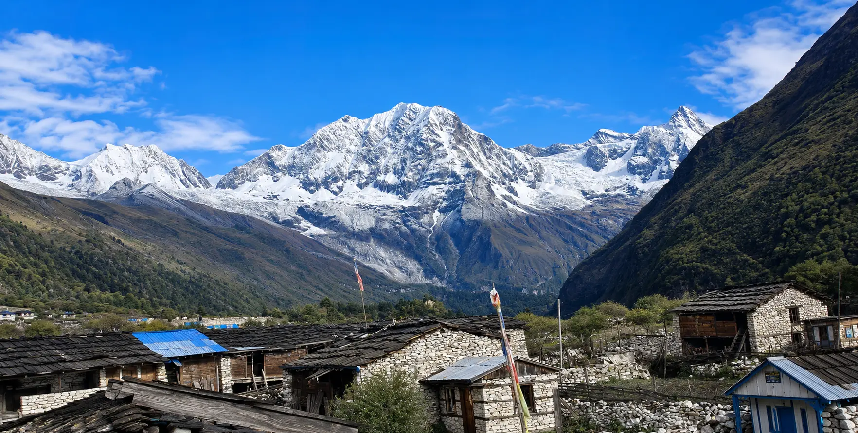
Crafting Your Lumbini Itinerary — Day by Day


DayFocusSitesFirst ActivityKey Experience
Day 1Inner Sacred ZoneMaya Devi Temple, Pushkarni, Ashokan Pillar, Eternal Flame, World Peace Pagoda5:00 AM Sacred Garden at dawnDawn meditation at Maya Devi Temple — before the crowds arrive — is the most moving experience in Lumbini.
Day 2West Monastic Zone deep diveGerman Monastery (full interior), Thai Monastery, Myanmar Temple, Vietnamese Monastery, French Stupa6:00 AM Thai Monastery morning chantingMorning chanting at Thai Monastery — gold hall, Pali chanting, dawn light
Day 3East Monastic Zone + meditationSri Lankan Monastery, Cambodian Monastery, Korean Temple (meditation session), Lumbini Museum9:00 AM Korean Temple meditationKorean Son meditation session — one of Lumbini’s most accessible retreat experiences
Day 4Western Sacred CircuitTilaurakot, Kudan, Gotihawa, Niglihawa, Sagarhawa, Kapilvastu Museum8:00 AM departure from LumbiniStanding at Tilaurakot East Gate — biographical heart of the Buddha’s story
Day 5Eastern Sacred CircuitRamagrama Stupa, Devdaha7:00 AM departure from LumbiniRamagrama Stupa — the only original Buddha relic stupa, never opened in 2,500 years.
Day 6DeepReflectionsearchhLIRI Library, Lumbini Development Trust, meditation practice, monastery guest houseFlexibleLIRI reading room — the world’s premier specialist library for Buddhist studies in this sacred setting

Explore Lumbini Hidden Spiritual Places beyond the Maya Devi Temple, including Ramagrama Stupa, Tilaurakot, Devdaha, Gotihawa, Niglihawa, and other sacred Buddhist heritage sites.

Deeper Reading — Understanding What You Are Visiting

The Lumbini outer sacred circuit rewards visitors who arrive with prior reading in Buddhist history, archaeology, and biographical tradition. The following books are specifically recommended for deepening the Lumbini experience:

  • ‘Old Path White Clouds’ by Thich Nhat Hanh — A beautifully written narrative retelling of the Buddha’s life story, drawn from the Pali sutras and presented as a readable, vivid historical narrative. Reading this before visiting Lumbini and Tilaurakot transforms every site from an archaeological location to a living scene from a biography.
  • ‘In the Buddha’s Words,’ edited by Bhikkhu Bodhi — An anthology of Pali canon teachings in translation, organized thematically. Reading the early sutras relating to the Buddha’s time in the Kapilvastu region — his meetings with his father, the ordination of Rahula, the return to Devdaha — while visiting those locations creates an unusually direct connection between text and landscape.
  • ‘Lumbini: The Birthplace of the Lord Buddha’ by UNESCO — The official archaeological and heritage documentation of the Lumbini site and its wider sacred landscape. Essential background for understanding the site’s archaeological complexity and the ongoing excavation work.
  • ‘Ashoka and the Decline of the Mauryas’ by Romila Thapar — The definitive scholarly account of Ashoka and his pilgrimage program, essential for understanding the full significance of the Ashokan pillars at Lumbini, Niglihawa, Gotihawa, and throughout the sacred landscape.
  • ‘Power of the Buddha’ by John Snelling — A comprehensive biography of the historical Buddha drawing on the complete range of early Buddhist textual sources, with detailed treatment of the geographical setting of the Sakya Kingdom world.

Food and Accommodation Near the Hidden Sites — Practical 2026 Information

Accommodation in the Lumbini area ranges from monastery guesthouses within the Monastic Zone to commercial hotels in the Lumbini bazaar area and the larger town of Bhairahawa (Siddharthanagar), approximately 22 km south. For visitors planning to visit the outer sacred circuit sites, basing yourself in Lumbini (within the development zone or nearby bazaar) is more convenient than Bhairahawa, as it saves 45 minutes of additional driving each way. For visitors arriving late in the evening or departing early in the morning by flight from Gautam Buddha International Airport, Bhairahawa offers better commercial hotel options.

  • Monastery guesthouses (within Monastic Zone): NPR 1,500–3,000/night, vegetarian meals, peaceful location. Korean, German, and Vietnamese monasteries all accept spiritual visitors. Advance contact is essential.
  • Lumbini bazaar area hotels: NPR 2,500–6,000/night for mid-range rooms. Several options within 1–2 km of the main Sacred Garden entrance. Convenient for early morning Sacred Garden access.
  • Buddha Maya Garden Hotel and similar: Higher-end Lumbini-area accommodation at NPR 6,000–12,000/night. Well-maintained, good restaurants, closest to the development zone of the former hotels.
  • Bhairahawa commercial hotels: NPR 4,000–10,000 for mid-range; up to NPR 18,000+ for business-class rooms. Better range but 22 km from Lumbini. Best for flight-connection travelers.

Food near the hidden outer sites: Tilaurakot, Kudan, Gotihawa, Niglihawa, and Sagarhawa are all in rural areas with few or no restaurants. Pack a lunch and sufficient water before departing Lumbini for the outer circuit. Several small teahouses and dhaba-style restaurants operate on the road between Lumbini and Taulihawa and can provide dal bhat or simple snacks in the Taulihawa town area.
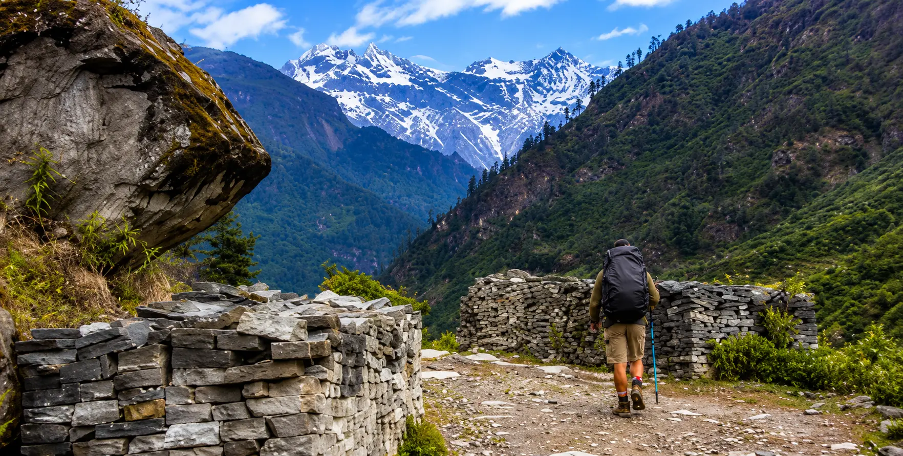
Essential Etiquette for AllLumbini’s Hidden Spiritual Places

  • Remove footwear before entering the Sacred Garden, Maya Devi Temple, and all monastery buildings — shoe storage is provided at entrances.
  • Dress modestly at all sites — shoulders and knees covered for both men and women. Many monasteries display signs to this effect. Lightweight shawls or scarves are useful cover-ups for tanks and shorts.
  • No photography inside the Maya Devi Temple inner sanctum — signs and guards enforce this rule. Photography is generally permitted in monastery grounds but not always inside prayer halls — check signs or ask.
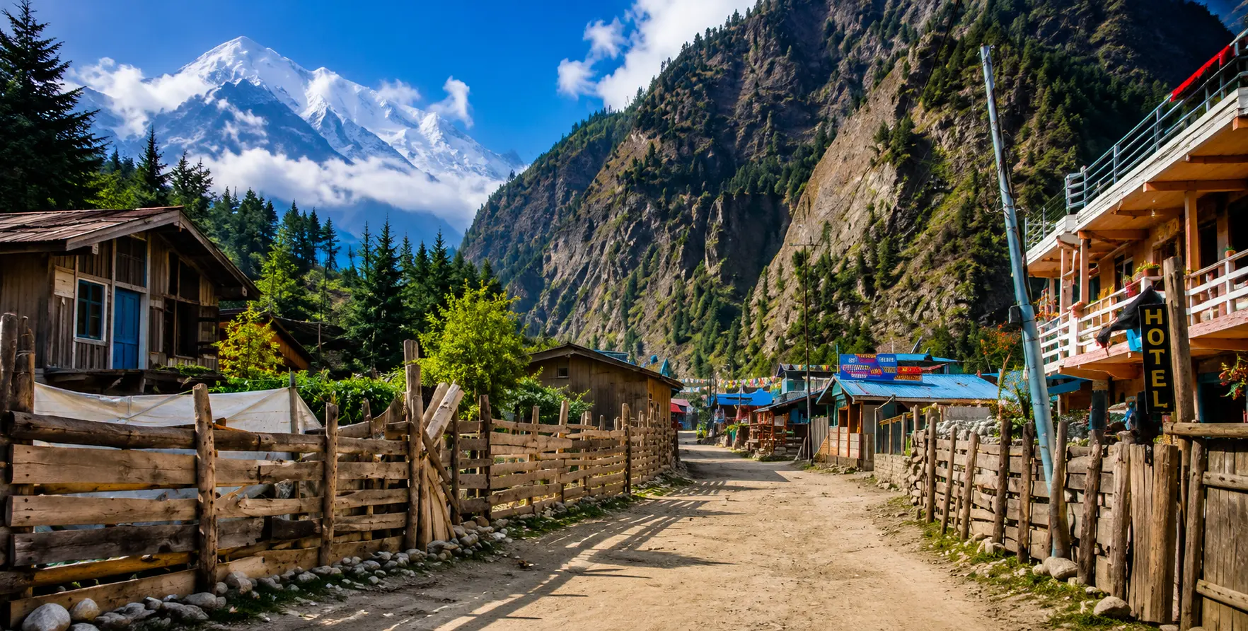
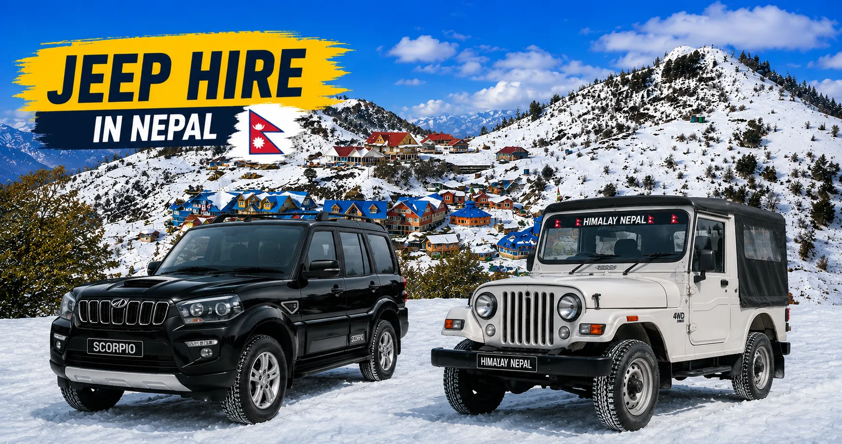
  • Maintain silence in the Sacred Garden and near the Maya Devi Temple — this is a living place of prayer, not a heritage museum. Phone calls and loud conversation are deeply disrespectful to praying pilgrims.
  • Circumambulate all stupas clockwise (keeping the stupa to your right as you walk). This applies to both the Maya Devi Temple complex and the Ramagrama Stupa.
  • At the outer archaeological sites, stay on marked paths and do not climb on or touch the ancient brick structures. These are fragile two-thousand-year-old remains in a tropical climate — physical contact accelerates deterioration.
  • At Sagarhawa and sites with historical associations with tragedy and violence, maintain a respectful, contemplative attitude. These are places of deep historical sorrow as well as Buddhist sacred significance.
  • Donations at monasteries: A small donation (NPR 100–500) at monastery donation boxes acknowledges the community’s maintenance of the sacred space and is appreciated. Donations are always discretionary.

Explore Lumbini Hidden Spiritual Places beyond the Maya Devi Temple, including Ramagrama Stupa, Tilaurakot, Devdaha, Gotihawa, Niglihawa, and other sacred Buddhist heritage sites.

Frequently Asked Questions — Lumbini’s hidden spiritual places.

What is the single most important hidden site at Lumbini that most visitors miss?

Ramagrama Stupa, located approximately 35 km east of Lumbini, is the most historically significant and spiritually profound hidden site in the wider Lumbini sacred landscape. It is the only one of the original eight stupas built after the Buddha’s death to contain his cremated remains that has never been opened — making it the oldest continuously preserved Buddhist sacred object in the world and the only site where the historical Buddha’s physical remains may still be present.

The site requires a private vehicle to reach. It is about an hour’s drive from Lumbini, but standing before this unremarkable earthen mound, knowing what it may contain and what it certainly represents, is one of the most moving experiences available to any Buddhist pilgrim.

How many days do I need to see all the important hidden sites?

A minimum of 4 full days is needed to do justice to both the inner sacred zone of Lumbini and the most significant outer sites. Day 1: Dawn sacred garden visit + Inner Monastic Zone. Day 2: Complete Monastic Zone (all 32+ monasteries). Day 3: Western outer circuit — Tilaurakot, Kudan, Gotihawa, Niglihawa, Sagarhawa (full day by vehicle). Day 4: Eastern outer circuit — Ramagrama Stupa and Devdaha (half to full day by vehicle). An additional 1–2 days for meditation retreat activities, the LIRI Library, and more contemplative engagement with the sites already visited would complete an ideal Lumbini pilgrimage.

Is the Tilaurakot site definitely the capital of ancient Kapilvastu?

The identification of Tilaurakot as the ancient Kapilvastu — the capital of the Shakya Kingdom and the site of the Buddha’s childhood palace — is supported by convergent evidence from multiple scholarly disciplines. Archaeological evidence (coin types, pottery sequences, architectural phasing), epigraphic evidence (nearby Niglihawa’s Ashokan pillar marking locations consistent with Tilaurakot being Kapilvastu), textual evidence (distances between sites mentioned in ancient texts matching the current geography), and topographical evidence (Tilaurakot’s location relative to Lumbini and other identified sites) all point to the same identification. While alternative identifications have been proposed (most notably the site of Piprahwa in the Indian state of Uttar Pradesh), the scholarly consensus in 2026 strongly favors Tilaurakot as the ancient Kapilvastu.

Can I attend meditation retreats at Lumbini monasteries as a non-Buddhist?

Yes — several of the international monasteries in the Lumbini Monastic Zone offer meditation programs that are explicitly open to non-Buddhist participants. The Korean Buddhist Temple’s meditation retreat programs are specifically designed for international participants and are taught in English without religious preconditions. The German Monastery (Drigung Kagyu) accepts retreat visitors of any background who come with ga enuine spiritual interest. The Lumbini Buddhist Circuit Research (LBCR) center runs secular Vipassana retreats in the Theravada insight meditation tradition. All programs require advance contact and registration.

How do I get from Kathmandu to Lumbini?

The most popular option is a domestic flight from Tribhuvan International Airport (Kathmandu) to Gautam Buddha International Airport (Bhairahawa) — approximately 35 minutes flying time, with multiple daily flights by Buddha Air and Yeti Airlines (NPR 9,000–18,000 per person in 2026). From Bhairahawa Airport, Nepal Vehicle Hiring Pvt. Ltd. provides airport pickup and transfer to Lumbini (approximately 22 km, 45 minutes). The alternative is private vehicle hire from Kathmandu to Lumbini (approximately 330 km, 7–8 hours) — Nepal Vehicle Hiring provides this service in Cars, 4WD Jeeps, and Hiace Vans. Contact our team at +977 9851013196 or vehiclehiringnepal.com for transport arrangements.

Are the outer sacred circuit sites accessible during monsoon season?

Most of the outer sacred sites are accessible during the monsoon (June–September) with appropriate caution and a suitable vehicle. The main roads to Tilaurakot, Kudan, and most western circuit sites are paved and manageable in rain. Some final approach roads to Gotihawa, Sagarhawa, and sections near Ramagrama can become muddy in heavy rain and require a 4WD vehicle. The spiritual experience at the outer sites during monsoon has a particular quality — the lush green landscape, the atmospheric mist, and the absence of other visitors create a contemplative setting of unusual depth. Nepal Vehicle Hiring Pvt. Ltd. recommends a 4WD Fortuner or Hilux for outer circuit visits during monsoon and monitors road conditions to advise clients on current access.

What is the Lumbini Master Plan and how does it affect what I can see?

The Lumbini Master Plan, designed by Japanese architect Kenzo Tange in 1978 under UNESCO auspices, defines the spatial organization of the entire Lumbini Development Zone — the 4.8 km × 1.6 km protected area within which athe Lumbini Development Trust regulates all development The plan allocated plots within the Monastic Zone to Buddhist nations and organizations, established the central canal as the organizing spatial axis, defined the Sacred Garden as the primary protected archaeological zone, and created the New Lumbini Village as the service infrastructure zone south of the main complex.

The Master Plan has been only partially realized — as of 2026, approximately 32 of the 42 allocated monastery plots have been developed, and several plots remain under construction or in planning. The plan does not address the outer sacred circuit sites (Ramagrama, Tilaurakot, etc.), which are managed separately by the Lumbini Development Trust in collaboration with the Department of Archaeology.

Lumbini Hidden Spiritual Places featuring Maya Devi Temple, Ramagrama Stupa, Tilaurakot, Devdaha, and ancient Buddhist monasteries

Conclusion: The Lumbini That Changes Everything

There are two Lumbinis. The first — the one that tour operators describe, that travel guides summarize in two pages, that Instagram presents in golden-hour photographs of the gleaming World Peace Pagoda — is extraordinary: the Maya Devi Temple marking the exact birthplace of one of history’s greatest spiritual figures, the Ashokan Pillar providing one of the world’s oldest and most important archaeological inscriptions, and the Monastic Zone offering a remarkable walking survey of Buddhist traditions from thirty nations. This first Lumbini is genuinely world-class and genuinely moving.

The second Lumbini — the one that requires a private vehicle, some planning, a willingness to leave the paved tourist path for the rural roads of the Rupandehi and Kapilvastu districts, and the imaginative and intellectual effort to see what the modest earthen mounds and scattered brick foundations of the outer sites truly represent — is something of a different order entirely. This second Lumbini is where you stand before the only stupa in the world that may contain the actual remains of the Buddha and feel the weight of 2,500 years of preserved sanctity.

It is where you walk through the excavated East Gate of Tilaurakot — the gate through which Siddhartha rode out at midnight on the night of his Great Renunciation — and feel the biographical reality of the Buddha’s life story with an immediacy that no amount of scripture reading can replicate.

Explore Lumbini Hidden Spiritual Places beyond the Maya Devi Temple, including Ramagrama Stupa, Tilaurakot, Devdaha, Gotihawa, Niglihawa, and other sacred Buddhist heritage sites

It is where the broken Ashokan Pillar in a Niglihawa rice field, forgotten by most tourists, speaks more eloquently about the world of the Buddha than any museum exhibit. It is where the old pond at Sagarhawa, in its melancholy rural setting, reminds you that the very human violence eventually destroyed the world that produced the Buddha, whom he spent his life addressing — and that this makes his achievement of compassion and wisdom not less but more extraordinary.

To visit both Lumbinis — to experience the sacred core in full depth and the hidden outer circuit with genuine attention — is to undergo a spiritual Education that changes your relationship to the Buddha’s story and to the possibility of human wisdom permanently. It is neither a comfortable nor an efficient journey. It requires time, planning, physical engagement with sometimes remote and unassuming sites, and the willingness to sit with the profound discomfort of historical and spiritual reality presented without comfortable heritage packaging. But it is, for those who make it, one of the most significant journeys available to any human being in the world today.

Nepal Vehicle Hiring Pvt. Ltd. is the transport partner that makes this complete Lumbini journey possible — providing professional, reliable, and comfortable vehicle service to every inner and outer sacred site in the Lumbini spiritual landscape. From a 5:00 AM dawn drive to the Sacred Garden to a full-day western circuit through the Tilaurakot archaeological landscape to the deeply moving rural path to Ramagrama Stupa, we are with you at every stage of the most profound journey available in Nepal. Contact our team today. The hidden Lumbini is waiting.

For travelers who have completed their trek and are planning to explore Kathmandu, we recommend continuing your journey with our trusted sister companies, Trek Nepal Himalayas and Alpine Luxury Treks. We specialize in organizing a wide range of travel experiences across Nepal, from classic trekking adventures to cultural and wildlife tours.

Our top offerings include iconic journeys such as the Everest Base Camp helicopter tour, immersive Kathmandu sightseeing tours, breathtaking Nagarkot sunrise experiences, exciting Chitwan jungle safaris, and luxury packages. In addition, we can arrange short hikes, heritage tours, mountain flights, and customized travel plans tailored to your schedule and interests.

Whether you are looking for a budget-friendly trip or a luxury trekking experience with premium lodges, private guides, and high-end services, we ensure every detail is professionally managed. Our goal is to provide a seamless transition from your trekking adventure to a comfortable) and a memorable travel experience in Nepal.