Plan a Trip


Pasang Lhamu Highway 2026 Update: Full Route Guide
Pasang Lhamu Highway 2026 Update: Complete Route and Travel Guide
If your Nepal trip runs anywhere near Langtang, Gosaikunda, the Tamang Heritage Trail, or the Kerung border with Tibet, you’re going to spend time on the Pasang Lhamu Highway — and this year’s monsoon has given travelers a fresh reason to check current conditions before departing. This guide covers the highway’s full route, its recent 2026 disruptions, what’s currently drivable, and every practical detail for planning a trip along this genuinely important stretch of road.
Whether you’re heading to Syabrubesi for the Langtang Valley trek, continuing to the Rasuwagadhi-Kerung border crossing into China, or researching the route before booking transport, this guide covers the highway’s history, current road conditions, vehicle recommendations, permits, and seasonal planning for 2026 and 2027.
What Is the Pasang Lhamu Highway?
The Pasang Lhamu Highway, officially National Highway 18 (NH18), is a strategically important road running north from Kathmandu through Nuwakot and Rasuwa districts, ultimately reaching the Nepal-China border. The core highway stretches roughly 65 kilometers, with an extension continuing toward Rasuwagadhi that brings the total route length to nearly 144 kilometers. It’s named in honor of Pasang Lhamu Sherpa, the first Nepali woman to summit Mount Everest in 1993, who tragically died during her descent—a fitting namesake for a highway that climbs into some of Nepal’s most dramatic mountain terrain.
The highway begins near Machhapokhari in Balaju, Kathmandu, branching off the Kathmandu Ring Road, and proceeds north via Nagarjun before crossing into Nuwakot district. It later intersects with the Trishuli Corridor (NH42) at Pipaltar near Bidur, continues through Nuwakot and into Rasuwa district, and eventually reaches the Nepal-China border crossing at Rasuwagadhi, opposite Kerung (Gyirong) on the Tibetan side.
Naming a national highway after Pasang Lhamu Sherpa reflects more than symbolic honor — it places her legacy directly on one of Nepal’s genuinely strategic transport corridors, connecting the capital to both a major trekking region and an international border crossing. Her 1993 Everest summit was itself a landmark moment for Nepali mountaineering, making this a highway whose very name carries weight for Nepali travelers passing along it, not just a bureaucratic route designation.
Pasang Lhamu Highway 2026 Update: Current Road Conditions and Recent Disruptions
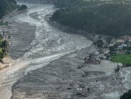
This year’s monsoon has disrupted sections of the highway. Recent reporting confirms the Pasang Lhamu Highway at Khalte, in Uttargaya Rural Municipality-5 in Rasuwa district, was completely blocked due to erosion caused by the Trishuli River — part of a broader pattern of monsoon-season highway blockages reported across Nepal in recent weeks, alongside separate landslide disruption on the Larke-Benighat road in Gorkha and river erosion affecting the Lamosangu-Ramechhap road in Dolakha.
This kind of monsoon-season disruption isn’t unusual for this specific highway — the road runs alongside the Trishuli River for much of its length, and the same river that gives the drive its scenic gorge views is also the source of recurring erosion risk during the heaviest rainfall months. Nepal Police have urged travelers to check current road conditions with relevant authorities before departing, advice that applies with particular force to this route given its history of monsoon-season blockages.
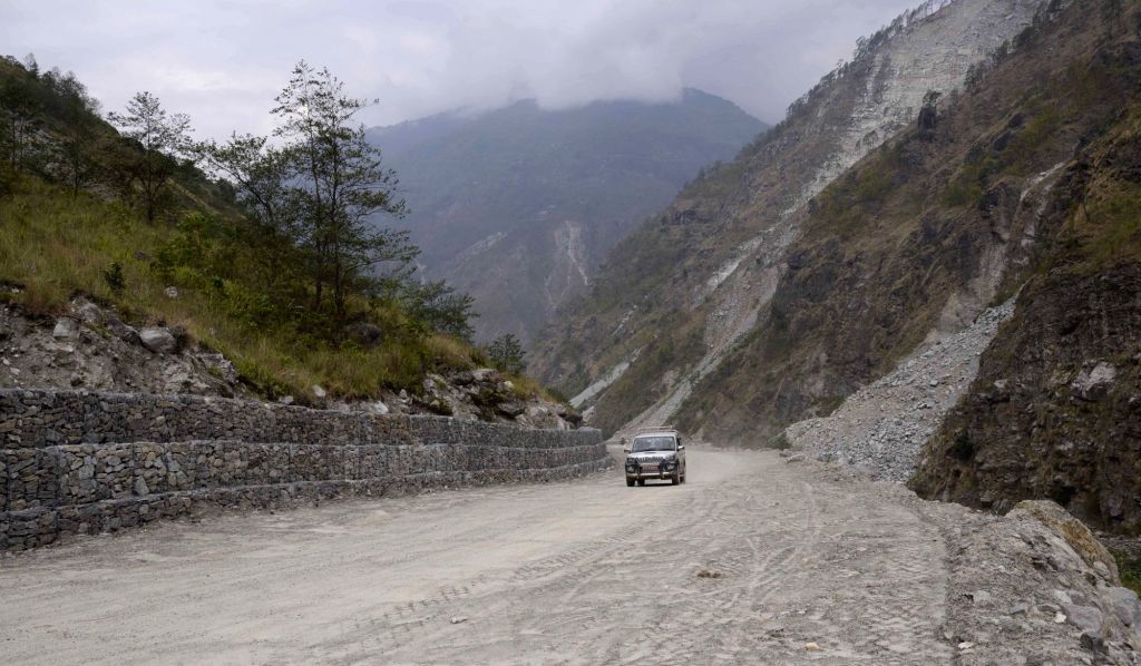
Beyond this specific 2026 disruption, the roughly 3-kilometer Ramche landslide zone near Dhunche remains the most technically challenging section of the route on an ongoing basis. Road improvement work continues in this area, but as of 2026, sections remain rough and unpaved, with high ground clearance and genuine 4WD capability strongly recommended.
For travelers planning trips in the weeks or months following any reported blockage, it’s worth understanding how these disruptions typically resolve: river-erosion damage of this kind is usually addressed with temporary diversion tracks or emergency repair work rather than a full closure lasting an entire season, but the exact timeline depends on the severity of the damage and how quickly local authorities and the Department of Roads can mobilize repair crews. Confirming current status directly with a locally based operator remains the most reliable way to get an accurate, up-to-date picture rather than relying on a single news report that may already be outdated by the time you’re ready to travel.
Full Route Breakdown
Understanding this route stage by stage helps set realistic expectations for travel time, road quality, and where to plan rest stops.
Kathmandu to Kakani/Tokha
The route leaves Kathmandu via Balaju and Nagarjun, with private vehicles often taking an alternate stretch through Kakani and Galchhi, climbing into the hills northwest of the city with early views back over the Kathmandu Valley.
Through Nuwakot to Trishuli/Bidur
The road descends via sharp hairpin bends toward Chhahare in Nuwakot district, continuing along a flatter, faster stretch through Dhikure before reaching Bidur, commonly known as Trishuli — Nuwakot’s commercial hub and a popular base for river rafting on the Trishuli River.
Trishuli to Betrawati to Dhunche
From Trishuli, the road climbs through spectacular river-gorge scenery alongside the Trishuli River, narrowing and becoming considerably windier as it gains elevation. However, it generally remains in reasonable condition for this stretch and takes roughly 2 to 2.5 hours. Dhunche, Rasuwa’s administrative center, is also the checkpoint for Langtang National Park, making it a natural stop to confirm permits before continuing.
Dhunche to Syabrubesi (The Ramche Landslide Zone)
This final stretch before Syabrubesi passes through the roughly 3-kilometer Ramche landslide zone, the most technically demanding section of the entire highway. Road improvement work is ongoing, but expect rough, unpaved sections here regardless of when you’re traveling, with jeeps handling this stretch noticeably better than buses.
Syabrubesi to Rasuwagadhi/Kerung Border
Beyond Syabrubesi, the road continues toward the Rasuwagadhi border crossing, following the roar of the Bhote Koshi River to the 91-meter Bailey bridge, which marks the border crossing into Chinese immigration territory at Kerung (Gyirong). This final stretch is the most rugged, and travelers typically allow 7 to 9 hours for the full Kathmandu-to-Kerung border journey.
The Rasuwagadhi crossing point sits in a dramatic gorge, with the Bhote Koshi River marking the international boundary below the bridge. This is one of only a handful of formal Nepal-China land border crossings, and its relatively recent rise in importance after damage to the older Kodari crossing has driven steady, ongoing infrastructure investment on the Nepali side, even as the final approach road remains genuinely rugged mountain terrain.
Gateway to Langtang National Park
Syabrubesi, roughly 122 to 130 kilometers from Kathmandu depending on the exact route, is the principal trailhead for several of Nepal’s most rewarding mid-length treks: the Langtang Valley Trek to Kyanjin Gompa, the Tamang Heritage Trail, the Gosaikunda Lake Trek, and the more demanding Ganjala Pass route. Sitting at roughly 1,550 meters at the confluence of the Bhote Koshi and Langtang Khola rivers, it’s the natural staging point for this entire region. Our Jeep vs Bus to Syabrubesi comparison covers the full transport decision for this specific leg in detail, and our Dhunche to Kathmandu jeep guide covers the return journey from the Langtang National Park checkpoint town.
Langtang National Park itself was significantly affected by the 2015 earthquake, which triggered a devastating landslide that struck Langtang village directly. The region has rebuilt steadily since, and today offers some of the most accessible high-Himalayan scenery in Nepal relative to how close it sits to Kathmandu—a genuine advantage for travelers with limited time who still want a real high-mountain trekking experience.
Gateway to Tibet: The Rasuwagadhi-Kerung Border
Beyond its trekking significance, the Pasang Lhamu Highway serves as Nepal’s primary paved land route to the Nepal-China border, terminating at Rasuwagadhi opposite Kerung (Gyirong) on the Tibetan side. This crossing has become an increasingly important trade and travel corridor since the 2015 earthquake damaged the older Kodari-Zhangmu crossing further east. Our Kathmandu to Kerung border transportation guide covers this full journey in detail, including the border crossing process itself and the alternate detour through Gatlang, a traditional Tamang settlement on the Tamang Heritage Trail worth visiting if your schedule allows.
Alternative Route via Gatlang and the Tamang Heritage Trail
For travelers with extra time, a detour through Gatlang offers a genuinely different experience from the direct Syabrubesi-Rasuwagadhi route — traditional stone houses, homestays, and some of the finest direct views of the Langtang Himalayan range available from any village in the region. This route runs off-road beyond Dhunche and Syabrubesi, rougher than the main highway but rewarding for travelers specifically seeking Tamang cultural immersion alongside the mountain scenery. See our Kathmandu to Kerung border transportation guide for how this detour fits into a full border-crossing itinerary.
Alternative Route: The Trishuli Corridor
The Pasang Lhamu Highway is sometimes described as an alternative to the Trishuli Corridor (NH42) in Rasuwa district, since both roads serve overlapping parts of the same region. Most standard tourist and trekking traffic uses the Pasang Lhamu Highway route described throughout this guide. Still, travelers or operators facing a specific closure or disruption on one road may use the other as a fallback option, which is worth knowing given this year’s monsoon-related blockages.
It’s worth noting that these two roads aren’t fully interchangeable for every purpose — the Trishuli Corridor primarily serves lower-elevation Rasuwa district communities rather than functioning as a direct alternate route to Syabrubesi or the Kerung border, so treat it as a partial fallback for specific sections rather than a complete substitute for the full Pasang Lhamu Highway journey.
Nuwakot: A Worthwhile Detour
Nuwakot district, which the highway passes directly through, holds genuine historical significance beyond its role as a transit corridor — the Nuwakot Durbar complex, a UNESCO-recognized historical palace site, and the nearby Kakani viewpoint both offer worthwhile stops for travelers with flexible schedules. Our Nuwakot historical and spiritual sites guide covers this region in full, including the Belkot viewpoint, which offers some of the finest distant views of the Nuwakot palace complex, and Trishuli town, the district’s commercial and river-rafting hub.
Choosing a Reliable Operator for This Route
- Confirm the operator has current, verified information on the Khalte blockage and any other active disruptions before booking.g
- Ask specifically about their driver’s experience with the Ramche landslide zone, not just general Rasuwa district driving.ng
- Request a clear plan for how delays or detours would be handled if conditions change between booking and departure. ure
- Confirm whether your quote includes Langtang National Park permit assistance or if you need to arrange it separately. tely
- Check the specific vehicle model being offered, since this route’s difficulty depends heavily on genuine 4WD capability.
Choosing the Right Vehicle
A genuine 4WD jeep remains the strongly recommended choice for this route, particularly through the Ramche landslide zone, where jeeps handle the rough, unpaved sections noticeably better than buses. A well-driven SUV can sometimes manage the route in favorable dry-season conditions, but a jeep remains the safer default, especially for groups traveling with significant trekking gear. Our jeep and SUV comparison covers specific routes and examples to help you choose the right vehicle class for Nepal’s mountain roads. Budget travelers can also consider the shared jeep or public bus options detailed in our Jeep vs Bus to Syabrubesi comparison.
Cost of Private Vehicle Hire
Private jeep charter for the Dhunche-Kathmandu leg commonly runs around USD 160 for the full vehicle, typically a 4WD Scorpio or Toyota Prado, comfortably seating 6 to 7 passengers. Shared jeeps running fixed routes between Dhunche, Trishuli, and Kathmandu offer a cheaper per-seat alternative, generally departing only once full and running primarily in the morning window between roughly 6:00 a.m. and 111:30 a.m. Full Kathmandu-to-Kerung border transport, given the longer distance and rougher final stretch, is typically priced higher, reflecting both the extra distance and the additional time required.
Altitude and Health Considerations
The Pasang Lhamu Highway stays at relatively modest elevations throughout, with Syabrubesi at roughly 1,550 meters—low enough that altitude sickness isn’t a significant concern on the road journey. Trekkers continuing beyond Syabrubesi into the Langtang Valley, Gosaikunda, or the Ganjala Pass should take standard altitude precautions once climbing beyond roughly 2,500- 3,000 meters, separate from the road journey covered throughout most of this guide.
Permits Required
Every visitor to Langtang National Park, including trekkers heading to the Langtang Valley, Tamang Heritage Trail, or Gosaikunda, needs a Langtang National Park entry permit and a TIMS (Trekkers’ Information Management System) card, both of which you should arrange in Kathmandu before departure. Dhunche also serves as a checkpoint for these permits, so it’s a good place to double-check your documentation if you haven’t already confirmed everything before leaving Kathmandu. Travelers continuing to the Rasuwagadhi-Kerung border for onward travel into Tibet require separate Chinese entry documentation, arranged well in advance through an authorized agency given the complexity of Tibet travel permits.
Insurance and Emergency Preparedness
Given both this route’s monsoon-season disruption history and its role connecting to genuinely remote trekking and border regions, travel insurance covering trekking activities and emergency evacuation is worth having in place for any trip beyond the immediate Kathmandu-Trishuli stretch. Medical facilities become progressively more limited beyond Trishuli, and any serious issue in the Langtang region or near the Kerung border would require evacuation back toward Kathmandu or, in urgent cases, by helicopter.
Best Time to Travel This Route
Autumn (September to November) offers the most reliable conditions, with dry roads, clear skies, and the Langtang region at its most beautiful for trekkers continuing beyond Syabrubesi. Spring (March to May) is a strong second choice. Monsoon season (June to August) brings a genuinely elevated risk of landslides and river erosion along this specific highway, as this year’s Khalte blockage demonstrates — this guide strongly advises against non-essential travel on this route during peak monsoon months, consistent with the broader travel advisory in circulation following this year’s disruptions.
Photography Along the Route
This drive offers genuinely varied photographic interest — the Trishuli River gorge between Trishuli town and Betrawati, the terraced hillsides of Nuwakot district, and the first dramatic Himalayan views as the road climbs toward Dhunche and Syabrubesi. A private jeep offers the flexibility to pause for photos at these points, something a fixed-schedule bus generally can’t accommodate.
What to Pack
- Sufficient Nepali cash for the full trip, since ATMs are unavailable between Trishuli and Syabrubesi
- Motion sickness tablets, given how winding the road becomes beyond Trishuli
- A face mask or scarf for dusty sections near Ramche
- At least 1.5 liters of water, refilled at teahouses in Trishuli and Dhunche
- Warm layers, since temperatures drop noticeably as the road climbs toward Dhunche and Syabrubesi
Rest Stops Along the Way
Most travelers on this route stop in Trishuli town roughly midway, with reliable food and restroom facilities, and again in Dhunche if continuing beyond Syabrubesi; both are natural break points given the roughly 6-8 hour total journey time to Syabrubesi. Drivers experienced on this specific route generally know which stops offer the most reliable facilities, an advantage over guessing at unfamiliar options along the way.
Trekking Routes Reached via This Highway
- Langtang Valley Trek. The classic route from Syabrubesi to Kyanjin Gompa, Nepal’s third most popular trek.
- Tamang Heritage Trail. A cultural route through traditional Tamang villages including Gatlang, off the main highway.
- Gosaikunda Lake Trek. A sacred high-altitude lake trek, accessed via Dhunche or Syabrubesi.
- Ganjala Pass Trek. A more demanding high-altitude crossing for experienced trekkers.
- Langtang-Gosaikunda-Helambu Loop. A classic long-distance circuit finishing at Sundarijal, covered in our Kathmandu to Sundarijal trek transfer guide.
Environmental and Responsible Travel Considerations
Langtang National Park operates under a protected-area management model, with permit fees supporting conservation work throughout the region, particularly important given the area’s ongoing recovery since the 2015 earthquake. Responsible travel along this route means packing out waste, minimizing single-use plastic given limited waste infrastructure beyond Trishuli, and supporting locally owned guesthouses and transport operators in Rasuwa district, whose communities were directly affected by the earthquake and continue rebuilding their tourism economy.
Group Travel Options
For groups with substantial trekking gear or multiple porters, a Hiace van is recommended for the paved stretches of this route, given the extra luggage capacity, while groups continuing through the Ramche landslide zone should confirm with their operator whether a switch to jeeps is needed for that specific stretch. Our Kathmandu to Sundarijal trek transfer guide explicitly recommends a Hiace for groups with two or more porters given the combined gear load.
Booking Tips
- Check current road conditions before departure, particularly during or shortly after monsoon season, given this route’s history of weather-related disruption.
- Confirm your Langtang National Park permit and TIMS card are arranged in Kathmandu before departure.e
- Ask your operator specifically about current Ramche landslide zone conditions, since these change with ongoing road improvement work.
- Book a private jeep in advance during peak autumn season, when demand for this route rises sharply.y
- If continuing to the Kerung border, confirm your Chinese travel documentation timeline well in advance given the added complexity.
Common Mistakes to Avoid
- Traveling during peak monsoon season without checking current highway conditions, given this year’s Khalte blockage and broader landslide risk
- Assuming a standard car can handle the Ramche landslide zone the way a genuine 4WD jeep can
- Forgetting Langtang National Park permits, mistakenly assuming this route requires no permits since it isn’t part of the more widely known Annapurna Conservation Area.
- Underestimating the 7-9 hour total journey time to the Kerung border, particularly if combining it with a Gatlang detour
- Not carrying sufficient cash, given the lack of ATMs beyond Trishuli
Understanding the 2015 Earthquake’s Lasting Impact
Rasuwa district, and Langtang specifically, sit close to the epicenter zone of the devastating 2015 Gorkha earthquake, which triggered a massive landslide that struck Langtang village directly, one of the disaster’s most severe single losses. This history isn’t just background context — it shaped much of the region’s current infrastructure, including road reconstruction along parts of this highway, and continues to influence how local communities in Rasuwa think about disaster preparedness, including monsoon-season landslide risk, asd covered in this guide’s 2026 update section. Langtang village has been rebuilt since then, and today’s trekkers pass through a community that has visibly recovered while still carrying the memory of that event.
Vehicle Maintenance and What to Check Before Departure
Given how demanding the Ramche landslide zone and the final stretch toward Rasuwagadhi are on tires and suspension, ask your operator about vehicle condition before departure rather than assuming any jeep marketed for the route is equally well maintained. Confirm recent servicing, particularly ahead of the busy autumn season when vehicles on this route see heavy, repeated use across many bookings in a short window.
Traveling With Photography and Filming Equipment
Given the rough sections covered throughout this guide, trekkers and travelers carrying sensitive camera equipment should pack it with extra padding and keep it as accessible hand luggage rather than in checked bags, since the bumpier stretches near Ramche and beyond Syabrubesi can jostle poorly secured gear considerably more than the smoother Kathmandu-Trishuli section.
What Makes This Highway Different From Other Nepal Routes
Few highways in Nepal combine trekking-gateway status, international border significance, and documented monsoon vulnerability in quite the same package as the Pasang Lhamu Highway. Most comparable mountain routes serve either a trekking region or a border crossing, not both simultaneously, and fewer still have such a well-documented recent history of weather-related disruption making regular news coverage. This combination is exactly why this guide treats the highway as deserving its own dedicated, regularly updated resource rather than folding it into a broader regional overview.
Long-Term Outlook for This Route
Given the highway’s strategic importance for both tourism and Nepal-China trade, continued government investment in improvement and monsoon-resilience work is likely over the coming years, following the same pattern of gradual mountain road upgrades seen elsewhere in Nepal. Travelers researching this route in 2027 or later should expect the Ramche landslide zone and other rough sections to be somewhat improved relative to their current 2026 condition, though the fundamental monsoon-season erosion risk along the Trishuli River corridor is unlikely to disappear entirely given the underlying geography.
Driver Experience and Local Knowledge
Experienced drivers on this route carry practical knowledge that goes well beyond simply knowing the way—which specific sections of the Ramche zone tend to worsen first after rain, the current status of any monsoon-related repairs, and the safest timing for the final stretch toward Rasuwagadhi given the border crossing’s operating hours. This is one of the strongest reasons to book through an operator with genuine, current experience on this exact route rather than a general Kathmandu-based driver unfamiliar with Rasuwa district’s particular seasonal challenges.
Documents and Cash to Carry
Beyond your Langtang National Park permit and TIMS card, carry sufficient Nepali rupees for the full journey, since ATMs become unreliable beyond Trishuli and unavailable entirely beyond Dhunche. Travelers continuing to the Kerung border need their Chinese travel documentation organized and easily accessible, separate from their Nepal permits, given the more complex, multi-stage nature of an international border crossing compared to a domestic trekking permit check.
Weather Patterns Along the Route in Detail
The Pasang Lhamu Highway climbs through several distinct climate zones as it heads north. Kathmandu and the initial stretch through Nuwakot sit in Nepal’s temperate mid-hill zone, with warm summers and mild winters. As the road climbs toward Dhunche and Syabrubesi, temperatures drop noticeably, and the region’s proximity to the high Himalaya means genuine winter cold at these elevations, with occasional snow at the higher points along the route. Monsoon rainfall, concentrated between June and September, is heaviest along the Trishuli River corridor, specifically the stretch most prone to erosion-related disruption covered in this guide’s 2026 update section.
Comparing Vehicle Types for Different Trip Purposes
Trekkers heading to Langtang or Gosaikunda generally prioritize reaching Syabrubesi efficiently. Hence, a private jeep or the cheaper bus option in the Jeep vs Bus to Syabrubesi comparison is reasonable, depending on budget and schedule flexibility.
Travelers continuing to the Kerung border for Tibet travel should prioritize a reliable, experienced operator over cost savings alone, given the added complexity and lower margin for error on this longer, more remote final stretch.
Cultural travelers visiting Nuwakot or Gatlang specifically benefit most from a private vehicle’s flexibility to add these detours, something a fixed-schedule bus or shared jeep generally can’t accommodate.
Traveling With Trekking Groups and Porters
For organized trekking groups heading into Langtang, Gosaikunda, or the Tamang Heritage Trail, porters are commonly arranged either in Kathmandu before departure or in Syabrubesi itself upon arrival. Coordinating porter logistics with your vehicle booking is worth doing in advance during peak autumn season, when demand for both porters and jeeps rises sharply, given how many trekking groups converge on this route during the most reliable weather window.
Local Cuisine Along the Route
Food along the Pasang Lhamu Highway reflects the changing communities the road passes through — Nepali staples like dal bhat and momos throughout, with increasingly Tibetan-influenced options as you approach Rasuwa district and Syabrubesi, reflecting the strong Tamang and Tibetan Buddhist cultural presence in this part of Nepal. Trishuli town and Dhunche both offer reasonable meal stops along the way, while options narrow considerably beyond Syabrubesi toward the border itself.
A History of Road Access to This Region
Before this highway existed in its current form, travel between Kathmandu and the Rasuwa district relied on slower, more rudimentary tracks, and the journey to Langtang or the Tibet border took much longer than today’s roughly 6-9 hour drive. Road construction reaching this far into the mountains represents a genuinely significant piece of national infrastructure, both for trekking tourism and for Nepal-China trade, which helps explain why the government continues investing in improvements despite the road’s ongoing monsoon-season vulnerability.
The 2015 earthquake, which struck this region with particular severity given its proximity to the epicenter, also damaged sections of the existing road network, adding post-disaster reconstruction to the list of factors shaping the highway’s current condition. Understanding this layered history—pre-existing terrain challenges, earthquake damage, and ongoing monsoon vulnerability—helps explain why this highway appears more often in condition updates than many of Nepal’s other national highways.
Communicating With Your Driver
Most drivers operating on this route with established agencies have functional English, though given the region’s Tamang and Tibetan Buddhist cultural character, a few basic Nepali or Tamang phrases can genuinely enhance the journey, particularly around Gatlang and the villages closer to the border. Confirm before departure how to communicate any change of plans — an added stop, a delay, or a change to your return timing — so expectations stay clear throughout the trip.
What This Highway Means for Nepal-China Trade
Beyond its tourism role, the Pasang Lhamu Highway and the Rasuwagadhi-Kerung crossing it leads to have taken on growing importance for Nepal-China bilateral trade, particularly following the 2015 earthquake, which disrupted the older Kodari-Zhangmu crossing. Its dual role as a tourism corridor and trade route helps explain why the highway continues to attract government investment despite ongoing seasonal challenges, and why disruptions like this year’s Khalte blockage draw national news coverage rather than remaining a purely local concern.
Family and Beginner-Friendly Considerations
Families or first-time Nepal visitors considering this route should weigh the Kathmandu-to-Syabrubesi drive as the more accessible option, given its shorter length and less demanding final stretch than continuing all the way to the Kerung border. Our Kathmandu to Sundarijal trek transfer guide covers a related loop itinerary for families who want a taste of the Langtang region without committing to the full border-crossing logistics covered elsewhere in this guide.
Solo Traveler Considerations
Solo travelers have more flexibility to weigh cost against comfort on this route than groups needing to coordinate shared preferences. Budget-focused solo trekkers can reasonably choose the shared jeep or bus options for the Kathmandu-Syabrubesi leg. At the same time, those prioritizing time or continuing to the Kerung border often find a private jeep’s reliability easier to justify against a single traveler’s overall trip budget.
Final Checklist Before You Depart
- Confirm current road status with your operator, especially during or shortly after monsoon season.
- Langtang National Park permit and TIMS card arranged in Kathmandu
- Genuine 4WD vehicle booked, particularly for any trip continuing beyond Dhunche
- Sufficient Nepali cash for the full journey, since ATM access disappears beyond Trishuli
- Chinese travel documentation confirmed well in advance if continuing to the Kerung border
- Realistic time buffer built into your schedule given this route’s documented disruption history
A Note on Comparing Quotes Between Operators
When comparing quotes for this route, confirm exactly what’s included: vehicle type, whether Langtang National Park permit assistance is bundled in, and how the operator handles a scenario where road conditions change between booking and departure. A quote that seems unusually low compared with others may reflect a less capable vehicle or an operator less prepared to handle the Ramche landslide zone confidently; always confirm the specifics rather than comparing headline prices alone.
What First-Time Visitors Often Get Wrong
The most common planning mistake on this route is underestimating how much the monsoon season affects it. Travelers used to Nepal’s more resilient highway corridors sometimes assume this route behaves similarly, only to discover a genuine blockage risk that other, better-engineered roads don’t share to the same degree. Building real flexibility into your travel dates if you must travel during June-August, or simply avoiding this route during peak monsoon altogether, remains the single most effective way to sidestep the kind of disruption this guide’s 2026 update section covers in detail.
Frequently Confused Terms for This Route
A few terms are worth clarifying: Syabrubesi (also spelled Syaphrubesi or Syafrubesi in different sources) is the trailhead town for Langtang region trekking. Rasuwagadhi is the Nepali border post, while Kerung (also spelled Gyirong) is the corresponding town on the Tibetan/Chinese side. Dhunche is Rasuwa district’s administrative center and the Langtang National Park checkpoint, distinct from Syabrubesi further along the same road. In casual conversation, the Theasang Lhamu Highway is sometimes referred to informally as the ‘Rasuwa Highway’ or ‘Syabrubesi Highway,’ though NH18 remains its official designation.
Why This Guide Focuses So Heavily on Current Conditions
Most route guides for popular Nepal highways can be written once and remain broadly accurate for years. This particular highway is a genuine exception, given its documented history of monsoon-season disruption and its dual strategic role connecting trekking tourism with international trade. That’s why this guide leads with a dedicated 2026 update section rather than burying current conditions deep in the article. For this route, knowing what’s actually driveable right now matters as much as understanding the highway’s broader geography and history.
How This Guide Stays Current
Because conditions on this highway can change quickly, treat the road-condition details in this guide as a snapshot from the 2026 monsoon season rather than a permanently fixed status. We monitor this route closely and update our own operational guidance as conditions shift. Still, the most reliable way to get an accurate same-week picture is to ask directly when you book, rather than relying solely on any published guide, including this one.
Comparing This Route to Nepal’s Other Border Highways
The Pasang Lhamu Highway isn’t Nepal’s only route to an international border. Travelers researching other border crossings can compare it against our Bhairahawa to Kathmandu private car guide covering the Sunauli crossing with India, or our eastern border vehicle hire guide for the Kakarvitta crossing. What sets the Pasang Lhamu Highway apart is its role as Nepal’s primary paved route to China specifically, a genuinely different kind of border crossing from the several Indian border points covered elsewhere in our guides.
Summary: Key Facts for This Route
- Highway length: roughly 65 kilometers core, extending to nearly 144 kilometers to Rasuwagadhi
- 2026 status: monitor conditions closely given a recent monsoon-season blockage near Khalte, Rasuwa
- Most difficult section: the roughly 3-kilometer Ramche landslide zone near Dhunche
- Travel time: 6-8 hours to Syabrubesi, 7-9 hours to the Kerung border
- Recommended vehicle: genuine 4WD jeep, especially through Ramche and beyond Syabrubesi
- Permits required: Langtang National Park entry permit and TIMS card
- Best season: autumn (September-November), with spring (March-May) a strong second
- Key destinations reached: Syabrubesi, Langtang Valley, Gosaikunda, Tamang Heritage Trail, and the Rasuwagadhi-Kerung border
For the most current information on any of these points, our Jeep vs Bus to Syabrubesi comparison and Kathmandu to Kerung border transportation guide are both actively maintained resources worth checking alongside this guide before finalizing your travel dates.
Final Thoughts on This Route
The Pasang Lhamu Highway carries outsized importance relative to its modest length — connecting Kathmandu to one of Nepal’s most rewarding trekking regions, and serving as the country’s primary paved route to an international border crossing with genuine trade and travel significance. This same importance is exactly why staying current on road conditions matters so much here, given the route’s documented history of monsoon-season disruption, including this year’s Khalte blockage.
Travelers who check current conditions before departing, choose a genuine 4WD vehicle for the rougher sections, and build reasonable buffer time into their schedule consistently report a smooth, genuinely rewarding journey along this route — one that delivers dramatic river gorge scenery, access to world-class trekking, and, for those continuing all the way to Rasuwagadhi, a rare overland crossing into Tibet.
A Final Word on This Route
The Pasang Lhamu Highway is, in many ways, two roads in one — a well-traveled trekking gateway for most of its length, and a genuinely strategic international border route for its final, most demanding stretch. Understanding which of these two roles matches your specific trip, and planning your vehicle, permits, and timing accordingly, is the core message this guide has tried to deliver throughout. Whether you’re bound for the Langtang Valley’s mountain scenery or the Rasuwagadhi bridge into Tibet, arriving informed about current conditions can make the difference between a smooth journey and an unwelcome surprise, especially on a route with this much genuine variation between its best and worst travel days.
Given this year’s monsoon disruption near Khalte, that advice carries particular weight for 2026 travel specifically — check current status, choose a genuine 4WD vehicle, and build in reasonable flexibility. This highway delivers exactly the kind of dramatic, rewarding mountain journey that has made it one of Nepal’s most consequential roads relative to its modest length, connecting a capital city to both world-class trekking and an international frontier in a single day’s drive.
Putting It All Together: Planning Your Trip Timeline
To bring everything together, decide whether your trip ends at Syabrubesi for Langtang region trekking or continues to the Kerung border for Tibet travel, since this determines your total time budget and documentation needs. Check current road status, especially during monsoon season; arrange your Langtang National Park permit and TIMS card in Kathmandu; book a genuine 4WD vehicle with an operator experienced on this specific route; and build in realistic buffer time given the highway’s documented disruption history. Our Kathmandu to Sundarijal trek transfer guide and Nuwakot historical and spiritual sites guide both offer natural extensions if you want to build a fuller itinerary around this single highway rather than treating it as a simple point-to-point transfer.
Closing Thoughts for Border-Crossing Travelers
For travelers whose journey along this highway ends at the Rasuwagadhi bridge rather than a Langtang trailhead, this route represents something genuinely distinct in a Nepal travel itinerary—the moment when a domestic mountain drive becomes an international border crossing into Tibet. Taking the time to plan this leg properly, with confirmed Chinese documentation and a realistic understanding of the final stretch’s rough conditions, sets a considerably better tone for the rest of that onward journey than arriving at the border underprepared after an unplanned, uncomfortable drive.
Why Book With Nepal Vehicle Hiring Pvt Ltd
We monitor current conditions on the Pasang Lhamu Highway, including seasonal disruptions like this year’s Khalte blockage, and our drivers know the Ramche landslide zone and the wider route to Syabrubesi and Rasuwagadhi in detail. Every booking includes a well-maintained 4WD vehicle suited to this route’s real demands and transparent pricing agreed before departure, regardless of the road conditions on your specific travel dates.
Reach out through our contact page to arrange your trip along the Pasang Lhamu Highway, whether you’re trekking into Langtang, crossing into Tibet at Kerung, or simply exploring Nuwakot and Rasuwa districts along the way.
Explore More Nepal Routes, Tours, and Vehicles
The Pasang Lhamu Highway connects to several distinct regions covered across our guides. Here’s a fuller map of the routes, tours, and vehicle options we cover, in case your trip extends further.
Langtang, Rasuwa, and the Kerung Border
See our Jeep vs Bus to Syabrubesi comparison, Dhunche to Kathmandu jeep guide, Kathmandu to Kerung border transportation guide, Kathmandu to Sundarijal trek transfer, our Nuwakot historical and spiritual sites guide, and our jeep and SUV comparison for vehicle-choice guidance specific to this region.
Other Remote Trekking Gateways
See Kathmandu to Soti Khola, Kathmandu to Salleri-Phaplu, Kathmandu to Gorkha jeep service, Kathmandu to Besisahar bus ticket, Besisahar private vehicle hire, our Rolwaling Valley vehicle service guide, the Everest Base Camp trek, our general trekking services, why 4WD is best for Nepal, and why a genuine 4WD jeep matters.
Annapurna Circuit and Manang Region
See Pokhara to Manang transport, Manang to Kathmandu private jeep hire, Kathmandu to Manang jeep, Besisahar to Chame and Upper Pisang, why Dharapani is the Annapurna Circuit’s most popular starting point, Pokhara to Landruk jeep hire, Pokhara to Ghandruk jeep, and Pokhara to Sikles jeep rental.
Mustang and Muktinath Region
See our Jomsom Airport to Muktinath vehicle options guide, our Jomsom to Muktinath jeep rental guide, our best time to visit Muktinath guide, our Muktinath temple Hiace hire guide, Upper Mustang 4WD jeep, our jeep rental for Mustang tour guide, places to visit in Mustang, and the ACAP permit guide.
Annapurna Circuit and Manang Region
See Pokhara to Manang transport, Manang to Kathmandu private jeep hire, Kathmandu to Manang jeep, Besisahar to Chame and Upper Pisang, Pokhara to Landruk jeep hire, and Pokhara to Ghandruk jeep.
Kathmandu and Pokhara Transport
See Kathmandu to Pokhara bus tickets, Kathmandu to Pokhara bus ticket, Pokhara to Kathmandu bus, Kathmandu to Pokhara road trip, Kathmandu to Pokhara vehicle rental, our Pokhara bus ticket price guide, VIP Sofa Bus hire in Nepal, and car hire in Pokhara.
Kathmandu Valley Sightseeing
Round out your trip with Kathmandu sightseeing, Kathmandu’s historical heritage sites, our Nepal UNESCO World Heritage Sites guide, Bhaktapur Durbar Square, Kathmandu to Nagarkot vehicle hire, the Nagarkot sunrise tour, and reliable Kathmandu airport transfers.
Chitwan, Lumbini, and Border Routes
See Pokhara to Chitwan bus, Chitwan to Kathmandu bus, our Chitwan VIP bus ticket price guide, Kathmandu to Lumbini bus, Sunauli to Pokhara car, our Muktinath tour from Sunauli border guide, and our Bhairahawa to Kathmandu private car guide.
Vehicle Fleet and Booking Resources
Compare our full fleet: jeep, car, Hiace, bus, coaster, car hire in Nepal, Scorpio jeep hire, Toyota Land Cruiser 4WD hire, our SUV rental in Nepal guide, our alternate Hiace van hire listing, why a genuine 4WD jeep matters, why 4WD is best for Nepal, why private vehicle hire is the smartest way to travel Nepal, and our ultimate Nepal vehicle rental guide.
Plan and Learn More
Use our plan your trip tool, browse our Nepal tour package options, learn more about us, read our luxury trek vehicle hire guide, or browse our blog for further route guides across the country.
Frequently Asked Questions
What is the current status of the Pasang Lhamu Highway in 2026? Recent monsoon rainfall blocked a section near Khalte in Rasuwa due to Trishuli River erosion; check current conditions with your operator before departure, especially during monsoon season.
How long is the Pasang Lhamu Highway? The core highway is roughly 65 kilometers, extending to nearly 144 kilometers including the continuation toward Rasuwagadhi.
Who was Pasang Lhamu Sherpa? The first Nepali woman to summit Mount Everest in 1993, who died during her descent; the highway is named in her honor.
What is the most difficult section of the highway? The roughly 3-kilometer Ramche landslide zone near Dhunche, which remains rough and unpaved despite ongoing improvement work.
What vehicle is best for this route? A genuine 4WD jeep, particularly for the Ramche landslide zone and any continuation toward Rasuwagadhi.
How long does it take from Kathmandu to Syabrubesi? Roughly 6-8 hours by vehicle, depending on road conditions and stops along the way.
How long does it take to reach the Kerung border? Typically 7 to 9 hours from Kathmandu, given the additional distance and rougher final stretch beyond Syabrubesi.
Do I need a permit for this route? Yes, you need a Langtang National Park entry permit and a TIMS card for anyone trekking into the Langtang region.
Is this route safe during monsoon season? Not recommended — this route has a documented history of monsoon-season landslide and erosion disruption, including a 2026 blockage near Khalte.
Can I visit Nuwakot’s historical sites along the way? Yes, the Nuwakot Durbar complex and nearby Kakani viewpoint both make worthwhile stops for travelers with flexible schedules.
Is there an alternative route if the highway is blocked? The Trishuli Corridor (NH42) serves as an alternative for parts of the same region, though most standard tourist traffic uses the Pasang Lhamu Highway.
What treks can I reach via this highway? The Langtang Valley Trek, Tamang Heritage Trail, Gosaikunda Lake Trek, Ganjala Pass Trek, and the Langtang-Gosaikunda-Helambu Loop.
Is a shared jeep or bus cheaper than a private jeep? Yes, both are cheaper per person, though they run on fixed schedules and offer less comfort than a private charter.
Can I cross into Tibet at Rasuwagadhi as an independent traveler? Tibet travel requires specific Chinese permits arranged through an authorized agency well in advance; you can’t cross the border independently without this documentation.
Is the highway open year-round when not affected by monsoon damage? Yes, outside of specific disruption events, the highway generally remains passable year-round, though winter can bring cold conditions at higher points along the route.
How do I get the most current road condition information? Confirm directly with a locally based operator shortly before departure, since online reports can become outdated quickly on a route with this history of change.
Is Syabrubesi the same as Syaphrubesi? Yes, this is simply an alternate spelling of the same trailhead town, along with the less common variant Syafrubesi.
Does this route pass through any UNESCO sites? The nearby Nuwakot Durbar complex is a UNESCO-recognized historical site, reachable as a detour from the main highway.
Can I visit Gatlang without continuing all the way to the Kerung border? Yes, you can visit Gatlang as a standalone detour from the Syabrubesi area without continuing to Rasuwagadhi.
Is winter travel on this highway generally reliable? Yes, outside specific weather events, winter conditions are generally more predictable than monsoon-season disruptions, though cold-weather gear is essential.
How does this highway compare to the road toward Rolwaling Valley? Both are demanding mountain routes that require genuine 4WD capability, though the Pasang Lhamu Highway also serves as an international border route, a role the Rolwaling access road doesn’t share.
What’s the significance of the highway’s name beyond honoring Pasang Lhamu Sherpa? It reflects a broader Nepali tradition of naming major infrastructure after national figures, tying a strategic transport route to a landmark moment in Nepali mountaineering history.
Is there mobile phone coverage along the full route? Coverage is generally reliable through Trishuli and Dhunche, becoming increasingly patchy beyond Syabrubesi and toward the border.
Planning a trip along the Pasang Lhamu Highway? Book your vehicle and get current road condition updates through our contact page, whether you’re heading to Langtang, Gosaikunda, or the Kerung border.
Whichever direction your journey along this highway takes, the same underlying principle applies: check current conditions, choose the right vehicle for the terrain, and build in reasonable flexibility given this route’s documented history.

Related Blog & Articles
Is Nepal Safe After Floods | Complete Travel Guide
Kerung Border Nepal China Condition 2026
Kathmandu to Dhunche Syabrubesi Road Conditions 2026